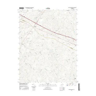
2016 Map of Zion Crossroads
USGS Topo · Published 2016About this map
Zion Crossroads serves as a central hub where the Piedmont landscape meets the modern transport corridors of Louisa and Fluvanna counties. This survey illustrates a rural Virginia community defined by its watercourses, including the three-pronged headwaters of Kent Br—the W Fork Kent Br, Middle Fork Kent Br, and E Fork Kent Br. Small agricultural and residential settlements like Bybee, Poindexter, and Kents Store are scattered across the terrain, connected by historical routes such as Richmond Rd and Three Notch Rd. Local family heritage is preserved in small burial grounds like Jones Cem and Henson Cem, while the landscape is punctuated by water features like Linton Lake and Cosner Lake. The map details a transition from the rolling hills of the Triassic Basin into the traditional farming tracts of central Virginia.
Find a feature on this map
100 named features on this map. Tap any name to fly to it.
Don’t see what you’re looking for? This feature index may not catch every label — zoom into the map to look around manually.
Map Details
Editions of this 2016 Zion Crossroads Map
This is the sole edition of this map. No revisions or reprints were ever made.
Other maps of this area

1891 · Palmyra
USGS Topo · 1:125,000

1892 · Gordonsville
USGS Topo · 1:125,000

1895 · Palmyra
USGS Topo · 1:125,000

1897 · Palmyra
USGS Topo · 1:125,000

1935 · Charlottesville
USGS Topo · 1:62,500

1939 · Charlottesville
USGS Topo · 1:62,500

1943 · Scottsville
USGS Topo · 1:62,500

1946 · Scottsville
USGS Topo · 1:62,500

1947 · Roanoke
USGS Topo · 1:250,000

1949 · Charlottesville
USGS Topo · 1:250,000