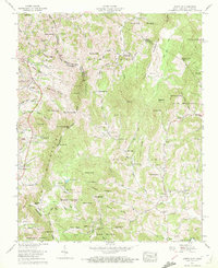
1959 Map of Zionville
USGS Topo · Published 1972About this map
The Tennessee North Carolina border zig-zags across this high-country landscape, where the ridges of Hessian Ridge and Sugartree Ridge define the local topography. In the late 1950s, the rural life of this borderland was anchored by small crossroads like Zionville and Pottertown, the latter serving as a post office for the surrounding hollows. The settlement pattern follows the drainage of the North Fork New River and Meat Camp Creek, with family-named burial grounds like Greer Cem and Maine Cem testifying to the area's deep genealogical roots. Industry is represented by the Winebarger Mill, while local education and faith are centered at the Green Valley Sch and numerous country chapels such as Thomas Chapel and Friendship Church. Fine red dashed lines indicate historical fence and field lines, providing a rare look at mid-century agricultural land use across these steep slopes.
Find a feature on this map
113 named features on this map. Tap any name to fly to it.
Don’t see what you’re looking for? This feature index may not catch every label — zoom into the map to look around manually.
Map Details
Editions of this 1959 Zionville Map
4 editions found
Other maps of this area

1893 · Cranberry
USGS Topo · 1:125,000

1895 · Cranberry
USGS Topo · 1:125,000

1899 · Cranberry
USGS Topo · 1:125,000

1902 · Cranberry
USGS Topo · 1:125,000

1934 · Valle Crucis
USGS Topo · 1:24,000

1934 · Boone
USGS Topo · 1:24,000

1935 · Baldwin Gap
USGS Topo · 1:24,000

1935 · Doe Mountain
USGS Topo · 1:48,000

1935 · Sherwood
USGS Topo · 1:24,000

1935 · Zionville
USGS Topo · 1:24,000