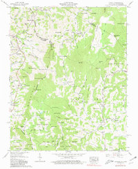
1959 Map of Zionville
USGS Topo · Published 1981About this map
The High Country borderlands of Watauga Co and Ashe Co meet the Tennessee state line in this mid-century landscape. Steep terrain is segmented by numerous ridges like Sugartree Ridge and Hessian Ridge, which dictated the early settlement patterns of mountain communities. Local commerce and social life are anchored around the Trade and Zionville settlements, while higher elevations are marked by remote landmarks such as Meat Camp 1 and Meat Camp 2.
Find a feature on this map
125 named features on this map. Tap any name to fly to it.
Don’t see what you’re looking for? This feature index may not catch every label — zoom into the map to look around manually.
Map Details
Editions of this 1959 Zionville Map
4 editions found
Other maps of this area

1893 · Cranberry
USGS Topo · 1:125,000

1895 · Cranberry
USGS Topo · 1:125,000

1899 · Cranberry
USGS Topo · 1:125,000

1902 · Cranberry
USGS Topo · 1:125,000

1934 · Valle Crucis
USGS Topo · 1:24,000

1934 · Boone
USGS Topo · 1:24,000

1935 · Baldwin Gap
USGS Topo · 1:24,000

1935 · Doe Mountain
USGS Topo · 1:48,000

1935 · Sherwood
USGS Topo · 1:24,000

1935 · Zionville
USGS Topo · 1:24,000