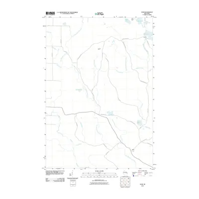
2010 Map of Zoar
USGS Topo · Published 2010About this map
Zoar stands as the primary community in this 2010 survey of a water-rich landscape defined by the drainage of the Little West Branch Wolf River and its numerous tributaries. The geography is characterized by a dense network of glacial lakes and small ponds, including Lake Neconish, Lake Noseum, and Lake Elma, which are connected by forest roads and residential ways like Zoar Rd and Lake Elma Rd. The presence of Camp Black Hawk near Niobe Lake and the Red River Camp suggests a landscape largely shaped by seasonal recreation and conservation. Genealogists and local historians can trace family-named routes such as Ernest Neconish Rd, Lukes Rd, and Oshkosh Rd, which provide access to the remote lakefronts and creeks that define this portion of Wisconsin.
Find a feature on this map
37 named features on this map. Tap any name to fly to it.
Don’t see what you’re looking for? This feature index may not catch every label — zoom into the map to look around manually.
Map Details
Editions of this 2010 Zoar Map
This is the sole edition of this map. No revisions or reprints were ever made.
Other maps of this area

1952 · Antigo
USGS Topo · 1:48,000

1952 · White Lake
USGS Topo · 1:48,000

1954 · Wittenberg
USGS Topo · 1:48,000

1954 · Gresham
USGS Topo · 1:48,000

1954 · Iron Mountain
USGS Topo · 1:250,000

1955 · Green Bay
USGS Topo · 1:250,000

1959 · Iron Mountain
USGS Topo · 1:250,000

1964 · Wittenberg
USGS Topo · 1:62,500

1964 · Gresham
USGS Topo · 1:62,500
1973 · Bryant
USGS Topo · 1:24,000