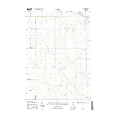
2015 Map of Zoar
USGS Topo · Published 2015About this map
Zoar and the surrounding woodlands define this part of the Menominee Indian Reservation where Langlade, Shawano, and Menominee counties meet. The landscape is characterized by a dense network of water bodies, including Lake Neconish, Lake Noseum, and Lake Elma, which drain into the meandering Little W Br Wolf River. To the west, the Red River flows southward through the terrain, while the settlement of Red Springs serves as a local landmark. A complex system of Bureau of Indian Affairs routes, such as BIA Rte 165 and BIA Rte 128, provides access across the glaciated topography. This 2015 survey illustrates how traditional indigenous land boundaries and modern infrastructure coexist, preserving the natural hydrological features like Niobe Lake and the Upper Reservoir that remain vital to the region's geography.
Find a feature on this map
54 named features on this map. Tap any name to fly to it.
Don’t see what you’re looking for? This feature index may not catch every label — zoom into the map to look around manually.
Map Details
Editions of this 2015 Zoar Map
This is the sole edition of this map. No revisions or reprints were ever made.
Other maps of this area

1952 · Antigo
USGS Topo · 1:48,000

1952 · White Lake
USGS Topo · 1:48,000

1954 · Wittenberg
USGS Topo · 1:48,000

1954 · Gresham
USGS Topo · 1:48,000

1954 · Iron Mountain
USGS Topo · 1:250,000

1955 · Green Bay
USGS Topo · 1:250,000

1959 · Iron Mountain
USGS Topo · 1:250,000

1964 · Wittenberg
USGS Topo · 1:62,500

1964 · Gresham
USGS Topo · 1:62,500
1973 · Bryant
USGS Topo · 1:24,000