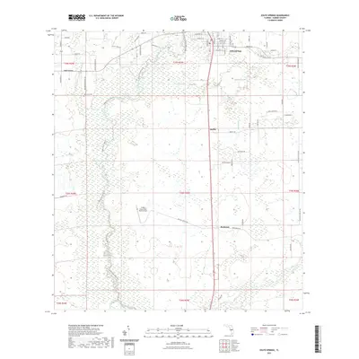
2021 Map of Zolfo Springs
USGS Topo · Published 2021About this map
The Peace River carves a winding path through this central Hardee County landscape, serving as a geographic anchor for the town of Zolfo Springs and the rural communities of Oak Grove, Moffitt, and Buchanan. The map details a transition from organized municipal grids, seen in the streets of Zolfo Springs, to the extensive citrus groves and ranching tracts that define the surrounding Florida interior. These agricultural patterns are interrupted by natural wetlands and water bodies such as Mud Lake and the drainage of Alligator Br. Local history and land use are reflected in sites like the Oak Grove Cem and the Griffins Peace River Ranch Airport. Along the river corridor, the Peace River State Trl follows the natural topography, highlighting the region's shift toward conservation and recreation amid its traditional agricultural roots.
Find a feature on this map
68 named features on this map. Tap any name to fly to it.
Don’t see what you’re looking for? This feature index may not catch every label — zoom into the map to look around manually.
Map Details
Editions of this 2021 Zolfo Springs Map
This is the sole edition of this map. No revisions or reprints were ever made.
Other maps of this area

1955 · Ft. Green
USGS Topo · 1:24,000

1955 · Wauchula
USGS Topo · 1:24,000

1956 · Gardner
USGS Topo · 1:24,000

1956 · Ona
USGS Topo · 1:24,000

1956 · Sweetwater
USGS Topo · 1:24,000

1956 · Limestone
USGS Topo · 1:24,000

1956 · Zolfo Springs
USGS Topo · 1:24,000

1956 · Crewsville SW
USGS Topo · 1:24,000

1956 · Griffins Corner
USGS Topo · 1:24,000

1956 · Fort Pierce
USGS Topo · 1:250,000