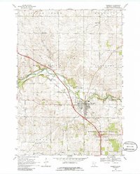
1968 Map of Zumbrota
USGS Topo · Published 1986About this map
The Zumbrota townsite and its surrounding Goodhue County townships are defined by the winding course of the North Fork Zumbro River and its confluence with the main Zumbro River. This 1960s landscape preserves the transition of transportation in the region, featuring both the Chicago Milwaukee St Paul and Pacific Railroad Grade and an older Old Railroad Grade further north. Local industry and agriculture are evidenced by numerous Gravel Pits scattered near the riverbanks and the presence of the small settlement at Forest Mills. Cultural markers for genealogists include St Johns Ch, Landa Ch, and the United Cem located near Sugarloaf Hill. To the south, the terrain shifts into the protected boundaries of the Minnesota Memorial Hardwood State Forest and Pine Island State Forest.
Find a feature on this map
30 named features on this map. Tap any name to fly to it.
Don’t see what you’re looking for? This feature index may not catch every label — zoom into the map to look around manually.
Map Details
Editions of this 1968 Zumbrota Map
2 editions found
Other maps of this area

1953 · Saint Paul
USGS Topo · 1:250,000

1959 · Saint Paul
USGS Topo · 1:250,000

1965 · Concord
USGS Topo · 1:24,000

1965 · Oronoco
USGS Topo · 1:24,000

1965 · Pine Island
USGS Topo · 1:24,000

1968 · Goodhue East
USGS Topo · 1:24,000

1968 · Zumbrota
USGS Topo · 1:24,000

1968 · Mazeppa
USGS Topo · 1:24,000

1968 · Wanamingo
USGS Topo · 1:24,000

1968 · White Rock
USGS Topo · 1:24,000