1950s Maps of Puerto Rico
Explore 151 historic maps of Puerto Rico from the 1950s. These maps offer a rare glimpse into what life looked like during the 1950s — showing old roads, neighborhoods, homes, and landmarks that have changed or disappeared over time.
Whether you're researching your family's past, planning a metal detecting trip, or studying how Puerto Rico's landscape evolved across the 1950s, these high-resolution maps are a powerful tool for exploring the history of this region.
- Focus on a specific era: All maps on this page are from the 1950s, giving you a focused view of this time period.
- See what’s changed: Compare century-old streets, trails, and buildings to today's modern landscape using overlays and satellite layers.
- Research with precision: Use these maps for genealogy, historical research, land use analysis, or educational projects.
- View, download, or print: Maps are fully viewable online in high resolution, and can be downloaded or printed for your own records.
Start exploring Puerto Rico's history through authentic maps from the 1950s. This is your window into the past.
Puerto Rico maps
(151)- 1950 Map of Moca SE
 1950 Moca SE1950 Print · USGSMid-century Puerto Rico is captured here during a period of transition in the rural uplands between Isabela and San Sebastián. Researchers can trace ancestral home sites and small community centers like La Vega or find the Iglesia de la Virgen del Rosario.
 - 1950 Map of Camuy NE
 1950 Camuy NE1950 Print · USGSCoastal Hatillo and the surrounding barrios are captured in the mid-twentieth century as the rail lines still served the northern shore. Genealogists and historians can locate community centers like Lechuga and rural landmarks such as Iglesia Santa Teresita and the Escuela Eugenio María de Hostos.
 - 1950 Map of Central La Plata NE
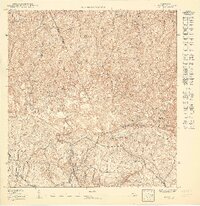
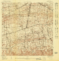
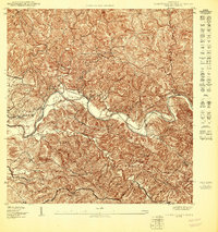
 1950 Central La Plata NE1950 Print · USGSMid-century San Sebastián and Moca are captured here during a period of transition for Puerto Rico's interior. Researchers can trace the agricultural landscape surrounding Central La Plata and topographic landmarks like Cerro de las Velas and the Rio Culebrinas.
 - 1950 Map of Rincon ONO
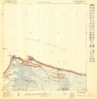
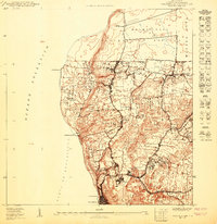
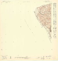 1950 Rincon ONO1950 Print · USGSCoastal Rincón at mid-century reveals a landscape shaped by the rail industry and steep Caribbean topography. Genealogists and historians can trace old homesteads around Centro Puntas and the path of the American RR of Porto Rico as it skirts the shoreline.
 - 1950 Map of Mayaguez SE
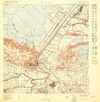
 1950 Mayaguez SE1950 Print · USGSCoastal sugar plantations and rail networks dominate the Mayagüez shoreline at the midpoint of the century. Genealogists and historians can trace family-named lands like Colonia García or locate early civic landmarks such as the Escuela Industrial y Reformatoria.
 - 1950 Map of San Juan SE
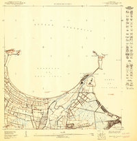
 1950 San Juan SE1950 Print · USGSMid-century San Juan reveals a landscape in transition as the university district expands and new infrastructure emerges near the coast. Researchers can trace early urban development in Río Piedras, locate the Aeropuerto Internacional site, and find legacy landmarks like Hipodromo Las Casas.
 - 1950 Map of Rosario NE
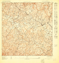
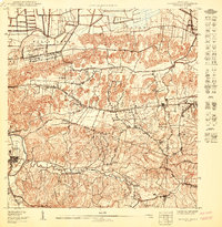
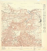
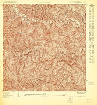
 1950 Rosario NE1950 Print · USGSMid-century Mayagüez and Las Marías come alive through this 1950 topography of the island's interior coffee-growing regions. Researchers can trace the heritage of old estates like Hacienda Esperanza and Hacienda Juanita or locate landmarks like Pico San Bernardo.
 - 1950 Map of San Sebastian NE
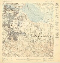
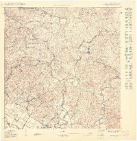
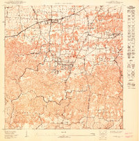
 1950 San Sebastian NE1950 Print · USGSThe northern hills of San Sebastián appear here at mid-century, centered around the industrial and agricultural life of the sugar economy. Researchers can trace the footprint of Central Soller, locate the Campamento Guajataca by the lake, and find local landmarks like Iglesia Santa Ana.
 - 1950 Map of Central La Plata SE
 1950 Central La Plata SE1950 Print · USGSMid-century life in the Puerto Rican interior is defined by the winding Río Grande de Añasco and the high ridges of Alto Sano. Genealogists and historians can locate rural landmarks like the Escuela Segunda Unidad de Añones and Cerro Valladares.
 - 1950 Map of Vega Alta NO
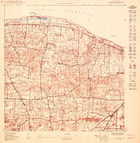
 1950 Vega Alta NO1950 Print · USGSNorthern Puerto Rico during the 1940s and 50s reveals an economy centered on coastal sugar production and rail transport. Genealogists and researchers can trace local families through Poblado Ceiba and locate historic industrial sites like Central San Vicente.
 - 1950 Map of Bayamon NE
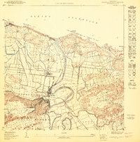
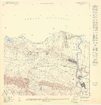
 1950 Bayamon NE1950 Print · USGSThe shoreline of Toa Baja and Cataño is captured here at mid-century as the harbor area began its modern expansion. Researchers can trace the wetlands of Ciénaga de los Cucharillas or locate the historic El Cañuelo (Ruinas) and Palo Seco.
 - 1950 Map of Bayamon SO
 1950 Bayamon SO1950 Print · USGSCoastal plains meet the limestone hills south of San Juan at mid-century, before modern urbanization transformed the landscape. Trace the boundaries of the Reservacion Naval and locate family homesteads near Toa Alta, Sabana Seca, and the Iglesia Evangelica.
 - 1950 Map of Moca NE
 1950 Moca NE1950 Print · USGSNorthwestern Puerto Rico is captured here at mid-century, showing a high density of rural settlements and early infrastructure. Genealogists can trace family sites near Mora or the Iglesia Arenales Altos, while the American R R of Porto Rico marks the era's rail transit.
 - 1950 Map of Rosario SO
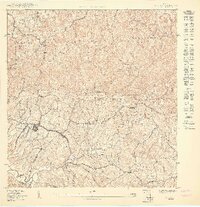
 1950 Rosario SO1950 Print · USGSWestern Puerto Rico at the midpoint of the century shows a landscape of mountain forests and sugar-related rail infrastructure. Genealogists and historians can locate rural centers like Rosario, find family landmarks such as Desvío Eureka, and trace early sites like the Hospital de Tuberculosis.
 - 1950 Map of Central La Plata SO
 1950 Central La Plata SO1950 Print · USGSAñasco's river valley and surrounding highlands are captured here at mid-century as traditional haciendas met new infrastructure. Genealogists and historians can trace family locations near Hacienda Libertad, the Iglesia at Cerro Gordo, and along the banks of the Río Grande de Añasco.
 - 1950 Map of Arecibo NO
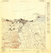 1950 Arecibo NO1950 Print · USGSCoastal Arecibo in the mid-twentieth century was a bustling nexus of sugar production and rail transport. Genealogists and historians can trace family roots through neighborhoods like Obrero or locate industrial sites like Central Cambalache and the American Railroad.
 - 1950 Map of Camuy SE
 1950 Camuy SE1950 Print · USGSThe northern highlands of Hatillo and Arecibo are documented here at mid-century as traditional rural life meets new planning. Trace family lineages and local landmarks from Parcelas de Campo Alegre to the Estacion Cuchi rail stop.
 - 1950 Map of Carolina SE
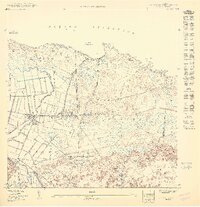
 1950 Carolina SE1950 Print · USGSThe coastal and riverine landscape of Loíza and Carolina comes to life in this mid-century survey of Puerto Rico's sugar country. Researchers can trace the industrial footprint of Central Canóvanas and the narrow-gauge Fajardo Development Co RR as they wind through agricultural enclaves like Colonia Santa Barbara.
 - 1950 Map of Quebradillas NO
 1950 Quebradillas NO1950 Print · USGSMid-century Isabela and Quebradillas are defined here by the coastal path of the American Railroad and the deep gorge of the Río Guajataca. Genealogy researchers can locate family sites near San Antonio, the Iglesia Virgen del Carmen, or Estación Quebradillas.
 - 1950 Map of Carolina NO
 1950 Carolina NO1950 Print · USGSThe coastal marshlands of Loíza and Carolina appear at a turning point in the mid-twentieth century as infrastructure began to transform the area. Genealogists and researchers can trace local landmarks like Escuela Piñones and the planned Aeropuerto Internacional site.
 - 1950 Map of Moca SO
 1950 Moca SO1950 Print · USGSMid-century Moca and its surrounding barrios are captured here during a period of infrastructure growth in northwest Puerto Rico. Genealogists and researchers can locate family homes and landmarks across Caimital Alto, the Escuela Segunda Unidad de Voladoras, and along the Río Culebrinas.
 - 1950 Map of Barceloneta NE
 1950 Barceloneta NE1950 Print · USGSNorthern Puerto Rico in the 1950s shows an economy transitioning around the sugar industry and the coast. Trace the rail lines of the American RR or locate family roots in Barceloneta and the Central Plazuela sugar estate.
 - 1950 Map of Central La Plata NO
 1950 Central La Plata NO1950 Print · USGSMoca's interior highlands are mapped here at mid-century, showing the dense rural settlement patterns of western Puerto Rico. Genealogists can trace family footprints across the barrios of Cerro Gordo and Voladoras along the winding Río Culebrinas.
 - 1950 Map of Aguadilla NE
 1950 Aguadilla NE1950 Print · USGSThe Aguadilla coastline in the mid-century shows a landscape shaped by the rail industry and military presence. Genealogists and historians can trace the development of housing at Caserío José de Diego and the path of the American Railroad Company of Porto Rico.
 - 1950 Map of Vega Alta NE
 1950 Vega Alta NE1950 Print · USGSThe northern coast of Puerto Rico in the early fifties reveals a landscape shaped by sugar production and the rail lines of the American RR. Genealogists and historians can trace the foundations of Dorado and Toa Baja, along with the industrial footprint of Central Constancia.
Showing maps 1-25 of 151
Top regions of Puerto Rico
- San Juan historical maps
- Bayamón historical maps
- Carolina historical maps
- Ponce historical maps
- Caguas historical maps
- Guaynabo historical maps
See more
Top cities of Puerto Rico
- San Juan historical maps
- Bayamón historical maps
- Carolina historical maps
- Ponce historical maps
- Caguas historical maps
- Guaynabo historical maps
See more
Frequently asked questions
- What are the different types of historical maps available for Puerto Rico?
- What is the oldest map of Puerto Rico?
- Where can I purchase historical maps of Puerto Rico for my home or office?
- Where can I download high-res historical maps of Puerto Rico?
- Are there historical topographic maps available for Puerto Rico?
- Is there historical aerial imagery available for Puerto Rico?
- Where are historical maps of Puerto Rico sourced from?