2020s Maps of Puerto Rico
Explore 81 historic maps of Puerto Rico from the 2020s. These maps offer a rare glimpse into what life looked like during the 2020s — showing old roads, neighborhoods, homes, and landmarks that have changed or disappeared over time.
Whether you're researching your family's past, planning a metal detecting trip, or studying how Puerto Rico's landscape evolved across the 2020s, these high-resolution maps are a powerful tool for exploring the history of this region.
- Focus on a specific era: All maps on this page are from the 2020s, giving you a focused view of this time period.
- See what’s changed: Compare century-old streets, trails, and buildings to today's modern landscape using overlays and satellite layers.
- Research with precision: Use these maps for genealogy, historical research, land use analysis, or educational projects.
- View, download, or print: Maps are fully viewable online in high resolution, and can be downloaded or printed for your own records.
Start exploring Puerto Rico's history through authentic maps from the 2020s. This is your window into the past.
Puerto Rico maps
(81)- 2024 Map of Punta Tuna, 2024 Print
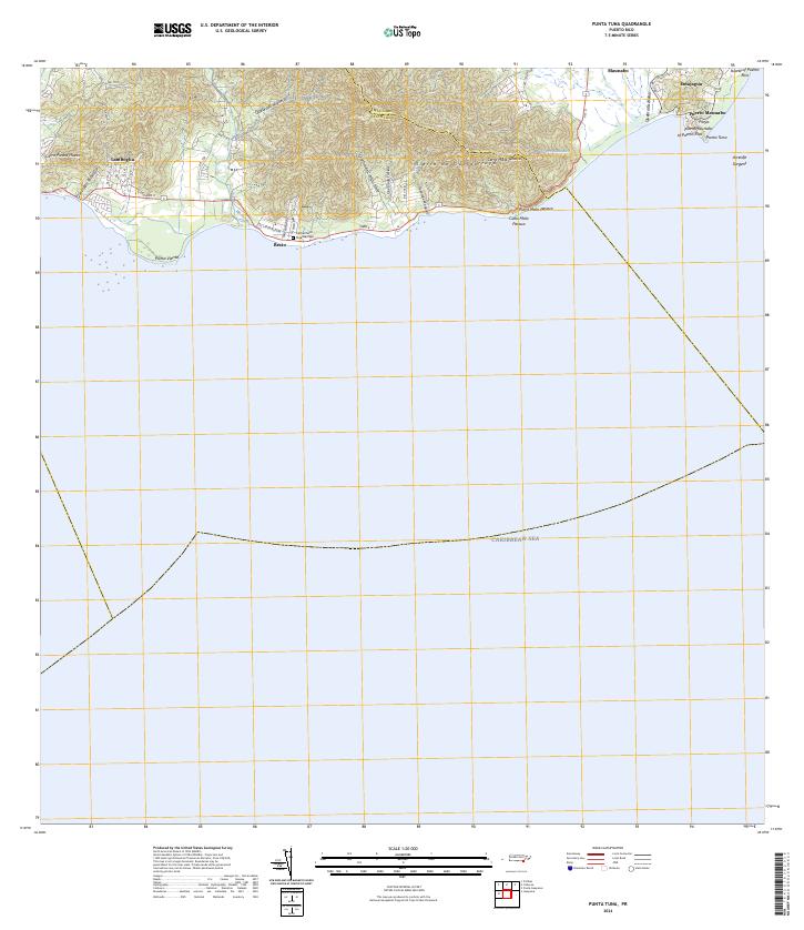 2024 Punta Tuna2024 Print · USGSSoutheastern Puerto Rico is mapped here in the modern era as the mountains meet the sea. Researchers can trace coastal settlements like Emajagua, visit the Cementerio Guardarraya, or locate the maritime landmark at Punta Tuna.
 - 2024 Map of Santa Isabel, 2024 Print
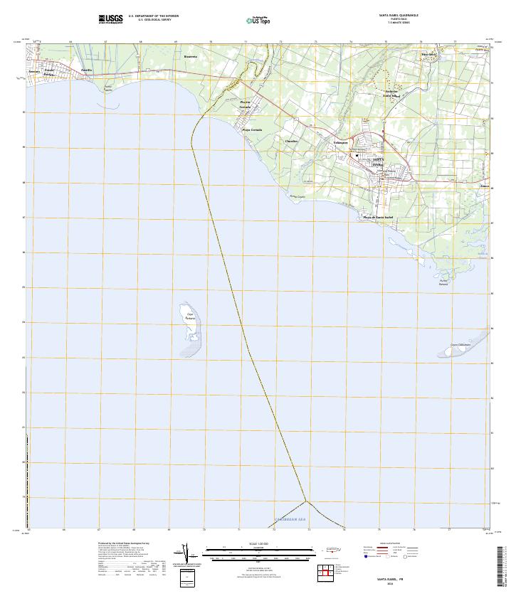 2024 Santa Isabel2024 Print · USGSThe southern coast of Puerto Rico is captured here in the 2020s, showcasing the development of Santa Isabel and its surrounding coastal barrios. Trace family roots and local landmarks at the Santiago Apostol Santa Isabel Cem or explore the waterfronts of Playa de Santa Isabel and Playita Cortada.
 - 2024 Map of Central Aguirre, 2024 Print
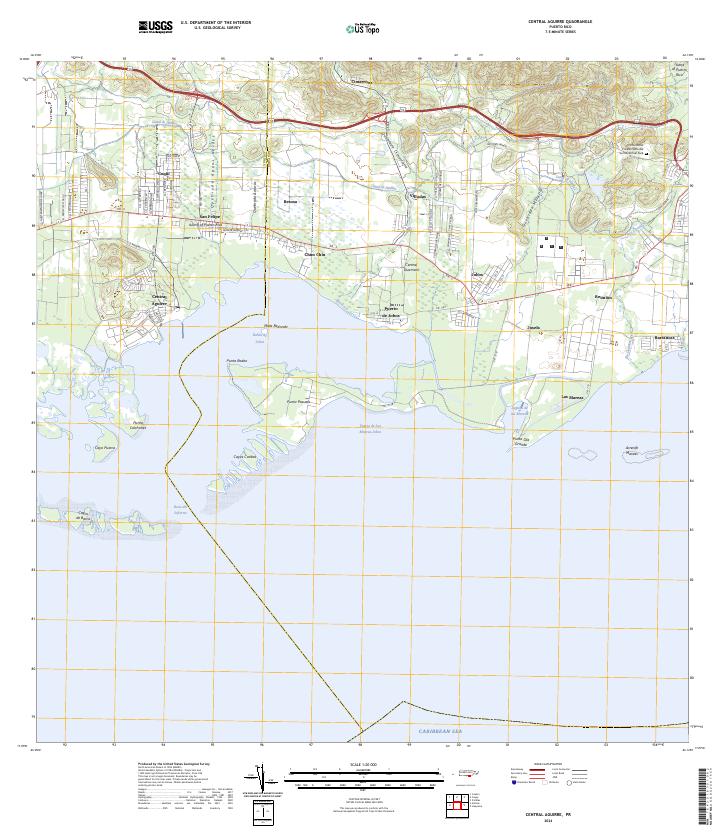 2024 Central Aguirre2024 Print · USGSThe southern coast of Puerto Rico is mapped here in the modern era, showing the transition from mangrove lagoons to industrial centers. Genealogists can trace family names and local landmarks in Central Aguirre, Puerto de Jobos, and Coquí.
 - 2024 Map of Salinas, 2024 Print
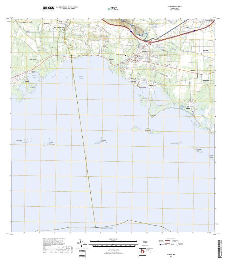 2024 Salinas2024 Print · USGSThe southern coast of Puerto Rico is mapped here in the early twenty-first century, showing the developed corridor between the mountains and the sea. Researchers can locate the Cementerio Municipal de Salinas, the military training grounds of NG MTA Camp Santiago, and coastal villages like Las Mareas.
 - 2024 Map of San German, 2024 Print
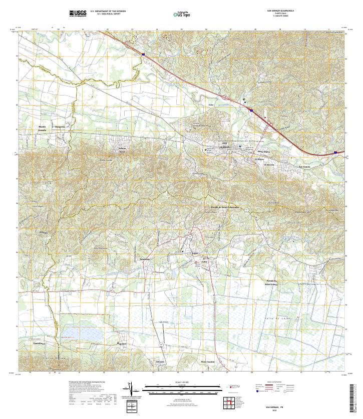 2024 San German2024 Print · USGSSan Germán and the surrounding Lajas Valley are depicted in detail during the early twenty-first century. Researchers can trace the layout of the Universidad Interamericana and locate family sites near Sabana Eneas or the Lajas Cemetery.
 - 2024 Map of Isla de Mona, 2024 Print
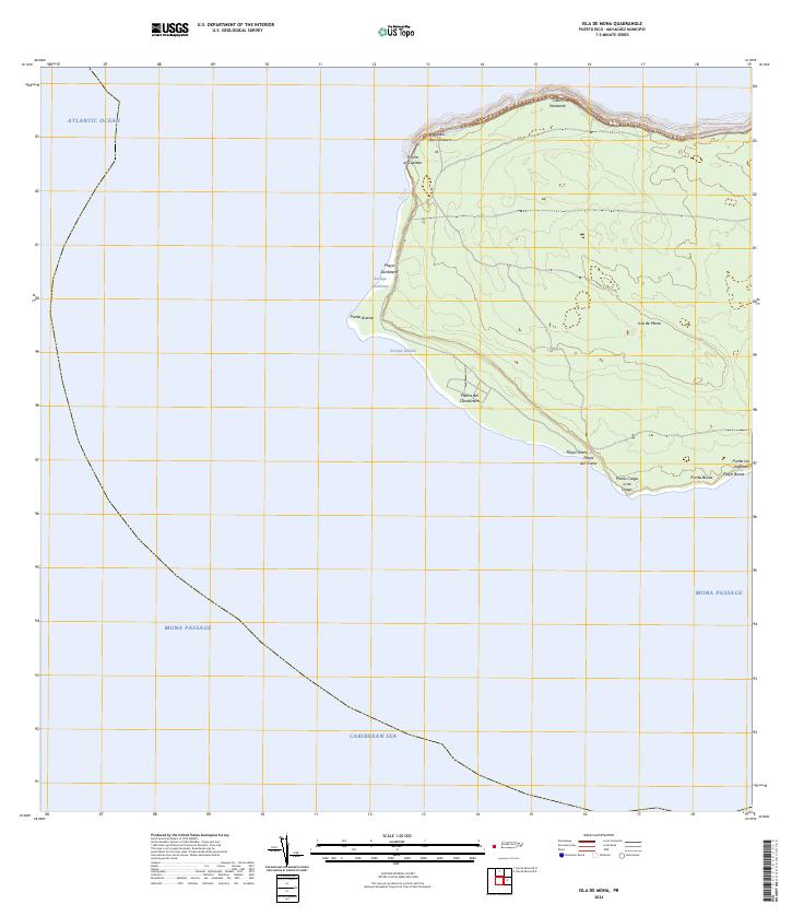 2024 Isla de Mona2024 Print · USGSIsla de Mona stands at the maritime crossroads of the Caribbean and Atlantic in this recent topographic survey. Boaters and researchers can trace the coastal landings and rugged points of the island, from the Anclaje Sardinera to the strikingly named Punta Caigo o no Caigo.
 - 2024 Map of Playa De Ponce, 2024 Print
 2024 Playa De Ponce2024 Print · USGSThe southern coast of Puerto Rico is captured here in contemporary detail, showing the integration of maritime industry and urban growth. Researchers can trace the layout of Playa de Ponce or locate landmarks like the Muelle de Ponce and offshore Isla Caja de Muertos.
 - 2024 Map of Isabela, 2024 Print
 2024 Isabela2024 Print · USGSThe northern coast of Puerto Rico is captured here in the contemporary era, showcasing the coastal settlement of Isabela. Researchers can trace the scientific footprint of the Ramey AF Solar Observatory Research Site and coastal features like Punta Sardina.
 - 2024 Map of Isla de Mona OE N, 2024 Print
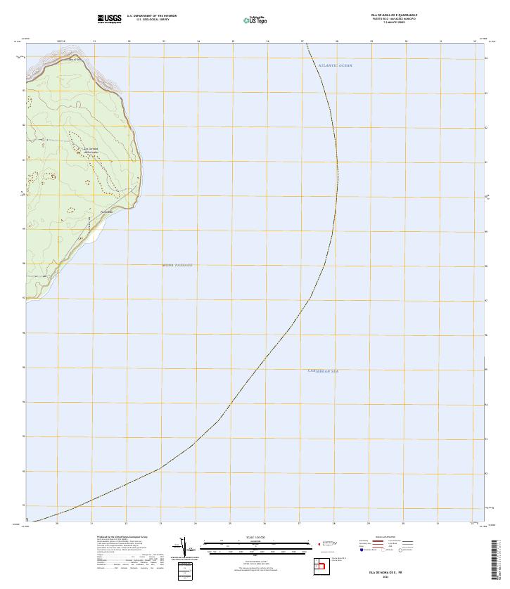
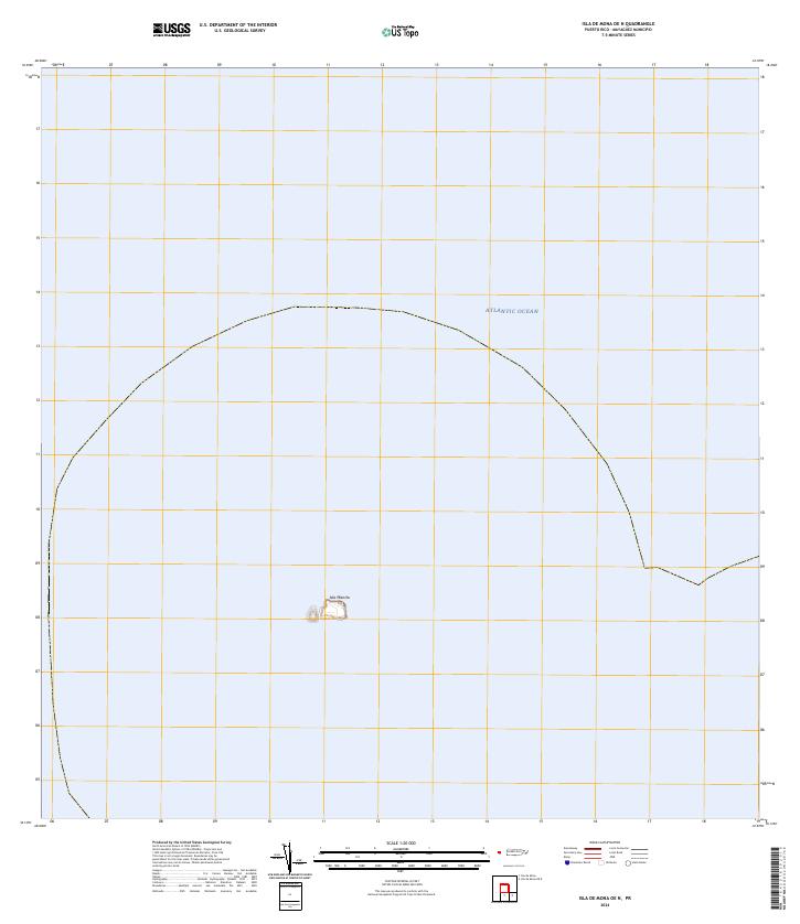 2024 Isla de Mona OE N2024 Print · USGSThe isolated limestone cliffs of the Mona Passage are documented in this recent survey. Researchers can trace the exact perimeter and topographic contours of Isla Monito as it sits surrounded by the Atlantic Ocean.
 - 2024 Map of Guanica, 2024 Print
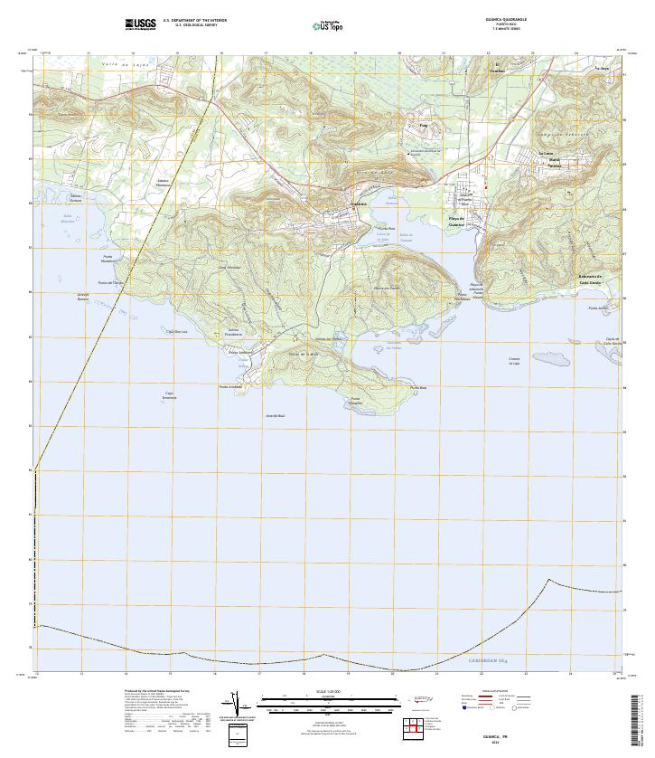 2024 Guanica2024 Print · USGSThe southern coast of Puerto Rico is detailed here in the contemporary era, centered on the deep harbor and salt-producing history of the region. Researchers can trace local heritage through the Cementerio Municipal de Guánica and settlements like Fuig and Sabana Montalva.
 - 2024 Map of Isla Desecheo, 2024 Print
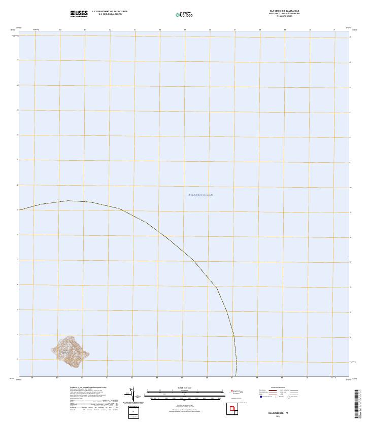 2024 Isla Desecheo2024 Print · USGSIsla Desecheo sits isolated in the Mona Passage during the early twenty-first century, preserved as a sanctuary. Researchers can trace the steep topography and boundaries of the Desecheo National Wildlife Refuge across the entire landmass.
 - 2024 Map of Aguadilla OE N, 2024 Print
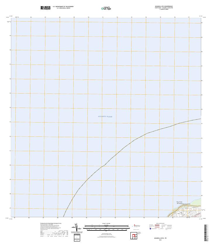 2024 Aguadilla OE N2024 Print · USGSCoastal Puerto Rico at the island's northwestern edge is captured in this survey, showing the waters of the Atlantic Ocean meeting the shore. You can trace the road networks near Playa Punta Borinquen and the point at Punta Agujereada.
 - 2024 Map of Isla de Mona OE E, 2024 Print
 2024 Isla de Mona OE E2024 Print · USGSMona Island sits at the maritime crossroads of the Caribbean and Atlantic during this recent survey. Researchers can trace the rugged eastern coastline from Cabo el Toro down to Punta Este and locate the historic Los Corrales de los Indios.
 - 2024 Map of Rincon OE W, 2024 Print
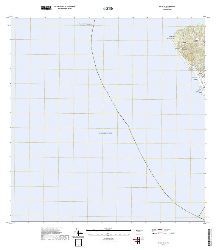 2024 Rincon OE W2024 Print · USGSWestern Puerto Rico is documented here in the early twenty-first century as the coast meets two different seas. Local researchers can trace residential growth and land use around Centro Puntas, Domes Beach, and the inland roads of Cerro Martinica.
 - 2024 Map of Isla De Vieques East, 2024 Print
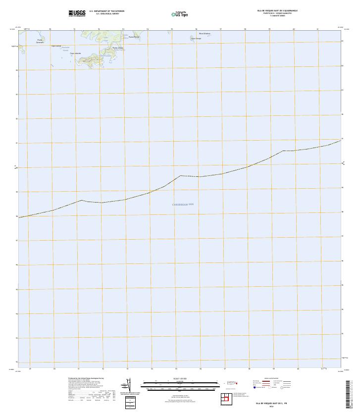
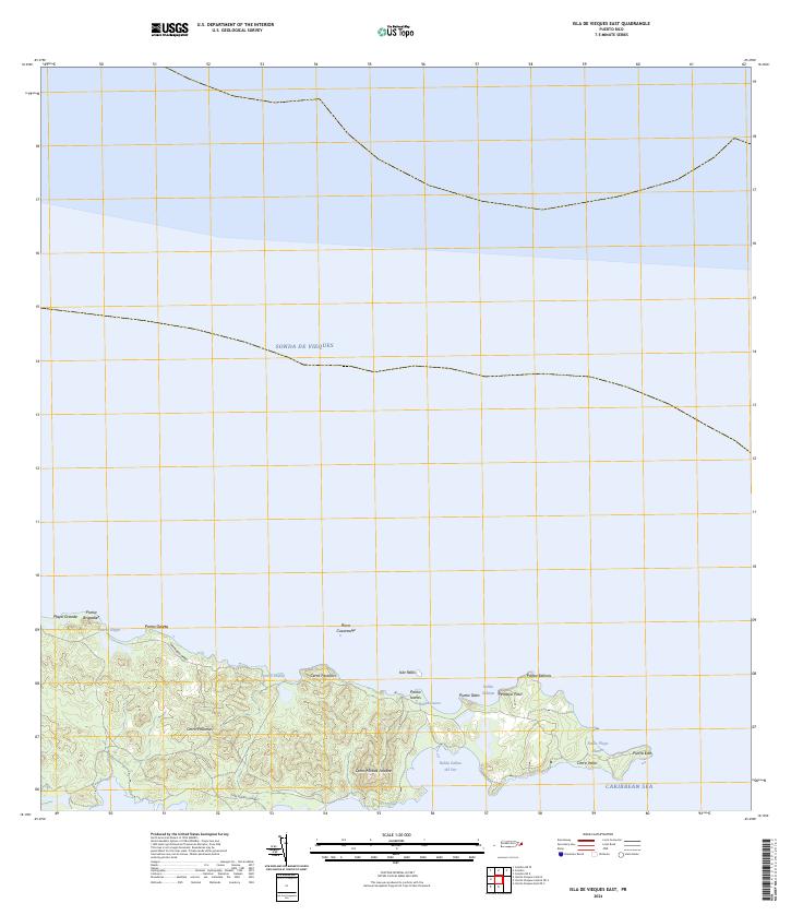 2024 Isla De Vieques East2024 Print · USGSThe eastern reaches of Vieques are documented here in the 2020s, showing the protected wilderness and rugged coastline of the Vieques National Wildlife Refuge. Researchers can trace the trails near Cerro Matías Jalobre or locate coastal landmarks like Punta Este and Bahía Salinas del Sur.
 - 2024 Map of Naguabo, 2024 Print
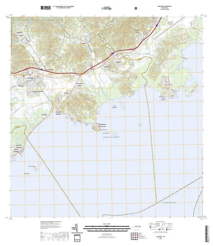 2024 Naguabo2024 Print · USGSThe eastern coast of Puerto Rico is captured here as it meets the Caribbean, showing the interface between the rainforest and the sea. Researchers can trace local history through sites like Viejo Pueblo, the Cementerio Municipal, and the coastal Campamento Punta Lima.
 - 2024 Map of Fajardo, 2024 Print
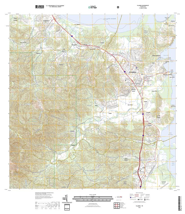 2024 Fajardo2024 Print · USGSNortheast Puerto Rico is shown in great detail here, from the heights of the national forest to the bustling coastal docks. Researchers can locate specific neighborhoods like Espanta Sueño, trace the Quebrada Fajardo, or find the Cementerio De Ceiba.
 - 2024 Map of Fajardo OE N, 2024 Print
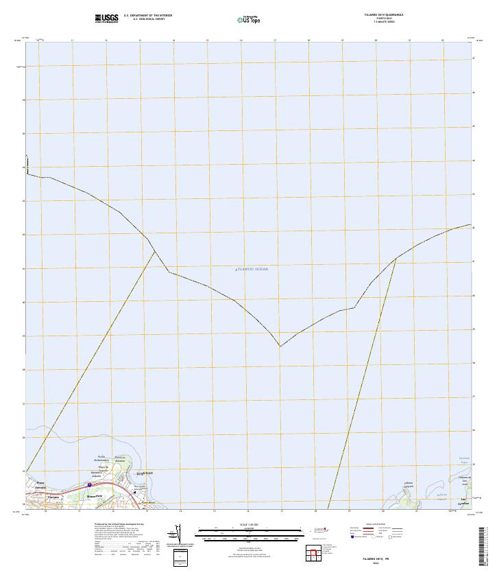 2024 Fajardo OE N2024 Print · USGSLuquillo and the northeast coast of Puerto Rico appear in clear detail in this recent survey. Researchers can trace the town grid of Luquillo, locate the Old Luquillo Municipal Cem, and explore the shoreline from Playa Fortuna to Las Croabas.
 - 2024 Map of Isla De Vieques Central OE S, 2024 Print
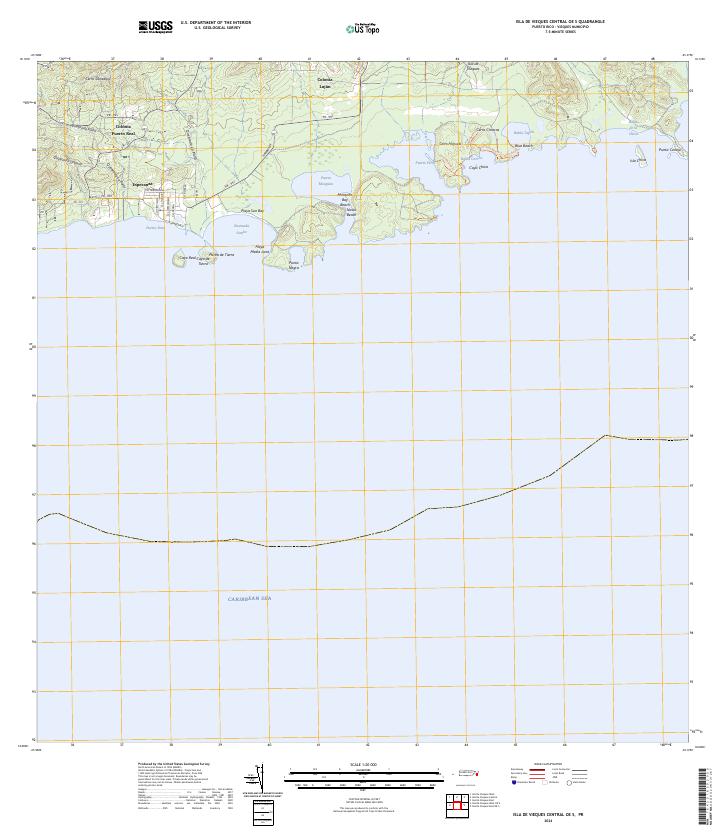 2024 Isla De Vieques Central OE S2024 Print · USGSSouthern Vieques remains a landscape of coastal settlements and conservation at the time of this survey. Genealogists and researchers can trace the roads of Esperanza or locate the inland sites of Colonia Fuerto Real and Colonia Luján.
 - 2024 Map of Isla De Vieques Central, 2024 Print
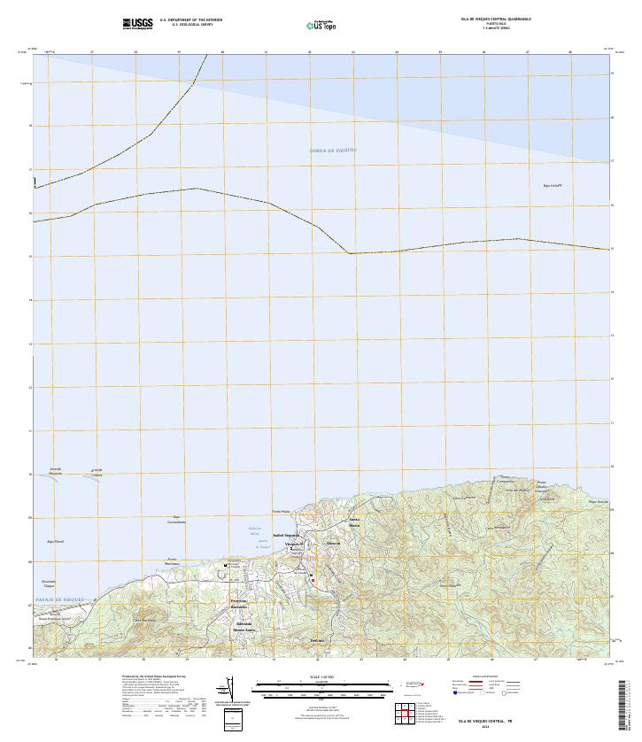 2024 Isla De Vieques Central2024 Print · USGSModern-day Vieques is captured here during the 2020s, showing the island's primary hub of Isabel Segunda and its surrounding coastal landscape. Trace local sites including the Antonio Rivera Rodriguez Airport, the Cementerio Viejo de Vieques, and Punta Mulas.
 - 2024 Map of El Yunque, 2024 Print
 2024 El Yunque2024 Print · USGSEastern Puerto Rico's tropical highlands are mapped here in the modern era, showing the intersection of coastal settlements and mountain wilderness. Researchers can trace local landmarks like Cementerio Municipal Palmer and Campamento Eliza Colberg alongside the peaks of Pico El Yunque.
 - 2024 Map of Cayo Icacos OE N, 2024 Print
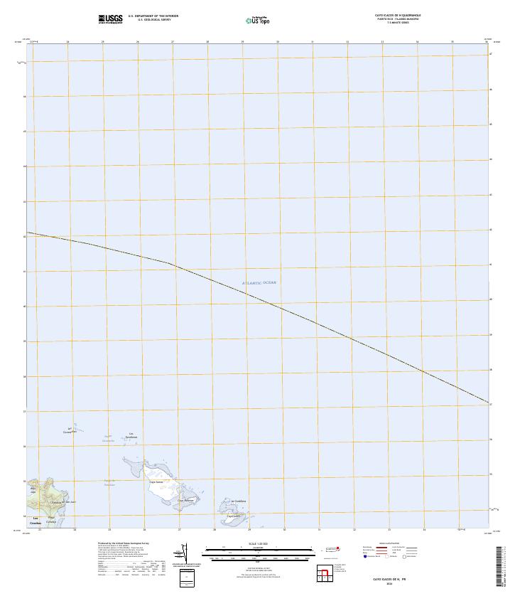 2024 Cayo Icacos OE N2024 Print · USGSNortheastern Puerto Rico’s coastline and its offshore cays are shown here during the mid-2020s. Trace the maritime geography from Las Croabas to the reefs of La Cordillera, including Cayo Icacos and the waters of Pasaje Cucaracha.
 - 2024 Map of Punta Guayanes, 2024 Print
 2024 Punta Guayanes2024 Print · USGSThe Yabucoa coast and fertile valley are documented here during a period of modern development and educational growth. Researchers can trace the coastal landscape from Palmas del Mar to Puerto Yabucoa or locate inland sites like El Negro.
 - 2024 Map of Isla De Vieques East OE S, 2024 Print
 2024 Isla De Vieques East OE S2024 Print · USGSThe eastern coast of Vieques remains a landscape of conservation and maritime isolation in the early twenty-first century. Researchers can trace the protected shorelines of Vieques National Wildlife Refuge, from the reaches of Ensenada Honda to Roca Alcatraz.
 - 2024 Map of Quebradillas, 2024 Print
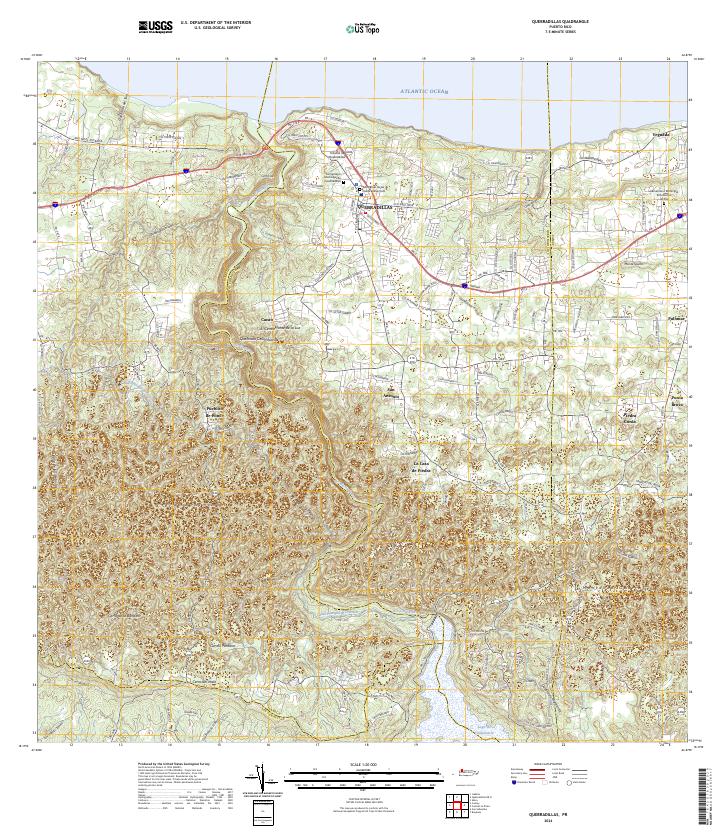 2024 Quebradillas2024 Print · USGSThe northern coast of Puerto Rico meets the limestone hills of the interior in this recent survey. Genealogists can trace family landmarks and burial sites like Hacienda la Sabana and the Cementerio Municipal de Quebradillas.
Showing maps 1-25 of 81
Top regions of Puerto Rico
- San Juan historical maps
- Bayamón historical maps
- Carolina historical maps
- Ponce historical maps
- Caguas historical maps
- Guaynabo historical maps
See more
Top cities of Puerto Rico
- San Juan historical maps
- Bayamón historical maps
- Carolina historical maps
- Ponce historical maps
- Caguas historical maps
- Guaynabo historical maps
See more
Frequently asked questions
- What are the different types of historical maps available for Puerto Rico?
- What is the oldest map of Puerto Rico?
- Where can I purchase historical maps of Puerto Rico for my home or office?
- Where can I download high-res historical maps of Puerto Rico?
- Are there historical topographic maps available for Puerto Rico?
- Is there historical aerial imagery available for Puerto Rico?
- Where are historical maps of Puerto Rico sourced from?