Old Maps of Bessemer, Alabama for Metal Detecting
Plan your next treasure hunt with 49 historic maps of Bessemer. Find old homesites, ghost towns, trails, and gathering spots that may be lost to time — perfect for identifying promising metal detecting locations.
- Locate forgotten sites: Uncover places like long-lost settlements, abandoned rail lines, or gathering spots.
- Plan better hunts: Use map overlays combined with LiDAR or satellite views to narrow in on historically rich areas.
- Made for detectorists: Thousands of hobbyists use these maps to discover relics, coins, and hidden history.
Use these historic maps to boost your research and find new opportunities beneath the surface of Bessemer.
Bessemer, AL maps
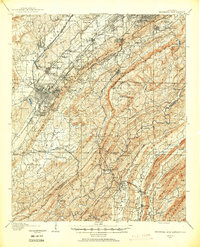
(49)- 1890 Map of Bessemer
 1890 Bessemer1890 Print · USGSCentral Alabama emerges as an industrial powerhouse in the late nineteenth century as railroads weave through the ridges of Jefferson and Shelby counties. Genealogists and historians can trace the early footprints of Bessemer, the iron operations at Sloss, and remote landmarks like Woods Ferry.
 - 1892 Map of Bessemer
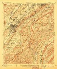
 1892 Bessemer1892 Print · USGSCentral Alabama was at its industrial peak in the late nineteenth century as railroads and iron mines transformed the ridges south of Birmingham. Genealogists and researchers can trace the early foundations of Bessemer, the operations at Smith Mine, and rural crossings like Nunley's Ford.2 unique versions available
 - 1899 Map of Brookwood
 1899 Brookwood1899 Print · USGSCentral Alabama at the close of the nineteenth century is a landscape of growing mining towns and vital river crossings. Trace the early industrial rail lines like the Birmingham Mineral R. R. and locate family landmarks such as Weaver Mill, Pratt Ferry, and Providence Ch.4 unique versions available
 - 1905 Map of Bessemer Iron District
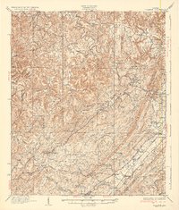
 1905 Bessemer Iron District1905 Print · USGSJefferson County was at the peak of its iron-mining boom at the turn of the century, centered on the dense rail networks of Bessemer. Genealogists and industrial historians can trace old residential pockets like Wylam and Brighton alongside the Spaulding Mine and numerous rural river crossings.3 unique versions available
 - 1907 Map of Bessemer Special
 1907 Bessemer Special1907 Print · USGSJefferson County industrial development is at its peak in the first decade of the century, centered on the heavy rail networks of the Jones Valley. Genealogists and historians can trace early community centers like Hopewell Church and Canaan Church alongside mining sites at Redding and Ware.4 unique versions available
 - 1927 Map of Adger
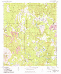
 1927 Adger1927 Print · USGSThe industrial heart of Alabama comes alive in the late twenties, showing the intersection of mining and rail. Genealogists can trace family roots at Concord Ch, Connellsville Mine, and the early settlement at Tannehill.
 - 1932 Map of Yolande, 1964 Print
 1932 Yolande1964 Print · USGSThe industrial corridor southwest of Birmingham comes alive in this survey of the early thirties, where coal and iron roots run deep. Trace the rail lines serving Gilmore Mines and Connellsville or locate family sites near McCalla and Yolande.
 - 1935 Map of Yolande
 1935 Yolande1935 Print · USGSThe Jefferson and Tuscaloosa county line was a hub of coal production and rail activity in the 1930s. Researchers can trace the layout of mining communities like Yolande and Johns or locate family roots at Dogwood Ch and Kniss Store.3 unique versions available
 - 1953 Map of Birmingham, 1964 Print
 1953 Birmingham1964 Print · USGSCentral Alabama at mid-century shows a landscape defined by industrial expansion and the iron-rich ridges surrounding Birmingham. Researchers can trace the extensive rail networks of the L & N RR or locate historic federal sites like the Anniston Ordnance Depot.4 unique versions available
 - 1956 Map of Birmingham
 1956 Birmingham1956 Print · USGSCentral Alabama in the mid-fifties exhibits a landscape of growing cities and deep-rooted industrial corridors. Genealogists and historians can trace the development of suburban Mountain Brook or locate regional hubs like Sylacauga and Jasper.
 - 1957 Map of Birmingham
 1957 Birmingham1957 Print · USGSNorth-Central Alabama in the mid-fifties is an industrial powerhouse centered on the steel valleys and sprawling iron ridges. Genealogists and historians can trace the rail-linked growth of Birmingham and Tuscaloosa, or locate rural landmarks like Talladega College and the Anniston Ordnance Depot.
 - 1959 Map of Bessemer, 1960 Print
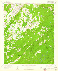
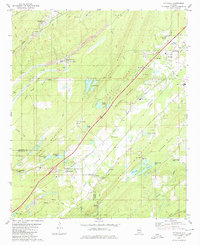
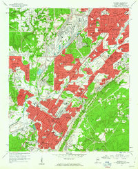 1959 Bessemer1960 Print · USGSThe industrial heart of Jefferson County thrives at mid-century, defined by a dense intersection of heavy rail and emerging suburbs. Researchers can trace the footprints of Miles Memorial College and historic sites like Cedar Hill Cemetery or Brighton High Sch.5 unique versions available
 - 1959 Map of Greenwood, 1960 Print
 1959 Greenwood1960 Print · USGSCentral Alabama's industrial and rural landscape is captured here in the late fifties, showing the interplay between mining operations and family settlements. Genealogists can trace local roots at Sadlers Cem or Lacey's Chapel, while collectors will find interest in the Bessemer Airport and the region's complex rail network.5 unique versions available
 - 1959 Map of Helena, 1960 Print
 1959 Helena1960 Print · USGSShelby County's ridge-and-valley landscape in the late fifties shows a region balanced between railroad industry and new growth. Genealogists and researchers can trace old family sites at Cumberland Cem, the location of Piney Grove Ch, and the grounds of Indian Springs Sch.7 unique versions available
 - 1975 Map of Yolande NE, 1977 Print
 1975 Yolande NE1977 Print · USGSJefferson County’s industrial and residential fringes come into sharp focus in the mid-1970s. Researchers can trace the development of Hueytown and Virginia, or follow the winding path of Valley Creek through the wooded hills.
 - 1975 Map of Helena, 1977 Print
 1975 Helena1977 Print · USGSShelby County emerges in the mid-seventies in this aerial survey, showing the landscape just as suburban growth began to take hold. Researchers can trace the original footprint of Helena and follow the winding course of the Cahaba River.
 - 1975 Map of Yolande SE, 1977 Print
 1975 Yolande SE1977 Print · USGSJefferson County in the mid-1970s is shown in this detailed orthophoto as industrial patterns and rural settlements meet. Genealogists and local historians can trace the clear physical footprints of Mc Calla, Baylor, and Kimbrell.
 - 1975 Map of Greenwood, 1977 Print
 1975 Greenwood1977 Print · USGSJefferson County residential and industrial clearings are captured during the mid-seventies in this detailed aerial orthophoto. Researchers can trace the development of Greenwood and Parkwood or follow the winding path of the Cahaba River.
 - 1975 Map of Bessemer, 1977 Print
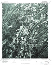
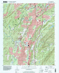
 1975 Bessemer1977 Print · USGSBessemer and the Birmingham industrial corridor are shown in sharp detail during the mid-seventies in this rectified aerial survey. Local historians can trace the physical footprints of Bessemer, Hueytown, and Pleasant Grove as they appeared decades ago.
 - 1979 Map of Concord, 1980 Print
 1979 Concord1980 Print · USGSSouthwest of Birmingham in the late 1970s, this area shows a landscape shaped by coal and community. Genealogists can trace family roots at Old Shady Grove Ch, Valley Creek Cem, or the namesake Concord Mine.2 unique versions available
 - 1980 Map of Mc Calla
 1980 Mc Calla1980 Print · USGSThe industrial corridor southwest of Birmingham appears in the 1980s as a complex landscape of coal mining and ridge-and-valley settlements. Genealogists and local historians can trace family roots through McCalla, North Johns, and several landmarks like Ligon Cem and the McAdory High Sch.2 unique versions available
 - 1984 Map of Tuscaloosa, 1985 Print
 1984 Tuscaloosa1985 Print · USGSWest-central Alabama centers on the mid-1980s expansion of the university and the river economy. Genealogists and historians can trace small-town connections through Burchfield Store, North Johns, and the rail lines of the Southern railroad.2 unique versions available
 - 1984 Map of Birmingham South, 1985 Print
 1984 Birmingham South1985 Print · USGSThe Birmingham metropolitan region and the Coosa River valley are shown here in the mid-eighties as suburban growth expanded south into the ridges. Genealogists and local historians can trace the development of communities from Bessemer to Sylacauga alongside the Lay Lake shoreline and the Talladega National Forest.2 unique versions available
 - 1997 Map of Helena, 2001 Print
 1997 Helena2001 Print · USGSThe Shelby County hills in the late nineties show a landscape of rapid growth along the Cababa River corridor. Researchers can trace the development of Helena and Pelham alongside local landmarks like Mars Hill Ch and the Scottrock Quarry.
 - 2011 Map of Concord, 2011 Print
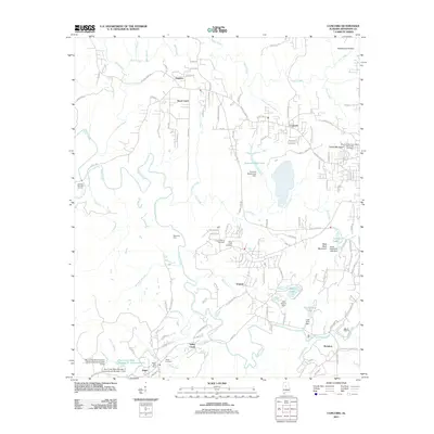 2011 Concord2011 Print · USGSCovers Bessemer, including Birmingham, Hueytown, and other nearby areas
Showing maps 1-25 of 49
Top cities near Bessemer
- Birmingham historical maps
- Hoover historical maps
- Hoover historical maps
- Vestavia Hills historical maps
- Alabaster historical maps
- Homewood historical maps
See more
Top neighborhoods of Bessemer
- Hilltop historical maps
- Hopewell historical maps
- McAdory historical maps
- Morgan historical maps
- Chinn historical maps
- Parkwood historical maps
See more
Frequently asked questions
- What are the different types of historical maps available for Bessemer?
- What is the oldest map of Bessemer?
- Where can I purchase historical maps of Bessemer for my home or office?
- Where can I download high-res historical maps of Bessemer?
- Are there historical topographic maps available for Bessemer?
- Is there historical aerial imagery available for Bessemer?
- Where are historical maps of Bessemer sourced from?