1930s Maps of Lawrence County, Alabama
Explore 23 historic maps of Lawrence County from the 1930s. These maps offer a rare glimpse into what life looked like during the 1930s — showing old roads, neighborhoods, homes, and landmarks that have changed or disappeared over time.
Whether you're researching your family's past, planning a metal detecting trip, or studying how Lawrence County's landscape evolved across the 1930s, these high-resolution maps are a powerful tool for exploring the history of this region.
- Focus on a specific era: All maps on this page are from the 1930s, giving you a focused view of this time period.
- See what’s changed: Compare century-old streets, trails, and buildings to today's modern landscape using overlays and satellite layers.
- Research with precision: Use these maps for genealogy, historical research, land use analysis, or educational projects.
- View, download, or print: Maps are fully viewable online in high resolution, and can be downloaded or printed for your own records.
Start exploring Lawrence County's history through authentic maps from the 1930s. This is your window into the past.
Lawrence County, AL maps
(23)- 1935 Map of Moulton
 1935 Moulton1935 Print · USGSLawrence County during the mid-thirties reveals a rural landscape poised between the plateau farms and the timbered heights of the national forest. Researchers can trace family history through local sites like the Rosenwald Sch, Shoemaker Cem, and the settlement at Wren.
 - 1935 Map of Upshaw
 1935 Upshaw1935 Print · USGSLawrence and Winston counties are captured here in the mid-1930s, documenting a landscape of rural schoolhouses and forest management lookouts. You can trace early twentieth-century life at Upshaw, Templeton Sch, and the Friendship Cem.
 - 1935 Map of Danville
 1935 Danville1935 Print · USGSIn the mid-thirties, the borderlands of Lawrence and Morgan counties featured a landscape of remote stores and hilltop churches. Genealogists can trace family footprints at Strauge Crossroads or locate the ancient Indian Mounds near Oakville.2 unique versions available
 - 1935 Map of Oakville
 1935 Oakville1935 Print · USGSLawrence County, Alabama, is documented here in the mid-1930s as a landscape of small schools, family cemeteries, and ancient landmarks. Genealogists and historians can trace the locations of the Indian Mounds, Hodges Store, and several rural anchors like Oakville Sch.
 - 1936 Map of Newburg
 1936 Newburg1936 Print · USGSFranklin County's rural ridge-and-valley landscape is captured here in the mid-1930s as the Black Warrior National Forest was being established. Family historians can locate specific community centers like Kimbrough Chapel, Newburg, and Little Trapp Sch among the winding hollows.
 - 1936 Map of Kinlock Spring
 1936 Kinlock Spring1936 Print · USGSWinston and Franklin Counties were transitioning into a new era of federal land management and infrastructure during the mid-thirties. Genealogists can locate family-named landmarks like Posey Mill, Carrolls Cross Roads, and the CCC Camp No F 3 near the National Forest boundary.
 - 1936 Map of Caddo
 1936 Caddo1936 Print · USGSLawrence County's rural communities are meticulously recorded here during the mid-1930s, just as the Tennessee Valley Authority was transforming the region. Researchers can trace the exact locations of family-centered landmarks like Lentz Store, Penny Cem, and Morris Chapel.
 - 1936 Map of Mc Kendry
 1936 Mc Kendry1936 Print · USGSThe rural highlands of North Alabama come into focus in the mid-1930s as a network of ridge-top settlements and forest boundaries. Genealogists can trace family connections through numerous rural landmarks like Andrews Chapel, Blairs Store, and the scattered homes of McKendry.
 - 1936 Map of Thorntontown
 1936 Thorntontown1936 Print · USGSLauderdale County was undergoing a massive transformation in the mid-1930s as the Tennessee Valley Authority flooded the river basin. Researchers can trace the submerged geography of Former Islands or locate family sites like Fuqua Cem and Haraway Sch.
 - 1936 Map of Stewart Cross Roads
 1936 Stewart Cross Roads1936 Print · USGSThe Tennessee River valley underwent a massive transformation in the mid-1930s as the new reservoir flooded the lowlands. You can trace submerged riverbanks and find upland landmarks like Stewart Cross Roads, Beulah Land, and St Luke Sch.
 - 1936 Map of Courtland
 1936 Courtland1936 Print · USGSLawrence County enters a period of massive change in the mid-1930s as the Tennessee Valley Authority reshapes the northern landscape. Researchers can trace rural school locations like St Paul Sch, old pond names, and the Southern rail line through Courtland.
 - 1936 Map of Trinity
 1936 Trinity1936 Print · USGSThe Tennessee River valley near the Lawrence and Morgan county line is captured here just as the new reservoir system was taking shape. Genealogists can trace family names at Roselawn Cem, find old rural schools like Means Sch, and locate the historic Kirby Bridge.
 - 1936 Map of Hillsboro
 1936 Hillsboro1936 Print · USGSHillsboro and the Tennessee River banks are captured here during the transformative mid-1930s as the new reservoir began to fill. Local historians can locate early schools and churches such as Ebenezer Sch, Canaan Ch, and the riverside Milton Bluff.
 - 1936 Map of Wheeler Dam
 1936 Wheeler Dam1936 Print · USGSThe Tennessee River valley was undergoing a massive transformation in the mid-1930s as the TVA reservoirs filled. Local researchers can trace the early layout of Wheeler Dam Village and locate family landmarks like Fosters Mill, Center Star Sch, and Houstontown.
 - 1936 Map of Moulton
 1936 Moulton1936 Print · USGSLawrence County in the mid-1930s shows a landscape of rural schools and family cemeteries clustered around Moulton. Genealogists and historians can trace the foundations of Rabbitt Town and Landersville or locate Shoemaker Cem and CCC Camp 12.2 unique versions available
 - 1936 Map of Town Creek
 1936 Town Creek1936 Print · USGSThe rural landscape of Lawrence and Colbert counties is captured here in the mid-1930s as modern power infrastructure arrived. Trace local roots at Mt Miles Ch, Macedonia Sch, and the crossings at Buck Bridge.
 - 1936 Map of Cairo
 1936 Cairo1936 Print · USGSLimestone County and the newly formed Wheeler Reservoir are captured here during a pivotal era of regional change. Researchers can trace the submerged Former Tennessee River and locate community sites like Coxey and Temperance Oak Sch.
 - 1936 Map of Masterson
 1936 Masterson1936 Print · USGSLawrence County, Alabama, is captured here in the mid-1930s as the Tennessee Valley Authority began transforming the region's infrastructure. Researchers can locate early rural landmarks like Masterson Mill, Grahams Race Track, and Old Bethel Ch.
 - 1936 Map of Stroups Crossroads
 1936 Stroups Crossroads1936 Print · USGSIn the mid-1930s, this portion of Morgan County was defined by its transition toward a reservoir-based economy near Stroups Crossroads. Researchers can locate old community landmarks like Rocky Ford Sch, the Means Bridge, and the Danville Pond.
 - 1936 Map of Hatton
 1936 Hatton1936 Print · USGSLawrence County saw extensive mapping in the mid-1930s as the Tennessee Valley Authority surveyed the local landscape. Researchers can trace the roots of rural communities through numerous local landmarks like Wolf Springs, Sanderson Chapel, and Roden Sch.
 - 1936 Map of Landersville
 1936 Landersville1936 Print · USGSLawrence County's agricultural heartland and rising forest ridges are captured here in the mid-1930s. Genealogists can trace family footprints through numerous local landmarks like Cave Spring Sch, Owens Chapel, and Mt Hope.
 - 1936 Map of Old Bethel
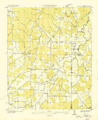 1936 Old Bethel1936 Print · USGSNorthwest Alabama at the height of the 1930s reveals a landscape of interconnected family farms and small rural hubs. Genealogists and local historians can locate early homesteads near Old Bethel, Clemments Mill, and community schools like Rocky Glen Sch.
 - 1938 Map of Danville
 1938 Danville1938 Print · USGSNorthern Alabama’s uplands are captured here in the mid-1930s, showing the early boundaries of the Black Warrior National Forest. Researchers can locate rural schools and churches like Speake Sch and Evergreen Ch or trace old crossings at McDaniel Bridge.2 unique versions available
End of results
Showing maps 1-23 of 23
Top cities of Lawrence County
- Moulton historical maps
- Town Creek historical maps
- Courtland historical maps
- North Courtland historical maps
- Hillsboro historical maps
- Hatton historical maps
Frequently asked questions
- What are the different types of historical maps available for Lawrence County?
- What is the oldest map of Lawrence County?
- Where can I purchase historical maps of Lawrence County for my home or office?
- Where can I download high-res historical maps of Lawrence County?
- Are there historical topographic maps available for Lawrence County?
- Is there historical aerial imagery available for Lawrence County?
- Where are historical maps of Lawrence County sourced from?