1940s Maps of Mobile County, Alabama
Explore 40 historic maps of Mobile County from the 1940s. These maps offer a rare glimpse into what life looked like during the 1940s — showing old roads, neighborhoods, homes, and landmarks that have changed or disappeared over time.
Whether you're researching your family's past, planning a metal detecting trip, or studying how Mobile County's landscape evolved across the 1940s, these high-resolution maps are a powerful tool for exploring the history of this region.
- Focus on a specific era: All maps on this page are from the 1940s, giving you a focused view of this time period.
- See what’s changed: Compare century-old streets, trails, and buildings to today's modern landscape using overlays and satellite layers.
- Research with precision: Use these maps for genealogy, historical research, land use analysis, or educational projects.
- View, download, or print: Maps are fully viewable online in high resolution, and can be downloaded or printed for your own records.
Start exploring Mobile County's history through authentic maps from the 1940s. This is your window into the past.
Mobile County, AL maps
(40)- 1940 Map of Hollingers Island
 1940 Hollingers Island1940 Print · USGSMobile County coastal life at the dawn of the 1940s is defined here by its tidal bayous and waterfront social clubs. Trace the locations of Racetrack Sch, Cashier Cem, and local landmarks like the Mobile Yacht Club along the bay.2 unique versions available
 - 1940 Map of Mobile
 1940 Mobile1940 Print · USGSMobile at the brink of the 1940s reveals a thriving Gulf Coast port where urban industry meets the tidal marshlands. Genealogists and historians can trace the early layout of Prichard, identify long-standing institutions like the Visitation Convent, or locate coastal landmarks such as the Quarantine Sta and Monroe Park Armory.3 unique versions available
 - 1940 Map of Mobile, 1955 Print
 1940 Mobile1955 Print · USGSMobile and its surrounding bayou country appear here just before the mid-century, from the busy State Docks to the quiet reaches of Hollingers Island. Genealogists can locate family landmarks like St Marys Ch, Magnolia Cemetery, and several old rural schools.5 unique versions available
 - 1941 Map of Chickasaw
 1941 Chickasaw1941 Print · USGSThe industrial riverfront north of Mobile is captured here just before the war, showing the busy Ship Yard and rail hubs. Trace local roots through the early streets of Whistler and Chickasaw or locate family landmarks like Alvarez Bridge and Liveoak Landing.2 unique versions available
 - 1941 Map of Daphne
 1941 Daphne1941 Print · USGSThe Alabama shoreline along Mobile Bay appears here just before the Second World War, showing the early layouts of Fairhope and Daphne. Genealogists can trace family footprints at Jackson Oak, Lebanon Chapel, and the Loyola Catholic Home.2 unique versions available
 - 1941 Map of Cedar Point
 1941 Cedar Point1941 Print · USGSCoastal Mobile County is shown here just before the mid-century, from the fishing docks of Bayou La Batre to the shores of Dauphin Island. Researchers can trace the path of the G M and O railroad or locate old landings at Mon Louis and Alabama Port.2 unique versions available
 - 1941 Map of Blakeley
 1941 Blakeley1941 Print · USGSThe Baldwin County shoreline and Tensaw delta are captured here just before the Second World War. Researchers can locate Civil War Trenches, Kings Battery, and family landmarks like Blakeley Cem and the settlement of Bridgehead.
 - 1941 Map of Hurley, 1953 Print
 1941 Hurley1953 Print · USGSThe borderlands between Mississippi and Alabama are captured here in the early 1940s as rural life centered on the river and rail. Local researchers can trace family landmarks and forgotten road networks from Hurley to St Elmo, including Tanners Cem, Baker Sch, and Slaughter Flat Landing.3 unique versions available
 - 1941 Map of Bay Minette, 1955 Print
 1941 Bay Minette1955 Print · USGSCoastal Alabama at the start of the 1940s is defined here by the complex river delta and the timber-rich uplands of Baldwin County. Genealogists and historians can trace old community centers like Whitehouse Forks, schools such as Stockton Sch, and the path of the Louisville and Nashville RR.2 unique versions available
 - 1941 Map of Creola, 1959 Print
 1941 Creola1959 Print · USGSMobile County during the early 1940s was a landscape of rail-connected settlements and coastal bayous. Genealogists can trace family roots through sites like Indian Springs Cem, St Louis Sch, and the riverside town of Creola.3 unique versions available
 - 1941 Map of Fairhope, 1965 Print
 1941 Fairhope1965 Print · USGSEastern Baldwin County and the Mobile Bay shore come alive in the early 1940s, when coastal villages were connected by the Old Spanish Trail. Researchers can locate Civil War Trenches, family sites like Johns Log Cabin, and community centers like the Bohemian Hall.
 - 1942 Map of Petit Bois Island
 1942 Petit Bois Island1942 Print · USGSCoastal barrier islands along the Alabama and Mississippi border appear in this wartime survey, showing the shifting sands before modern development. Maritime researchers can trace the navigational landscape of Petit Bois Pass and the position of the Horn Island L H.
 - 1942 Map of Hurricane
 1942 Hurricane1942 Print · USGSThe Mobile and Tensaw River deltas are captured here in the early 1940s, showing a world of tidal bayous and river landings. Genealogists and historians can locate the CIVIL WAR TRENCHES, family sites like Miller Cem, and old river stops including Steam Mill Landing.
 - 1942 Map of Blakeley
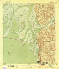 1942 Blakeley1942 Print · USGSThe Baldwin County shoreline and Mobile Bay delta appear here just before the mid-century boom, showing the intersection of military history and early coastal transit. Researchers can trace Civil War Trenches near Blakeley or locate old settlements like Park City and Bridgehead.2 unique versions available
 - 1942 Map of Fort Morgan
 1942 Fort Morgan1942 Print · USGSThe mouth of Mobile Bay is captured in the early 1940s, highlighting the strategic coastal defenses of the Alabama shore. Nautical researchers can trace the Main Channel past Fort Morgan and the site of Fort Gaines to the Sand Island L H.3 unique versions available
 - 1942 Map of Kushla
 1942 Kushla1942 Print · USGSMobile County settlements and timberlands appear here just before the mid-century boom. Genealogists can trace the rural communities of Kushla and Mauvilla, finding specific family-history sites like Indian Springs Ch and Kushla Sch along the Gulf Mobile and Ohio rail line.2 unique versions available
 - 1942 Map of Theodore
 1942 Theodore1942 Print · USGSTheodore and Irvington are shown at the start of the 1940s, highlighting a landscape shaped by historic trails and the bustling Louisville and Nashville Railroad. Researchers can locate family landmarks such as Magnolia Ch, St Elmo-Irvington Sch, and the unique Three Notches settlement.
 - 1942 Map of Deer Park, 1966 Print
 1942 Deer Park1966 Print · USGSCrossing the state line in the 1940s, this area is defined by the river systems and early rail lines of the Piney Woods. Genealogists can locate family landmarks like Turners Store, Stalworth Camp, and small rural schools including McCann Sch.
 - 1942 Map of Wilmer, 1968 Print
 1942 Wilmer1968 Print · USGSMobile County and the Mississippi borderlands are captured here in the early 1940s, showing a landscape of timber ridges and river bottoms. Family historians can trace rural roots through Moffet Cem, Fellowship Ch, and the settlement at Wilmer.
 - 1943 Map of Cedar Point
 1943 Cedar Point1943 Print · USGSThe Alabama Gulf Coast was a hub of maritime trade and seafood harvesting in the early 1940s. Trace the path of the G M and O (Abandoned) railroad near Bayou La Batre or locate coastal settlements like Alabama Port and Mon Louis.4 unique versions available
 - 1943 Map of Theodore
 1943 Theodore1943 Print · USGSMobile County during the early 1940s reveals a landscape defined by the intersection of major railroads and coastal wetlands. Researchers can locate community anchors like Three Notches Ch, St Elmo-Irvington Sch, and the rail junction at Theodore.2 unique versions available
 - 1943 Map of Hurricane
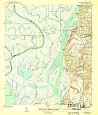 1943 Hurricane1943 Print · USGSThe Mobile-Tensaw Delta in the early 1940s is a intricate network of bayous and river islands where the railroad meets the swamp. Researchers can locate family landmarks like Miller Cem, the Civil War Trenches, and the old Hurricane Sch.2 unique versions available
 - 1943 Map of Creola
 1943 Creola1943 Print · USGSMobile County during the early 1940s shows a landscape of rail-dependent settlements and dense bayous before the mid-century suburban expansion. Researchers can locate family landmarks like Indian Springs Cem, the Oak Grove Sch, and old stops along the Alabama Tennessee and Northern Railroad.2 unique versions available
 - 1943 Map of Chickasaw
 1943 Chickasaw1943 Print · USGSCoastal Alabama was transforming during the early 1940s as industrial and rail networks expanded north of Mobile. Genealogists and historians can trace the early footprints of Saraland and Chickasaw, locate the massive Ship Yard, and study the rail lines of the Southern Railway.3 unique versions available
 - 1943 Map of Mobile
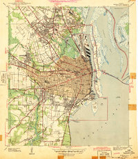 1943 Mobile1943 Print · USGSMobile and its bustling harbor at the height of the Second World War reveal a portrait of Alabama's port city before modern sprawl. Researchers can trace the layout of the State Docks, identify old neighborhood schools like Leinkauf Sch, or locate the historic grounds of Magnolia Cemetery.2 unique versions available
Showing maps 1-25 of 40
Top cities of Mobile County
- Mobile historical maps
- Prichard historical maps
- Tillmans Corner historical maps
- Saraland historical maps
- Satsuma historical maps
- Chickasaw historical maps
See more
Frequently asked questions
- What are the different types of historical maps available for Mobile County?
- What is the oldest map of Mobile County?
- Where can I purchase historical maps of Mobile County for my home or office?
- Where can I download high-res historical maps of Mobile County?
- Are there historical topographic maps available for Mobile County?
- Is there historical aerial imagery available for Mobile County?
- Where are historical maps of Mobile County sourced from?