1980s Maps of Washington County, Alabama
Explore 18 historic maps of Washington County from the 1980s. These maps offer a rare glimpse into what life looked like during the 1980s — showing old roads, neighborhoods, homes, and landmarks that have changed or disappeared over time.
Whether you're researching your family's past, planning a metal detecting trip, or studying how Washington County's landscape evolved across the 1980s, these high-resolution maps are a powerful tool for exploring the history of this region.
- Focus on a specific era: All maps on this page are from the 1980s, giving you a focused view of this time period.
- See what’s changed: Compare century-old streets, trails, and buildings to today's modern landscape using overlays and satellite layers.
- Research with precision: Use these maps for genealogy, historical research, land use analysis, or educational projects.
- View, download, or print: Maps are fully viewable online in high resolution, and can be downloaded or printed for your own records.
Start exploring Washington County's history through authentic maps from the 1980s. This is your window into the past.
Washington County, AL maps
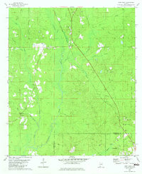
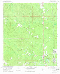
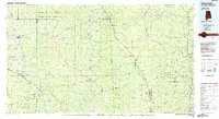
(18)- 1982 Map of Wagarville
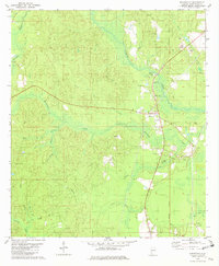 1982 Wagarville1982 Print · USGSThe area surrounding the St. Stephens Meridian in the early eighties shows a landscape of rural settlements and rail corridors. Trace the path of the Southern Railway through Wagarville and locate country churches like Ebenezer Ch.
 - 1982 Map of Citronelle West
 1982 Citronelle West1982 Print · USGSMobile County and Washington County meet at the Esca Tawpa River in the early eighties, where timberlands and oil exploration define the landscape. Genealogists can trace family landmarks like New Hope Cemetery, Bethel Church, and the Oil City Speedway.2 unique versions available
 - 1982 Map of Calvert
 1982 Calvert1982 Print · USGSSouthwestern Alabama's timber and rail country comes to life in the early 1980s. Genealogists and local historians can trace family locations near numerous rural landmarks like Vaughn Cem, Byrd Chapel, and the Fairford Lookout Tower.
 - 1982 Map of Rutan
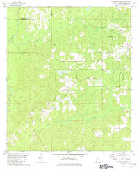
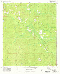
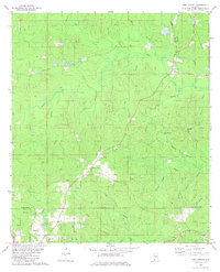
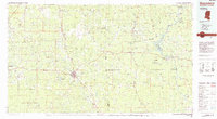
 1982 Rutan1982 Print · USGSThe Washington County seat of Chatom and surrounding rural settlements are documented here in the early 1980s. Researchers can locate the County Hospital, trace the route of Old Copeland Road, and find local landmarks like Pine Level Ch and the Turner Lookout Tower.
 - 1982 Map of Deer Park
 1982 Deer Park1982 Print · USGSThe timber and rail corridor of Washington County is captured here in the early eighties. Researchers can trace the Illinois Central Gulf through Deer Park, locating family landmarks like Weldy Cem and New Light Ch.2 unique versions available
 - 1982 Map of Seaboard
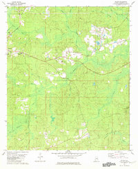
 1982 Seaboard1982 Print · USGSWashington County, Alabama, is shown in the early eighties as a landscape of rural settlements and timberland. Genealogists can trace the locations of Chalker Memorial Ch and Bethel Ch or follow the path of the Burlington Northern Road.
 - 1982 Map of Brown Town
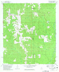 1982 Brown Town1982 Print · USGSThe Alabama and Mississippi borderlands are captured here in the early eighties, showcasing a rural landscape of timbered ridges and creek bottoms. Local researchers can locate Mt Pisgah Ch, the Maples Cem, and the small settlements of Brown Town and Pisgah.3 unique versions available
 - 1982 Map of Rounsaville
 1982 Rounsaville1982 Print · USGSThe borderlands of Greene County and Washington County come into focus during the late seventies, showing a landscape defined by timber and transit. Genealogists and historians can trace the Old Railroad Grade and locate Rounsaville Ch or Burbank Cem.
 - 1982 Map of Sims Chapel
 1982 Sims Chapel1982 Print · USGSLower Washington and Mobile counties appear in the early eighties as a landscape of timber, rail, and emerging oil production. Genealogists and local historians can trace the communities of Sims Chapel and Charity Chapel, or locate family sites at Sawyer Cem and Red Wash Cem.
 - 1982 Map of Mc Intosh
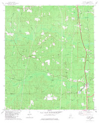
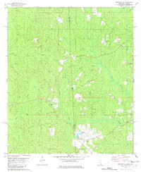
 1982 Mc Intosh1982 Print · USGSCoastal plain settlements and timberlands in Washington County are documented here in the early eighties. Genealogists can trace family roots through landmarks like Mt Pleasant Ch, Harris Cem, and the Boykin Sch.
 - 1983 Map of Bilbo Island
 1983 Bilbo Island1983 Print · USGSThe confluence of the Alabama and Tombigbee Rivers is captured here in the early 1980s, marking the boundary of four coastal counties. Researchers can trace river landmarks and backwater features like Little Shanty Landing, Bilbo Lake, and the headwaters of the Mobile River.2 unique versions available
 - 1983 Map of Prestwick, 1984 Print
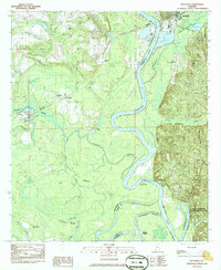 1983 Prestwick1984 Print · USGSThe Tombigbee River corridor in the early eighties reveals a landscape shaped by water and woods on the Washington and Clarke county line. Researchers can trace rural settlement patterns through Harrells Quarters, locate Pleasant Ridge Ch, or explore the limits of the Fred T Stimpson State Game Sanctuary.
 - 1984 Map of Citronelle
 1984 Citronelle1984 Print · USGSThe Alabama-Mississippi borderlands in the mid-1980s were a hub of timber and rail, spanning from the Leaf River to the Mobile County line. Genealogists can trace family roots through rural communities like Sims Chapel, Leakesville, and Vinegar Bend.2 unique versions available
 - 1984 Map of Hattiesburg
 1984 Hattiesburg1984 Print · USGSSouth Mississippi’s Pine Belt is seen here in the mid-eighties, showing the region as a hub of timber production and petroleum extraction. Trace the rail lines of the Illinois Central Gulf RR through old settlements like Richton or the energy developments at the Heidelberg Oil Field.2 unique versions available
 - 1984 Map of Waynesboro
 1984 Waynesboro1984 Print · USGSThe borderlands of Mississippi and Alabama come alive in this mid-eighties survey of timber and river country. Researchers can trace the Illinois Central Gulf Railroad corridor through Waynesboro and Shubuta, or locate remote lookouts like Maynor Creek Lookout.2 unique versions available
 - 1984 Map of Ginhouse Island
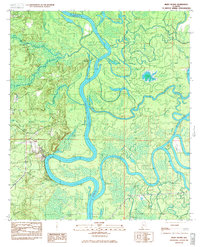
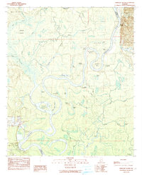 1984 Ginhouse Island1984 Print · USGSThe Tombigbee River bottomlands during the mid-1980s reveal a landscape of dramatic river meanders and emerging industrial footprints. Researchers can trace the river economy through historical river access points like McIntosh Landing and Export Landing, or explore the wooded sanctuary of Stimpson State Game Sanctuary.
 - 1986 Map of Monroeville
 1986 Monroeville1986 Print · USGSMonroe and Clarke counties are captured here in the mid-eighties, centered on the river valleys of the Alabama River and Tombigbee River. Genealogists and local historians can trace legacy settlements like Burnt Corn, Whatley, and the river site of Claiborne.2 unique versions available
 - 1986 Map of Atmore
 1986 Atmore1986 Print · USGSSouth Alabama’s river country and timberlands are captured here in the mid-eighties, showing the deep-water bends of the Alabama River and the expanding road networks. Genealogists and historians can trace family locations through small-town post offices and rural churches like Chrysler Ch and the settlement of Barlow Bend.2 unique versions available
End of results
Showing maps 1-18 of 18
Top cities of Washington County
- Chatom historical maps
- Leroy historical maps
- Millry historical maps
- Calvert historical maps
- McIntosh historical maps
Frequently asked questions
- What are the different types of historical maps available for Washington County?
- What is the oldest map of Washington County?
- Where can I purchase historical maps of Washington County for my home or office?
- Where can I download high-res historical maps of Washington County?
- Are there historical topographic maps available for Washington County?
- Is there historical aerial imagery available for Washington County?
- Where are historical maps of Washington County sourced from?