Old Maps of Washington County, Alabama for Academic Research
Study the evolution of Washington County with 175 high-resolution historic maps. Whether you're teaching, researching, or modeling changes in land use, these maps provide essential visual documentation of urban, environmental, and geographic change.
- Analyze long-term change: Track patterns in development, transportation, and natural features.
- Ideal for environmental or urban studies: Support academic projects with primary historical map data.
- Use in the classroom or lab: Educators and researchers rely on these maps to bring historical context to life.
These maps are a powerful tool for teaching, research, and visualizing how Washington County has changed over the decades.
Washington County, AL maps
(175)- 1942 Map of Deer Park, 1966 Print
 1942 Deer Park1966 Print · USGSCrossing the state line in the 1940s, this area is defined by the river systems and early rail lines of the Piney Woods. Genealogists can locate family landmarks like Turners Store, Stalworth Camp, and small rural schools including McCann Sch.
 - 1943 Map of Deer Park
 1943 Deer Park1943 Print · USGSSouthwestern Alabama near the Mississippi border is shown here during the early 1940s, centered on the logging and rail corridors of the Escatawpa River. Researchers can locate rural landmarks like Stalworth Camp, the Mississippi and Alabama RR, and several churches including Shiloh Ch.2 unique versions available
 - 1943 Map of Choctaw Bluff, 1958 Print
 1943 Choctaw Bluff1958 Print · USGSSouthwestern Alabama during the 1940s is shaped by the meeting of the Tombigbee River and Alabama River. Researchers can trace old river landings like Dixie Ldg and find the historic Grave of Red Eagle (Weatherford).2 unique versions available
 - 1943 Map of Tensaw, 1958 Print
 1943 Tensaw1958 Print · USGSBaldwin County at the height of the river-landing era is detailed here through its complex bayous and plantations. Genealogists can locate family names at Lancaster Cem and trace rural life at Fleming Sch or Davis Ldg.2 unique versions available
 - 1943 Map of Citronelle, 1960 Print
 1943 Citronelle1960 Print · USGSThe pine hills of northern Mobile County are captured here in the early 1940s, just as the river-and-rail economy matured. Genealogists can locate family landmarks like St Thomas Cem, Sims Chapel, and the Weaver Community House.2 unique versions available
 - 1943 Map of McIntosh, 1972 Print
 1943 McIntosh1972 Print · USGSMcIntosh and the Piney Woods of Washington County are shown here during the early 1940s, highlighting a landscape of timber, rails, and small settlements. Researchers can trace family roots through landmarks like Harris Cem, Fields Sch, and Pine Lodge Ch.
 - 1944 Map of McIntosh
 1944 McIntosh1944 Print · USGSWashington County during the early 1940s is captured here in detail, showing the rural communities of the Alabama pine belt. Genealogists can trace family landmarks like Harris Cem and the small country congregations at Bethel Ch and Pine Lodge Ch.2 unique versions available
 - 1944 Map of Tensaw
 1944 Tensaw1944 Print · USGSThe Alabama and Mobile River deltas are captured here during the mid-forties, showing a landscape defined by intricate waterways and rural landings. Researchers can trace historic river access at Old Ft Stoddard Mt Vernon Ldg or locate family sites like Lancaster Cem and Stockton Sch.3 unique versions available
 - 1946 Map of Citronelle
 1946 Citronelle1946 Print · USGSCoastal Alabama's pine-belt communities and rail networks are captured here in the mid-1940s as industry and infrastructure expanded. Researchers can locate specific local landmarks like Cherokee Mineral Sprs, Cedar Creek State Park, and the Fairford Fire Tower.2 unique versions available
 - 1946 Map of Choctaw Bluff
 1946 Choctaw Bluff1946 Print · USGSThe river-bottom country of southwest Alabama is shown here just after the war, where the mighty Tombigbee and Alabama rivers meet. Researchers can trace historic river landings like Oven Bluff or find the Grave of Red Eagle (Weatherford) near the confluence.2 unique versions available
 - 1953 Map of Andalusia, 1965 Print
 1953 Andalusia1965 Print · USGSSouth Alabama in the mid-twentieth century remains a land of pine forests and river-fed settlements. You can trace the vital rail corridors of the Louisville & Nashville and locate regional centers such as Andalusia, Brewton, and Monroeville.3 unique versions available
 - 1953 Map of Hattiesburg, 1965 Print
 1953 Hattiesburg1965 Print · USGSSouth Mississippi and western Alabama are shown here during the mid-twentieth century as the timber and rail industries shaped the region. Genealogists and historians can trace rail lines like the Mississippi Central and locate rural centers such as Magee, Richton, and Mount Vernon.4 unique versions available
 - 1957 Map of Andalusia
 1957 Andalusia1957 Print · USGSSouthern Alabama in the mid-1950s was a landscape defined by timbered stretches and the rhythmic flow of the Alabama River. Researchers can trace the legacy of the rail era through the Central of Georgia tracks and the storied river bluffs at Choctaw Bluff.
 - 1958 Map of Hattiesburg
 1958 Hattiesburg1958 Print · USGSSoutheastern Mississippi's timber and rail networks are at their peak during the late fifties, centered on the growing hubs of Hattiesburg and Laurel. Researchers can trace old family landmarks like Sims Chapel, the Busbey Game Refuge, and the vanished stops along the Mississippi Central railroad.2 unique versions available
 - 1971 Map of Bigbee, 1974 Print
 1971 Bigbee1974 Print · USGSThe rural pine woods of Washington County appear here in the early seventies, centered on the community of Bigbee. Researchers can trace the layout of timberlands like St Stephens State Forest and find family-history landmarks such as Wesley Chapel Cem and Spring Hill Cem.2 unique versions available
 - 1971 Map of Bladon Springs, 1975 Print
 1971 Bladon Springs1975 Print · USGSThe borderlands of Choctaw and Washington Counties come to life in this early 1970s survey of the Alabama piney woods. Researchers can trace ancestral roots through rural landmarks like Antioch Ch, the community of Frankville, and the grounds of Bladon Springs State Park.
 - 1972 Map of Tattlersville, 1975 Print
 1972 Tattlersville1975 Print · USGSThe Tombigbee River corridor in southwestern Alabama was defined by its water-bound commerce and quiet rural crossroads in the early 1970s. Genealogists can trace family names at Blount Landing and rural congregations at New Hope Ch or St Pauls Ch.2 unique versions available
 - 1972 Map of St. Stephens, 1975 Print
 1972 St. Stephens1975 Print · USGSThe Tombigbee River corridor at the Washington and Clarke county line comes to life in this early 1970s survey. Researchers can trace historic river navigation at Old Lock No 1 or locate family plots at Old St Stephens Cem and Granade Cem.2 unique versions available
 - 1974 Map of Fruitdale, 1977 Print
 1974 Fruitdale1977 Print · USGSFruitdale and the Mississippi-Alabama borderlands appear here in the mid-1970s, showcasing a landscape of timber, rail, and deep-rooted family settlements. Genealogists can locate several burial sites including South Oak Grove Cem and Fruitdale Cem, while tracing the Illinois Central Gulf line.2 unique versions available
 - 1974 Map of Millry South, 1977 Print
 1974 Millry South1977 Print · USGSSouthwestern Alabama’s timber and rail corridor is captured here in the 1970s, showing the rural communities between the Millry and Jordan settlements. Genealogists can trace family landmarks like Barlow Chapel, Loper Cem, and the historic Old Indian Treaty Boundary.2 unique versions available
 - 1974 Map of Chatom, 1977 Print
 1974 Chatom1977 Print · USGSChatom and its rural Washington County surroundings are captured in the mid-seventies, showing the area's transition between timberlands and small-town industry. Genealogists and historians can locate specific landmarks like Laton Hill Cem, Spring Bank Ch, and the St Louis-San Francisco rail line.
 - 1974 Map of State Line, 1977 Print
 1974 State Line1977 Print · USGSThe Mississippi-Alabama borderlands come into focus in the mid-1970s, showing the vital rail and timber corridor near State Line. Genealogists and local historians can locate rural landmarks like Yellow Pine, the Gilley Cem, and the Milstead Lookout Tower.2 unique versions available
 - 1974 Map of Millry North, 1977 Print
 1974 Millry North1977 Print · USGSThe border of Washington and Choctaw Counties is captured here in the mid-1970s, as the St Louis-San Francisco railroad connects rural hubs. Trace family roots at Winsletts Cem or Mt Zion Chapel, and locate the historic Healing Springs.
 - 1974 Map of Copeland, 1977 Print
 1974 Copeland1977 Print · USGSStraddling the border in the 1970s, this area shows a landscape defined by traditional rural life and historical lines. You can trace the Old Indian Treaty Boundary and locate community anchors like Lewis Chapel and the Zion Rest Cem.3 unique versions available
 - 1974 Map of Aquilla, 1977 Print
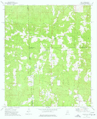 1974 Aquilla1977 Print · USGSThe Alabama-Mississippi borderlands come into focus in the 1970s, revealing a landscape of rural communities and winding creek bottoms. Researchers can trace family history through sites like Old Aquilla Cemetery, Kings Chapel, and the settlement at Shady Grove.2 unique versions available
Showing maps 1-25 of 175
Top cities of Washington County
- Chatom historical maps
- Leroy historical maps
- Millry historical maps
- Calvert historical maps
- McIntosh historical maps
Frequently asked questions
- What are the different types of historical maps available for Washington County?
- What is the oldest map of Washington County?
- Where can I purchase historical maps of Washington County for my home or office?
- Where can I download high-res historical maps of Washington County?
- Are there historical topographic maps available for Washington County?
- Is there historical aerial imagery available for Washington County?
- Where are historical maps of Washington County sourced from?