Old Maps of Winston County, Alabama for Genealogy
Trace your family roots with 184 historic maps of Winston County. These high-res maps reveal old neighborhoods, homesites, landmarks, and streets — helping you uncover where your ancestors lived and how the area evolved over time.
- Explore historic neighborhoods: Identify where your relatives may have lived in the 1800s or 1900s.
- Compare maps over time: Trace the changes in streets, buildings, and landmarks for multi-generational research.
- Perfect for genealogy & ancestry research: Used by family historians and researchers to map out lineage and migration.
These maps are an incredible resource for exploring your personal connection to Winston County's past.
Winston County, AL maps
(184)- 1893 Map of Jasper
 1893 Jasper1893 Print · USGSNorthern Alabama’s coal and timber country comes into focus in the 1890s as railroads began to penetrate the river valleys. Genealogists and historians can trace family-named river crossings like Miller Ferry and Baltimore Ford or early industry at Gamble Mines.5 unique versions available
 - 1935 Map of Upshaw
 1935 Upshaw1935 Print · USGSLawrence and Winston counties are captured here in the mid-1930s, documenting a landscape of rural schoolhouses and forest management lookouts. You can trace early twentieth-century life at Upshaw, Templeton Sch, and the Friendship Cem.
 - 1935 Map of Danville
 1935 Danville1935 Print · USGSIn the mid-thirties, the borderlands of Lawrence and Morgan counties featured a landscape of remote stores and hilltop churches. Genealogists can trace family footprints at Strauge Crossroads or locate the ancient Indian Mounds near Oakville.2 unique versions available
 - 1936 Map of Delmar
 1936 Delmar1936 Print · USGSHaleyville and the surrounding Winston County terrain are captured here in the mid-1930s as modern infrastructure reached the region. Genealogists and historians can trace the early road network of State Highway No 5 and locate landmarks like Prospect Ch and Quarter Creek.
 - 1936 Map of Kinlock Spring
 1936 Kinlock Spring1936 Print · USGSWinston and Franklin Counties were transitioning into a new era of federal land management and infrastructure during the mid-thirties. Genealogists can locate family-named landmarks like Posey Mill, Carrolls Cross Roads, and the CCC Camp No F 3 near the National Forest boundary.
 - 1936 Map of Mc Kendry
 1936 Mc Kendry1936 Print · USGSThe rural highlands of North Alabama come into focus in the mid-1930s as a network of ridge-top settlements and forest boundaries. Genealogists can trace family connections through numerous rural landmarks like Andrews Chapel, Blairs Store, and the scattered homes of McKendry.
 - 1936 Map of Phil Campbell
 1936 Phil Campbell1936 Print · USGSNorthwest Alabama at the height of the mid-thirties shows a landscape of ridge-top settlements and creek-side industry. Genealogists can trace family roots through numerous rural landmarks like Morris Hill Ch, Phillips Sch, and the Lowler Mines.
 - 1936 Map of Moulton
 1936 Moulton1936 Print · USGSLawrence County in the mid-1930s shows a landscape of rural schools and family cemeteries clustered around Moulton. Genealogists and historians can trace the foundations of Rabbitt Town and Landersville or locate Shoemaker Cem and CCC Camp 12.2 unique versions available
 - 1936 Map of Goddard
 1936 Goddard1936 Print · USGSNorthern Alabama's ridgeline terrain is documented in the mid-1930s, showing the intersection of heavy rail and forest boundaries. Genealogists can locate Union Grove Ch and Goddard near the Southern rail line and Black Warrior National Forest.
 - 1938 Map of Danville
 1938 Danville1938 Print · USGSNorthern Alabama’s uplands are captured here in the mid-1930s, showing the early boundaries of the Black Warrior National Forest. Researchers can locate rural schools and churches like Speake Sch and Evergreen Ch or trace old crossings at McDaniel Bridge.2 unique versions available
 - 1940 Map of Mt Hope
 1940 Mt Hope1940 Print · USGSLawrence and Winston counties are captured here in the early 1940s as the Moulton Valley agricultural landscape meets the forest. Researchers can trace family sites at Cave Spring Ch, Heflin Cem, and the depression-era CCC Camp.3 unique versions available
 - 1946 Map of Phil Campbell, 1967 Print
 1946 Phil Campbell1967 Print · USGSNorthwestern Alabama in the mid-1940s reveals a landscape defined by the SOUTHERN rail line and deep mining roots. Trace the locations of early rural schools and churches like Phillips High Sch and Shady Grove Ch, or locate old mines and the Donaldson Mill.3 unique versions available
 - 1947 Map of Phil Campbell
 1947 Phil Campbell1947 Print · USGSPhil Campbell and Bear Creek anchor this post-war survey of the Alabama hill country at a time when the Southern railroad still fueled local industry. Researchers can trace rural life through numerous sites like Phillips High Sch, Dime, and the Wilson Mine (Aband).2 unique versions available
 - 1947 Map of Kinlock Spring, 1974 Print
 1947 Kinlock Spring1974 Print · USGSWinston County and its surrounding forest lands are captured here during the mid-twentieth century as federal management and rural life intersected. Researchers can locate early schools and churches like Trapptown Sch, Maxwell Chapel, and the site of an abandoned CCC Camp.
 - 1949 Map of Kinlock Spring
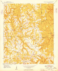 1949 Kinlock Spring1949 Print · USGSIn the late 1940s, this portion of the Bankhead National Forest was a landscape of remote ridges and family settlements. Genealogists can trace rural life through landmarks like Posey Mill, New Bethlehem, and the CCC Camp 931 (Abandoned).
 - 1949 Map of Cold Springs, 1969 Print
 1949 Cold Springs1969 Print · USGSCullman County life in the late 1940s centers on the ridge-top settlements and creek valleys near the Sipsey Fork. Researchers can trace rural lineages through numerous country landmarks like Cold Springs, Drummond Sch, and the Banking Grounds.5 unique versions available
 - 1949 Map of Manchester, 1972 Print
 1949 Manchester1972 Print · USGSWalker County during the late 1940s shows a landscape of small mining and farming settlements connected by the Alabama Central Railroad. Genealogists can locate family landmarks like Old Bennett Cem, Macedonia Sch, and the rural community at Five Points.2 unique versions available
 - 1949 Map of Nauvoo, 1973 Print
 1949 Nauvoo1973 Print · USGSPost-war Walker County comes to life in this detailed survey of the plateau country. Researchers can trace family roots through numerous local landmarks like Keeton Cem, Old Zion Ch, and the rural Nix Sch.2 unique versions available
 - 1949 Map of Sunlight, 1973 Print
 1949 Sunlight1973 Print · USGSWalker County at the end of the 1940s reveals a landscape of winding creek valleys and emerging coal extraction. Researchers can trace family history at sites like Blooming Grove Cem, the settlement of Sunlight, and Philadelphia Ch.3 unique versions available
 - 1950 Map of Nauvoo
 1950 Nauvoo1950 Print · USGSThe northern forest lands and rural settlements of Walker and Winston counties are detailed in this mid-century survey. Genealogists and local historians can trace the early layout of Nauvoo and its connection to the expansive William B Bankhead National Forest.2 unique versions available
 - 1950 Map of Manchester
 1950 Manchester1950 Print · USGSWalker County during the mid-century period shows a landscape of rural schoolhouses and forest management just north of Jasper. Researchers can trace the Alabama Central RR (Abandoned) and locate vanished local landmarks like Hudson Settlement and the Bankhead Farmstead Sch.2 unique versions available
 - 1951 Map of Cold Springs
 1951 Cold Springs1951 Print · USGSCullman and Walker Counties are shown here just after mid-century as a landscape of rural ridge-top churches and river-bottom crossings. Genealogists can locate family landmarks like Addington Chapel, McKinley Chapel, and the community of Cold Springs.2 unique versions available
 - 1951 Map of Sunlight
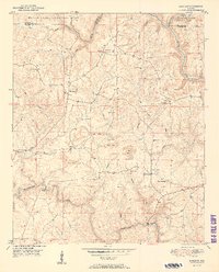 1951 Sunlight1951 Print · USGSWalker County at mid-century shows a landscape of forest and industry just as mining operations began to mark the terrain. Genealogists can trace family roots through numerous country churches like Mt Joy Ch and quiet burial grounds such as Tidwell Cem.2 unique versions available
 - 1953 Map of Birmingham, 1964 Print
 1953 Birmingham1964 Print · USGSCentral Alabama at mid-century shows a landscape defined by industrial expansion and the iron-rich ridges surrounding Birmingham. Researchers can trace the extensive rail networks of the L & N RR or locate historic federal sites like the Anniston Ordnance Depot.4 unique versions available
 - 1956 Map of Birmingham
 1956 Birmingham1956 Print · USGSCentral Alabama in the mid-fifties exhibits a landscape of growing cities and deep-rooted industrial corridors. Genealogists and historians can trace the development of suburban Mountain Brook or locate regional hubs like Sylacauga and Jasper.
Showing maps 1-25 of 184
Top cities of Winston County
- Haleyville historical maps
- Double Springs historical maps
- Lynn historical maps
- Addison historical maps
- Arley historical maps
- Natural Bridge historical maps
Frequently asked questions
- What are the different types of historical maps available for Winston County?
- What is the oldest map of Winston County?
- Where can I purchase historical maps of Winston County for my home or office?
- Where can I download high-res historical maps of Winston County?
- Are there historical topographic maps available for Winston County?
- Is there historical aerial imagery available for Winston County?
- Where are historical maps of Winston County sourced from?