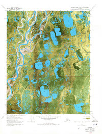
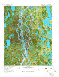
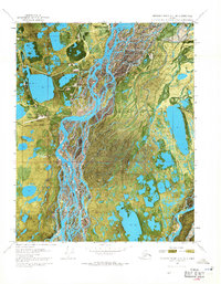
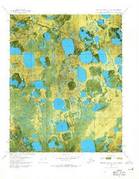
1970s Maps of Alaska
Explore 225 historic maps of Alaska from the 1970s. These maps offer a rare glimpse into what life looked like during the 1970s — showing old roads, neighborhoods, homes, and landmarks that have changed or disappeared over time.
Whether you're researching your family's past, planning a metal detecting trip, or studying how Alaska's landscape evolved across the 1970s, these high-resolution maps are a powerful tool for exploring the history of this region.
- Focus on a specific era: All maps on this page are from the 1970s, giving you a focused view of this time period.
- See what’s changed: Compare century-old streets, trails, and buildings to today's modern landscape using overlays and satellite layers.
- Research with precision: Use these maps for genealogy, historical research, land use analysis, or educational projects.
- View, download, or print: Maps are fully viewable online in high resolution, and can be downloaded or printed for your own records.
Start exploring Alaska's history through authentic maps from the 1970s. This is your window into the past.
Alaska maps
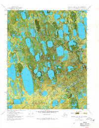
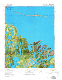
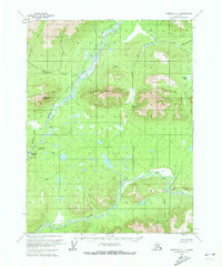
(225)- 1970 Map of Beechey Point A-4 NE, 1971 Print
 1970 Beechey Point A-4 NE1971 Print · USGSAlaska's North Slope is captured here during the early years of oil exploration, showing a landscape defined by braided rivers and frozen tundra. Researchers can trace the Winter Trail and locate early survey markers like Placid Et Al State No. 1 near the Kuparuk River.2 unique versions available
 - 1970 Map of Beechey Point B-4 SE, 1971 Print
 1970 Beechey Point B-4 SE1971 Print · USGSThe Alaskan North Slope appears in the early days of oil exploration, showing a landscape of seasonal routes and remote pads. Researchers can trace the footprint of early industrial sites like Rivers Camp Service City and the Winter Trail.2 unique versions available
 - 1970 Map of Beechey Point A-3 NE, 1971 Print
 1970 Beechey Point A-3 NE1971 Print · USGSThe Arctic coast was undergoing a massive industrial transformation in the early seventies as energy exploration took hold. Researchers can trace the layout of early oil field infrastructure including Deadhorse, Halliburton Camp, and the Winter Trail.2 unique versions available
 - 1970 Map of Beechey Point A-3 NW, 1971 Print
 1970 Beechey Point A-3 NW1971 Print · USGSThe Alaska North Slope at the dawn of the 1970s reveals a landscape transitioning toward industrial resource development. Trace early Arctic infrastructure and natural hydrology through sites like Put River State No 1 and the Winter Trail.2 unique versions available
 - 1970 Map of Beechey Point B-3 SW, 1971 Print
 1970 Beechey Point B-3 SW1971 Print · USGSThe North Slope during the early years of the oil boom is revealed here, documenting the initial industrial infrastructure along Prudhoe Bay. Trace the early logistics of the region through Frontier Camp, the Winter Landing Strip, and the historic Discovery Well Prudhoe Bay State No 1.2 unique versions available
 - 1970 Map of Beechey Point B-2 SE, 1971 Print
 1970 Beechey Point B-2 SE1971 Print · USGSThe Arctic coastline of Alaska’s North Slope is captured in the early seventies as industrial development began to touch the delta. Trace the remains of Cabins (Ruins) at Point Brower and follow the Winter trail near the delta.3 unique versions available
 - 1970 Map of Beechey Point B-2 SW, 1971 Print
 1970 Beechey Point B-2 SW1971 Print · USGSThe North Slope coast comes into focus in 1970 as industrial exploration begins in the Arctic. Trace the early industrial footprint at Sag Delta No 1 Oil Well and follow the remote Winter trail through the Sagavanirktok River Delta.2 unique versions available
 - 1970 Map of Beechey Point B-3 NW, 1971 Print
 1970 Beechey Point B-3 NW1971 Print · USGSThe Arctic coastline of the North Slope comes into focus during the early 1970s as industrial development began to reach the Beaufort Sea. Local historians can trace early petroleum sites like North Prudhoe State 1 alongside traditional Cabins and the Winter Trail.3 unique versions available
 - 1970 Map of Beechey Point B-3 SE, 1971 Print
 1970 Beechey Point B-3 SE1971 Print · USGSThe Arctic coast of the North Slope is shown here during the initial expansion of the oil industry in the early seventies. Trace the early layout of Prudhoe Bay Airfield, the Prudhoe Dock, and early drilling infrastructure like Drill Site 2.2 unique versions available
 - 1970 Map of Beechey Point B-4 NE, 1971 Print
 1970 Beechey Point B-4 NE1971 Print · USGSThe North Slope coast comes into focus during the early 1970s, showcasing the complex river deltas and barrier islands of the arctic. Researchers can trace the seasonal Winter Trail as it crosses the Kuparuk River and the shores of Gwydyr Bay.2 unique versions available
 - 1970 Map of Beechey Point A-2 NW, 1971 Print
 1970 Beechey Point A-2 NW1971 Print · USGSThe North Slope during the 1970s was a landscape defined by early oil exploration and braided river deltas. Trace the industrial footprint of the era through isolated sites like Kadler State No 1 and the remote Coastal Landing Strip.2 unique versions available
 - 1970 Map of Beechey Point A-2 NE, 1971 Print
 1970 Beechey Point A-2 NE1971 Print · USGSThe Arctic coastline of the North Slope is captured in this 1970 orthophotomap, showing the intricate Sagavanirktok River Delta. Researchers can trace the coastal morphology of Foggy Island Bay and the isolated Foggy Island.2 unique versions available
 - 1970 Map of Bendeleben A-4, 1972 Print
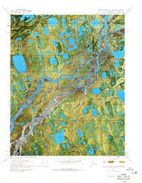
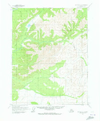
 1970 Bendeleben A-41972 Print · USGSThe Seward Peninsula backcountry comes into focus in this 1970s revision, showing the high ridges and mining-era waterworks of the Nome region. Researchers can trace the path of the Pargon Ditch and the long Tractor Trail through Grass Valley.
 - 1970 Map of Bettles B-4, 1973 Print
 1970 Bettles B-41973 Print · USGSThe Alaskan interior in the early seventies was a wilderness of shifting wetlands and seasonal routes. Trace the path of the Winter Trail as it crosses a landscape defined by Kanuti Flats and Taclodalten Lake.2 unique versions available
 - 1970 Map of Bettles D-4, 1973 Print
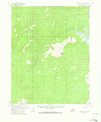
 1970 Bettles D-41973 Print · USGSThe Koyukuk River backcountry comes into focus during the early seventies, centered on the aviation and river hub of Evansville. Researchers can trace the Winter Trail and locate remote sites like the Bettles Cem, Bettles Field, and Pitchuk Lake.2 unique versions available
 - 1970 Map of Beaver D-5, 1973 Print
 1970 Beaver D-51973 Print · USGSThe Alaskan interior north of the Yukon River is captured here in the early seventies, showing a vast wilderness before modern infrastructure. Researchers can trace the winding course of the Granite Fork Hodzana River and its tributaries like Lansing Creek.
 - 1970 Map of Wiseman A-1, 1973 Print
 1970 Wiseman A-11973 Print · USGSThe remote interior of the Brooks Range foothills comes into focus in the early 1970s, where river travel and winter routes define the landscape. Researchers can trace historic river landings at Tramway Bar, navigate Sitkum Pass, and locate isolated Cabin sites along the Middle Fork Koyukuk River.4 unique versions available
 - 1970 Map of Wiseman A-6, 1973 Print
 1970 Wiseman A-61973 Print · USGSThe northern interior of Alaska in the early 1970s is defined by the wandering Malamute Fork Alatna River. Genealogists and researchers can trace the natural landmarks of this roadless region, from Deadman Mountain to the remote valley of Roosevelt Creek.
 - 1970 Map of Wiseman A-4, 1973 Print
 1970 Wiseman A-41973 Print · USGSInterior Alaska in the early 1970s is defined by its seasonal routes and isolated outposts along the John River. Researchers can trace the path of the Winter Road past Ninemile Cabin or locate small dwellings like the lone Cabin near Death Valley Creek.
 - 1970 Map of Bettles D-1, 1973 Print
 1970 Bettles D-11973 Print · USGSThe Yukon-Koyukuk region in the early seventies shows a landscape defined by seasonal transit and remote waterways. Researchers can trace the path of the Winter Road as it passes Grayling Lake and crosses the Jim River and Prospect Creek.3 unique versions available
 - 1970 Map of Bettles A-3, 1973 Print
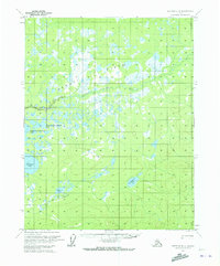
 1970 Bettles A-31973 Print · USGSInterior Alaska's wilderness is captured in the early 1970s, showcasing a roadless landscape of lakes and rivers. Researchers can trace the winding Kanuti River and locate the significant waters of Sithylemenkat Lake and Tokusatatquaten Lake.
 - 1970 Map of Bettles A-4, 1973 Print
 1970 Bettles A-41973 Print · USGSThe Alaskan interior at the start of the 1970s reveals a wilderness shaped by the shifting Kanuti River. Researchers can trace the seasonal Winter Trail and locate remote water bodies like Old Dummy Lake and Kanuti Lake.
 - 1970 Map of Bettles B-2, 1973 Print
 1970 Bettles B-21973 Print · USGSThe Kanuti River valley is captured here in the early 1970s, showing the winding waterways of the Alaskan interior before modern development. You can trace seasonal transportation routes like the Winter Road and Winter Trail as they pass the base of Caribou Mountain.2 unique versions available
 - 1970 Map of Beaver C-6, 1973 Print
 1970 Beaver C-61973 Print · USGSThe Alaskan interior comes into focus during the early seventies, showcasing a pristine landscape of winding waterways and high peaks. Researchers can trace the path of the Hodzana River and locate the distinctive rise of Dall Mountain and the Dall River.
 - 1970 Map of Beaver B-6, 1973 Print
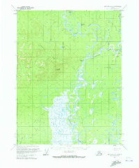
 1970 Beaver B-61973 Print · USGSThe northern Alaskan interior along the Dall River appears here in the early 1970s, showing a landscape defined by seasonal access and remote outposts. Researchers can identify the Dall City (Site) and trace the path of the Winter Road as it crosses Coal Creek.
Showing maps 1-25 of 225
Top cities of Alaska
- Anchorage historical maps
- Fairbanks historical maps
- Juneau historical maps
- Badger historical maps
- Wasilla historical maps
- Sitka historical maps
See more
Top boroughs of Alaska
Frequently asked questions
- What are the different types of historical maps available for Alaska?
- What is the oldest map of Alaska?
- Where can I purchase historical maps of Alaska for my home or office?
- Where can I download high-res historical maps of Alaska?
- Are there historical topographic maps available for Alaska?
- Is there historical aerial imagery available for Alaska?
- Where are historical maps of Alaska sourced from?