1980s Maps of Alaska
Explore 455 historic maps of Alaska from the 1980s. These maps offer a rare glimpse into what life looked like during the 1980s — showing old roads, neighborhoods, homes, and landmarks that have changed or disappeared over time.
Whether you're researching your family's past, planning a metal detecting trip, or studying how Alaska's landscape evolved across the 1980s, these high-resolution maps are a powerful tool for exploring the history of this region.
- Focus on a specific era: All maps on this page are from the 1980s, giving you a focused view of this time period.
- See what’s changed: Compare century-old streets, trails, and buildings to today's modern landscape using overlays and satellite layers.
- Research with precision: Use these maps for genealogy, historical research, land use analysis, or educational projects.
- View, download, or print: Maps are fully viewable online in high resolution, and can be downloaded or printed for your own records.
Start exploring Alaska's history through authentic maps from the 1980s. This is your window into the past.
Alaska maps
(455)- 1980 Map of Russian Mission
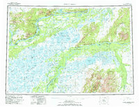 1980 Russian Mission1980 Print · USGSThe Yukon and Kuskokwim river basins are detailed here during the late twentieth century, showing a network of remote villages and seasonal camps. Researchers can trace traditional travel routes and settlements like Russian Mission, Chuathbaluk, and the historic Portage Trail.3 unique versions available
 - 1980 Map of Bethel
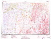 1980 Bethel1980 Print · USGSThe Kuskokwim Delta and its riverbank villages are shown here in the early eighties as they relied on the water for transport and trade. Researchers can trace the layout of settlements like Bethel and Kwethluk or explore the wilderness around Chikuminuk Lake and Shining Dome.4 unique versions available
 - 1981 Map of Seldovia B-4
 1981 Seldovia B-41981 Print · USGSThe Kenai Peninsula coastline is captured here in the early eighties, showing a landscape defined by deep fjords and the rising Kenai Mountains. Researchers can locate the Chrome Mine near Red Mountain or trace early coastal sites at San Juan and Picnic Harbor.
 - 1981 Map of Arctic B-5
 1981 Arctic B-51981 Print · USGSThe northern Alaskan wilderness is documented here in the early 1980s, showcasing a landscape defined by untouched river systems. You can trace the winding path of the Junjik River and locate remote water bodies like Timber Lake and Portage Lake.
 - 1982 Map of Teshekpuk B-2, 1987 Print
 1982 Teshekpuk B-21987 Print · USGSThe North Slope during the mid-twentieth century reveals a world of Arctic wetlands and early federal management. Trace the seasonal paths of a Winter Trail as it crosses the tundra near Teshekpuk Lake and Kealok Creek.
 - 1983 Map of Table Mountain D-2
 1983 Table Mountain D-21983 Print · USGSThe northern Brooks Range and the high Arctic tundra are captured here in the early eighties. Researchers can trace the path of the Continental Divide and follow the remote courses of Mancha Creek and the Kongakut River.2 unique versions available
 - 1983 Map of Coleen C-6
 1983 Coleen C-61983 Print · USGSThe northern interior of Alaska is shown here in the early 1980s, shortly after the formal establishment of the Arctic National Wildlife Refuge. Researchers can trace the braided paths of the Sheenjek River and Koness River through this uninhabited wilderness.
 - 1983 Map of Valdez A-6 SW
 1983 Valdez A-6 SW1983 Print · USGSCoastal Alaska at the height of the early eighties energy boom shows the convergence of mountain terrain and industrial growth. Researchers can trace the path of the Trans-Alaska Pipeline and Richardson Highway past Robe Lake and the Valdez Marine Terminal.
 - 1983 Map of Valdez A-7 SE
 1983 Valdez A-7 SE1983 Print · USGSCoastal Alaska in the early eighties shows the intersection of the energy industry and a relocated community. Trace the massive Valdez Marine Terminal, the former Old Valdez (Site), and remote landmarks like the Midas Mine.
 - 1983 Map of Seward A-7 SE
 1983 Seward A-7 SE1983 Print · USGSThe eastern coast of the Kenai Peninsula is captured here in the early eighties, showing the town of Seward where it meets the waters of Resurrection Bay. Researchers can trace the drainage of Godwin Glacier and explore the shoreline from Lowell Point to the Thumb Cove inlet.
 - 1983 Map of Mount Michelson A-3
 1983 Mount Michelson A-31983 Print · USGSThe northern Brooks Range and North Slope transition through this early 1980s survey of the Brooks Range. Researchers can trace the path of the Canning River and explore the remote drainage basins of Franklin Creek and Whistle Creek.
 - 1983 Map of Port Moller B-6
 1983 Port Moller B-61983 Print · USGSThe volcanic wilderness of the Alaska Peninsula is documented here in the early eighties, showcasing a landscape of active peaks and coastal lagoons. Researchers can locate geological landmarks such as Pavlof Volcano, Mount Hague, and the tidal reaches of Long John Lagoon.
 - 1983 Map of Table Mountain D-4
 1983 Table Mountain D-41983 Print · USGSThe northern reaches of the Brooks Range are captured here during the early eighties, showcasing a landscape untouched by roads or industry. Researchers can trace the winding Continental Divide as it cuts through the Kongakut River valley and the Arctic National Wildlife Refuge.
 - 1983 Map of Port Moller B-3
 1983 Port Moller B-31983 Print · USGSThe northern reaches of Unga Island and the Alaska Peninsula are captured here in the early eighties. Researchers can trace the maritime landscape from Cape Aliaksin to Unga Spit, including remote coastal points and the waters of Beaver Bay.2 unique versions available
 - 1983 Map of Seward A-7 NW
 1983 Seward A-7 NW1983 Print · USGSThe Kenai Peninsula's glacial valleys and high peaks are captured here in the early eighties as federal land boundaries were being defined. Trace the wilderness limits of the Kenai Fjords National Monument and landmarks like Mount Benson.
 - 1983 Map of Demarcation Point A-5
 1983 Demarcation Point A-51983 Print · USGSThe high Brooks Range of the early 1980s reveals a wilderness of ice and peaks along the Continental Divide. Trace the glacial reaches of Arey Glacier and the slopes of Mount Isto near the headwaters of the Jago River.
 - 1983 Map of Christian C-3
 1983 Christian C-31983 Print · USGSNorthern Alaska in the early eighties remains a wilderness of indigenous lands and conservation areas. Researchers can trace the path of the Winter Trail as it crosses the Venetie Indian Reservation and the Christian River.
 - 1983 Map of Demarcation Point A-2
 1983 Demarcation Point A-21983 Print · USGSThe northern reaches of the Alaskan wilderness are captured here in the early eighties, showcasing a landscape of high peaks and river valleys. Researchers can trace the Kongakut River through the British Mountains and locate Mount Greenough.
 - 1983 Map of Tyonek D-1 SE
 1983 Tyonek D-1 SE1983 Print · USGSThe Susitna River valley in the early eighties shows a landscape of braided channels and aviation hubs north of Anchorage. Researchers can trace early infrastructure around Kashwitna, including local tracks, the Willow Airport, and a small Cem.
 - 1983 Map of Seward A-7 SW
 1983 Seward A-7 SW1983 Print · USGSSeward and the northeastern edge of the Kenai Fjords are captured in the early eighties as the town sits between the mountains and the sea. Researchers can trace the coastal landscape from Lowell Point to Derby Cove and locate landmarks like Marathon Mountain and the Bear Glacier.
 - 1983 Map of Anchorage D-7 SW
 1983 Anchorage D-7 SW1983 Print · USGSThe Matanuska-Susitna interior in the early eighties was a landscape of remote watersheds and seasonal access routes. Researchers can trace the drainage of Willow Creek and Peters Creek alongside a solitary winter trail.
 - 1983 Map of Demarcation Point A-4
 1983 Demarcation Point A-41983 Print · USGSThe North Slope interior during the early 1980s reveals a roadless wilderness defined by the Romanzof Mountains and the Continental Divide. Researchers can trace the braided Aichilik River or locate remote landmarks like Bathtub Ridge and Drain Creek.
 - 1983 Map of Table Mountain D-3
 1983 Table Mountain D-31983 Print · USGSThe Brooks Range and the far northern reaches of Alaska are captured here in the early eighties. Researchers can trace the path of the Continental Divide and the remote course of the Kongakut River through the Arctic National Wildlife Refuge.
 - 1983 Map of Anchorage D-8 SE
 1983 Anchorage D-8 SE1983 Print · USGSMatanuska-Susitna in the early eighties was a landscape of seasonal trails and high-country drainages. Researchers can trace the path of the Winter trail or locate local landmarks like Twelvemile Lake and the Radio Tower.
 - 1983 Map of Cordova C-5 SW
 1983 Cordova C-5 SW1983 Print · USGSThe coastal community of Cordova is captured here in the early 1980s, showing the intersection of maritime life and mountain terrain. Trace the local infrastructure from the Ferry Terminal and Municipal Airport to the Copper River Highway and Orca.
Showing maps 1-25 of 455
Top cities of Alaska
- Anchorage historical maps
- Fairbanks historical maps
- Juneau historical maps
- Badger historical maps
- Wasilla historical maps
- Sitka historical maps
See more
Top boroughs of Alaska
Frequently asked questions
- What are the different types of historical maps available for Alaska?
- What is the oldest map of Alaska?
- Where can I purchase historical maps of Alaska for my home or office?
- Where can I download high-res historical maps of Alaska?
- Are there historical topographic maps available for Alaska?
- Is there historical aerial imagery available for Alaska?
- Where are historical maps of Alaska sourced from?