Old Maps of Prince of Wales-Hyder, Alaska for Metal Detecting
Plan your next treasure hunt with 429 historic maps of Prince of Wales-Hyder. Find old homesites, ghost towns, trails, and gathering spots that may be lost to time — perfect for identifying promising metal detecting locations.
- Locate forgotten sites: Uncover places like long-lost settlements, abandoned rail lines, or gathering spots.
- Plan better hunts: Use map overlays combined with LiDAR or satellite views to narrow in on historically rich areas.
- Made for detectorists: Thousands of hobbyists use these maps to discover relics, coins, and hidden history.
Use these historic maps to boost your research and find new opportunities beneath the surface of Prince of Wales-Hyder.
Prince of Wales-Hyder, AK maps
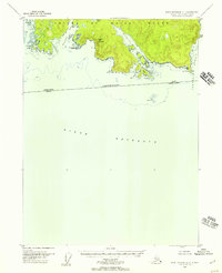
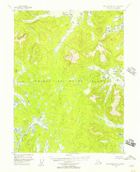
(429)- 1948 Map of Craig A-4, 1957 Print
 1948 Craig A-41957 Print · USGSThe maritime wilderness of Dall Island and Suemez Island is captured here in the post-war era, documenting the intricate coastline of the Tongass National Forest. Discover the location of the Limestone Quarry or trace the remote shores of Sea Otter Harbor and Sakie Bay.
 - 1948 Map of Petersburg A-6, 1957 Print
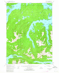
 1948 Petersburg A-61957 Print · USGSThe maritime wilderness of Southeast Alaska is documented here in the late 1940s, centering on the waters of Sumner Strait. Researchers can trace the rugged coastlines of Kuiu Island and Kosciusko Island, locating specific landmarks like Ruins Pt and Pt St Albans.
 - 1948 Map of Dixon Entrance D-5, 1957 Print
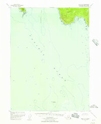
 1948 Dixon Entrance D-51957 Print · USGSForrester Island and its surrounding rocks are captured here in the late 1940s, highlighting this remote corner of the Tongass National Forest. Researchers can trace the layout of the Military Camp (Inactive) and find the location of a lone Cabin near Wood Cove.2 unique versions available
 - 1948 Map of Craig B-5, 1957 Print
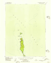
 1948 Craig B-51957 Print · USGSPrince of Wales Island's western edges appear in this post-war survey, capturing a complex maritime landscape of channels and bays. Trace the Spanish-named harbors and coastal markers from Port Santa Cruz to the Mineral site near Port San Antonio.2 unique versions available
 - 1948 Map of Petersburg B-6, 1957 Print
 1948 Petersburg B-61957 Print · USGSSoutheast Alaska’s maritime frontier is detailed here in the late 1940s, documenting the rugged coastline of Kuiu Island and its surrounding straits. Nautical researchers and local historians can trace remote coastal Cabins and vital navigational markers like Beauclerc Light and Strait Island.
 - 1948 Map of Craig A-5, 1957 Print
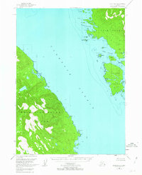
 1948 Craig A-51957 Print · USGSThe outer islands of Southeast Alaska are captured here at the end of the 1940s, highlighting the dramatic maritime transition to the open sea. Trace the jagged coastline of Suemez Island and the isolated sanctuary of the Forrester I Bird Refuge.3 unique versions available
 - 1948 Map of Dixon Entrance D-2, 1957 Print
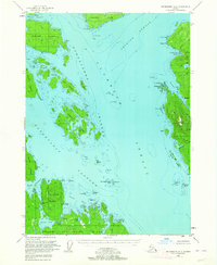
 1948 Dixon Entrance D-21957 Print · USGSPrince of Wales Island and the Alexander Archipelago are captured here in the late 1940s, mapping a maritime landscape of deep fjords and isolated inlets. Trace the remote coastline to find a Cabin at Hunter Bay or explore the sheltered waters of Mabel Bay and Klinkwan Cove.
 - 1948 Map of Prince Rupert D-6, 1957 Print
 1948 Prince Rupert D-61957 Print · USGSThe southeastern coast of Prince of Wales Island is documented here just after the war, showing a landscape defined by maritime access and forestry. Researchers can locate isolated signs of development like the mine and cabins tucked into the shores of McLean Arm.
 - 1948 Map of Dixon Entrance C-3, 1957 Print
 1948 Dixon Entrance C-31957 Print · USGSDall Island's southern coastline in the late 1940s reveals a maritime landscape shaped by the Pacific and the international border. Researchers can locate the Kaigani (Site) and trace the complex shorelines of Mc Leod Bay and Security Cove.3 unique versions available
 - 1948 Map of Dixon Entrance C-1, 1957 Print
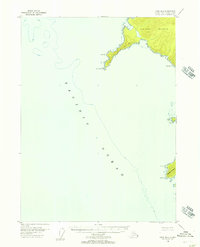
 1948 Dixon Entrance C-11957 Print · USGSThe southern tip of Prince of Wales Island was a remote maritime frontier at the close of the 1940s. Trace the jagged coastline and offshore hazards like Brown Bear Rks and Nunez Rks near the high peak of Nichols Mountain.3 unique versions available
 - 1948 Map of Craig B-6, 1957 Print
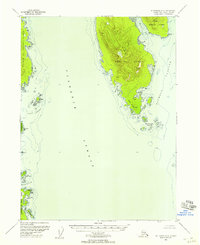
 1948 Craig B-61957 Print · USGSCoastal Prince of Wales Island comes into focus in the late 1940s, mapping the maritime boundaries of the Alexander Archipelago. Maritime historians and researchers can trace the hazardous waters and rocky outcrops surrounding Noyes Island and Cape Addington.3 unique versions available
 - 1948 Map of Dixon Entrance D-4, 1957 Print
 1948 Dixon Entrance D-41957 Print · USGSThe remote coastline of Southeast Alaska is captured in the late 1940s, showing the intricate shoreline before modern development. Maritime history researchers can trace the natural anchorages of Waterfall Bay and Gold Harbor or locate Twin Peaks.
 - 1948 Map of Ketchikan A-6, 1957 Print
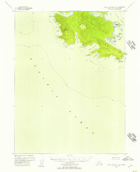
 1948 Ketchikan A-61957 Print · USGSSoutheast Alaska's coastal wilderness comes into focus in the late 1940s, mapping the rugged shores of Gravina Island and Prince of Wales Island. Maritime researchers can trace old anchorages and landmarks like Sawmill, Cabin, and Dall Head.2 unique versions available
 - 1948 Map of Craig A-1, 1957 Print
 1948 Craig A-11957 Print · USGSPrince of Wales Island in the post-war years shows a remote coastal economy transitioning away from early twentieth-century sites. Researchers can locate former centers like Dolomie and Niblack or trace activity at the Cannery and Mine.4 unique versions available
 - 1948 Map of Dixon Entrance D-1, 1957 Print
 1948 Dixon Entrance D-11957 Print · USGSSouthern Prince of Wales Island in the late 1940s reveals a coastline of deep inlets and the early industrial traces of the Tongass wilderness. Local historians can locate the Cannery (Abandoned) at Hunter Bay or trace the maritime routes through Moira Sound and Hessa Narrows.2 unique versions available
 - 1948 Map of Dixon Entrance D-3, 1958 Print
 1948 Dixon Entrance D-31958 Print · USGSCoastal life in the Alexander Archipelago during the late 1940s is defined by remote maritime outposts and island geography. Researchers can identify former settlement locations at Howkan (Site) and Koianglas (Site), or trace the industrial footprint of the Cannery at Rose Inlet.
 - 1948 Map of Craig A-3, 1958 Print
 1948 Craig A-31958 Print · USGSCoastal Prince of Wales Island in the late 1940s is defined by its deep straits and the Haida community at Hydaburg. Trace the maritime routes through Sukkwan Strait or locate landmarks like Kasook Inlet and the McFarland Islands.
 - 1948 Map of Craig A-2, 1958 Print
 1948 Craig A-21958 Print · USGSPrince of Wales Island's rugged coastline is documented here during the post-war era, showing the infrastructure of the early copper industry. Researchers can trace the locations of Coppermount, the Corbin Mine (Aband), and Copper City (Aband).
 - 1949 Map of Craig D-3, 1954 Print
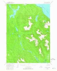 1949 Craig D-31954 Print · USGSPrince of Wales Island in the late 1940s was a roadless expanse of the Southeast Alaskan wilderness. Researchers can trace the original shoreline of Coffman Cove or follow the intricate drainage of Hatchery Creek and the Thorne River.3 unique versions available
 - 1949 Map of Craig C-2, 1962 Print
 1949 Craig C-21962 Print · USGSPrince of Wales Island in the late 1940s reveals a rugged landscape of industrial mining and maritime trade. Genealogists and historians can trace the foundations of Kasaan or locate numerous extraction sites like the Salt Chuck Mine and the Cannery at the edge of the strait.3 unique versions available
 - 1949 Map of Petersburg B-5, 1963 Print
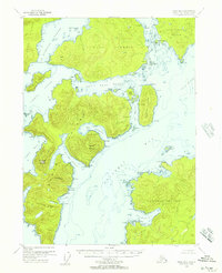
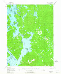
 1949 Petersburg B-51963 Print · USGSPrince of Wales and Kupreanof Islands are shown in the mid-twentieth century as maritime life centers on these intricate straits. Trace old coastal activity at the Trading Post near Point Baker and explore the waters of Port Protection.3 unique versions available
 - 1949 Map of Craig D-2, 1963 Print
 1949 Craig D-21963 Print · USGSCoastal life in Southeast Alaska at the end of the 1940s is defined by the deep waterways and islands of the Alexander Archipelago. Researchers can trace early maritime landmarks and small settlements, from the Cabins at Narrow Pt to protected waters at Dewey Anchorage and Ratz Harbor.4 unique versions available
 - 1949 Map of Craig B-2, 1964 Print
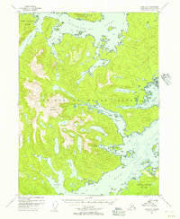
 1949 Craig B-21964 Print · USGSThe intricate fjords of Prince of Wales Island are shown here just as post-war aviation and maritime traffic began to transform the archipelago. Researchers can trace the early industrial footprint of the Khayyam Mine and the historic Sulzer Portage near the settlement of Hollis.3 unique versions available
 - 1949 Map of Petersburg A-3, 1964 Print
 1949 Petersburg A-31964 Print · USGSThe coastal waters of the Alexander Archipelago are captured here in the mid-twentieth century. Researchers can locate the Cannery (Aband) near Lake Bay and trace the maritime routes marked by the Steamer Pt Light.3 unique versions available
 - 1949 Map of Craig D-4, 1964 Print
 1949 Craig D-41964 Print · USGSPrince of Wales Island in the late 1940s reveals a landscape of maritime settlements and shifting populations. Trace the locations of Deweyville and Tuxekan or locate the Seaplane Base and Silver Salmon Falls among the coastal narrows.3 unique versions available
Showing maps 1-25 of 429
Top cities of Prince of Wales-Hyder
- Craig historical maps
- Klawock historical maps
- Thorne Bay historical maps
- Hydaburg historical maps
- Coffman Cove historical maps
- Kasaan historical maps
Frequently asked questions
- What are the different types of historical maps available for Prince of Wales-Hyder?
- What is the oldest map of Prince of Wales-Hyder?
- Where can I purchase historical maps of Prince of Wales-Hyder for my home or office?
- Where can I download high-res historical maps of Prince of Wales-Hyder?
- Are there historical topographic maps available for Prince of Wales-Hyder?
- Is there historical aerial imagery available for Prince of Wales-Hyder?
- Where are historical maps of Prince of Wales-Hyder sourced from?