1990s Maps of Prince of Wales-Hyder, Alaska
Explore 24 historic maps of Prince of Wales-Hyder from the 1990s. These maps offer a rare glimpse into what life looked like during the 1990s — showing old roads, neighborhoods, homes, and landmarks that have changed or disappeared over time.
Whether you're researching your family's past, planning a metal detecting trip, or studying how Prince of Wales-Hyder's landscape evolved across the 1990s, these high-resolution maps are a powerful tool for exploring the history of this region.
- Focus on a specific era: All maps on this page are from the 1990s, giving you a focused view of this time period.
- See what’s changed: Compare century-old streets, trails, and buildings to today's modern landscape using overlays and satellite layers.
- Research with precision: Use these maps for genealogy, historical research, land use analysis, or educational projects.
- View, download, or print: Maps are fully viewable online in high resolution, and can be downloaded or printed for your own records.
Start exploring Prince of Wales-Hyder's history through authentic maps from the 1990s. This is your window into the past.
Prince of Wales-Hyder, AK maps
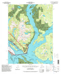
(24)- 1991 Map of Ketchikan B-5 SW
 1991 Ketchikan B-5 SW1991 Print · USGSThe maritime gateway of Ketchikan and the neighboring community of Saxman are captured here during the 1990s. Researchers can trace the waterfront infrastructure of Ketchikan Harbor and historic locations like China Town on Annette Island.2 unique versions available
 - 1994 Map of Ketchikan B-5, 1998 Print
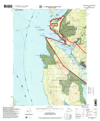
 1994 Ketchikan B-51998 Print · USGSThe Ketchikan waterfront and neighboring Saxman are captured here in the mid-nineties, showing a coastline defined by maritime industry and indigenous heritage. Researchers can trace the development of China Town on Annette Island or locate the site of the Mahoney Mine.
 - 1994 Map of Craig D-3, 1998 Print
 1994 Craig D-31998 Print · USGSPrince of Wales Island in the 1990s reflects a balance of wild terrain and forest management infrastructure. Researchers can trace the Honker Divide Canoe Portage and locate backcountry outposts like the Sweetwater Lake Cabin (FS).
 - 1994 Map of Craig C-2, 1998 Print
 1994 Craig C-21998 Print · USGSPrince of Wales Island in the 1990s reveals a coastal landscape defined by timber, maritime transit, and historical mining. Researchers can trace the industrial footprint of the Salt Chuck Mine, explore the Karta River Trail, and locate the early boundaries of Kasaan and Thorne Bay.
 - 1994 Map of Petersburg A-4, 1998 Print
 1994 Petersburg A-41998 Print · USGSPrince of Wales Island and the Tongass National Forest are shown in the 1990s as the timber industry and wilderness management shaped the coast. Researchers can trace land use near Whale Pass, El Capitan Work Center, and Camp Taylor (Site).
 - 1994 Map of Craig D-4, 1998 Print
 1994 Craig D-41998 Print · USGSPrince of Wales Island in the 1990s shows the transition from water-based transport to a growing network of timber roads. Researchers can trace the location of Deweyville (Aban'd), the Lighthouse Reserve, and the Naukati Bunkhouse (FS).
 - 1994 Map of Petersburg A-3, 1998 Print
 1994 Petersburg A-31998 Print · USGSCoastal life in Southeast Alaska's wilderness comes into focus during the 1990s as the timber and fishing industries left their mark on the archipelago. Researchers can locate remote Forest Service outposts like the Barnes Lake Cabin and industrial remains such as the Cannery Ruins and Log Transfer Facility.
 - 1994 Map of Ketchikan B-6, 1998 Print
 1994 Ketchikan B-61998 Print · USGSSoutheast Alaska in the 1990s reveals a landscape defined by the maritime economy and the North Tongass Highway corridor. Genealogists and historians can trace coastal development through the US Coast Guard Station, Higgins Elm Sch, and industrial landmarks at Ward Cove.
 - 1994 Map of Dixon Entrance D-1, 1998 Print
 1994 Dixon Entrance D-11998 Print · USGSPrince of Wales Island in the 1990s reveals a complex network of coastal sounds and forest wilderness. Researchers can trace the site of the Cannery (Aband) at Hunter Bay, explore the heights of Bokan Mountain, or locate remote points like Whirlpool Point.
 - 1994 Map of Craig D-2, 1998 Print
 1994 Craig D-21998 Print · USGSThe maritime landscape of Southeast Alaska is documented here in the mid-1990s as it spans the waters between Prince of Wales Island and Etolin Island. Researchers can trace old coastal sites like the Lighthouse Reserve, Cabin Ruins, and established anchorages at Ratz Harbor.
 - 1994 Map of Dixon Entrance C-3, 1998 Print
 1994 Dixon Entrance C-31998 Print · USGSDall Island in the 1990s presents a rugged coastline of the southern Panhandle where the forest meets the sea. Genealogists and historians can locate the Kaigani (Site), trace an Underground Cable (Aband), and find the settlement of Muzon.
 - 1994 Map of Craig A-4, 1998 Print
 1994 Craig A-41998 Print · USGSCoastal Alaska in the 1990s is defined by the labyrinthine waterways of the Alexander Archipelago. Researchers can trace land use through the Logging Camp near View Cove or locate landmarks like White Mtn and Sea Otter Harbor.2 unique versions available
 - 1994 Map of Craig C-3, 1998 Print
 1994 Craig C-31998 Print · USGSPrince of Wales Island in the 1990s reveals a landscape of industrial forestry and remote outposts. Researchers can trace forest management history via the Lucky Nell Mine and remote sites like Control Lake Cabin.
 - 1995 Map of Petersburg A-5, 1999 Print
 1995 Petersburg A-51999 Print · USGSThe rugged shoreline of Prince of Wales Island and its surrounding archipelago are shown here as they appeared in the mid-1990s. Researchers can trace maritime history at the Shakan Light Station Island Lighthouse Reserve and locate former settlements at Calder and Holbrook.
 - 1995 Map of Petersburg B-4, 1999 Print
 1995 Petersburg B-41999 Print · USGSSoutheast Alaska's intricate coastline is mapped during the mid-nineties as a network of maritime passages and timber management zones. Trace remote forest service outposts like the Salmon Bay Lake Cabin (FS) and coastal markers at Point Colpoys.
 - 1995 Map of Petersburg B-5, 1999 Print
 1995 Petersburg B-51999 Print · USGSPrince of Wales Island and Kupreanof Island are shown in the mid-nineties during a period of active timber management and coastal settlement. Researchers can trace the layout of the Logging Camp and Log Transfer Facility near Port Protection and the small harbor at Point Baker.
 - 1996 Map of Craig A-2, 1999 Print
 1996 Craig A-21999 Print · USGSPrince of Wales Island at the end of the century reveals a landscape returning to wilderness. You can trace the remnants of the early copper mining boom at Coppermount and the Corbin Mine near Copper Harbor.
 - 1996 Map of Craig D-5, 2000 Print
 1996 Craig D-52000 Print · USGSThe maritime timber economy of the Prince of Wales-Hyder region is captured in the late nineties, documenting the remote outposts of the Alaskan archipelago. Genealogists and historians can locate industrial hubs like the Logging Camp and the historic Tokeen (Site).
 - 1996 Map of Bradfield Canal A-1, 2000 Print
 1996 Bradfield Canal A-12000 Print · USGSThe international borderlands of Southeast Alaska meet British Columbia in this late twentieth-century revision, showcasing a landscape of glaciers and old mining infrastructure. Researchers can locate the Riverside Mine, an Aerial Tramway, and the Boundary Roadhouse.
 - 1996 Map of Ketchikan D-2, 2000 Print
 1996 Ketchikan D-22000 Print · USGSAlaskan wilderness near the Canadian border is mapped here during the late twentieth century, showing a landscape of ice and water. Trace the path of the Through Glacier or the winding Chickamin River through the heart of the Tongass National Forest.
 - 1997 Map of Bradfield Canal A-1, 2000 Print
 1997 Bradfield Canal A-12000 Print · USGSIn the late nineties, this coastal corner of the Tongass National Forest supported a network of remote wilderness outposts and hydroelectric infrastructure. You can trace early habitations at Cabin Ruins and locate active Forest Service sites like Reflection Lake Shelter (FS) and the Powerhouse near Tyee Lake.
 - 1997 Map of Craig A-1, 2000 Print
 1997 Craig A-12000 Print · USGSSoutheastern Prince of Wales Island is shown in the late 1990s as a landscape of deep sounds and remote wilderness. Local historians can trace the status of sites like Chomly, the Logging Camp at Johnson Port, and the rugged peaks of Eudora Mountain.
 - 1997 Map of Craig A-3, 2000 Print
 1997 Craig A-32000 Print · USGSPrince of Wales Island and the village of Hydaburg are shown in the late nineties as the coastal timber and fishing economy continued to shape the region. Genealogists and researchers can locate the Cem, trace the Hydaburg River, and explore the Lighthouse Reserve.
 - 1997 Map of Craig B-2, 2000 Print
 1997 Craig B-22000 Print · USGSPrince of Wales Island in the late nineties shows a landscape of deep fjords and industrial timber operations within the Tongass National Forest. Trace historical resource sites like the Khayyam Mine or the remote Logging Camp and Hollis settlements.
End of results
Showing maps 1-24 of 24
Top cities of Prince of Wales-Hyder
- Craig historical maps
- Klawock historical maps
- Thorne Bay historical maps
- Hydaburg historical maps
- Coffman Cove historical maps
- Kasaan historical maps
Frequently asked questions
- What are the different types of historical maps available for Prince of Wales-Hyder?
- What is the oldest map of Prince of Wales-Hyder?
- Where can I purchase historical maps of Prince of Wales-Hyder for my home or office?
- Where can I download high-res historical maps of Prince of Wales-Hyder?
- Are there historical topographic maps available for Prince of Wales-Hyder?
- Is there historical aerial imagery available for Prince of Wales-Hyder?
- Where are historical maps of Prince of Wales-Hyder sourced from?