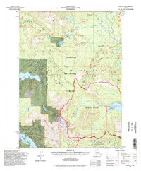
1994 Map of Craig C-3
USGS Topo · Published 1998About this map
Prince of Wales Island is documented here through a complex network of forest management and industrial transit in the mid-1990s. The landscape is defined by the Thorne River and Karta River systems, where the map details numerous Forest Service facilities such as the Control Lake Cabin and the Rio Roberts Fish Pass. A legacy of resource extraction is evident at the Lucky Nell Mine, while logging activity is implied by the extensive road network including the Salt Chuck Road. The transition from active working forest to protected lands is marked by the Karta River Wilderness and the Maybeso Experimental Forest, showing the shift in land use priorities during this era. High-elevation landmarks like Rush Pk and Granite Mtn anchor the topography above a series of remote lakes including Black Bear Lake and Salmon Lake.
Find a feature on this map
36 named features on this map. Tap any name to fly to it.
Don’t see what you’re looking for? This feature index may not catch every label — zoom into the map to look around manually.
Map Details
Editions of this 1994 Craig C-3 Map
This is the sole edition of this map. No revisions or reprints were ever made.
Other maps of this area

1949 · Craig D-3
USGS Topo · 1:63,360

1949 · Craig C-2
USGS Topo · 1:63,360

1949 · Craig D-2
USGS Topo · 1:63,360

1949 · Craig B-2
USGS Topo · 1:63,360

1949 · Craig D-4
USGS Topo · 1:63,360

1949 · Craig B-3
USGS Topo · 1:63,360

1949 · Craig C-3
USGS Topo · 1:63,360

1949 · Craig C-4
USGS Topo · 1:63,360

1949 · Craig B-4
USGS Topo · 1:63,360

1950 · Craig D-3
USGS Topo · 1:63,360