1950s Maps of Sierra Vista, Arizona
Explore 19 historic maps of Sierra Vista from the 1950s. These maps offer a rare glimpse into what life looked like during the 1950s — showing old roads, neighborhoods, homes, and landmarks that have changed or disappeared over time.
Whether you're researching your family's past, planning a metal detecting trip, or studying how Sierra Vista's landscape evolved across the 1950s, these high-resolution maps are a powerful tool for exploring the history of this region.
- Focus on a specific era: All maps on this page are from the 1950s, giving you a focused view of this time period.
- See what’s changed: Compare century-old streets, trails, and buildings to today's modern landscape using overlays and satellite layers.
- Research with precision: Use these maps for genealogy, historical research, land use analysis, or educational projects.
- View, download, or print: Maps are fully viewable online in high resolution, and can be downloaded or printed for your own records.
Start exploring Sierra Vista's history through authentic maps from the 1950s. This is your window into the past.
Sierra Vista, AZ maps
(19)- 1952 Map of Tombstone SE, 1955 Print
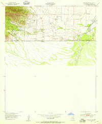
 1952 Tombstone SE1955 Print · USGSCochise County in the early fifties shows a landscape defined by cattle ranching and early transit corridors south of Tombstone. Researchers can trace historic homesteads like Keller Ranch and the path of the Southern Pacific near the Mule Mountains.3 unique versions available
 - 1952 Map of Lewis Springs, 1955 Print
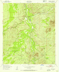
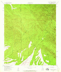
 1952 Lewis Springs1955 Print · USGSCochise County ranchlands and military grounds are captured here during the early fifties, centering on the San Pedro River. Researchers can trace historic family holdings like the Donnet-Fry Ranch and Schrader Ranch or the rail stop at Lewis Springs.4 unique versions available
 - 1952 Map of Hereford, 1955 Print
 1952 Hereford1955 Print · USGSThe ranching country of southern Cochise County comes into focus in this early 1950s survey of the San Pedro River valley. Researchers can trace historic family holdings like the Ullrich Ranch and Stagg Ranch alongside the Southern Pacific Railroad.4 unique versions available
 - 1952 Map of Fairbank, 1955 Print
 1952 Fairbank1955 Print · USGSCochise County during the early 1950s was a landscape of remote rail junctions and desert ranching along the San Pedro River. Genealogists and historians can trace the foundations of Fairbank, the operations at Boquillas Ranch, and the Charleston Lead Mine.3 unique versions available
 - 1952 Map of Nicksville, 1955 Print
 1952 Nicksville1955 Print · USGSNicksville and the surrounding Cochise County ranchlands are captured here in the early fifties, showing a landscape of specialized agriculture and aviation. Researchers can locate named family spreads like Wintergreen Mink Ranch and the Bauer-Kircher Mine.4 unique versions available
 - 1952 Map of Hereford SW, 1955 Print
 1952 Hereford SW1955 Print · USGSThe Arizona-Mexico borderlands in the early fifties reveal a landscape of isolated cattle operations and mountain canyons. Genealogists and historians can trace family properties like Smith Ranch and Montezuma Ranch along the San Pedro River.3 unique versions available
 - 1952 Map of Tombstone, 1959 Print
 1952 Tombstone1959 Print · USGSCochise County during the early 1950s reveals a landscape defined by ranching, mining, and frontier legacy. Genealogists and historians can trace old homesteads like Bakarich-McCool Ranch or locate the famed Boothill Cem and Fairbank rail junction.2 unique versions available
 - 1952 Map of Hereford, 1959 Print
 1952 Hereford1959 Print · USGSCochise County ranching and rail life are on full display in the early fifties, from the valley floor to the national forest peaks. Genealogists can trace family holdings like Smiling Tiger Ranch and Rancho Del Rio or locate the Cem near Palominas.2 unique versions available
 - 1956 Map of Nogales, 1963 Print
 1956 Nogales1963 Print · USGSSouthern Arizona in the mid-fifties is captured here from the Papago tribal lands to the San Pedro valley. Genealogists and historians can trace border settlements like Sasabe, the legacy of Tombstone, and old mining sites including the Mary G Mine.4 unique versions available
 - 1958 Map of Nogales
 1958 Nogales1958 Print · USGSSouthern Arizona in the late fifties was a landscape of international borders and high-desert outposts, dominated by the Huachuca Mountains and the Papago Indian Reservation. Local historians can trace old mining camps like Ruby and Greaterville or locate historic military grounds at the Fort Huachuca Military Reservation.
 - 1958 Map of Fort Huachuca, 1959 Print
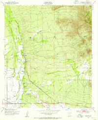
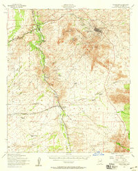
 1958 Fort Huachuca1959 Print · USGSSouthern Arizona in the late fifties shows the intersection of military growth and ranching heritage. Genealogists and historians can trace family-named sites like Pyeatt Ranch and Becker Ranch or locate early schools like Myer School.3 unique versions available
 - 1958 Map of Pyeatt Ranch, 1959 Print
 1958 Pyeatt Ranch1959 Print · USGSCochise County's ranching and military landscape is captured here in the late 1950s as the high desert meets the canyonlands. Researchers can trace family ranching sites like Page Ranch and Boss Ranch or locate the historic Manila Mine and Pyeatt Cave.3 unique versions available
 - 1958 Map of Miller Peak, 1959 Print
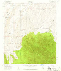
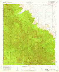 1958 Miller Peak1959 Print · USGSThe Huachuca Mountains are shown at the height of the mid-century ranching and mining era, split between forest land and military grounds. Researchers can locate remote sites like the Reef Mine, the Wakefield Camp settlement, and early family spreads such as Barchas Ranch.4 unique versions available
 - 1958 Map of Huachuca Vista, 1959 Print
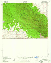
 1958 Huachuca Vista1959 Print · USGSCochise County during the late fifties reveals a landscape of high-desert ranching and expanding military footprints near the Huachuca Mountains. Genealogists and historians can trace family holdings like Boedecker Ranch and the rail-side community of Huachuca Village.4 unique versions available
 - 1958 Map of Montezuma Pass, 1959 Print
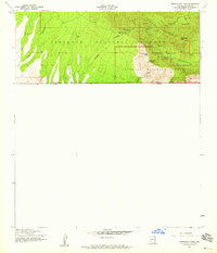 1958 Montezuma Pass1959 Print · USGSThe Arizona-Mexico border landscape comes into focus during the late fifties, showing where the southern Huachuca Mountains meet the international line. Trace mining history and remote landmarks like the State of Texas Mine, the high Montezuma Peak, and Yaqui Spring.5 unique versions available
 - 1958 Map of Sunnyside, 1959 Print
 1958 Sunnyside1959 Print · USGSSoutheast Arizona's high mountain borderlands are captured here in the late fifties, where mining and ranching met the international line. Genealogists and historians can locate remote outposts like Sunnyside, the Reef Mine, and family landmarks such as Barchas Ranch.2 unique versions available
 - 1958 Map of Huachuca Peak, 1959 Print
 1958 Huachuca Peak1959 Print · USGSThe high canyons of the Huachuca Mountains are captured here in the late fifties as a landscape of remote cattle camps and mining claims. Genealogists and hikers can trace the Parker Canyon Trail to family landmarks like Peterson Ranch, Sunnyside, and the Eureka Mine.5 unique versions available
 - 1958 Map of Fort Huachuca, 1959 Print
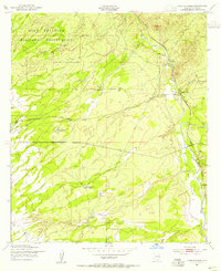
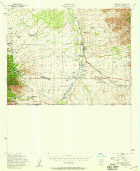
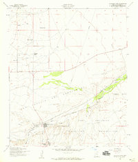
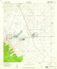 1958 Fort Huachuca1959 Print · USGSCochise County during the late fifties shows the expanding footprint of the Fort Huachuca military post alongside the growth of Sierra Vista. Genealogists and local historians can trace the early neighborhood layouts of Fry, find vanished landmarks like the Drive-in Theater, and locate local schools like Buena School.5 unique versions available
 - 1959 Map of Nogales
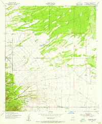
 1959 Nogales1959 Print · USGSThe Southern Arizona borderlands appear in the late fifties as a complex landscape of military ranges, tribal lands, and high-desert mining towns. Local historians can trace the Southern Pacific rail lines connecting Tombstone and Benson or locate family ranches such as Canoa Ranch.
End of results
Showing maps 1-19 of 19
Top cities near Sierra Vista
Top neighborhoods of Sierra Vista
- Ramsey historical maps
- Bledsoe historical maps
- West Pershing Plaza historical maps
- Village Meadows historical maps
- Apache Flats historical maps
- Fry historical maps
See more
Frequently asked questions
- What are the different types of historical maps available for Sierra Vista?
- What is the oldest map of Sierra Vista?
- Where can I purchase historical maps of Sierra Vista for my home or office?
- Where can I download high-res historical maps of Sierra Vista?
- Are there historical topographic maps available for Sierra Vista?
- Is there historical aerial imagery available for Sierra Vista?
- Where are historical maps of Sierra Vista sourced from?