1990s Maps of Sierra Vista, Arizona
Explore 12 historic maps of Sierra Vista from the 1990s. These maps offer a rare glimpse into what life looked like during the 1990s — showing old roads, neighborhoods, homes, and landmarks that have changed or disappeared over time.
Whether you're researching your family's past, planning a metal detecting trip, or studying how Sierra Vista's landscape evolved across the 1990s, these high-resolution maps are a powerful tool for exploring the history of this region.
- Focus on a specific era: All maps on this page are from the 1990s, giving you a focused view of this time period.
- See what’s changed: Compare century-old streets, trails, and buildings to today's modern landscape using overlays and satellite layers.
- Research with precision: Use these maps for genealogy, historical research, land use analysis, or educational projects.
- View, download, or print: Maps are fully viewable online in high resolution, and can be downloaded or printed for your own records.
Start exploring Sierra Vista's history through authentic maps from the 1990s. This is your window into the past.
Sierra Vista, AZ maps
(12)- 1994 Map of Fort Huachuca
 1994 Fort Huachuca1994 Print · USGSSouthern Arizona in the mid-nineties shows a landscape of expansive military reservations, historic land grants, and storied mining districts. Researchers can trace the S P RR through the San Pedro River valley or locate dozens of remote mountain workings like the Montezuma Mine and Eureka Mine.3 unique versions available
 - 1994 Map of Nogales
 1994 Nogales1994 Print · USGSThe Arizona-Sonora borderlands come into focus in the mid-1990s, showcasing the intricate Spanish land grants and mining districts that shaped the region. Genealogists and historians can trace old mining camps like Washington Camp and Duquesne or locate the historic Mowry Mine.2 unique versions available
 - 1996 Map of Fort Huachuca, 2002 Print
 1996 Fort Huachuca2002 Print · USGSThe High Desert of Cochise County comes into focus in the mid-1990s as military and civilian sectors converge. Genealogists can locate General Myer Sch or Fry, while researchers can trace the Old Railroad Grade and base boundaries.
 - 1996 Map of Tombstone SE, 2002 Print
 1996 Tombstone SE2002 Print · USGSCochise County’s high desert landscape is shown here in the mid-1990s, where traditional ranching meets federal conservation efforts. You can trace the Old Railroad Grade and locate legacy family holdings like Keller Ranch and Johnson Ranch.
 - 1996 Map of Fairbank, 2002 Print
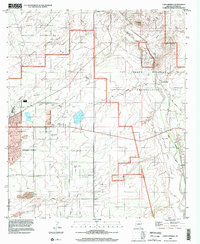
 1996 Fairbank2002 Print · USGSCochise County during the late twentieth century reflects a landscape shaped by river corridors and former mining hubs. Genealogists and historians can locate Fairbank, the Charleston Lead Mine, and ruins near the Babocomari River.
 - 1996 Map of Huachuca Peak, 2002 Print
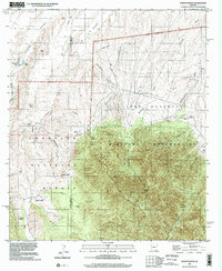
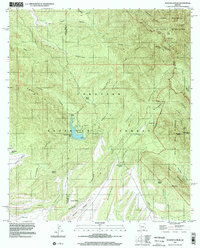 1996 Huachuca Peak2002 Print · USGSThe high Huachuca Mountains and Coronado National Forest are captured here in the late nineties as a landscape of remote ranches and wilderness. Genealogists and hikers can trace sites like the Sunnyside Cemetery, Eureka Mine, and the Parker Ranch homestead.
 - 1996 Map of Nicksville, 2002 Print
 1996 Nicksville2002 Print · USGSThis late-twentieth-century survey of the Arizona borderlands captures a landscape of cattle ranches and rugged canyons on the edge of the Huachuca Mountains. Genealogists and local historians can trace family-named properties like Smiling Tiger Ranch and Wilcox Ranch alongside the Baumkirchner Mine.
 - 1996 Map of Hereford, 2002 Print
 1996 Hereford2002 Print · USGSThe San Pedro River valley in the late twentieth century reveals a landscape defined by deep-rooted ranching and river conservation. Trace family histories at the Hereford Dairy Ranch or Double Mill Ranch, and follow the Old Railroad Grade through the valley.
 - 1996 Map of Huachuca City, 2002 Print
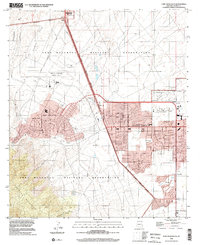
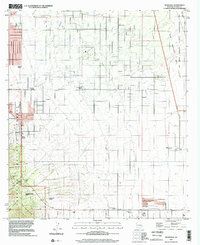
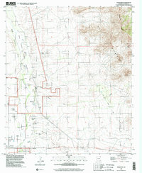
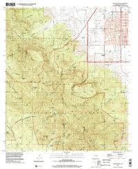
 1996 Huachuca City2002 Print · USGSHuachuca City and the surrounding high desert are captured here in the late nineties, showcasing the region's military and ranching roots. Genealogists and researchers can locate Hunt Ranch, the community of Campstone, and the expansive Fort Huachuca Military Reservation.
 - 1996 Map of Pyeatt Ranch, 2002 Print
 1996 Pyeatt Ranch2002 Print · USGSCochise County ranching and military life intersect in the mid-1990s as the high desert meets the canyon lands. Researchers can trace the legacy of local families at the Pyeatt Ranch and Flying B Ranch or locate the historic Manila Mine and Anderson Mill.
 - 1996 Map of Lewis Springs, 2002 Print
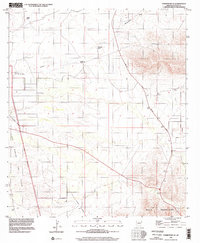
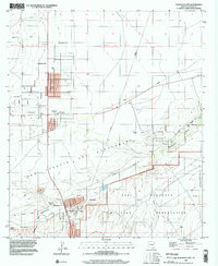
 1996 Lewis Springs2002 Print · USGSCochise County during the mid-nineties shows the growth of Sierra Vista alongside the San Pedro River. Genealogists and historians can trace family-named sites like the Donnet-Fry Ranch or follow the path of the Old Railroad Grade near Lewis Springs.
 - 1996 Map of Miller Peak, 2002 Print
 1996 Miller Peak2002 Print · USGSCochise County's high-mountain terrain is captured here in the late nineties, showcasing the complex interface of military, forest, and mining lands. Genealogists and historians can trace old homesteads at Barchas Ranch or locate the Hamburg Mine and Cemetery near the canyon floors.
End of results
Showing maps 1-12 of 12
Top cities near Sierra Vista
Top neighborhoods of Sierra Vista
- Ramsey historical maps
- Bledsoe historical maps
- West Pershing Plaza historical maps
- Village Meadows historical maps
- Apache Flats historical maps
- Fry historical maps
See more
Frequently asked questions
- What are the different types of historical maps available for Sierra Vista?
- What is the oldest map of Sierra Vista?
- Where can I purchase historical maps of Sierra Vista for my home or office?
- Where can I download high-res historical maps of Sierra Vista?
- Are there historical topographic maps available for Sierra Vista?
- Is there historical aerial imagery available for Sierra Vista?
- Where are historical maps of Sierra Vista sourced from?