2020s Maps of Sierra Vista, Arizona
Explore 12 historic maps of Sierra Vista from the 2020s. These maps offer a rare glimpse into what life looked like during the 2020s — showing old roads, neighborhoods, homes, and landmarks that have changed or disappeared over time.
Whether you're researching your family's past, planning a metal detecting trip, or studying how Sierra Vista's landscape evolved across the 2020s, these high-resolution maps are a powerful tool for exploring the history of this region.
- Focus on a specific era: All maps on this page are from the 2020s, giving you a focused view of this time period.
- See what’s changed: Compare century-old streets, trails, and buildings to today's modern landscape using overlays and satellite layers.
- Research with precision: Use these maps for genealogy, historical research, land use analysis, or educational projects.
- View, download, or print: Maps are fully viewable online in high resolution, and can be downloaded or printed for your own records.
Start exploring Sierra Vista's history through authentic maps from the 2020s. This is your window into the past.
Sierra Vista, AZ maps
(12)- 2021 Map of Fairbank, 2021 Print
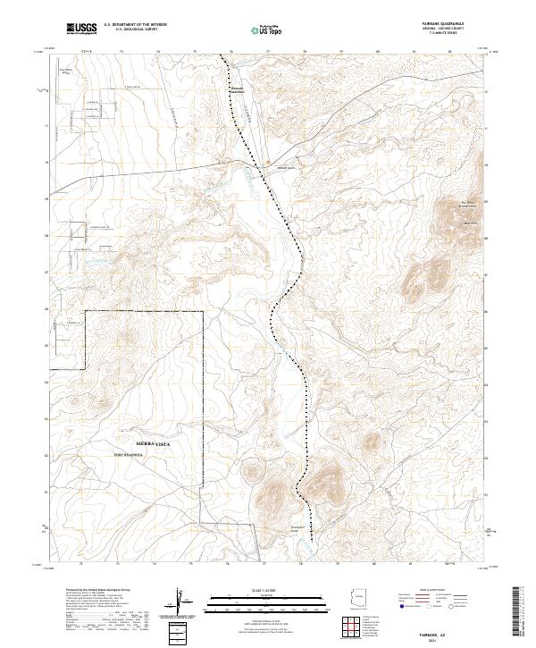 2021 Fairbank2021 Print · USGSThe San Pedro River valley comes to life in this recent survey, showing the desert confluence where the Babocomari River meets the main channel. Trace local landmarks like Graveyard Gulch or the heights of The Three Brothers Hills.
 - 2021 Map of Tombstone SE, 2021 Print
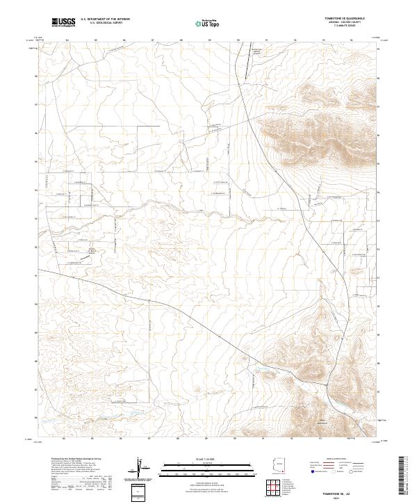 2021 Tombstone SE2021 Print · USGSSoutheast of Tombstone in the early 2020s, this desert landscape is defined by ranching heritage and private aviation. Trace the network of rural roads with Old West names like E Birdcage St and N Clanton Ave, or locate landmarks like Legacy Ranch and the Mule Mountains.
 - 2021 Map of Huachuca Peak, 2021 Print
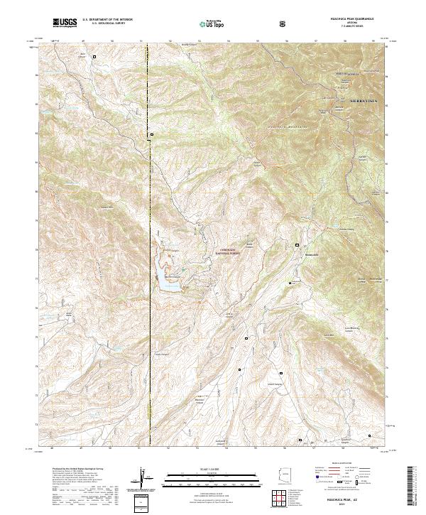 2021 Huachuca Peak2021 Print · USGSHigh in the southern Arizona mountains in 2021, this survey documents the rugged terrain around the Sunnyside settlement. Researchers can trace historic ranching sites like Beckers Folly or locate the Sunnyside Cem near Parker Lake.
 - 2021 Map of Miller Peak, 2021 Print
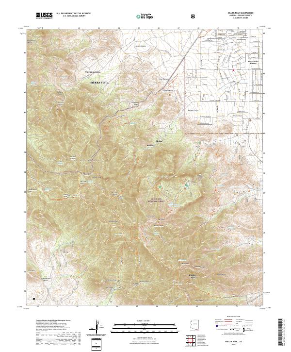 2021 Miller Peak2021 Print · USGSSoutheastern Arizona’s desert floor meets the high peaks of the Huachuca Mountains in this recent survey. Local historians can trace the intersection of Fort Huachuca with the mining legacy of the Scheelite Mine and peaks like Miller Peak.
 - 2021 Map of Fort Huachuca, 2021 Print
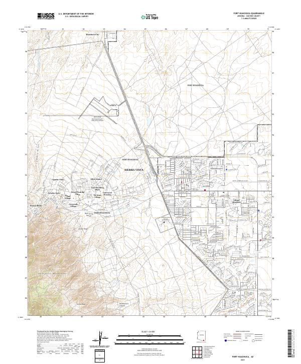 2021 Fort Huachuca2021 Print · USGSSierra Vista and the San Pedro Valley are shown in detail during the early 2020s, reflecting decades of residential and military growth. Researchers can trace local neighborhoods from Miles Manor to Fry, or locate the Southern Arizona Veterans Memorial Cemetery.
 - 2021 Map of Bob Thompson Peak, 2021 Print
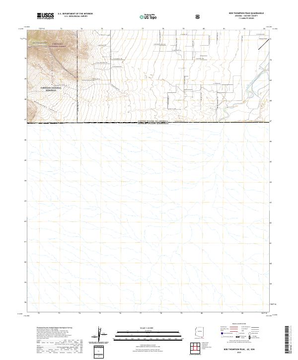 2021 Bob Thompson Peak2021 Print · USGSThe Arizona-Mexico border near the San Pedro River is captured here in the early twenty-first century. Genealogists and historians can trace the intersection of the Coronado National Memorial with local landmarks like Evelyn Field and S Brown Ranch Rd.
 - 2021 Map of Huachuca City, 2021 Print
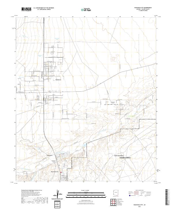 2021 Huachuca City2021 Print · USGSHuachuca City and the surrounding desert plains are shown in this contemporary study of Cochise County's growth. Researchers can trace local development around the Babocomari River, the Whetstone Airport, and the small settlement of Campstone.
 - 2021 Map of Hereford, 2021 Print
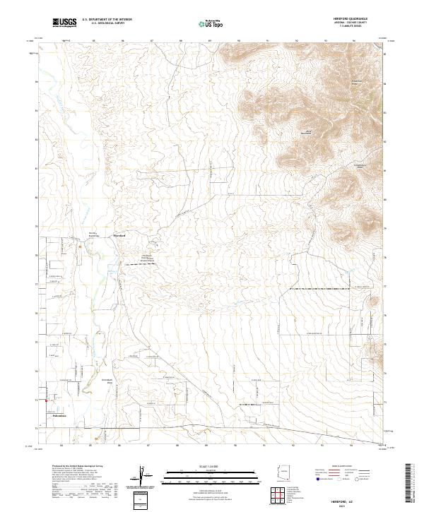 2021 Hereford2021 Print · USGSCochise County's river valley and high desert ridges are documented here during the early twenty-first century. Genealogists and local historians can trace modern rural settlements like Hereford and Palominas, alongside landmarks such as Hereford Road Bridge.
 - 2021 Map of Nicksville, 2021 Print
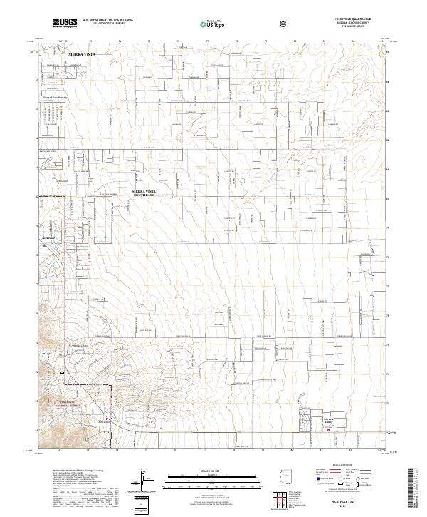 2021 Nicksville2021 Print · USGSCochise County habitation meets the high desert mountains in this 2021 study of the San Pedro Valley's western edge. Local researchers can trace the growth of Nicksville and Miracle Valley or locate family-named landmarks like Ash Canyon and Hunter Canyon.
 - 2021 Map of Lewis Springs, 2021 Print
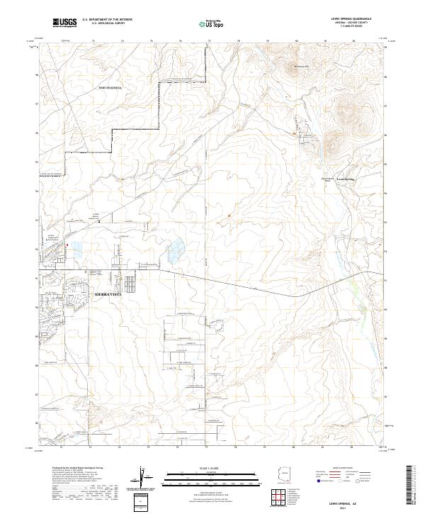 2021 Lewis Springs2021 Print · USGSSierra Vista and the San Pedro River valley appear in this recent survey during a period of significant suburban and institutional growth. Researchers can trace modern developments like Cochise College Sierra Vista Campus or find local landmarks such as Cochise Memory Gardens Cem and Brunckow Hill.
 - 2021 Map of Pyeatt Ranch, 2021 Print
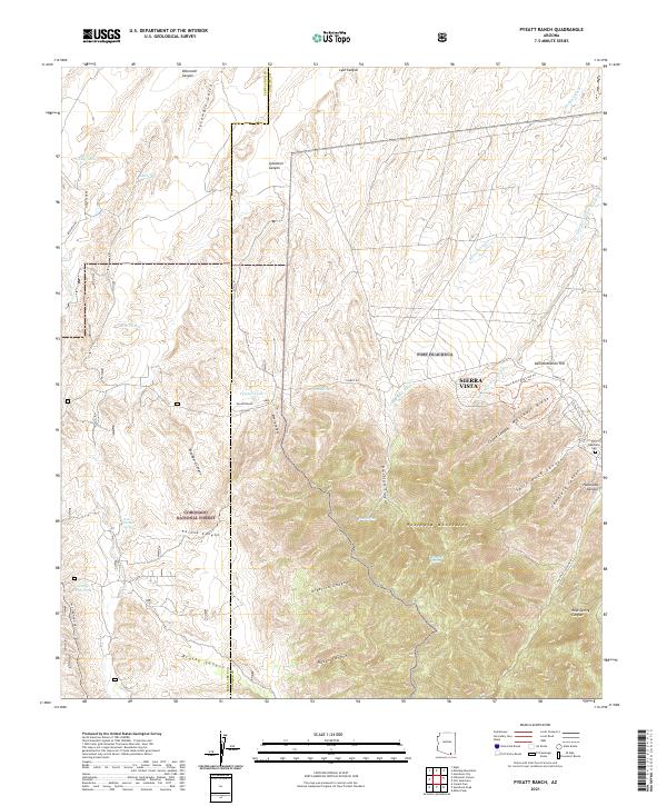 2021 Pyeatt Ranch2021 Print · USGSCochise County high-country meets the military history of the Huachuca Mountains in this contemporary survey. Researchers can trace land use through cattle-ranching features like Pyeatt Ranch and the quiet presence of Huachuca Cem near the mountain foothills.
 - 2021 Map of Montezuma Pass, 2021 Print
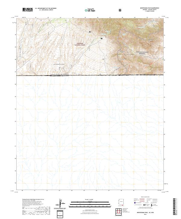 2021 Montezuma Pass2021 Print · USGSSouthern Arizona’s high-desert borderlands are captured here in the early twenty-first century where the Huachuca Mountains meet the international boundary. Researchers can trace the Arizona National Scenic Trail near Montezuma Pass and locate remote water sources like Yaqui Spring and Morgan Spring.
End of results
Showing maps 1-12 of 12
Top cities near Sierra Vista
Top neighborhoods of Sierra Vista
- Ramsey historical maps
- Bledsoe historical maps
- West Pershing Plaza historical maps
- Village Meadows historical maps
- Apache Flats historical maps
- Fry historical maps
See more
Frequently asked questions
- What are the different types of historical maps available for Sierra Vista?
- What is the oldest map of Sierra Vista?
- Where can I purchase historical maps of Sierra Vista for my home or office?
- Where can I download high-res historical maps of Sierra Vista?
- Are there historical topographic maps available for Sierra Vista?
- Is there historical aerial imagery available for Sierra Vista?
- Where are historical maps of Sierra Vista sourced from?