1960s Maps of Coconino County, Arizona
Explore 126 historic maps of Coconino County from the 1960s. These maps offer a rare glimpse into what life looked like during the 1960s — showing old roads, neighborhoods, homes, and landmarks that have changed or disappeared over time.
Whether you're researching your family's past, planning a metal detecting trip, or studying how Coconino County's landscape evolved across the 1960s, these high-resolution maps are a powerful tool for exploring the history of this region.
- Focus on a specific era: All maps on this page are from the 1960s, giving you a focused view of this time period.
- See what’s changed: Compare century-old streets, trails, and buildings to today's modern landscape using overlays and satellite layers.
- Research with precision: Use these maps for genealogy, historical research, land use analysis, or educational projects.
- View, download, or print: Maps are fully viewable online in high resolution, and can be downloaded or printed for your own records.
Start exploring Coconino County's history through authentic maps from the 1960s. This is your window into the past.
Coconino County, AZ maps
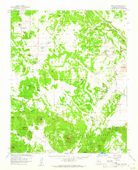
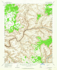
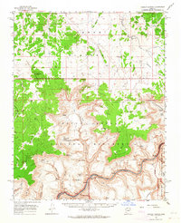
(126)- 1960 Map of Williams
 1960 Williams1960 Print · USGSNorthern Arizona in the mid-twentieth century was defined by its massive canyons and the vital rail line connecting its remote ranches. Genealogists and historians can trace the development of Peach Springs, the high-altitude Bill Williams Mountain, and isolated outposts like Diamond Bar Ranch.
 - 1960 Map of Grand Canyon
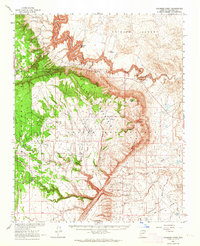
 1960 Grand Canyon1960 Print · USGSThe Arizona strip and the Colorado River corridor appear in the 1950s as a vast network of isolated plateaus and remote outposts. Researchers can trace historic ranching and tribal lands including Supai, the Kaibab Indian Reservation, and the Mt Trumbull Post Office.
 - 1960 Map of Prescott
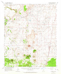
 1960 Prescott1960 Print · USGSYavapai County and the surrounding high-desert mining districts are captured here during a period of steady industrial and rail activity. Researchers can trace the routes of the Atchison Topeka and Santa Fe Railway and locate historic sites like the United Verde Mine and Bland School.2 unique versions available
 - 1960 Map of Flagstaff
 1960 Flagstaff1960 Print · USGSNorthern Arizona at the dawn of the sixties shows a landscape defined by mesa-top Hopi villages and the burgeoning railroad hub of Flagstaff. Trace the path of U.S. 66 past Meteor Crater or locate historic trading posts like Gray Mountain Trading Post.2 unique versions available
 - 1960 Map of Holbrook
 1960 Holbrook1960 Print · USGSNorthern Arizona is captured here just as modern highways began to reshape the cattle and timber country of the Colorado Plateau. Genealogists and historians can trace the early footprints of Snowflake, Sedona, and Payson, alongside the Atchison Topeka & Santa Fe RR rail line.
 - 1960 Map of Escalante
 1960 Escalante1960 Print · USGSSouthern Utah and northern Arizona appear at a historic turning point in the late fifties as Lake Powell begins to reshape the canyons. Researchers can trace remote sites like Goulding Trading Post, a lonely Uranium Mine, and Coyote Ranches before the reservoir's rise.
 - 1960 Map of Ebert Mtn, 1961 Print
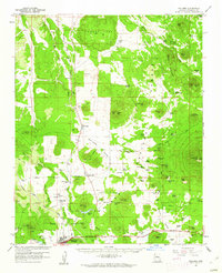
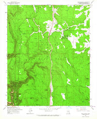
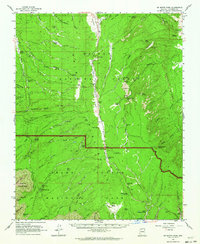
 1960 Ebert Mtn1961 Print · USGSCoconino County ranching life in the early sixties was defined by a rugged reliance on water tanks and isolated outposts. Researchers can trace the heritage of the Dent and Sayer Ranch or locate the remote Pearl Harbor Tank and Babbitt Lake.3 unique versions available
 - 1960 Map of Williams, 1961 Print
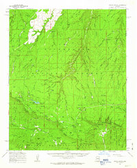
 1960 Williams1961 Print · USGSNorthern Arizona's high country is captured here in the early sixties, showing the vital rail and forest infrastructure surrounding the gateway to the canyon. Researchers can trace historic landmarks like the Grand Canyon Trading Post, Kaibab Lake, and the Atchison Topeka and Santa Fe railroad.2 unique versions available
 - 1961 Map of Marble Canyon
 1961 Marble Canyon1961 Print · USGSThe northern Arizona desert in the early sixties reveals a landscape of tribal lands and canyon crossings. Trace the old river life at Lees Ferry, find the Uranium mill at Tuba City, and locate the iconic Elephant Feet landmarks.
 - 1961 Map of Williams
 1961 Williams1961 Print · USGSNorthern Arizona in the mid-fifties reveals a high-desert landscape of rail towns and deep canyons along the Atchison Topeka and Santa Fe. Researchers can trace old Route 66 through Peach Springs, Seligman, and Ash Fork, or find remote sites like Music Mountain Mine.
 - 1961 Map of Woods Canyon, 1963 Print
 1961 Woods Canyon1963 Print · USGSThe high plateau meets the dramatic drop of the Mogollon Rim in the early sixties, a landscape of isolated ranching and forestry. Researchers can trace historic outposts like Dutch Joe Ranch and OW Ranch or locate the Rainbow Mines.3 unique versions available
 - 1962 Map of Flagstaff
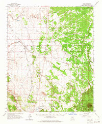
 1962 Flagstaff1962 Print · USGSNorthern Arizona in the early sixties showcases the intersection of Tribal lands, national forests, and the busy Route 66 corridor. Trace historic roadside stops and landmarks like Meteor Crater, the Buck-Rodgers Trading Post, and the ancient village of Old Oraibi.
 - 1962 Map of Cedar City
 1962 Cedar City1962 Print · USGSSouthern Utah in the early sixties showcases a landscape of dramatic plateaus and historic mining outposts. Trace the early settlement patterns at the Silver Reef (ruins), locate the Iron Mine near the Hurricane Cliffs, or find the Fort Harmony Monument.
 - 1962 Map of Bright Angel, 1963 Print
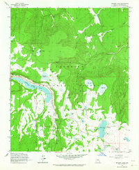
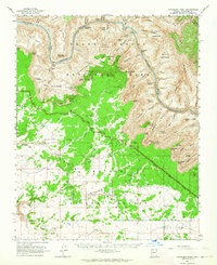
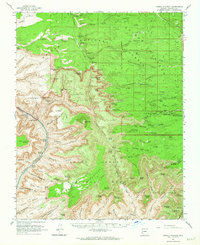
 1962 Bright Angel1963 Print · USGSThe South Rim and inner canyon are captured in the early sixties as the park's modern visitor infrastructure was taking shape. Genealogists and historians can trace the Atchison Topeka and Santa Fe rail line, Phantom Ranch, and the N P S Training Sch.7 unique versions available
 - 1962 Map of Kanab Point, 1964 Print
 1962 Kanab Point1964 Print · USGSThe deep canyons of the Colorado River and the ancestral lands of the Havasupai Indian Reservation are captured in the early sixties. Researchers can trace the famous cascades of Havasu Falls and Mooney Falls or locate a remote Mine and Cem near the canyon floor.2 unique versions available
 - 1962 Map of Mountainaire, 1964 Print
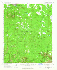
 1962 Mountainaire1964 Print · USGSThe high timber country south of Flagstaff in the early sixties reveals a landscape shaped by water management and industry. Researchers can trace the path of the Industrial Railroad and locate specific sites like Gates Cabin, the State Fish Hatchery, and several high-altitude springs.5 unique versions available
 - 1962 Map of Ashurst Lake, 1964 Print
 1962 Ashurst Lake1964 Print · USGSHigh in the Arizona forest during the early sixties, this terrain was a vital network of alpine lakes and early timber transport routes. You can trace the Old Railroad Grade past Walnut Creek or locate remote camps at Ashurst Lake and Horse Lake.5 unique versions available
 - 1962 Map of Valle, 1964 Print
 1962 Valle1964 Print · USGSCoconino County’s high plateau is captured here in the early sixties, centered on the transit junction at Valle. Researchers can trace the Atchison Topeka and Santa Fe line as it passes Quivero, along with dozens of historic stock tanks like Dance Tank and Troy Tank.
 - 1962 Map of Tuckup Canyon, 1964 Print
 1962 Tuckup Canyon1964 Print · USGSArizona's high plateau and the deep canyon floor are captured here in the early sixties, showing the overlap of park and monument lands. Researchers can trace remote water sources like Buckhorn Spring, historic stock tanks, and river features including the Cork.2 unique versions available
 - 1962 Map of Coconino Point, 1964 Print
 1962 Coconino Point1964 Print · USGSThe high desert and river canyons of northern Arizona come into focus in the early sixties, showing the intersection of forest and reservation lands. Researchers can trace the Little Colorado River to find Petroglyphs, Willows Camp, and Needmore.
 - 1962 Map of Bill Williams Mtn, 1964 Print
 1962 Bill Williams Mtn1964 Print · USGSWilliams and the surrounding Kaibab National Forest are captured here in the early sixties, as the railroad and timber industries shaped the Coconino County high country. Researchers can locate early family sites like Benham Ranch, trace the Santa Fe rail lines, and find local landmarks such as High School Hill.3 unique versions available
 - 1962 Map of S P Mountain, 1964 Print
 1962 S P Mountain1964 Print · USGSCoconino County volcanic fields and high-desert ranching lands are captured here in the early sixties. Genealogists and historians can trace livestock operations at Aso Ranch or locate ancient ruins near Wupatki National Monument and Beasley Lake.2 unique versions available
 - 1962 Map of De Motte Park, 1964 Print
 1962 De Motte Park1964 Print · USGSThe Kaibab Plateau in the early sixties was a landscape of remote fire lookouts and high-country ranching infrastructure. You can trace the boundary between Kaibab National Forest and the National Park, locating landmarks like Kaibab Lodge and the North Rim Entrance Sta.2 unique versions available
 - 1962 Map of Havasupai Point, 1964 Print
 1962 Havasupai Point1964 Print · USGSThe South Rim and inner canyon are captured here in the early sixties, showing the rugged geography before modern development. Researchers can trace the Bass Trail to the river or locate the Pasture Wash Ranger Station and Mexican Jack Tank.2 unique versions available
 - 1962 Map of Powell Plateau, 1964 Print
 1962 Powell Plateau1964 Print · USGSCoconino County’s North Rim was a remote wilderness of high plateaus and river rapids during the early 1960s. Researchers can trace historic access routes like the Saddle Trail and Shinumo Trail or locate early camps such as Big Saddle Camp.2 unique versions available
Showing maps 1-25 of 126
Top cities of Coconino County
- Flagstaff historical maps
- Page historical maps
- Doney Park historical maps
- Williams historical maps
- Kachina Village historical maps
- Timberline-Fernwood historical maps
See more
Frequently asked questions
- What are the different types of historical maps available for Coconino County?
- What is the oldest map of Coconino County?
- Where can I purchase historical maps of Coconino County for my home or office?
- Where can I download high-res historical maps of Coconino County?
- Are there historical topographic maps available for Coconino County?
- Is there historical aerial imagery available for Coconino County?
- Where are historical maps of Coconino County sourced from?