1990s Maps of Coconino County, Arizona
Explore 21 historic maps of Coconino County from the 1990s. These maps offer a rare glimpse into what life looked like during the 1990s — showing old roads, neighborhoods, homes, and landmarks that have changed or disappeared over time.
Whether you're researching your family's past, planning a metal detecting trip, or studying how Coconino County's landscape evolved across the 1990s, these high-resolution maps are a powerful tool for exploring the history of this region.
- Focus on a specific era: All maps on this page are from the 1990s, giving you a focused view of this time period.
- See what’s changed: Compare century-old streets, trails, and buildings to today's modern landscape using overlays and satellite layers.
- Research with precision: Use these maps for genealogy, historical research, land use analysis, or educational projects.
- View, download, or print: Maps are fully viewable online in high resolution, and can be downloaded or printed for your own records.
Start exploring Coconino County's history through authentic maps from the 1990s. This is your window into the past.
Coconino County, AZ maps
(21)- 1990 Map of O W Point, 1991 Print
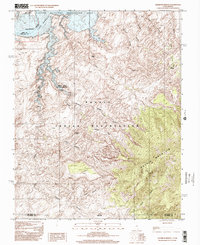
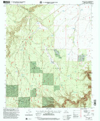
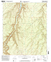
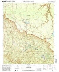
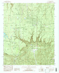 1990 O W Point1991 Print · USGSThe Mogollon Rim country comes into sharp focus during the early 1990s as forest communities and mountain recreation areas expanded. Researchers can trace the development of Forest Lakes, find the Gravel Pit, and locate remote landmarks like Willow Springs Lake and North Ow Point.3 unique versions available
 - 1990 Map of Weimer Point, 1991 Print
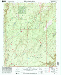
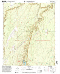
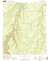 1990 Weimer Point1991 Print · USGSCoconino County high country in the early nineties is defined here by deep canyon systems and a vital network of livestock tanks. Trace the landscape from Chevelon Canyon Lake across family-named landmarks like Joe Smith Canyon and Weimer Point.2 unique versions available
 - 1990 Map of Woods Canyon, 1991 Print
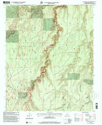
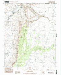
 1990 Woods Canyon1991 Print · USGSArizona's high country is defined by the massive escarpment of the Mogollon Rim during the late twentieth century. Researchers can trace the developed recreation landscape of the era, from the Woods Canyon Dam and Willow Springs Lake to the rugged Military Sinkhole.2 unique versions available
 - 1990 Map of Porcupine Ridge, 1991 Print
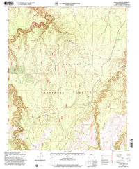
 1990 Porcupine Ridge1991 Print · USGSCoconino County’s high ridge country is captured here during the late twentieth century, showing a landscape of deep canyons and forest lookouts. Researchers can find old backcountry landmarks like Dutch Joe Ranch, West Chevelon Crossing, and the Dutch Joe Lookout.
 - 1997 Map of Rainbow Bridge, 2002 Print
 1997 Rainbow Bridge2002 Print · USGSThe Utah-Arizona borderlands at the end of the twentieth century reveal a terrain defined by ancient geological wonders and the rising waters of Lake Powell. Researchers can trace the path to Rainbow Bridge and the high slopes of Navajo Mountain within the Navajo Indian Reservation.
 - 1997 Map of Wrather Arch, 2003 Print
 1997 Wrather Arch2003 Print · USGSThe high desert of Coconino County is captured here in the late twentieth century as land protections expanded across the canyon country. Researchers can trace historic grazing markers and geologic landmarks like Wrather Arch, Hole in the Rock, and Lynn Tank.
 - 1997 Map of Water Pockets, 2003 Print
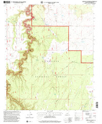
 1997 Water Pockets2003 Print · USGSCoconino County’s high-desert wilderness is captured here in the late twentieth century as it appeared within protected monument lands. Researchers can trace natural water catchments and terrain features like Water Pockets, Thousand Pockets, and the Paria River.
 - 1997 Map of Ferry Swale, 2003 Print
 1997 Ferry Swale2003 Print · USGSCoconino County’s high-desert canyons and plateaus are captured here in the late twentieth century. Researchers can trace historic water sources like Bishops Tank and explore geographic landmarks including Thousand Pockets and Ferry Swale.
 - 1998 Map of Knoll Lake, 2000 Print
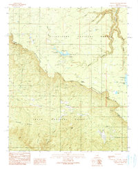
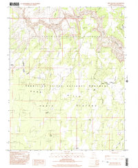
 1998 Knoll Lake2000 Print · USGSThe Mogollon Rim country of northern Arizona is captured here during the late nineties, showing the intersection of three major national forests. Researchers can trace historic sites like the Zane Grey Lodge (Site), the O'Haco Lookout, and various crossings like Besemer Crossing.
 - 1998 Map of Quayle Hill, 2000 Print
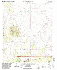
 1998 Quayle Hill2000 Print · USGSCoconino County at the close of the twentieth century is characterized by the livestock and forestry infrastructure of the Mogollon Rim country. Researchers can trace the historic Soldier Trail and locate family-named features like the Brown Landing Strip, Payne Tank, and Quayle Hill.
 - 1998 Map of Porcupine Ridge, 2000 Print
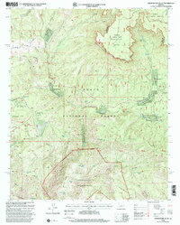
 1998 Porcupine Ridge2000 Print · USGSCoconino County ranching and timber lands are documented in the late nineties as they integrated into the forest service system. Researchers can locate remote family outposts like Dutch Joe Ranch, livestock sites such as Nagel Logging Camp Corral, and numerous named waters including Bear Canyon Lake.
 - 1998 Map of Leonard Canyon, 2000 Print
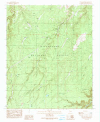
 1998 Leonard Canyon2000 Print · USGSThe high plateau country of the Coconino and Sitgreaves National Forests comes into focus in the late nineties, documenting the critical water-and-ranching network of the Mogollon Rim. Researchers can trace historic routes along the Soldier Trail and locate family landmarks like the Hugh Barr Ranch or Victorine Crossing.
 - 1998 Map of Grama Draw, 2000 Print
 1998 Grama Draw2000 Print · USGSCoconino County’s high timber country is shown here in the late 1990s, detailng the intricate water and forest management of the era. Researchers can locate remote Forest Service infrastructure and landmarks like the Chevelon Work Center, Wallace Historical Site, and Wiggins Crossing.
 - 1998 Map of Weimer Point, 2000 Print
 1998 Weimer Point2000 Print · USGSThe high forest plateaus of the Coconino-Navajo border are captured here in the late nineties. Modern researchers can trace the roads and rugged drainages around Chevelon Canyon Lake, Tillman Ranch, and Weimer Point.
 - 1998 Map of Chevelon Crossing, 2000 Print
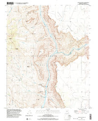
 1998 Chevelon Crossing2000 Print · USGSSitgreaves National Forest and the deep incisions of the Chevelon Creek system are captured here in the late nineties. Local researchers can trace historic transit points like Mormon Crossing and the water infrastructure around Chevelon Canyon Lake.
 - 1998 Map of Chevelon Butte, 2000 Print
 1998 Chevelon Butte2000 Print · USGSRanching and high-desert water management define this Coconino County landscape during the late twentieth century. Genealogists and historians can trace cattle operations via the Babbitt Winter Ranch and numerous stock tanks like Little Mormon Tank or Broken Tank.
 - 1998 Map of Hamilton Crossing, 2001 Print
 1998 Hamilton Crossing2001 Print · USGSCoconino and Sitgreaves national forests meet in the late 1990s as the high plateaus descend into deep canyon drainages. Researchers can trace land-use history through the Hamilton Crossing, old family ranch sites like Whitted Place, and remote forest wells like Ellsworth WT Well.
 - 1998 Map of Woods Canyon, 2001 Print
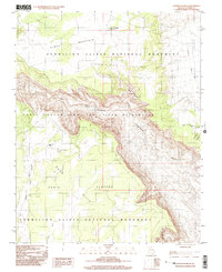
 1998 Woods Canyon2001 Print · USGSThe Mogollon Rim forms a dramatic divide through the Arizona high country during the late twentieth century. Researchers can trace historic routes like the General George Crook Road and locate mountain communities at Colcord Estates or Ponderosa Estates.
 - 1998 Map of Promontory Butte, 2001 Print
 1998 Promontory Butte2001 Print · USGSGila County during the late nineties shows a landscape defined by the towering Mogollon Rim and the clear waters of Tonto Creek. Genealogists and local historians can trace the development of seasonal communities like Kohls Ranch or Bear Flat Subdivision and find family landmarks along the Highline Trail.
 - 1999 Map of Lees Ferry, 2003 Print
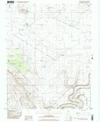
 1999 Lees Ferry2003 Print · USGSThe Colorado River corridor near the Navajo Indian Reservation comes alive in this late-century survey of the historic crossing at Lees Ferry. Genealogists and researchers can trace the vicinity of Navajo Spring, a local Cem, and various prospects along the canyon rim.
 - 1999 Map of Cape Solitude, 2003 Print
 1999 Cape Solitude2003 Print · USGSThe Grand Canyon's eastern rim and the Navajo territory meet at the turn of the millennium where the river forks. Geologists and researchers can trace the dramatic elevation shifts at Cape Solitude, the rapids at Sixtymile Rapids, and the isolated Mine near the canyon floor.
End of results
Showing maps 1-21 of 21
Top cities of Coconino County
- Flagstaff historical maps
- Page historical maps
- Doney Park historical maps
- Williams historical maps
- Kachina Village historical maps
- Timberline-Fernwood historical maps
See more
Frequently asked questions
- What are the different types of historical maps available for Coconino County?
- What is the oldest map of Coconino County?
- Where can I purchase historical maps of Coconino County for my home or office?
- Where can I download high-res historical maps of Coconino County?
- Are there historical topographic maps available for Coconino County?
- Is there historical aerial imagery available for Coconino County?
- Where are historical maps of Coconino County sourced from?