1970s Maps of Coconino County, Arizona
Explore 46 historic maps of Coconino County from the 1970s. These maps offer a rare glimpse into what life looked like during the 1970s — showing old roads, neighborhoods, homes, and landmarks that have changed or disappeared over time.
Whether you're researching your family's past, planning a metal detecting trip, or studying how Coconino County's landscape evolved across the 1970s, these high-resolution maps are a powerful tool for exploring the history of this region.
- Focus on a specific era: All maps on this page are from the 1970s, giving you a focused view of this time period.
- See what’s changed: Compare century-old streets, trails, and buildings to today's modern landscape using overlays and satellite layers.
- Research with precision: Use these maps for genealogy, historical research, land use analysis, or educational projects.
- View, download, or print: Maps are fully viewable online in high resolution, and can be downloaded or printed for your own records.
Start exploring Coconino County's history through authentic maps from the 1970s. This is your window into the past.
Coconino County, AZ maps
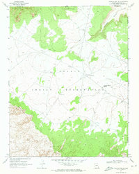
(46)- 1970 Map of Kinnikinick Lake, 1972 Print
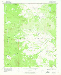
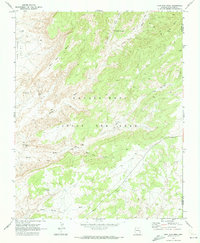
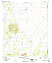
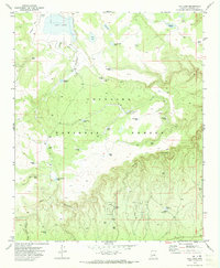
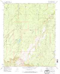
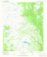 1970 Kinnikinick Lake1972 Print · USGSCoconino County was a landscape of high mesas and vital water catchments in the early 1970s. Researchers can trace the water-management history of the high country through features like Kinnikinick Lake, Anderson Spring, and Long Lake.5 unique versions available
 - 1970 Map of Turkey Mtn., 1972 Print
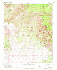
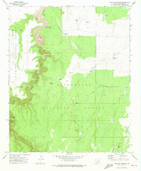
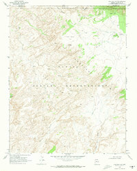
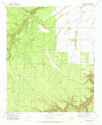
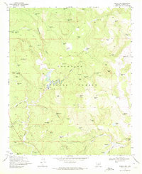 1970 Turkey Mtn.1972 Print · USGSCoconino National Forest at the start of the 1970s reveals a rugged landscape of high-country ranching and forest management. Researchers can trace the water network of the era through sites like Willow Valley Dam, Clintons Pool, and the working Wingfield Corral.3 unique versions available
 - 1970 Map of Cow Springs, 1972 Print
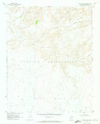
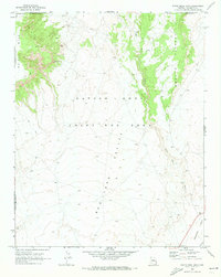
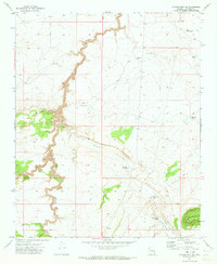
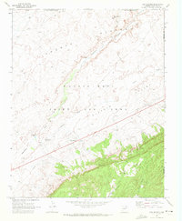 1970 Cow Springs1972 Print · USGSCoconino County was a crossroads of tradition and transition in the early 1970s, as shown by the settlements and land use patterns here. Researchers can trace the heritage of the Old Cow Springs Trading Post, the waters of Kai Si Kito, and the layout of Masitoh.
 - 1970 Map of Square Butte, 1972 Print
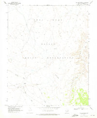
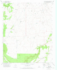
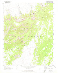 1970 Square Butte1972 Print · USGSCoconino County was a landscape of deep canyons and mesa heights in the early seventies, primarily within the Navajo Indian Reservation. Researchers can trace remote desert routes and find significant landmarks like the Cliff Dwelling at White Mesa or the distinctive Navajo Stand Rock.3 unique versions available
 - 1970 Map of Jaycox Mtn., 1972 Print
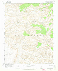
 1970 Jaycox Mtn.1972 Print · USGSCoconino County during the early seventies is revealed as a working landscape of cattle tanks and forest trails. Researchers can locate remote landmarks like Bargaman Park, the Soldier Annex Canal, and numerous family-named tanks such as Jaycox Tank.2 unique versions available
 - 1970 Map of Loy Butte, 1972 Print
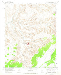
 1970 Loy Butte1972 Print · USGSCoconino National Forest in the early seventies was a land of remote cattle ranches and hidden canyon outposts. Researchers can trace the layout of historic operations like Hancock Ranch and Gray Ranch, or locate landmarks such as the Cliff Dwelling and the legendary Robbers Roost.2 unique versions available
 - 1970 Map of Whirlwind Rock, 1973 Print
 1970 Whirlwind Rock1973 Print · USGSThe Navajo Plateau in northern Arizona comes to life in this survey of the Shonto region during the early seventies. Genealogists and historians can trace essential water sources and livestock landmarks like Begay Windmill, Red Spot Spring, and Old Farm Spring.
 - 1970 Map of Chavez Mtn NW, 1973 Print
 1970 Chavez Mtn NW1973 Print · USGSCoconino County in the early 1970s was a landscape of deep canyons and critical water management for ranching and forest operations. Trace the early water improvements and access routes through Grapevine Canyon, Kinnikinick Canyon, and Morton Tanks.2 unique versions available
 - 1970 Map of John Daw Mesa, 1973 Print
 1970 John Daw Mesa1973 Print · USGSCoconino County, Arizona, is captured here during the early seventies, detailing the remote land within the Navajo - Hopi Joint Use Area. Researchers can trace specific family-named landmarks and water sources like the John Daw Grave, John Daw Well, and Kai Si Kato.
 - 1970 Map of Chaiyahi Rim SW, 1973 Print
 1970 Chaiyahi Rim SW1973 Print · USGSNorthern Arizona high-desert country within the Navajo Indian Reservation is documented here at the start of the 1970s. Researchers can trace traditional routes like the Navajo Trail across the heights of Gray Mesa.
 - 1970 Map of Two Red Mesas, 1973 Print
 1970 Two Red Mesas1973 Print · USGSCoconino County was characterized by its deep canyons and ancestral landmarks during the early 1970s. This survey allows for the tracing of Cliff Dwellings near Potato Canyon and local ranching sites like Bennett Corral.
 - 1970 Map of Inscription House Ruin, 1973 Print
 1970 Inscription House Ruin1973 Print · USGSCoconino County canyonlands are documented here in the early seventies, detailing indigenous archaeological sites and trading hubs. Researchers can locate cliff dwellings near Inscription House Ruin and trace remote routes like the Pack Trail to the Inscription House Trading Post.
 - 1970 Map of Chaiyahi Rim NE, 1973 Print
 1970 Chaiyahi Rim NE1973 Print · USGSThe high desert of the Navajo Indian Reservation appears here in the early seventies, just south of the Utah border. Researchers can trace remote sites like the Navajo Mountain Mission or ancient Cliff Dwelling and Red House ruins.
 - 1970 Map of Hamilton Crossing, 1973 Print
 1970 Hamilton Crossing1973 Print · USGSCoconino and Sitgreaves National Forests meet in this 1970s survey of high-country ranching and forest land. Trace the early pastoral landscape through family sites like Whitted Place and local landmarks such as Hamilton Crossing and O'Haco Tank.2 unique versions available
 - 1970 Map of Chaiyahi Rim SE, 1973 Print
 1970 Chaiyahi Rim SE1973 Print · USGSThe Navajo Indian Reservation at the start of the 1970s is shown here through its intricate canyon systems and high mesas. Researchers can trace ancient sites like the Cliff Dwelling and remote paths such as the Pack Trail near Forty Caves Canyon.
 - 1970 Map of Tonalea, 1973 Print
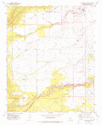
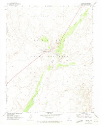 1970 Tonalea1973 Print · USGSThe northern Arizona desert around the Navajo - Hopi Joint Use Area is captured here in the early 1970s. Trace the life of this high-plateau community through its essential water sources like Mormon Well, landmarks like Elephant Feet, and the Red Lake post office.3 unique versions available
 - 1970 Map of Chevelon Butte, 1973 Print
 1970 Chevelon Butte1973 Print · USGSCoconino County ranching and forest lands come into focus during the early seventies. Genealogists and historians can trace the distribution of essential water improvements like Babbitt Tank, Big Windmill, and Mormon Tank around the landmark Chevelon Butte.2 unique versions available
 - 1970 Map of Chaiyahi Flat, 1973 Print
 1970 Chaiyahi Flat1973 Print · USGSNavajo Mountain and the high desert canyons of the Arizona-Utah border appear here as they were mapped in the early seventies. Researchers can trace the Jeep Trail to the Rainbow Lodge (Site) or locate geological features like the Natural Window and Round Rock Ruins.
 - 1970 Map of White Mesa Arch, 1973 Print
 1970 White Mesa Arch1973 Print · USGSCoconino County in the early 1970s reveals a high-desert landscape defined by the Navajo - Hopi Joint Use Area. Researchers can trace the rugged topography of White Mesa, the natural White Mesa Arch, and isolated landmarks like Tachaone Well.2 unique versions available
 - 1970 Map of Chavez Mtn West, 1973 Print
 1970 Chavez Mtn West1973 Print · USGSCoconino County was defined by its high-altitude water systems and mountain passes during the early 1970s. Trace the intricate plumbing of the Soldier Annex Canal and Chilson Ditch, or locate the historic Chavez Well site near Chavez Pass.3 unique versions available
 - 1970 Map of Hay Lake, 1973 Print
 1970 Hay Lake1973 Print · USGSThe high timber and deep draws of the Arizona high country are captured here during the 1970s. Trace the intricate network of ranching and forest water catchments like Hay Lake, Baucom Tank, and Duke Tank No 1 along the rim of Jacks Canyon.3 unique versions available
 - 1971 Map of Quayle Hill, 1973 Print
 1971 Quayle Hill1973 Print · USGSCoconino and Sitgreaves National Forests converged in the early 1970s across a high-country landscape of deep canyons and timber. Researchers can trace historic ranching and forest management through isolated landmarks like Brown Landing Strip, Soldier Trail Tank, and Quayle Well.3 unique versions available
 - 1971 Map of Chavez Mtn NE, 1973 Print
 1971 Chavez Mtn NE1973 Print · USGSCoconino County ranching lands are captured in the early 1970s, showing a landscape defined by canyons and essential water improvements. Researchers can trace remote infrastructure like Wolfolk Well, Broken Dam Tank, and the winding Diablo Canyon.
 - 1971 Map of Chavez Mtn East, 1973 Print
 1971 Chavez Mtn East1973 Print · USGSHigh-desert ranching and historic trails define this Coconino County landscape during the early 1970s. Researchers can trace remote water infrastructure and mountain routes including the Chavez Pass Trail, Melbourne Dam, and Lute Hart Tank.2 unique versions available
 - 1972 Map of Knoll Lake, 1974 Print
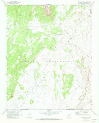
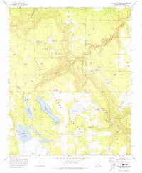
 1972 Knoll Lake1974 Print · USGSHigh in the Coconino National Forest during the early seventies, this area reveals a remote landscape of ranching outposts and high-country water sources. Trace historical sites like Limestone Ranch, O Haco Cabins, and the waters of Knoll Lake.2 unique versions available
Showing maps 1-25 of 46
Top cities of Coconino County
- Flagstaff historical maps
- Page historical maps
- Doney Park historical maps
- Williams historical maps
- Kachina Village historical maps
- Timberline-Fernwood historical maps
See more
Frequently asked questions
- What are the different types of historical maps available for Coconino County?
- What is the oldest map of Coconino County?
- Where can I purchase historical maps of Coconino County for my home or office?
- Where can I download high-res historical maps of Coconino County?
- Are there historical topographic maps available for Coconino County?
- Is there historical aerial imagery available for Coconino County?
- Where are historical maps of Coconino County sourced from?