Old Maps of Sprucedale, Arizona for Genealogy
Trace your family roots with 13 historic maps of Sprucedale. These high-res maps reveal old neighborhoods, homesites, landmarks, and streets — helping you uncover where your ancestors lived and how the area evolved over time.
- Explore historic neighborhoods: Identify where your relatives may have lived in the 1800s or 1900s.
- Compare maps over time: Trace the changes in streets, buildings, and landmarks for multi-generational research.
- Perfect for genealogy & ancestry research: Used by family historians and researchers to map out lineage and migration.
These maps are an incredible resource for exploring your personal connection to Sprucedale's past.
Sprucedale, AZ maps
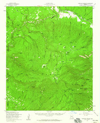
(13)- 1922 Map of Nutrioso
 1922 Nutrioso1922 Print · USGSHigh-altitude ranching and forest service outposts define the Arizona-New Mexico border in the early twenties. Researchers can trace remote family landmarks like Reservation Ranch and Colter's Res. or locate early settlements at Nutrioso and Alpine.
 - 1954 Map of Clifton, 1968 Print
 1954 Clifton1968 Print · USGSThe high timber and copper country of the Arizona-New Mexico border is captured here during the mid-fifties. Genealogists and historians can trace family holdings like the Double Circle Ranch or study the industrial footprint of the Smelting Plant at Clifton.3 unique versions available
 - 1957 Map of Clifton
 1957 Clifton1957 Print · USGSThe copper-mining district around Clifton and Morenci meets the high timberlands of the Mogollon Rim during the mid-1950s. Genealogists and researchers can trace family-named outposts and remote mountain settlements like Reserve, Stargo, and Fort Thomas.
 - 1958 Map of Clifton
 1958 Clifton1958 Print · USGSThe rugged high country of the Arizona-New Mexico border comes into focus in the mid-fifties, showing a landscape of mining camps and forest outposts. Genealogists and researchers can trace old settlements and remote sites like Mogollon, East Fork Mission, and the Tidwell Mine.
 - 1958 Map of Hannagan Meadow, 1960 Print
 1958 Hannagan Meadow1960 Print · USGSHigh atop the eastern Arizona plateau in the late fifties, this survey captures the remote outposts along the Coronado Trail. Researchers can trace the early Forest Service presence at Hannagan Meadow Ranger Station or locate family-named landmarks like Baldy Bill Point and Hoodoo Knoll.2 unique versions available
 - 1962 Map of Clifton
 1962 Clifton1962 Print · USGSThe copper-rich Arizona-New Mexico borderlands come into focus in the early sixties, centered on the mining complexes of Morenci and Clifton. Researchers can trace the Southern Pacific rail lines and locate remote outposts like Honeymoon and the Double Circle Ranch.
 - 1981 Map of Nutrioso, 1996 Print
 1981 Nutrioso1996 Print · USGSEastern Arizona and the New Mexico borderlands are captured here in the early eighties, showcasing a vast expanse of national forest and tribal lands. Researchers can trace the high-country routes between Nutrioso, Alpine, and Whiteriver, or locate landmarks along the Mogollon Rim and Black River.2 unique versions available
 - 1991 Map of Hannagan Meadow
 1991 Hannagan Meadow1991 Print · USGSHigh-country meadows and Forest Service outposts define this corner of the White Mountains during the early nineties. Researchers can trace historic mountain routes and water sources like Hannagan Meadow, the Caldwell FS Station, and the remote Balke Cabin.2 unique versions available
 - 1997 Map of Hannagan Meadow, 2000 Print
 1997 Hannagan Meadow2000 Print · USGSThe high meadows and forest camps of the Arizona high country appear here in the late nineties, centered on the Coronado Trail. Researchers can trace old forest service outposts like Caldwell FS Station and the remote Balke Cabin or locate livestock landmarks like Willow Corral.
 - 2011 Map of Hannagan Meadow, 2011 Print
 2011 Hannagan Meadow2011 Print · USGSCovers Sprucedale, including Cleaveland, Hannagan Meadow, and other nearby areas
 - 2014 Map of Hannagan Meadow, 2014 Print
 2014 Hannagan Meadow2014 Print · USGSCovers Sprucedale, including Cleaveland, Hannagan Meadow, and other nearby areas
 - 2018 Map of Hannagan Meadow, 2018 Print
 2018 Hannagan Meadow2018 Print · USGSCovers Sprucedale, including Cleaveland, Hannagan Meadow, and other nearby areas
 - 2021 Map of Hannagan Meadow, 2021 Print
 2021 Hannagan Meadow2021 Print · USGSThe high meadows and mountain canyons of Greenlee County are captured here in the early twenty-first century. Researchers can trace remote settlements and water sites like Hannagan Meadow, Sprucedale, and the numerous springs of Deep Cienega.
End of results
Showing maps 1-13 of 13
Top cities near Sprucedale
Frequently asked questions
- What are the different types of historical maps available for Sprucedale?
- What is the oldest map of Sprucedale?
- Where can I purchase historical maps of Sprucedale for my home or office?
- Where can I download high-res historical maps of Sprucedale?
- Are there historical topographic maps available for Sprucedale?
- Is there historical aerial imagery available for Sprucedale?
- Where are historical maps of Sprucedale sourced from?