2020s Maps of Phoenix, Arizona
Explore 23 historic maps of Phoenix from the 2020s. These maps offer a rare glimpse into what life looked like during the 2020s — showing old roads, neighborhoods, homes, and landmarks that have changed or disappeared over time.
Whether you're researching your family's past, planning a metal detecting trip, or studying how Phoenix's landscape evolved across the 2020s, these high-resolution maps are a powerful tool for exploring the history of this region.
- Focus on a specific era: All maps on this page are from the 2020s, giving you a focused view of this time period.
- See what’s changed: Compare century-old streets, trails, and buildings to today's modern landscape using overlays and satellite layers.
- Research with precision: Use these maps for genealogy, historical research, land use analysis, or educational projects.
- View, download, or print: Maps are fully viewable online in high resolution, and can be downloaded or printed for your own records.
Start exploring Phoenix's history through authentic maps from the 2020s. This is your window into the past.
Phoenix, AZ maps
(23)- 2021 Map of New River SE, 2021 Print
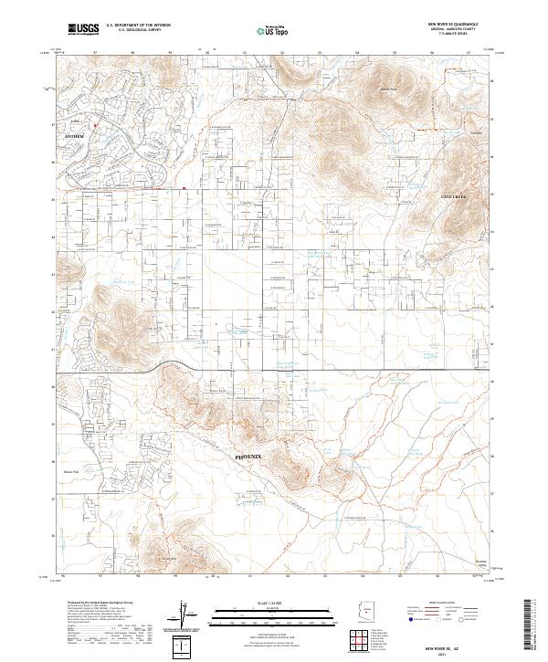 2021 New River SE2021 Print · USGSThe northern fringes of the Phoenix valley are captured here just as suburban growth meets the desert foothills. Researchers can trace the development of Anthem and Cave Creek alongside historic water features like Burro Tank and Ranieri Tank.
 - 2021 Map of Paradise Valley, 2021 Print
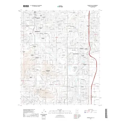 2021 Paradise Valley2021 Print · USGSParadise Valley and Scottsdale appear here in the early twenty-first century, showing a landscape defined by dramatic peaks and sprawling residential growth. Researchers can trace modern developments alongside landmarks like Camelback Mtn, Camelback Cem, and the Arizona Canal.
 - 2021 Map of Currys Corner, 2021 Print
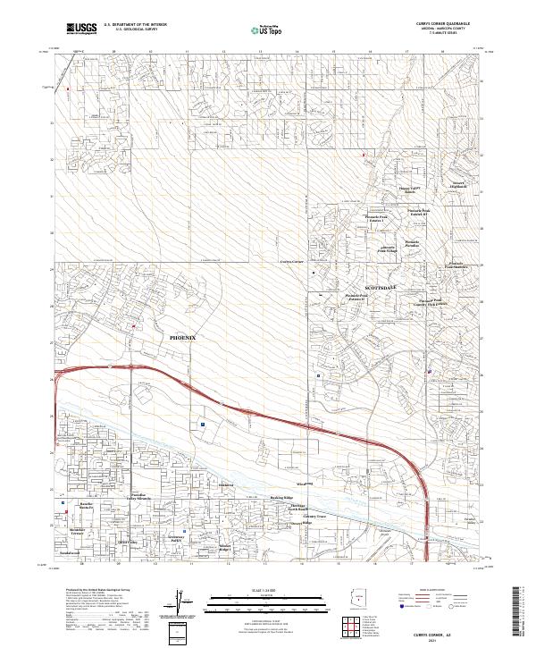 2021 Currys Corner2021 Print · USGSNorth Phoenix and Scottsdale are seen here during a phase of rapid desert development in the early 2020s. Researchers can trace modern community layouts from Pinnacle Peak Village to Oakhurst and the vital Central Arizona Project Aqueduct.
 - 2021 Map of Baldy Mountain, 2021 Print
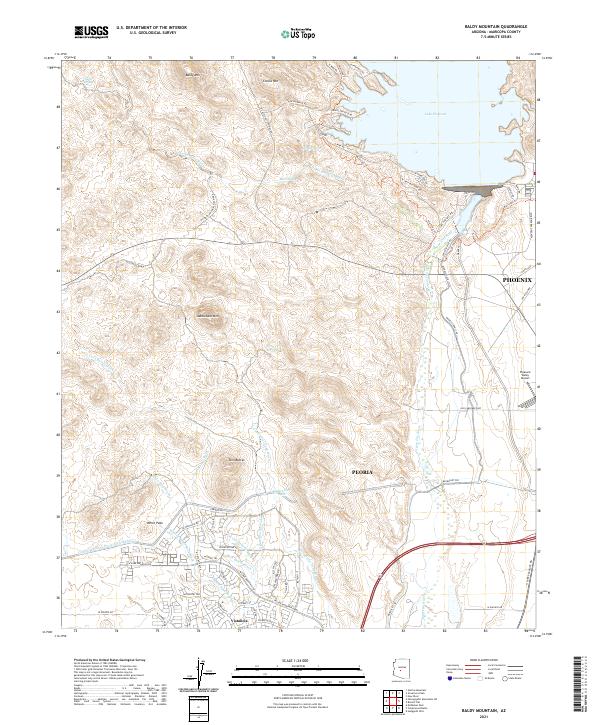 2021 Baldy Mountain2021 Print · USGSThe northern edge of the Phoenix valley meets the desert peaks of Maricopa County in the early twenty-first century. Researchers can trace modern water infrastructure like the Central Arizona Project Aqueduct and suburban growth at Vistancia near landmarks like Lake Pleasant.
 - 2021 Map of Tolleson, 2021 Print
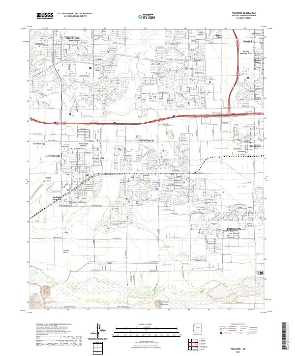 2021 Tolleson2021 Print · USGSThe West Valley at the start of the 2020s shows a complex landscape of rapid suburban growth and historic water infrastructure. Researchers can trace the original Initial Point near Monument Hill or locate early burial sites at Goodyear Farms Historic Cem.
 - 2021 Map of Phoenix, 2021 Print
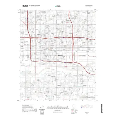 2021 Phoenix2021 Print · USGSCovers Phoenix, including Maricopa County, United States, and other nearby areas
 - 2021 Map of Lone Butte, 2021 Print
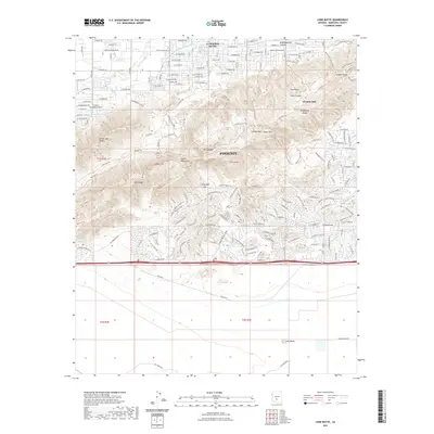 2021 Lone Butte2021 Print · USGSCovers Phoenix, including Maricopa County, United States, and other nearby areas
 - 2021 Map of Biscuit Flat, 2021 Print
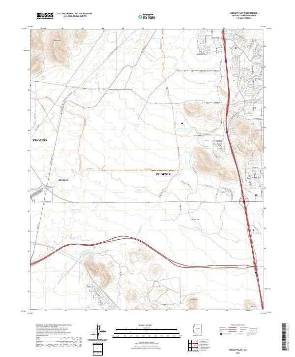 2021 Biscuit Flat2021 Print · USGSArizona's desert northern frontier near Phoenix shows its transition into a suburban and recreational hub in this recent survey. Trace the route of the Central Arizona Project Aqueduct or find trailheads along the Maricopa Trl and Black Canyon Trl.
 - 2021 Map of Fowler, 2021 Print
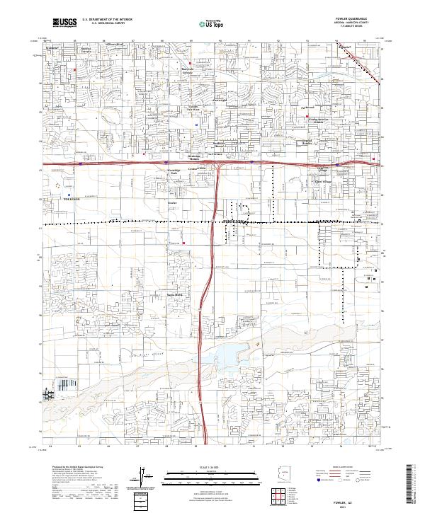 2021 Fowler2021 Print · USGSWestern Phoenix and the surrounding desert valley are captured here during a period of significant suburban expansion over former agricultural lands. Genealogists can trace family locations through numerous named residential tracts like Maryvale Terrace and Westridge Park or locate the Beth Israel Memorial Cem.
 - 2021 Map of Glendale, 2021 Print
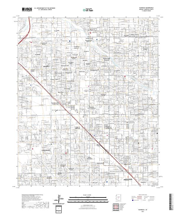 2021 Glendale2021 Print · USGSThe northern reaches of the Salt River Valley are shown in detail during a period of intense suburban growth and educational expansion. Researchers can pinpoint historic burial sites at Glendale Memorial Park and trace the paths of the Grand Canal and Skunk Cr through established neighborhoods.
 - 2021 Map of Laveen, 2021 Print
 2021 Laveen2021 Print · USGSCovers Phoenix, including Gila Crossing, Komatke, and other nearby areas
 - 2021 Map of Union Hills, 2021 Print
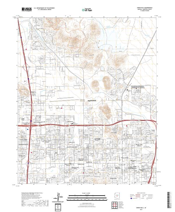 2021 Union Hills2021 Print · USGSNorth Phoenix at the start of the 2020s shows a landscape of rapid suburban development interwoven with desert preserves. Researchers can trace neighborhood growth and local landmarks like the National Memorial Cemetery of Arizona and Phoenix Deer Valley Airport.
 - 2021 Map of Hedgpeth Hills, 2021 Print
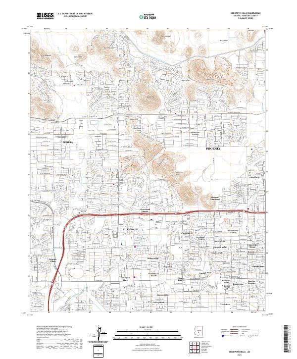 2021 Hedgpeth Hills2021 Print · USGSMaricopa County during its twenty-first-century expansion shows a complex landscape of master-planned communities and desert peaks. Trace the growth of Glendale and Peoria near landmarks like Arrowhead Ranch and the Midwestern University campus.
 - 2021 Map of Sunnyslope, 2021 Print
 2021 Sunnyslope2021 Print · USGSCovers Phoenix, including Paradise Valley, Site, and other nearby areas
 - 2021 Map of New River, 2021 Print
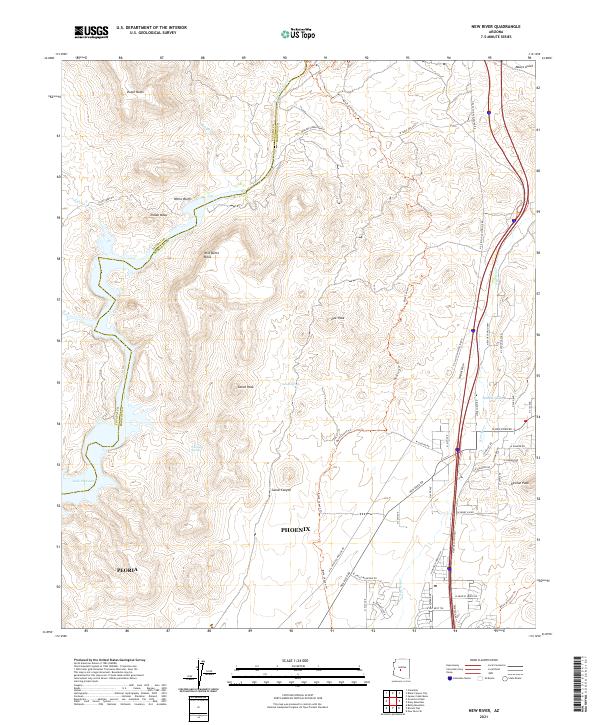 2021 New River2021 Print · USGSThe northern reaches of Phoenix and Peoria meet the desert foothills in the early twenty-first century as suburban growth reaches toward the Yavapai County line. Researchers can trace modern developments alongside land features like Indian Mesa, Whiskey Spring, and the historic Black Canyon Trl.
 - 2021 Map of El Mirage, 2021 Print
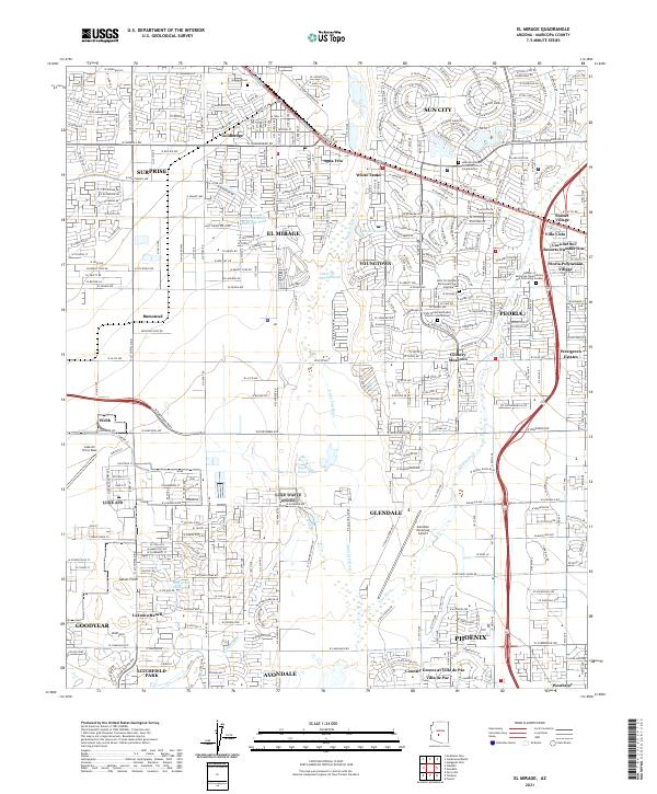 2021 El Mirage2021 Print · USGSThe West Valley of the Phoenix metro area is shown during a period of rapid development. Genealogists and local historians can trace legacy sites like Sunwest Cem or the industrial and residential shifts around Goldbadge and Bumstead.
 - 2021 Map of Cave Creek, 2021 Print
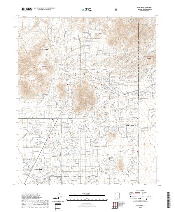 2021 Cave Creek2021 Print · USGSCave Creek and Carefree are shown in the early twenty-first century as suburban growth reaches the edge of the Tonto National Forest. Researchers can trace the modern development of these desert communities through landmarks like the Sky Ranch at Carefree Airport and the Cave Creek Cem.
 - 2021 Map of Tempe, 2021 Print
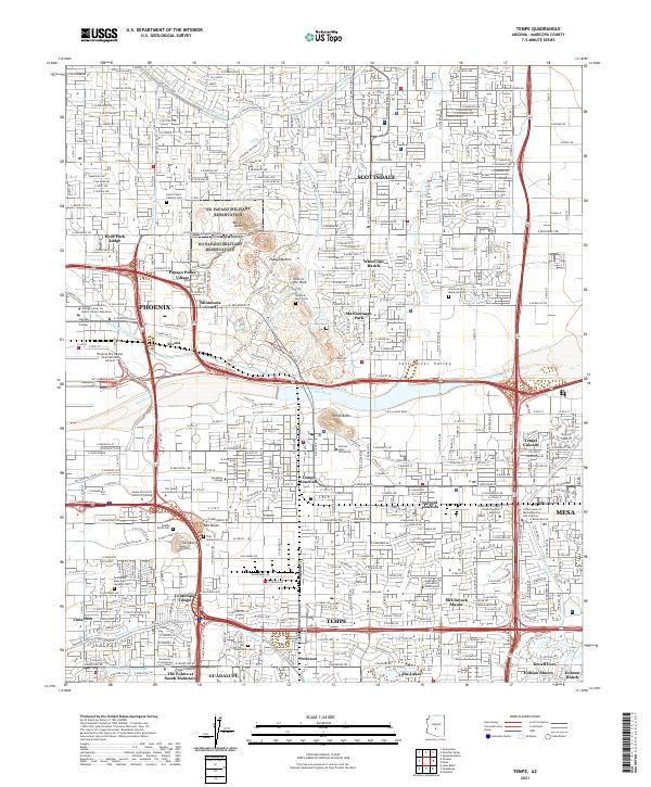 2021 Tempe2021 Print · USGSThe East Valley comes alive in this contemporary record of the desert metropolis and its canal-driven geography. Genealogists and historians can trace the foundations of Tempe and Guadalupe, locating landmarks like Double Butte Cem and the Arizona Canal.
 - 2021 Map of Guadalupe, 2021 Print
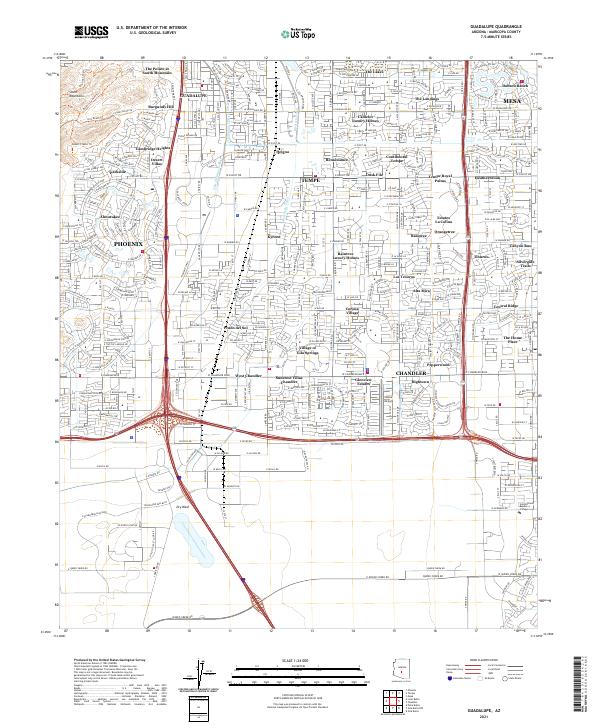 2021 Guadalupe2021 Print · USGSThe East Valley suburbs of Phoenix are shown in high detail during their twenty-first-century expansion. Researchers can trace local landmarks like the Highline Canal, the historic location of Kyrene, and the Village of Gila Springs within the dense urban grid.
 - 2023 Map of Lone Butte, 2023 Print
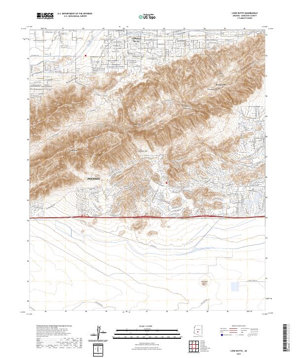 2023 Lone Butte2023 Print · USGSSouthern Arizona’s transition from suburban development to desert wilderness is captured here in the early 2020s. Researchers can trace the intersection of modern infrastructure and natural landmarks like Lone Butte, Haciendas Airport, and the Telegraph Pass trail network.
 - 2023 Map of Laveen, 2023 Print
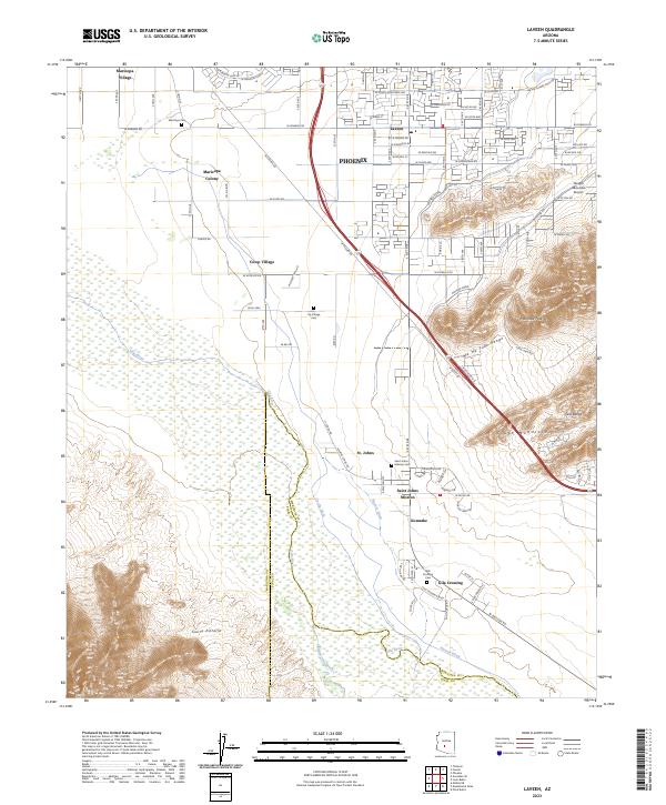 2023 Laveen2023 Print · USGSThe desert landscape south of Phoenix shows a blend of mountain ranges and traditional irrigation systems in the early twenty-first century. Genealogists and historians can trace community roots through sites like Saint Johns Mission, Maricopa Colony, and the Gila Crossing Cem.
 - 2023 Map of Phoenix, 2023 Print
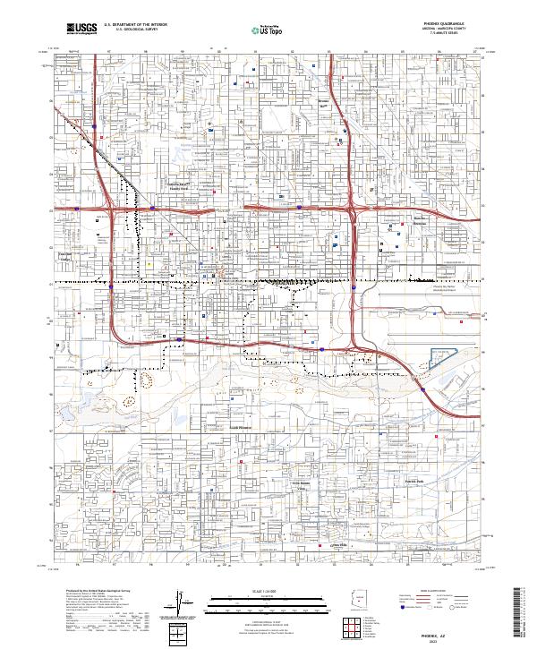 2023 Phoenix2023 Print · USGSPhoenix and its surrounding valley are captured here as a sprawling metropolitan center shaped by its river and canals. Genealogists and historians can trace the footprint of Beth El Cem, the Western Canal, and the early layout of South Phoenix.
 - 2023 Map of Sunnyslope, 2023 Print
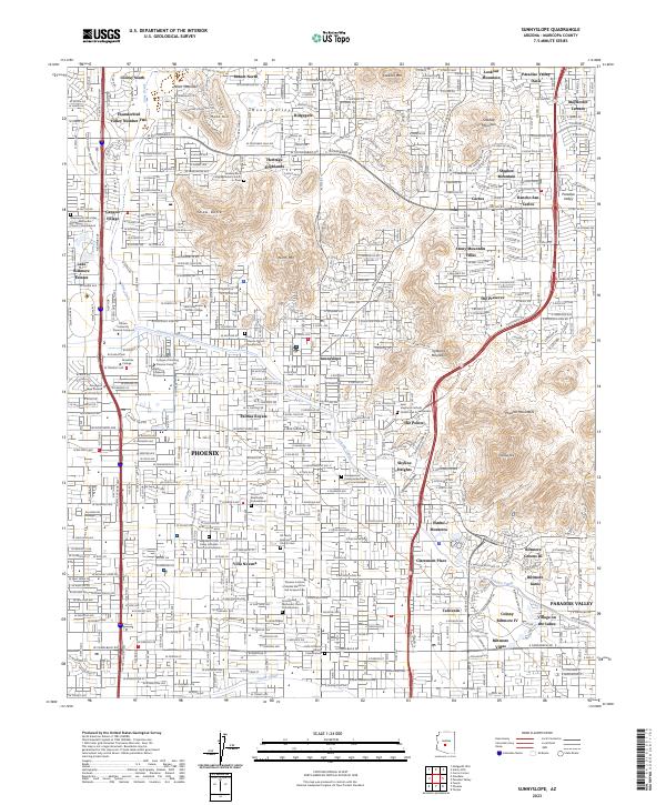 2023 Sunnyslope2023 Print · USGSThe Phoenix and Paradise Valley desert landscape is documented here in the early twenty-first century. Genealogists and local historians can locate specific sites like All Saints Episcopal Church Cem, Sunnyslope, and SAGU American Indian College.
End of results
Showing maps 1-23 of 23
Top cities near Phoenix
- Glendale historical maps
- Scottsdale historical maps
- Tempe historical maps
- Peoria historical maps
- Surprise historical maps
- Avondale historical maps
See more
Top neighborhoods of Phoenix
- Site historical maps
- Camelback East historical maps
- Rio Vista historical maps
- North Mountain historical maps
- North Gateway historical maps
- Estrella historical maps
See more
Frequently asked questions
- What are the different types of historical maps available for Phoenix?
- What is the oldest map of Phoenix?
- Where can I purchase historical maps of Phoenix for my home or office?
- Where can I download high-res historical maps of Phoenix?
- Are there historical topographic maps available for Phoenix?
- Is there historical aerial imagery available for Phoenix?
- Where are historical maps of Phoenix sourced from?