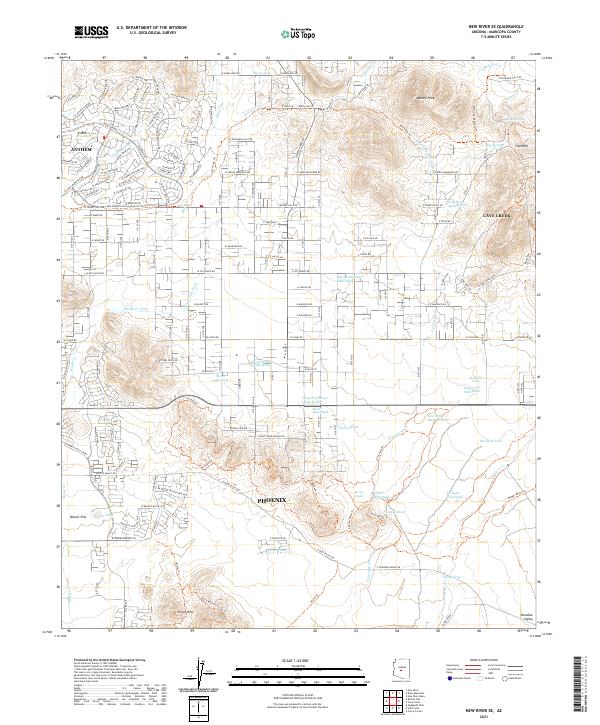
2021 Map of New River SE
USGS Topo · Published 2021About this map
Apache Peak stands as a prominent high point in this desert landscape, where the northern reaches of Phoenix meet the foothills. This 2021 survey documents the rapid residential expansion north of the Union Hills, particularly within the master-planned community of Anthem. The terrain is defined by a dense network of seasonal drainages, including Apache Wash, Skunk Cr, and West Fork Desert Hills Wash, which carve through the arid flats of Biscuit Flat.
Find a feature on this map
88 named features on this map. Tap any name to fly to it.
Don’t see what you’re looking for? This feature index may not catch every label — zoom into the map to look around manually.
Map Details
Editions of this 2021 New River SE Map
This is the sole edition of this map. No revisions or reprints were ever made.
Other maps of this area

1904 · Camelback
USGS Topo · 1:62,500

1906 · Camelsback
USGS Topo · 1:62,500

1930 · Cave Creek
USGS Topo · 1:125,000

1939 · Cave Creek
USGS Topo · 1:125,000

1954 · Phoenix
USGS Topo · 1:250,000

1954 · Mesa
USGS Topo · 1:250,000

1957 · Mesa
USGS Topo · 1:250,000

1957 · Phoenix
USGS Topo · 1:250,000

1957 · Hedgpeth Hills
USGS Topo · 1:24,000

1958 · Mesa
USGS Topo · 1:250,000