2020s Maps of Prescott Valley, Arizona
Explore 8 historic maps of Prescott Valley from the 2020s. These maps offer a rare glimpse into what life looked like during the 2020s — showing old roads, neighborhoods, homes, and landmarks that have changed or disappeared over time.
Whether you're researching your family's past, planning a metal detecting trip, or studying how Prescott Valley's landscape evolved across the 2020s, these high-resolution maps are a powerful tool for exploring the history of this region.
- Focus on a specific era: All maps on this page are from the 2020s, giving you a focused view of this time period.
- See what’s changed: Compare century-old streets, trails, and buildings to today's modern landscape using overlays and satellite layers.
- Research with precision: Use these maps for genealogy, historical research, land use analysis, or educational projects.
- View, download, or print: Maps are fully viewable online in high resolution, and can be downloaded or printed for your own records.
Start exploring Prescott Valley's history through authentic maps from the 2020s. This is your window into the past.
Prescott Valley, AZ maps
(8)- 2021 Map of Prescott, 2021 Print
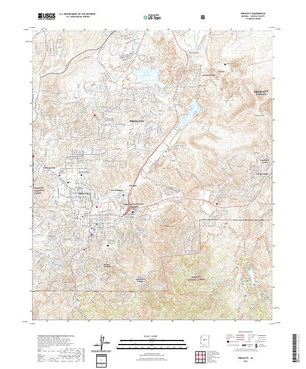 2021 Prescott2021 Print · USGSPrescott and the surrounding Yavapai County highlands are shown here in the modern era, detailing a landscape defined by institutional history and rugged basin-and-range terrain. Researchers can trace local heritage at the Prescott National Cem, Fort Whipple, and the Yavapai County Courthouse.
 - 2021 Map of Chino Valley South, 2021 Print
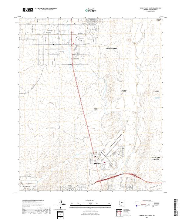 2021 Chino Valley South2021 Print · USGSThe high-desert ranching and aviation corridor between Prescott and Chino Valley is captured here in the early 2020s. Researchers can locate family sites near Chino Valley Cem, the rail stop at Granite Siding, and the local landmark of Robin Airport.
 - 2021 Map of Prescott Valley South, 2021 Print
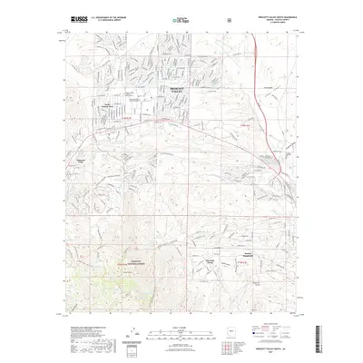 2021 Prescott Valley South2021 Print · USGSCovers Prescott Valley, including Dewey-Humboldt, Blue Hills Farms, and other nearby areas
 - 2021 Map of Prescott Valley North, 2021 Print
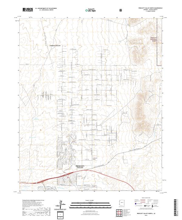 2021 Prescott Valley North2021 Print · USGSYavapai County's high-desert basin shows significant residential growth and water infrastructure in the early 2020s. Researchers can trace land development patterns and rural homesteads near the Prescott-Jerome Waterway and Lonesome Valley.
 - 2021 Map of Hickey Mountain, 2021 Print
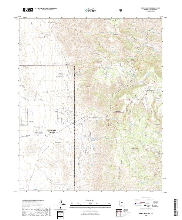 2021 Hickey Mountain2021 Print · USGSThe high peaks of the Black Hills overlook the growing eastern edge of Prescott Valley in this modern survey of central Arizona. Researchers can trace the rugged topography of Mingus Mountain and locate historic sites like the Yaeger Mine and Mingus Lake.
 - 2021 Map of Humboldt, 2021 Print
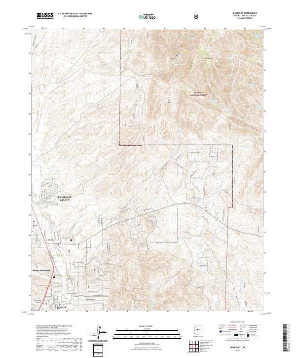 2021 Humboldt2021 Print · USGSThe Agua Fria River valley in Yavapai County shows its modern evolution from a mining and ranching hub into a growing residential region. Researchers can locate family landmarks such as Humboldt Cem or trace the early settlement footprints of Dewey and Humboldt.
 - 2023 Map of Prescott Valley South, 2023 Print
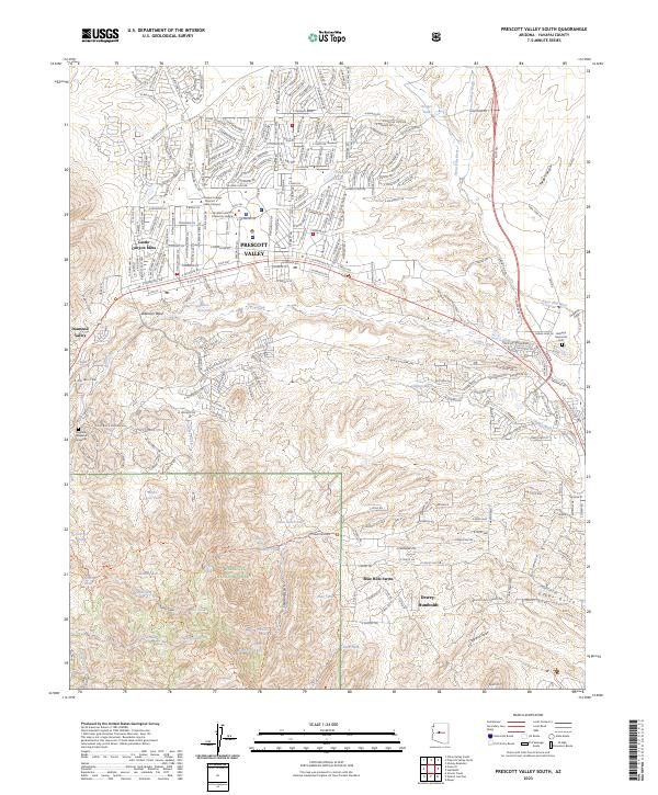 2023 Prescott Valley South2023 Print · USGSYavapai County's high desert communities and the edge of the national forest are mapped in extensive detail during a period of modern growth. Genealogists and hikers can locate the Angeline Hoagland Gravesite, trace the Agua Fria River, or explore the drainages of Charcoal Gulch.
 - 2026 Map of Humboldt, 2026 Print
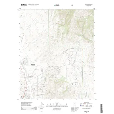 2026 Humboldt2026 Print · USGSCovers Prescott Valley, including Dewey-Humboldt, Dewey, and other nearby areas
End of results
Showing maps 1-8 of 8
Top cities near Prescott Valley
- Prescott historical maps
- Dewey-Humboldt historical maps
- Clarkdale historical maps
- Jerome historical maps
- Chino Valley historical maps
Top neighborhoods of Prescott Valley
Frequently asked questions
- What are the different types of historical maps available for Prescott Valley?
- What is the oldest map of Prescott Valley?
- Where can I purchase historical maps of Prescott Valley for my home or office?
- Where can I download high-res historical maps of Prescott Valley?
- Are there historical topographic maps available for Prescott Valley?
- Is there historical aerial imagery available for Prescott Valley?
- Where are historical maps of Prescott Valley sourced from?