1980s Maps of Yuma County, Arizona
Explore 19 historic maps of Yuma County from the 1980s. These maps offer a rare glimpse into what life looked like during the 1980s — showing old roads, neighborhoods, homes, and landmarks that have changed or disappeared over time.
Whether you're researching your family's past, planning a metal detecting trip, or studying how Yuma County's landscape evolved across the 1980s, these high-resolution maps are a powerful tool for exploring the history of this region.
- Focus on a specific era: All maps on this page are from the 1980s, giving you a focused view of this time period.
- See what’s changed: Compare century-old streets, trails, and buildings to today's modern landscape using overlays and satellite layers.
- Research with precision: Use these maps for genealogy, historical research, land use analysis, or educational projects.
- View, download, or print: Maps are fully viewable online in high resolution, and can be downloaded or printed for your own records.
Start exploring Yuma County's history through authentic maps from the 1980s. This is your window into the past.
Yuma County, AZ maps
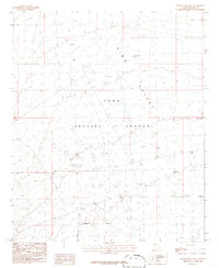
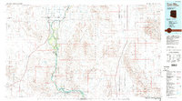
(19)- 1980 Map of Tinajas Altas Mts
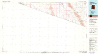 1980 Tinajas Altas Mts1980 Print · USGSThe Arizona-Sonora borderlands come into focus in the early eighties, showing a landscape shaped by military use and extreme desert terrain. Researchers can trace the Jeep Trail through the Tinajas Altas Mountains or locate the Smith Mine and San Luis Landing Field.2 unique versions available
 - 1980 Map of Cabeza Prieta Mts, 1996 Print
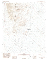
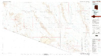 1980 Cabeza Prieta Mts1996 Print · USGSThe Arizona-Sonora borderlands come into focus in the 1980s, showcasing a vast landscape of protected wilderness and military ranges. Researchers can trace remote desert water sources like Tule Well and Papago Well or locate prominent landmarks such as Cabeza Prieta Peak.2 unique versions available
 - 1980 Map of Dateland, 1996 Print
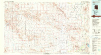
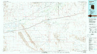 1980 Dateland1996 Print · USGSThe Yuma County desert during the late twentieth century is defined by the vital transit corridor along the Gila River. Researchers can trace the Southern Pacific rail line through remote stops like Sentinel and Aztec or locate the Sheep Mine in the rugged backcountry.
 - 1982 Map of Tinajas Altas
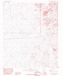
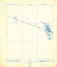 1982 Tinajas Altas1982 Print · USGSThe Arizona-Sonora borderlands come into focus in this military survey, which tracks the international line across the southern Yuma Desert. Researchers can locate historic boundary markers like Mon. 197 and water catchments at Tinajas Altas.
 - 1982 Map of Ajo
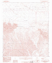
 1982 Ajo1982 Print · USGSThe Arizona-Sonora borderlands come into focus in the early eighties, showcasing a landscape of desert mining towns and expansive tribal lands. Trace the Southern Pacific rail line through Gila Bend or explore the remote settlements of Ajo and Lukeville.
 - 1986 Map of Mesquite Jim Well
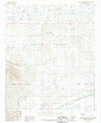
 1986 Mesquite Jim Well1986 Print · USGSKing Valley in the mid-1980s is shown here as a landscape of military testing and desert infrastructure. Researchers can trace the perimeter of the Yuma Proving Ground and locate landmarks like the Mesquite Jim Well and various observation Towers.
 - 1986 Map of Red Hill SW
 1986 Red Hill SW1986 Print · USGSIn the mid-1980s, the desert near the California border served as both a military testing site and a wildlife sanctuary. Researchers can trace the boundaries of the Yuma Proving Ground and locate river landmarks like Mc Allister Lake and the Observation Tower.
 - 1986 Map of Red Hill NE
 1986 Red Hill NE1986 Print · USGSIn the mid-1980s, the desert border between La Paz and Yuma counties remained a landscape of military testing and mining potential. Trace early mineral activity at the Mine Shaft or explore the vast Yuma Proving Ground and Indian Wash.
 - 1986 Map of Middle Mountains South
 1986 Middle Mountains South1986 Print · USGSThe Yuma desert in the mid-eighties shows a landscape defined by military operations and arid topography. Researchers can trace infrastructure across the Castle Dome Plain, from an Observation Tower to the peaks of the Middle Mountains.
 - 1986 Map of Red Bluff Mountain West
 1986 Red Bluff Mountain West1986 Print · USGSThe Yuma desert in the mid-eighties reveals a landscape shaped by defense testing and rugged drainage basins. Researchers can trace military landmarks like an Observation Tower and historical mineral sites along Vinegarroon Wash and the Muggins Mountains.
 - 1986 Map of Red Bluff Mountain East
 1986 Red Bluff Mountain East1986 Print · USGSThe Arizona desert south of the Castle Dome Plain reveals a landscape of military testing and irrigation in the mid-eighties. Researchers can trace the Military Reservation Boundary and locate remote infrastructure like Landing Strips and the Mohawk Canal.
 - 1986 Map of Trigo Mts
 1986 Trigo Mts1986 Print · USGSThe Colorado River corridor is captured here in the mid-eighties as it winds between Arizona and California. Researchers can trace decades of desert enterprise through locations like Paymaster Mine, the Cibola National Wildlife Refuge, and Walters Camp.2 unique versions available
 - 1986 Map of Trigo Pass
 1986 Trigo Pass1986 Print · USGSThe Arizona desert within the Yuma Proving Ground was a restricted military landscape in the mid-1980s. Geologists and researchers can trace drainage through Ehrenberg Wash or find early mineral workings at a Mine Shaft and Prospect.
 - 1986 Map of Tweed Mine
 1986 Tweed Mine1986 Print · USGSThe desert of western Arizona appears in the mid-1980s as a landscape of military testing and historical mining. Researchers can trace the rugged territory of the Chocolate Mountains and find old extraction sites like Tweed Mine or a specific Mine Shaft.
 - 1986 Map of Red Bluff Mountain NW
 1986 Red Bluff Mountain NW1986 Print · USGSThe Arizona desert of the mid-1980s is captured here at the junction of military and wildlife lands. Researchers can trace the legacy of mineral exploration through various Mine shafts and prospects scattered near the Castle Dome Mountains.
 - 1986 Map of Salton Tanks
 1986 Salton Tanks1986 Print · USGSThe Kofa Mountains and Yuma Proving Ground meet here in the mid-1980s, revealing a landscape of military boundaries and desert mining. Trace the remote network of Mine Shafts and Prospects or locate water at Salton Tanks and Dixon Spring.
 - 1986 Map of North of Roll
 1986 North of Roll1986 Print · USGSThe Yuma desert in the mid-eighties was a landscape shared by defense testing and wildlife preservation. Researchers can trace the Military Reservation Boundary and locate old mining sites like Prospect and the Black Hills.
 - 1986 Map of Middle Mountains North
 1986 Middle Mountains North1986 Print · USGSThe desert landscape of western Arizona in the mid-1980s is defined here by the rugged Middle Mountains and the sprawl of the Yuma Proving Ground. Researchers can trace the legacy of mineral exploration through several Prospects and Mine Shafts near the Castle Dome Plain.
 - 1988 Map of Little Horn Mountains
 1988 Little Horn Mountains1988 Print · USGSArizona's western desert reaches are captured here in the late eighties, from the protected wilderness to sprawling military training grounds. Researchers can trace the desert hydrology of Hoodoo Wash and the rugged borders of Yuma Proving Ground or Painted Rocks State Park.2 unique versions available
End of results
Showing maps 1-19 of 19
Top cities of Yuma County
- Yuma historical maps
- Fortuna Foothills historical maps
- San Luis historical maps
- Somerton historical maps
- Avenue B & C historical maps
- Wellton historical maps
See more
Frequently asked questions
- What are the different types of historical maps available for Yuma County?
- What is the oldest map of Yuma County?
- Where can I purchase historical maps of Yuma County for my home or office?
- Where can I download high-res historical maps of Yuma County?
- Are there historical topographic maps available for Yuma County?
- Is there historical aerial imagery available for Yuma County?
- Where are historical maps of Yuma County sourced from?