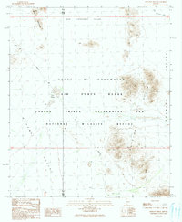
1990s Maps of Yuma County, Arizona
Explore 90 historic maps of Yuma County from the 1990s. These maps offer a rare glimpse into what life looked like during the 1990s — showing old roads, neighborhoods, homes, and landmarks that have changed or disappeared over time.
Whether you're researching your family's past, planning a metal detecting trip, or studying how Yuma County's landscape evolved across the 1990s, these high-resolution maps are a powerful tool for exploring the history of this region.
- Focus on a specific era: All maps on this page are from the 1990s, giving you a focused view of this time period.
- See what’s changed: Compare century-old streets, trails, and buildings to today's modern landscape using overlays and satellite layers.
- Research with precision: Use these maps for genealogy, historical research, land use analysis, or educational projects.
- View, download, or print: Maps are fully viewable online in high resolution, and can be downloaded or printed for your own records.
Start exploring Yuma County's history through authentic maps from the 1990s. This is your window into the past.
Yuma County, AZ maps
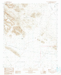
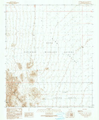
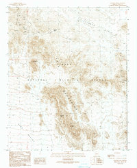
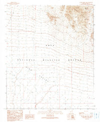
(90)- 1990 Map of Arch Tank
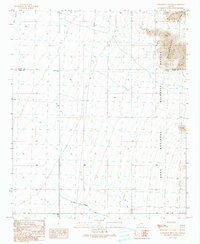
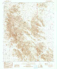 1990 Arch Tank1990 Print · USGSThe high desert of the Kofa Mountains comes into focus in 1990, showing a landscape defined by critical water catchments. Researchers can trace the path of the King Road past Arch Tank, Bandy Tank, and the narrow crossing at McPherson Pass.
 - 1990 Map of Palomas Mountains SE
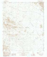
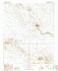
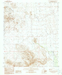 1990 Palomas Mountains SE1990 Print · USGSThe high desert of Yuma County in the late twentieth century reveals a landscape shaped by mineral prospecting and water management. Researchers can trace historic mining operations like mine shafts and adits or locate remote infrastructure such as Snyders Well and the Landing Strip.
 - 1990 Map of Slumgullion Pass
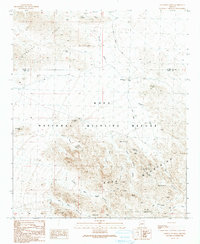
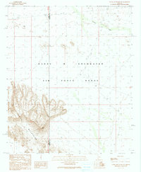
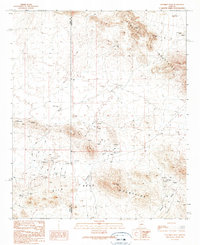
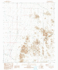
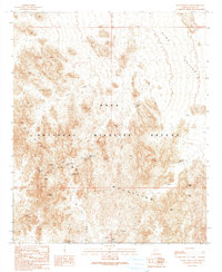 1990 Slumgullion Pass1990 Print · USGSArizona's high desert reveals its mining and ranching bones in the 1990s as it appeared within the Kofa National Wildlife Refuge. Researchers can trace old mineral prospects at the Big Eye Mine or locate desert water sources like Ketcherside Dam and Adams Well.
 - 1990 Map of Eagletail Mountains East
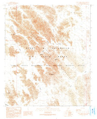
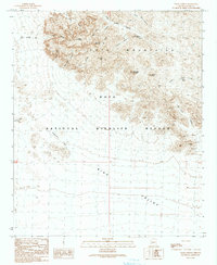
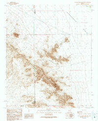 1990 Eagletail Mountains East1990 Print · USGSThe desert landscape of western Arizona is captured here as the nineties began, centered on the high ridges of the Eagletail Mountains. Local historians and explorers can trace old mining efforts at Frenchman Mine or locate geological landmarks like Courthouse Rock and the Natural Arch.
 - 1990 Map of Little Horn Mountains SE
 1990 Little Horn Mountains SE1990 Print · USGSThe Yuma County desert in the 1990s is captured here as a landscape of isolated peaks and critical water catchments. Researchers can trace early mining activity at the Mine Shaft and Prospect or follow the route of Red Raven Road through the Little Horn Mountains.
 - 1990 Map of Hoodoo Well
 1990 Hoodoo Well1990 Print · USGSArizona's Sonoran Desert landscape is documented here in the early nineties, revealing a region defined by mining and conservation. Prospectors can trace old workings at the Kofa Manganese Mine or locate desert water sources like Hoodoo Well and North Hoodoo Well.
 - 1990 Map of Livingston Hills
 1990 Livingston Hills1990 Print · USGSIn the high desert at the turn of the 1990s, the border between La Paz and Yuma counties reveals a rugged landscape of mining and wildlife conservation. Trace the locations of the Livingston Mine, isolated desert water sources like Budweiser Spring, and landmarks such as Lonesome Peak.
 - 1990 Map of Cabeza Prieta Peak
 1990 Cabeza Prieta Peak1990 Print · USGSYuma County’s desert interior is captured in the early 1990s as a high-clearance landscape of military ranges and protected wilderness. Researchers can locate vital desert water sources like Halfway Tank and follow the contours of Cabeza Prieta Peak and Surprise Canyon.
 - 1990 Map of Livingston Hills NW
 1990 Livingston Hills NW1990 Print · USGSThe Arizona desert at the turn of the 1990s reveals a landscape of conservation and utility between La Paz and Yuma counties. Map collectors and researchers can trace the rugged Livingston Hills and find specific landmarks like Palm Canyon Road and the Guzzler.
 - 1990 Map of Cholla Tank
 1990 Cholla Tank1990 Print · USGSThe arid borderlands of La Paz and Yuma counties are captured in the 1990s as a landscape of protected wilderness and mineral potential. Researchers can trace historic desert routes including the Kofa Manganese Road, Red Rock Pass, and various Prospects.
 - 1990 Map of Nottbusch Butte
 1990 Nottbusch Butte1990 Print · USGSYuma County during the late twentieth century shows a landscape shaped by desert mining and water management. Researchers can trace historical prospecting sites like the Big M Mine and the Yellow Breast Well, or locate landmarks such as Nottbusch Butte and Cemetery Ridge.
 - 1990 Map of Aguila Mountains NE
 1990 Aguila Mountains NE1990 Print · USGSThe Sonoran Desert at the Yuma and Maricopa county lines was primarily defined by military use in the early nineties. Researchers can trace the perimeter of the Barry M Goldwater Air Force Range and the rugged peaks of the Aguila Mountains.2 unique versions available
 - 1990 Map of Palm Canyon
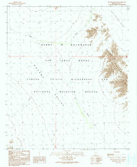
 1990 Palm Canyon1990 Print · USGSThe Kofa Mountains and King Valley are shown here in the early nineties, during a period of provisional mapping for this desert wilderness. Researchers can trace historic mineral exploration at the Kofa Queen Mine Prospects or locate water sources like Kofa Deep Well and Charlie Died Tank.
 - 1990 Map of Engesser Pass SW
 1990 Engesser Pass SW1990 Print · USGSYuma County during the 1990s showcases a landscape of overlapping military and conservation lands within the King Valley. Historians and researchers can locate old mining sites like Mine Shafts Adits and remote water sources such as Burnt Wagon Tank.
 - 1990 Map of Bryan Mountains
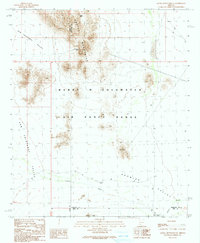
 1990 Bryan Mountains1990 Print · USGSYuma County, Arizona, was largely defined by vast federal tracts and desert valleys in the early 1990s. Researchers can trace the intersection of the Barry M Goldwater Air Force Range and the Bryan Mountains.
 - 1990 Map of Columbus Peak
 1990 Columbus Peak1990 Print · USGSThe Arizona desert on the Yuma and Maricopa county line shows its mid-century mining and ranching character here. Researchers can trace historic mineral claims like the Double Eagle Mine and Black Silver Mine or locate isolated landmarks such as Gibsons Roost Well.
 - 1990 Map of Granite Mountains South
 1990 Granite Mountains South1990 Print · USGSSouthern Arizona’s high desert was a landscape of strict military and wildlife boundaries during the late twentieth century. Researchers can trace the drainage of San Cristobal Wash through the Granite Mountains and identify remote landmarks like Granite Pass Tank.
 - 1990 Map of Engesser Pass
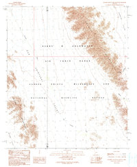
 1990 Engesser Pass1990 Print · USGSThe Kofa Mountains and King Valley are shown here as they appeared in the early nineties, during a period of provisional mapping. Researchers can trace the legacy of desert prospecting at the Engesser Mine or locate topographic landmarks like Black Dome and Frenchman Tank.
 - 1990 Map of O'Neill Hills
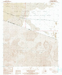
 1990 O'Neill Hills1990 Print · USGSThe Arizona-Sonora borderlands come into focus in the late twentieth century, showing a landscape shared by military ranges and wilderness refuges. Researchers can trace remote mining history at the Papago Mine or locate the solitary Grave near O'Neill Pass.
 - 1990 Map of Aguila Mountains SE
 1990 Aguila Mountains SE1990 Print · USGSThe Sonoran Desert at the start of the 1990s is captured here, showing the intersection of military airspace and traditional desert trails. Researchers can trace the path of the Daniels Trail and locate remote water sources like Eagle Tank and Indian Well.
 - 1990 Map of Las Playas
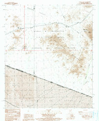
 1990 Las Playas1990 Print · USGSThe Arizona-Sonora borderlands come into focus in 1990 as they cross the desolate sands of the Yuma desert. Researchers can trace the legendary Camino Del Diablo as it skirts Las Playas and the Mexican settlement of Los Vidrios.
 - 1990 Map of Charlie Died Tank
 1990 Charlie Died Tank1990 Print · USGSThe desert wilderness of Yuma County is captured here during the 1990s, showing a land defined by isolation and survival. Researchers can trace the rugged transition from the Kofa Mountains to the King Valley and locate the remote Charlie Died Tank.
 - 1990 Map of Antelope Hills
 1990 Antelope Hills1990 Print · USGSThe Sonoran Desert borderlands are captured here in the early nineties, showing a landscape defined by federal conservation and military use. Researchers can trace the rugged topography of the Antelope Hills and locate remote water sources like Dos Playas.
 - 1990 Map of Little Horn Mountains NE
 1990 Little Horn Mountains NE1990 Print · USGSThe borderlands of La Paz and Yuma counties are captured in the late twentieth century, showing a transition from open desert to steep peaks. You can trace early ranching and mining efforts through features like Twin Tanks, the Corral, and various Prospects.
 - 1990 Map of Stone Cabin
 1990 Stone Cabin1990 Print · USGSThe Yuma County desert near Stone Cabin is captured in the late twentieth century, showing a remote landscape of mining and conservation. Researchers can trace desert water sources like Hidden Valley Tanks and find old routes through the Castle Dome Mountains.
Showing maps 1-25 of 90
Top cities of Yuma County
- Yuma historical maps
- Fortuna Foothills historical maps
- San Luis historical maps
- Somerton historical maps
- Avenue B & C historical maps
- Wellton historical maps
See more
Frequently asked questions
- What are the different types of historical maps available for Yuma County?
- What is the oldest map of Yuma County?
- Where can I purchase historical maps of Yuma County for my home or office?
- Where can I download high-res historical maps of Yuma County?
- Are there historical topographic maps available for Yuma County?
- Is there historical aerial imagery available for Yuma County?
- Where are historical maps of Yuma County sourced from?