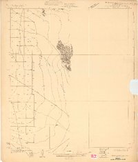
Old Maps of Yuma County, Arizona for Metal Detecting
Plan your next treasure hunt with 715 historic maps of Yuma County. Find old homesites, ghost towns, trails, and gathering spots that may be lost to time — perfect for identifying promising metal detecting locations.
- Locate forgotten sites: Uncover places like long-lost settlements, abandoned rail lines, or gathering spots.
- Plan better hunts: Use map overlays combined with LiDAR or satellite views to narrow in on historically rich areas.
- Made for detectorists: Thousands of hobbyists use these maps to discover relics, coins, and hidden history.
Use these historic maps to boost your research and find new opportunities beneath the surface of Yuma County.
Yuma County, AZ maps
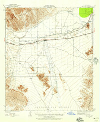
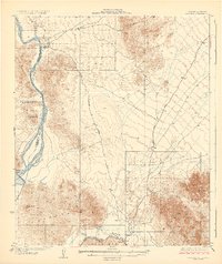
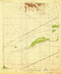
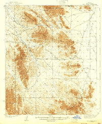
(715)- 1903 Map of Yuma, 1954 Print
 1903 Yuma1954 Print · USGSThe desert frontier around Yuma comes alive in this survey from the early 1900s, capturing the arrival of major irrigation and rail infrastructure. Genealogists and historians can trace the foundations of the Yuma Indian Reservation, the early layout of Somerton, and remote mining sites like the Picacho Mine.2 unique versions available
 - 1905 Map of Yuma
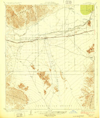
 1905 Yuma1905 Print · USGSThe Lower Colorado River borderlands come alive in the early 1900s, showing the early infrastructure of the Imperial Valley and the Yuma crossing. Genealogists and historians can trace the foundations of Somerton, the Yuma Indian Reservation, and remote desert mining camps like Hedges and Picacho Mine.5 unique versions available
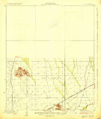
 - 1926 Map of Fortuna, 1956 Print
 1926 Fortuna1956 Print · USGSArizona's desert mining and rail corridors are captured here during the mid-1920s as modern utilities began to cross the landscape. Genealogists and historians can trace the Southern Pacific line through Blaisdell or locate the remote Fortuna Mine.
 - 1926 Map of Wellton, 1958 Print
 1926 Wellton1958 Print · USGSYuma County during the mid-1920s reveals a desert landscape defined by the arrival of the railroad and the management of the Gila River. Researchers can trace the early footprints of settlements like Wellton and Adonde or locate landmarks such as Radium Hot Springs and Antelope Hill.2 unique versions available
 - 1926 Map of Mohawk, 1960 Print
 1926 Mohawk1960 Print · USGSSouthern Arizona rail and river life converge in the mid-twenties as the iron horse crosses the desert floor. Trace the early layout of Mohawk, follow the Southern Pacific tracks to Colfred, or locate the Arizona Consolidated Mining Co works.
 - 1927 Map of Aguila Mountains
 1927 Aguila Mountains1927 Print · USGSThe desert of Yuma County is captured in the late twenties, showing the region as a wide-open basin organized by early township surveys. Researchers can trace the original path of Yager Road as it cuts across the San Cristobal Valley.2 unique versions available
 - 1927 Map of Kim, 1961 Print
 1927 Kim1961 Print · USGSSouthwestern Arizona's arid borderlands come into focus in the late 1920s, showing a landscape defined by the railroad and vital desert wells. Trace the Southern Pacific line past the stop at Kim or follow the historic Yager Road through the San Cristobal Valley.
 - 1927 Map of Hyder, 1961 Print
 1927 Hyder1961 Print · USGSThe arid basins of Yuma County are captured here in the late twenties just as regional transportation routes were maturing. Trace the early desert corridor along the Southern Pacific rail line and the historic Old Yuma-Phoenix Road.
 - 1928 Map of Mohawk
 1928 Mohawk1928 Print · USGSIn the late 1920s, the Gila River valley served as a critical corridor for the Southern Pacific railroad and early desert industry. Genealogists and historians can trace small railway stops like Colfred and Gael or locate the remote Arizona Consolidated Mining Co.3 unique versions available
 - 1928 Map of Norton, 1947 Print
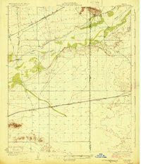
 1928 Norton1947 Print · USGSThe Yuma County desert in the late twenties was a landscape of remote rail stops and vital water holes along the Gila River. Researchers can trace the early path of the Southern Pacific railroad past the Norton settlement, Growler, and Terry Ranch.
 - 1929 Map of Fortuna
 1929 Fortuna1929 Print · USGSLower Arizona in the late twenties shows a landscape defined by the Gila River and the mining industry. Researchers can trace the Southern Pacific rail line through desert settlements like Blaisdell and Ligurta or locate the Fortuna Mine.4 unique versions available
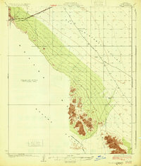
 - 1929 Map of Laguna
 1929 Laguna1929 Print · USGSThe confluence of the Colorado and Gila Rivers is captured here in the late twenties, during a period of significant water management and mining. Trace early river landings and remote desert prospects like Castle Dome Landing and the Old Senator Mine.4 unique versions available
 - 1929 Map of Wellton
 1929 Wellton1929 Print · USGSIn the late 1920s, this desert landscape centered on the Wellton rail corridor and the life-giving Gila River. Genealogists and historians can trace the railway settlements of Adonde and Tacna or locate the site of Radium Hot Springs.3 unique versions available
 - 1929 Map of Aztec
 1929 Aztec1929 Print · USGSYuma and Maricopa counties at the end of the 1920s reveal a landscape shaped by the rail and the river. Researchers can trace the desert infrastructure of the Southern Pacific through Aztec and find historical water sites like Agua Caliente and Baragans Well.2 unique versions available
 - 1929 Map of Norton
 1929 Norton1929 Print · USGSYuma County during the late 1920s shows a desert landscape shaped by the Southern Pacific railroad and the Gila River. Researchers can trace early ranching and utility sites like Terry Ranch and the Electric Gas and Water Co.2 unique versions available
 - 1930 Map of Aguila Mountains
 1930 Aguila Mountains1930 Print · USGSIn the Yuma County desert during the late 1920s, this survey captures a landscape of extreme verticality and open space. Researchers can trace early desert transit along the Yager Road or study the terrain surrounding the Aguila Mountains and Aztec Hills.3 unique versions available
 - 1930 Map of Stoval
 1930 Stoval1930 Print · USGSYuma County during the late twenties reveals a desert landscape organized around the Southern Pacific railroad and the Gila River. Genealogists and historians can locate old stops and sidings like Kofa Sta, Le Sage, and Stoval along the historic Old Palomas Yuma Road.4 unique versions available
 - 1930 Map of Hyder
 1930 Hyder1930 Print · USGSArid desert landscapes in Yuma County are captured here just before the 1930s, showing a critical crossroads for early rail and road travel. Genealogists and historians can trace the Southern Pacific line through Hyder and locate early landmarks like Morris Ranch and Hall Well.3 unique versions available
 - 1931 Map of Kim
 1931 Kim1931 Print · USGSYuma County’s desert corridor appears here during the early thirties, defined by the isolated railroad stop at Kim. Researchers can trace the early desert travel routes like Yager Road and locate critical historic water stops such as Pimoria Well and White Well.3 unique versions available
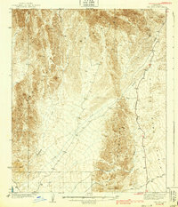
 - 1934 Map of Trigo Peaks
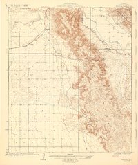
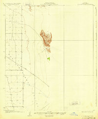
 1934 Trigo Peaks1934 Print · USGSThe arid reaches of western Arizona appear as they were in the early thirties, during the height of desert surveying. Trace the historical Cibola Road past the Tweed Mine and through the rugged Felipe Pass.
 - 1939 Map of Red Hill
 1939 Red Hill1939 Print · USGSThe high desert of Yuma County is mapped here in the mid-1930s, showing a landscape defined by mining prospects and historic transit routes. You can trace early desert roads and name points like the Annie Mine, Red Hill, and the long Quartzite Yuma Road.3 unique versions available
 - 1939 Map of Trigo Peaks
 1939 Trigo Peaks1939 Print · USGSArizona's high desert reveals its raw geography in the 1930s, showing a landscape defined by mountain corridors and seasonal washes. Researchers can trace early desert transit along the Cibola Road and locate remote industrial sites like the Tweed Mine.2 unique versions available
 - 1940 Map of Yuma, 1956 Print
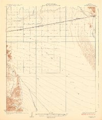
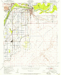 1940 Yuma1956 Print · USGSYuma and the surrounding desert irrigation districts are captured here at the start of the 1940s as the river economy matured. Genealogists and local historians can trace the foundations of Somerton, the Indian Sch, and family-named schools like Crane Sch.3 unique versions available
 - 1942 Map of Yuma
 1942 Yuma1942 Print · USGSThe desert frontier near Yuma underwent a massive transformation during the early war years as irrigation and military infrastructure expanded. Researchers can trace the development of the All American Canal Project and locate numerous historic workings like the Fortuna Mine and Old Senator Mine.
 - 1942 Map of Blythe
 1942 Blythe1942 Print · USGSThe Lower Colorado River valley appears here in the early 1940s, showcasing the agricultural development of the Palo Verde Mesa alongside a booming mining industry. Researchers can locate remote desert outposts and extraction sites like Midland, the U S Gypsum Mine, and Nortons Landing.2 unique versions available
Showing maps 1-25 of 715
Top cities of Yuma County
- Yuma historical maps
- Fortuna Foothills historical maps
- San Luis historical maps
- Somerton historical maps
- Avenue B & C historical maps
- Wellton historical maps
See more
Frequently asked questions
- What are the different types of historical maps available for Yuma County?
- What is the oldest map of Yuma County?
- Where can I purchase historical maps of Yuma County for my home or office?
- Where can I download high-res historical maps of Yuma County?
- Are there historical topographic maps available for Yuma County?
- Is there historical aerial imagery available for Yuma County?
- Where are historical maps of Yuma County sourced from?