Old Maps of Salem, Arkansas for Metal Detecting
Plan your next treasure hunt with 20 historic maps of Salem. Find old homesites, ghost towns, trails, and gathering spots that may be lost to time — perfect for identifying promising metal detecting locations.
- Locate forgotten sites: Uncover places like long-lost settlements, abandoned rail lines, or gathering spots.
- Plan better hunts: Use map overlays combined with LiDAR or satellite views to narrow in on historically rich areas.
- Made for detectorists: Thousands of hobbyists use these maps to discover relics, coins, and hidden history.
Use these historic maps to boost your research and find new opportunities beneath the surface of Salem.
Salem, AR maps
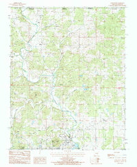
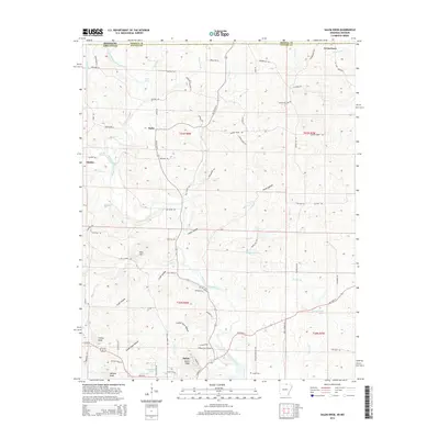
(20)- 1950 Map of Salem, 1973 Print
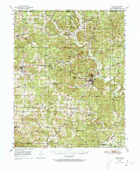 1950 Salem1973 Print · USGSFulton County and the surrounding Ozark borderlands are captured here in the mid-twentieth century, centered on the community of Salem. Local researchers can locate family homesteads near landmarks like Wesley Chapel, Bexar, and the Liberty Hill Ch.2 unique versions available
 - 1951 Map of Salem
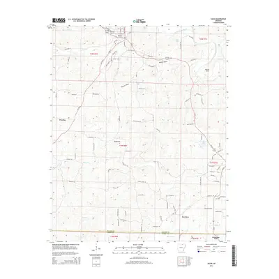
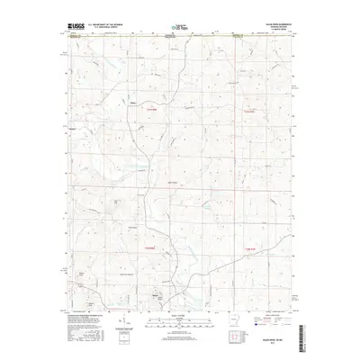
 1951 Salem1951 Print · USGSFulton County settlements and timberlands are mapped here in detail during the early fifties. Genealogists and local historians can trace family roots through numerous sites like Wesley Chapel, Crossroads Sch, and the Hunter Cem.
 - 1957 Map of Poplar Bluff, 1968 Print
 1957 Poplar Bluff1968 Print · USGSThe Missouri-Arkansas border region is captured here as the timber and rail industries shaped the Ozark foothills. Genealogists and historians can trace the Missouri Pacific Railroad through river towns like Pocahontas, Greenville, and Van Buren.3 unique versions available
 - 1959 Map of Poplar Bluff
 1959 Poplar Bluff1959 Print · USGSThe Missouri Ozarks and Arkansas borderlands meet in this late 1950s study of the region's diverse terrain and rail-fed towns. Researchers can trace the path of the Missouri Pacific Railroad through Poplar Bluff or locate smaller settlements like Birch Tree and Myrtle.
 - 1960 Map of Poplar Bluff
 1960 Poplar Bluff1960 Print · USGSSoutheast Missouri and Northeast Arkansas are captured here during the post-war era, showing the transition from the Ozark highlands to the Delta. Genealogists and historians can trace rail corridors like the St. Louis Southwestern RR and remote settlements such as Birch Tree and Warm Springs.
 - 1976 Map of Salem SE, 1977 Print
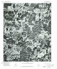 1976 Salem SE1977 Print · USGSThe northern Arkansas landscape comes into focus in the mid-1970s through this aerial orthophotoquad. Local historians can trace the rural layout of Salem and Wheeling or study the natural course of the South Fork Spring River.
 - 1976 Map of Salem NE, 1977 Print
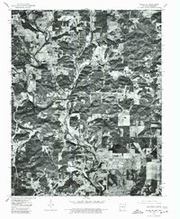 1976 Salem NE1977 Print · USGSFulton County land patterns and river bends are captured from the air during the mid-seventies. Researchers can trace rural property lines and woodlots near the South Fork Spring River and the settlements of Moko and Salem.
 - 1983 Map of Cherokee Village
 1983 Cherokee Village1983 Print · USGSThe Ozark foothills and river valleys of Northeast Arkansas are captured in the early eighties as modern planned communities began to reshape the landscape. Genealogists and historians can trace family-named ridges and schools across Evening Shade, Melbourne, and the rail junction at Hoxie.
 - 1984 Map of Salem
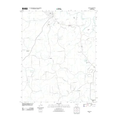
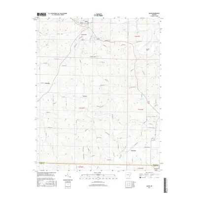
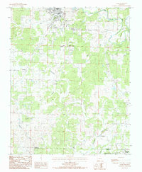 1984 Salem1984 Print · USGSNorth central Arkansas in the early eighties centers on the town of Salem, a landscape of winding Ozark creeks and small crossroads communities. Local historians can trace family roots through the settlements of Wheeling and Morriston or locate specific landmarks like Wheeler Spring and Pinhook Bend.
 - 1984 Map of Salem Knob
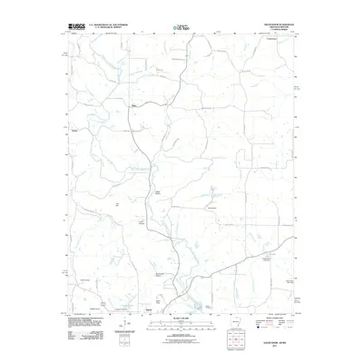
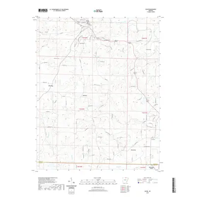
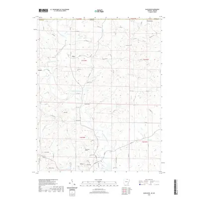
 1984 Salem Knob1984 Print · USGSNear the Missouri-Arkansas line in the 1980s, this area of the Ozarks shows a landscape defined by the South Fork Spring River. Researchers can locate Salem and Sturkie, trace the Hunter Cem, and find landmarks like the Lookout Tower on Salem Knob.
 - 2011 Map of Salem, 2011 Print
 2011 Salem2011 Print · USGSCovers Salem, including Horseshoe Bend, Fairview, and other nearby areas
 - 2011 Map of Salem Knob, 2011 Print
 2011 Salem Knob2011 Print · USGSCovers Salem, including Moko, Sturkie, and other nearby areas
 - 2014 Map of Salem, 2014 Print
 2014 Salem2014 Print · USGSCovers Salem, including Horseshoe Bend, Fairview, and other nearby areas
 - 2014 Map of Salem Knob, 2014 Print
 2014 Salem Knob2014 Print · USGSCovers Salem, including Moko, Sturkie, and other nearby areas
 - 2017 Map of Salem Knob, 2017 Print
 2017 Salem Knob2017 Print · USGSCovers Salem, including Moko, Sturkie, and other nearby areas
 - 2017 Map of Salem, 2017 Print
 2017 Salem2017 Print · USGSCovers Salem, including Horseshoe Bend, Fairview, and other nearby areas
 - 2020 Map of Salem, 2020 Print
 2020 Salem2020 Print · USGSCovers Salem, including Horseshoe Bend, Fairview, and other nearby areas
 - 2020 Map of Salem Knob, 2020 Print
 2020 Salem Knob2020 Print · USGSCovers Salem, including Moko, Sturkie, and other nearby areas
 - 2024 Map of Salem Knob, 2024 Print
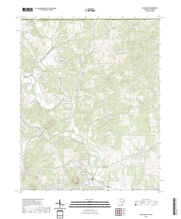 2024 Salem Knob2024 Print · USGSFulton County and the Arkansas-Missouri borderlands are captured here in the contemporary era. Researchers can trace the hollows and highlands that shaped local life, from the Hunter Cem to the waters of Langston Lake and Salem Knob.
 - 2024 Map of Salem, 2024 Print
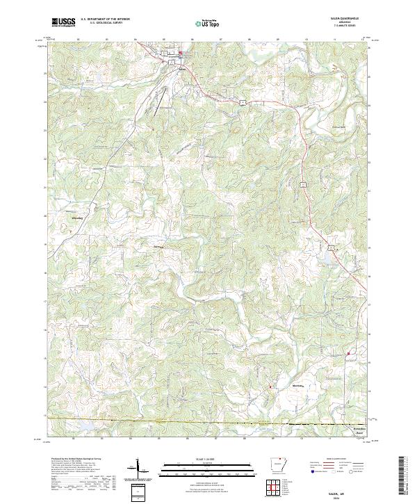 2024 Salem2024 Print · USGSSalem and its surrounding Fulton County communities appear here in a recent detailed survey. Genealogists and local historians can trace the developments around the Fulton County Courthouse and outlying locales like Wheeling and Morriston.
End of results
Showing maps 1-20 of 20
Top cities near Salem
- Cherokee Village historical maps
- Horseshoe Bend historical maps
- Ash Flat historical maps
- Oxford historical maps
- Viola historical maps
- Koshkonong historical maps
See more
Frequently asked questions
- What are the different types of historical maps available for Salem?
- What is the oldest map of Salem?
- Where can I purchase historical maps of Salem for my home or office?
- Where can I download high-res historical maps of Salem?
- Are there historical topographic maps available for Salem?
- Is there historical aerial imagery available for Salem?
- Where are historical maps of Salem sourced from?