1900s (20th Century) Maps of Johnson County, Arkansas
Explore 40 historic maps of Johnson County from the 1900s (20th Century). These maps offer a rare glimpse into what life looked like during the 1900s — showing old roads, neighborhoods, homes, and landmarks that have changed or disappeared over time.
Whether you're researching your family's past, planning a metal detecting trip, or studying how Johnson County's landscape evolved across the 1900s, these high-resolution maps are a powerful tool for exploring the history of this region.
- Focus on a specific era: All maps on this page are from the 1900s, giving you a focused view of this time period.
- See what’s changed: Compare century-old streets, trails, and buildings to today's modern landscape using overlays and satellite layers.
- Research with precision: Use these maps for genealogy, historical research, land use analysis, or educational projects.
- View, download, or print: Maps are fully viewable online in high resolution, and can be downloaded or printed for your own records.
Start exploring Johnson County's history through authentic maps from the 1900s. This is your window into the past.
Johnson County, AR maps
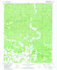
(40)- 1906 Map of Batson
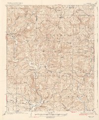
 1906 Batson1906 Print · USGSJohnson County highlands come into focus in the early 1900s through this rare advance sheet of the southern Batson area. Local historians can trace the early layout of Harmony, Hunt, and Grace near the waters of the East Fork of Horse Head Creek.
 - 1932 Map of Treat, 1972 Print
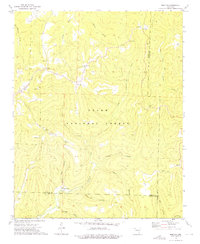
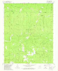
 1932 Treat1972 Print · USGSThe Arkansas Ozarks come alive in this early 1930s survey of the Piney Creek highlands. Researchers can trace rural life through numerous one-room schools like Ross Sch and remote outposts like Sand Gap Felsor PO or Fort Douglas.
 - 1934 Map of Treat
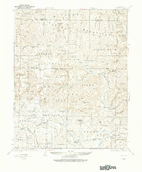
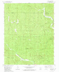
 1934 Treat1934 Print · USGSPope County highlands during the early thirties show a rugged network of forest outposts and mountain schools. Researchers can trace the layout of community sites like Sand Gap Pelsor PO, Ross Sch, and the Fairview Fire Tower.3 unique versions available
 - 1934 Map of Ozone, 1975 Print
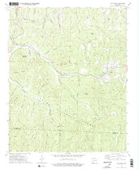
 1934 Ozone1975 Print · USGSThe Boston Mountains of Arkansas appear in the mid-1930s as a landscape of isolated mountain settlements and family farms. Researchers can trace genealogical roots at the Gillian Settlement, locate long-gone schools like Mountain Hall Sch, or find rural landmarks including the Devils Knob Fire Tower.
 - 1936 Map of Ozone
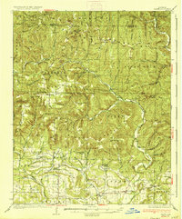 1936 Ozone1936 Print · USGSThe Boston Mountains of Johnson and Newton counties appear in the mid-thirties as a landscape of isolated ridges and winding hollows. Genealogists can trace family roots through the many rural schools and churches, including Murray Chapel Sch, Gillian Settlement, and the Hignite Cem.3 unique versions available
 - 1956 Map of Russellville
 1956 Russellville1956 Print · USGSThe Arkansas River valley and the surrounding Boston Mountains are captured here in the mid-fifties, showing a landscape of small timber towns and new reservoirs. Genealogists can trace family roots through upland settlements like Pelsor and Witts Springs or locate the campus of Arkansas Polytechnic College.2 unique versions available
 - 1961 Map of Coal Hill, 1962 Print
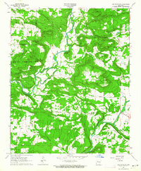
 1961 Coal Hill1962 Print · USGSThe mining and rail corridor of Johnson County comes into focus in the early sixties, showing the industrial landscape before modern reclamation. Genealogists and researchers can trace family plots at Houston Cem or Hardgraves Cem and follow the old MISSOURI PACIFIC line through Coal Hill.2 unique versions available
 - 1961 Map of Hartman, 1962 Print
 1961 Hartman1962 Print · USGSThe Arkansas River valley at the start of the sixties reveals a landscape of railroad towns and active coal mining. Genealogists and local historians can trace rural roots at Mount Vernon Ch, Kendall Cem, and the community of Sulphur Springs.3 unique versions available
 - 1961 Map of Paris, 1962 Print
 1961 Paris1962 Print · USGSParis and the surrounding Arkansas River valley are captured in the early 1960s during a period of established mining and agriculture. Researchers can trace local family roots through numerous sites like New Subiaco Academy, Oakwood Cem, and the Missouri Pacific Railroad line.3 unique versions available
 - 1962 Map of Knoxville, 1963 Print
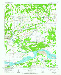
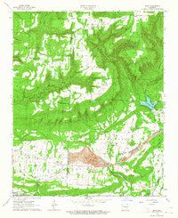
 1962 Knoxville1963 Print · USGSKnoxville and its surrounding ridges are captured here in the early 1960s, just as the Dardanelle Reservoir was reshaping the Arkansas River valley. Genealogists and local historians can locate remote landmarks like Maddin Chapel, Lutherville, and the Cazort Cem.2 unique versions available
 - 1962 Map of New Blaine, 1963 Print
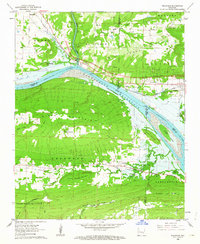
 1962 New Blaine1963 Print · USGSLogan County settlements and the rising waters of the Arkansas River valley are documented here in the early sixties. Genealogists and local historians can trace rural life through St Scholastica Ch, the Old Railroad Grade, and the New Blaine Sch.3 unique versions available
 - 1962 Map of Delaware, 1963 Print
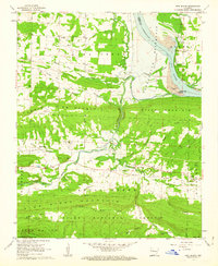
 1962 Delaware1963 Print · USGSThe Arkansas River valley was in a state of flux in the early sixties as the reservoir began to fill. Genealogists and historians can trace family ties at Chastain Cem and Pledger Cem or locate the Old Railroad Grade near Delaware.2 unique versions available
 - 1962 Map of Clarksville, 1963 Print
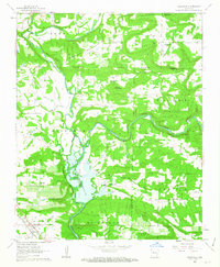
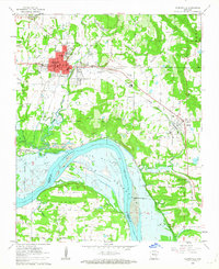 1962 Clarksville1963 Print · USGSJohnson County is captured in the early sixties as the rising waters of the Dardanelle Reservoir began reshaping the riverfront. Genealogists can locate several family burial grounds including Walton Cem and Gray Cem, alongside the College of the Ozarks campus.3 unique versions available
 - 1963 Map of Lee Mountain, 1964 Print
 1963 Lee Mountain1964 Print · USGSThe Pope and Johnson county line crosses a landscape of high ridges and creek bottoms in the early 1960s. Researchers can locate numerous family-named burial grounds like Pollard Cem and remote rural churches including Cumberland Ch and the Assembly of God Ch.2 unique versions available
 - 1963 Map of Harmony, 1964 Print
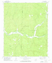
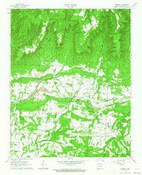 1963 Harmony1964 Print · USGSIn the early sixties, the valley below the Ozark National Forest supported a landscape of timber, mining, and rural homesteads. Genealogists can trace family lines through over a dozen burial sites including Zachary Cem and Porter Cem, while researchers can locate numerous Strip Mines and local landmarks like Stillwell Mtn.2 unique versions available
 - 1963 Map of Hunt, 1964 Print
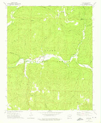
 1963 Hunt1964 Print · USGSJohnson and Franklin counties appear at a crossroads of industry and wilderness in the early 1960s. Genealogists can trace family names through numerous remote burial sites like Brendle Cem and Hardgrave Cem, or locate landmarks such as the Utah Strip Mine and Horsehead Lake.2 unique versions available
 - 1964 Map of Russellville
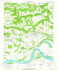
 1964 Russellville1964 Print · USGSMid-century Central Arkansas is defined here by the river-valley towns and the surrounding mountain ranges before the full expansion of the interstate system. Genealogists and historians can trace rail-town development along the Missouri Pacific Railroad and locate landmarks like Arkansas Polytechnic College or Petit Jean State Park.
 - 1973 Map of Boston, 1976 Print
 1973 Boston1976 Print · USGSThe high ridges and deep hollows of the Ozarks are meticulously detailed in the early 1970s, showing the rugged intersection of Madison and Newton counties. Genealogists and historians can locate family sites at Evans Cemetery, rural congregations like Boston Ch, and the isolated settlement of Red Star.2 unique versions available
 - 1973 Map of Pettigrew, 1976 Print
 1973 Pettigrew1976 Print · USGSMadison and Franklin Counties appear here in the early 1970s, showing the remote settlement patterns of the Ozark highlands. Genealogists can locate numerous family burial grounds including Adkins Cem, Kilgore Cem, and Liberty Cem near the banks of the White River.2 unique versions available
 - 1973 Map of Yale, 1976 Print
 1973 Yale1976 Print · USGSJohnson and Franklin counties in the 1970s reveal a landscape of deep valleys and highland forests along the Mulberry River. Genealogists and local historians can locate rural landmarks like Peanut, Pittston Junction, and the Good Hope Cem during this era.2 unique versions available
 - 1973 Map of Oark, 1976 Print
 1973 Oark1976 Print · USGSThe Mulberry River valley in the early 1970s remained a landscape of isolated forest settlements and winding creek beds. Genealogists and local historians can locate family landmarks like Patterson Springs Ch, Miller Cem, and the old community at Oark.2 unique versions available
 - 1977 Map of Russellville
 1977 Russellville1977 Print · USGSThe Arkansas River Valley and surrounding Ozark Mountains are documented here during a period of significant postwar growth and infrastructure development. Genealogists and researchers can locate family landmarks such as Mount Carmel Cem, St Josephs Church, and several remote Coal Mine sites along the Missouri Pacific RR line.
 - 1980 Map of Hagarville
 1980 Hagarville1980 Print · USGSHagarville and its surrounding mountain hollows are shown in detail during the late 1970s. Genealogists can trace family landmarks and burial sites including Adkins Cem, Russell Cem, and Minnow Creek Cem, alongside old rural churches like Lees Chapel.
 - 1980 Map of Ozone
 1980 Ozone1980 Print · USGSUpper Johnson County was a landscape of remote ridges and scattered mountain settlements at the dawn of the 1980s. Genealogists and local historians can trace the foundations of Gillian Settlement or locate rural landmarks like Miracle Temple Ch and Salus.
 - 1980 Map of Rosetta
 1980 Rosetta1980 Print · USGSThe Ozark highlands near the Johnson and Newton County border are documented here during the late twentieth century. Genealogists and hikers can trace remote landmarks like Rosetta Cem, the peaks of Pilot Rock Mountain, and the waters of Big Piney Creek.
Showing maps 1-25 of 40
Top cities of Johnson County
- Clarksville historical maps
- Lamar historical maps
- Coal Hill historical maps
- Knoxville historical maps
- Hartman historical maps
Frequently asked questions
- What are the different types of historical maps available for Johnson County?
- What is the oldest map of Johnson County?
- Where can I purchase historical maps of Johnson County for my home or office?
- Where can I download high-res historical maps of Johnson County?
- Are there historical topographic maps available for Johnson County?
- Is there historical aerial imagery available for Johnson County?
- Where are historical maps of Johnson County sourced from?