1980s Maps of Mississippi County, Arkansas
Explore 16 historic maps of Mississippi County from the 1980s. These maps offer a rare glimpse into what life looked like during the 1980s — showing old roads, neighborhoods, homes, and landmarks that have changed or disappeared over time.
Whether you're researching your family's past, planning a metal detecting trip, or studying how Mississippi County's landscape evolved across the 1980s, these high-resolution maps are a powerful tool for exploring the history of this region.
- Focus on a specific era: All maps on this page are from the 1980s, giving you a focused view of this time period.
- See what’s changed: Compare century-old streets, trails, and buildings to today's modern landscape using overlays and satellite layers.
- Research with precision: Use these maps for genealogy, historical research, land use analysis, or educational projects.
- View, download, or print: Maps are fully viewable online in high resolution, and can be downloaded or printed for your own records.
Start exploring Mississippi County's history through authentic maps from the 1980s. This is your window into the past.
Mississippi County, AR maps
(16)- 1983 Map of Dyersburg
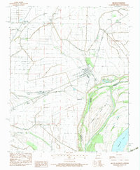
 1983 Dyersburg1983 Print · USGSSpanning the Mississippi River at the start of the 1980s, this area shows the vital river-and-rail connections between Tennessee and Missouri. Researchers can trace family sites at Mount Pisgah Cemetery or study the evolving shoreline near Caruthersville and Reelfoot Lake.
 - 1983 Map of Wilson
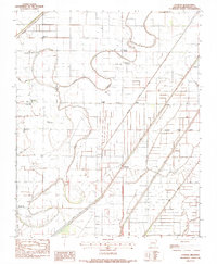
 1983 Wilson1983 Print · USGSIn the Mississippi River delta during the early eighties, this survey captures a landscape shaped by rail transport and complex drainage systems. Genealogists can trace family connections at Pleasant Grove Cem, McFadden Cem, or along the tracks of the Delta Valley & Southern railroad.
 - 1983 Map of Etowah, 1984 Print
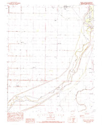
 1983 Etowah1984 Print · USGSMississippi County in the early eighties shows an engineered delta landscape of drainage canals and small farming hubs. Genealogists can locate family landmarks like Gant Cem and rural centers such as Etowah, Bondsville, and Athelstan.
 - 1983 Map of Manila South, 1984 Print
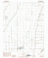
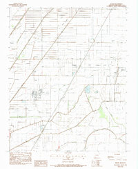
 1983 Manila South1984 Print · USGSMississippi County farmland meets the wetlands of the Delta in the early 1980s. Genealogists and local historians can trace rural settlements like Mandalay and Lennie alongside dozens of engineered waterways like Ditch No 18.
 - 1983 Map of Caraway, 1984 Print
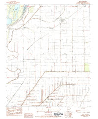
 1983 Caraway1984 Print · USGSEastern Arkansas farmland in the early eighties was defined by a complex grid of drainage canals and small agricultural hubs. Trace local history through family-named landmarks like Milligan Ridge and Cottonwood Corner, or locate ancestors at the Caraway Cem.
 - 1983 Map of Dell, 1984 Print
 1983 Dell1984 Print · USGSThe Mississippi County delta in the early eighties shows a landscape defined by an intensive drainage network and riverside refuges. Researchers can trace rural lineages through Mooney Cem, the settlement at Pettyville, and the community around Crossroads Ch.
 - 1983 Map of Manila North, 1984 Print
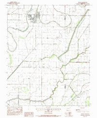
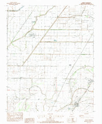
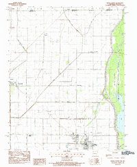 1983 Manila North1984 Print · USGSNorthern Mississippi County at the start of the eighties shows a landscape of reclaimed wetlands and established rural centers. Genealogists and historians can trace the foundations of Manila and Leachville or locate long-standing landmarks like Jolliff Store and Browns Chapel.
 - 1983 Map of Rivervale, 1984 Print
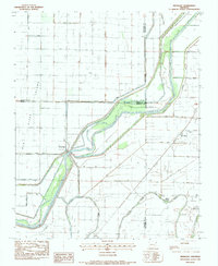 1983 Rivervale1984 Print · USGSNortheast Arkansas in the early eighties was a landscape of intensive water management where the Little River splits into its divergent chutes. Researchers can trace rural settlement patterns at Rivervale and West Ridge or locate local landmarks like Buffalo Ch and Helfer Landing.
 - 1983 Map of Leachville, 1984 Print
 1983 Leachville1984 Print · USGSThe Arkansas-Missouri state line comes alive in the late seventies, showing a landscape defined by drainage ditches and rural junctions. Trace local roots through Leachville, Monette, and community landmarks like Happy Corner Ch.
 - 1983 Map of Lepanto, 1984 Print
 1983 Lepanto1984 Print · USGSPoinsett County enters the 1980s as a landscape of intensive water management and rural Arkansas Delta settlements. Researchers can locate family landmarks at Potter Memorial Cem, follow the Tyronza River, or trace the path of the Old R.R. Grade through Lepanto.
 - 1983 Map of Keiser, 1984 Print
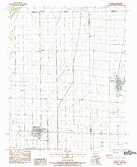
 1983 Keiser1984 Print · USGSMississippi County, Arkansas, appears in the early eighties as a highly organized agricultural landscape crisscrossed by essential drainage channels. Genealogists and local historians can locate rural landmarks like Zion Rock Cem, Keiser Chapel, and the settlement of Cottonwood Corner.
 - 1983 Map of Half Moon, 1984 Print
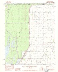 1983 Half Moon1984 Print · USGSThe Missouri-Arkansas borderlands in the early 1980s show a landscape of intensive drainage and wildlife conservation. Genealogists and local historians can trace small settlements like Half Moon and Stark City, or locate family landmarks such as Wilkerson Cem and Simmons Bridge.
 - 1983 Map of Joiner, 1984 Print
 1983 Joiner1984 Print · USGSThe Mississippi County Delta in the late seventies and early eighties shows an intensive agricultural landscape shaped by a massive network of drainage canals. Genealogists and local historians can trace rural family sites like Ashburn Cem, New Bethel Ch, and the community of Dyess.
 - 1986 Map of Jonesboro
 1986 Jonesboro1986 Print · USGSNortheast Arkansas in the mid-eighties shows a landscape of intensive drainage and railroad junctions centered on the rise of Crowley's Ridge. Researchers can trace the rail corridors of the St Louis Southwestern Railway and explore the unique geography of Hatchie Coon Island and the Mississippi River floodplain.2 unique versions available
 - 1986 Map of Blytheville
 1986 Blytheville1986 Print · USGSThe Arkansas-Tennessee borderlands appear here in the mid-eighties, centered on the mighty Mississippi River and its shifting islands. Trace the footprints of Blytheville Air Force Base, old river towns like Golddust, and the extensive grounds of the Fort Pillow State Prison Farm.2 unique versions available
 - 1986 Map of Memphis West
 1986 Memphis West1986 Print · USGSThe Mississippi River delta and the rise of Crowleys Ridge define this mid-1980s look at the Mid-South. Researchers can trace the development of West Memphis and Marion or locate landmarks like Crittenden Mem Cem and Village Creek State Park.2 unique versions available
End of results
Showing maps 1-16 of 16
Top cities of Mississippi County
- Blytheville historical maps
- Osceola historical maps
- Gosnell historical maps
- Manila historical maps
- Leachville historical maps
- Luxora historical maps
See more
Frequently asked questions
- What are the different types of historical maps available for Mississippi County?
- What is the oldest map of Mississippi County?
- Where can I purchase historical maps of Mississippi County for my home or office?
- Where can I download high-res historical maps of Mississippi County?
- Are there historical topographic maps available for Mississippi County?
- Is there historical aerial imagery available for Mississippi County?
- Where are historical maps of Mississippi County sourced from?