1960s Maps of Newton County, Arkansas
Explore 12 historic maps of Newton County from the 1960s. These maps offer a rare glimpse into what life looked like during the 1960s — showing old roads, neighborhoods, homes, and landmarks that have changed or disappeared over time.
Whether you're researching your family's past, planning a metal detecting trip, or studying how Newton County's landscape evolved across the 1960s, these high-resolution maps are a powerful tool for exploring the history of this region.
- Focus on a specific era: All maps on this page are from the 1960s, giving you a focused view of this time period.
- See what’s changed: Compare century-old streets, trails, and buildings to today's modern landscape using overlays and satellite layers.
- Research with precision: Use these maps for genealogy, historical research, land use analysis, or educational projects.
- View, download, or print: Maps are fully viewable online in high resolution, and can be downloaded or printed for your own records.
Start exploring Newton County's history through authentic maps from the 1960s. This is your window into the past.
Newton County, AR maps
(12)- 1964 Map of Russellville
 1964 Russellville1964 Print · USGSMid-century Central Arkansas is defined here by the river-valley towns and the surrounding mountain ranges before the full expansion of the interstate system. Genealogists and historians can trace rail-town development along the Missouri Pacific Railroad and locate landmarks like Arkansas Polytechnic College or Petit Jean State Park.
 - 1964 Map of Harrison
 1964 Harrison1964 Print · USGSThe Ozark and Boston Mountains of Arkansas and Missouri are captured here in the mid-sixties, showing the rugged highlands before extensive modern development. Genealogists and historians can trace family-named peaks like Gaither Mountain and follow the St Louis-San Francisco RR through Monett and Purdy.
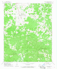
 - 1967 Map of Jasper, 1968 Print
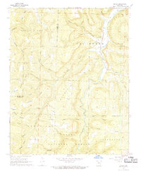
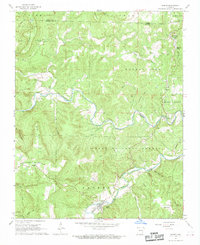 1967 Jasper1968 Print · USGSThe Newton County backcountry comes into focus during the late sixties, centered on the riverside town of Jasper. Genealogists and historians can trace family roots at Tom Thumb Cem or explore the landscape of Dogpatch and the Buffalo National River.2 unique versions available
 - 1967 Map of Ponca, 1968 Print
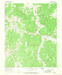
 1967 Ponca1968 Print · USGSThe Buffalo River corridor in the late sixties shows a landscape of deep hollows and high Ozark ridges. Researchers can trace rural genealogy through landmarks like Mountain Springs Cem and Plumlee Ch or locate the site of the Compton Lookout Tower.3 unique versions available
 - 1967 Map of Fallsville, 1968 Print
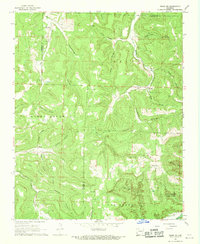
 1967 Fallsville1968 Print · USGSNewton County's high Ozark ridges and deep hollows are documented here during the late sixties. Researchers can trace remote family burial sites like Sullivan Cem and Kapark Cem or locate the old Buffalo Lookout Tower near Fallsville.3 unique versions available
 - 1967 Map of Hasty, 1968 Print
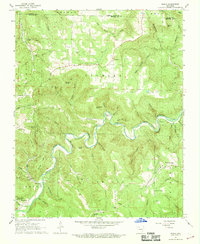
 1967 Hasty1968 Print · USGSThe Buffalo River valley in Newton County was still a quiet network of small settlements and river bluffs in the late sixties. Genealogists can trace family footprints at Yardelle, Wells Cem, and Collins Cem, or locate landmarks like Big Bear Cave.2 unique versions available
 - 1967 Map of Western Grove, 1968 Print
 1967 Western Grove1968 Print · USGSThe northern Arkansas Ozarks appear here in the late sixties, where the boundaries of four counties meet along the winding Buffalo River. Researchers can trace the lineage of rural communities through sites like Western Grove, the Old Railroad Grade, and several family burial grounds including Trammell Cem.2 unique versions available
 - 1968 Map of Swain, 1969 Print
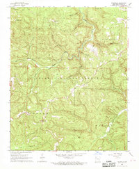
 1968 Swain1969 Print · USGSNewton County in the late sixties reveals a landscape of deep hollows and high ridges within the Ozark National Forest. Researchers can trace rural life through landmarks like Hickory Grove Cem and the small settlements of Swain and Limestone.2 unique versions available
 - 1968 Map of Osage, 1969 Print
 1968 Osage1969 Print · USGSCarroll County in the late sixties remains a landscape of deep hollows and high ridges centered on the Osage Creek valley. Genealogists and local historians can trace family locations near Rudd, the Gobbler Ch, and numerous burial sites including Bobo Cem.2 unique versions available
 - 1968 Map of Murray, 1969 Print
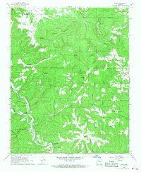
 1968 Murray1969 Print · USGSNewton County in the late 1960s shows a landscape of mountain ridges and river forks where remote settlements like Murray and Wayton persisted. Researchers can locate family landmarks such as Shiloh Cemetery, Buffalo Church, and the Low Gap Post Office.2 unique versions available
 - 1968 Map of Boxley, 1969 Print
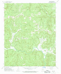
 1968 Boxley1969 Print · USGSThe upper Buffalo River valley and the high ridges of the Ozarks are captured here in the late sixties. Genealogists and hikers can trace remote settlements and landmarks like Boxley, the Walnut Grove Cem, and Cave Mountain Cave.3 unique versions available
 - 1968 Map of Osage SW, 1969 Print
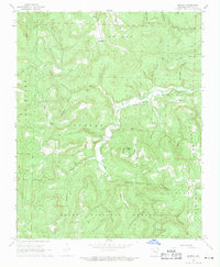
 1968 Osage SW1969 Print · USGSNewton County in the late 1960s remains a landscape of deep hollows and high ridges at the Buffalo River's edge. Researchers can trace the rural communities of George, Dinsmore, and Stoverville alongside family landmarks like Elkhorn Church.4 unique versions available
End of results
Showing maps 1-12 of 12
Top cities of Newton County
Frequently asked questions
- What are the different types of historical maps available for Newton County?
- What is the oldest map of Newton County?
- Where can I purchase historical maps of Newton County for my home or office?
- Where can I download high-res historical maps of Newton County?
- Are there historical topographic maps available for Newton County?
- Is there historical aerial imagery available for Newton County?
- Where are historical maps of Newton County sourced from?