1970s Maps of Newton County, Arkansas
Explore 11 historic maps of Newton County from the 1970s. These maps offer a rare glimpse into what life looked like during the 1970s — showing old roads, neighborhoods, homes, and landmarks that have changed or disappeared over time.
Whether you're researching your family's past, planning a metal detecting trip, or studying how Newton County's landscape evolved across the 1970s, these high-resolution maps are a powerful tool for exploring the history of this region.
- Focus on a specific era: All maps on this page are from the 1970s, giving you a focused view of this time period.
- See what’s changed: Compare century-old streets, trails, and buildings to today's modern landscape using overlays and satellite layers.
- Research with precision: Use these maps for genealogy, historical research, land use analysis, or educational projects.
- View, download, or print: Maps are fully viewable online in high resolution, and can be downloaded or printed for your own records.
Start exploring Newton County's history through authentic maps from the 1970s. This is your window into the past.
Newton County, AR maps
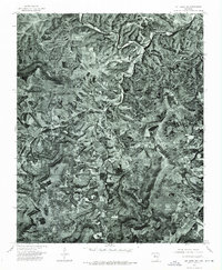
(11)- 1973 Map of Boston, 1976 Print
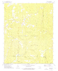 1973 Boston1976 Print · USGSThe high ridges and deep hollows of the Ozarks are meticulously detailed in the early 1970s, showing the rugged intersection of Madison and Newton counties. Genealogists and historians can locate family sites at Evans Cemetery, rural congregations like Boston Ch, and the isolated settlement of Red Star.2 unique versions available
 - 1973 Map of Weathers, 1976 Print
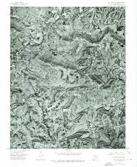
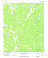 1973 Weathers1976 Print · USGSMadison and Newton Counties in the early 1970s are shown here as a landscape of deep hollows and high ridges within the Ozark National Forest. Researchers can trace old family sites and burial grounds like Venus Cem, Dripping Springs Cem, and Williams Cem along the Kings River watershed.2 unique versions available
 - 1973 Map of Oark, 1976 Print
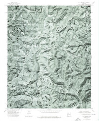
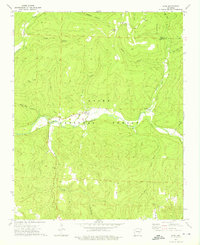 1973 Oark1976 Print · USGSThe Mulberry River valley in the early 1970s remained a landscape of isolated forest settlements and winding creek beds. Genealogists and local historians can locate family landmarks like Patterson Springs Ch, Miller Cem, and the old community at Oark.2 unique versions available
 - 1974 Map of Treat NE, 1975 Print
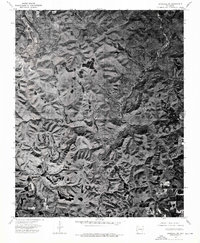
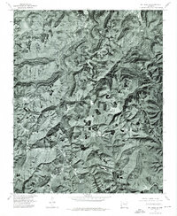
 1974 Treat NE1975 Print · USGSPope County highlands in the mid-1970s are captured here through detailed aerial imagery of the timbered ridges. Genealogists and local historians can pinpoint the exact locations of homesteads around Pelsor and trace the paths along Richland and Illinois creeks.
 - 1974 Map of Snowball SW, 1975 Print
 1974 Snowball SW1975 Print · USGSSearcy County as it appeared in the mid-seventies is captured in this detailed aerial survey of the Ozark interior. Researchers can trace the small rural community at Moore and the winding paths of Richland Creek and Falls Creek.
 - 1974 Map of Mt Judea NE, 1975 Print
 1974 Mt Judea NE1975 Print · USGSThe northern Ozark highlands appear in startling detail during the mid-1970s, showcasing the winding Buffalo River and the rural community of Mt Judea. Researchers can trace old homestead clearings and the intricate drainage of Big Creek and Cave Creek.
 - 1974 Map of Smyrna NW, 1975 Print
 1974 Smyrna NW1975 Print · USGSUpper Pope County is captured in mid-seventies aerial detail just as the rural landscape remained largely untouched by large-scale modern clearing. Local historians and genealogists can pinpoint exact farmstead locations near Ben Hur and trace the drainage of the Fork and Bayou.
 - 1974 Map of Mt Judea NW, 1975 Print
 1974 Mt Judea NW1975 Print · USGSThe Ozark highlands of Newton County are captured in detailed aerial imagery from the mid-seventies, revealing the remote settlement patterns of the era. Genealogists and local historians can trace the exact layout of the community at Parthenon and the winding course of the Little Buffalo River.
 - 1974 Map of Mt Judea SW, 1975 Print
 1974 Mt Judea SW1975 Print · USGSNewton County's high ridges are captured in detail during the mid-seventies through this aerial orthophotograph. Researchers can pinpoint specific building sites and farm clearings around the mountain settlements of Deer and Cowell.
 - 1974 Map of Mt Judea SE, 1975 Print
 1974 Mt Judea SE1975 Print · USGSNewton County in the mid-1970s is seen through a high-altitude lens, showing the Ozark highland clearings and timbered ridges. Genealogists and historians can trace the settlement at Lurton and the natural drainages of Big Creek and Richland Creek.
 - 1977 Map of Russellville
 1977 Russellville1977 Print · USGSThe Arkansas River Valley and surrounding Ozark Mountains are documented here during a period of significant postwar growth and infrastructure development. Genealogists and researchers can locate family landmarks such as Mount Carmel Cem, St Josephs Church, and several remote Coal Mine sites along the Missouri Pacific RR line.
End of results
Showing maps 1-11 of 11
Top cities of Newton County
Frequently asked questions
- What are the different types of historical maps available for Newton County?
- What is the oldest map of Newton County?
- Where can I purchase historical maps of Newton County for my home or office?
- Where can I download high-res historical maps of Newton County?
- Are there historical topographic maps available for Newton County?
- Is there historical aerial imagery available for Newton County?
- Where are historical maps of Newton County sourced from?