1990s Maps of Prairie County, Arkansas
Explore 10 historic maps of Prairie County from the 1990s. These maps offer a rare glimpse into what life looked like during the 1990s — showing old roads, neighborhoods, homes, and landmarks that have changed or disappeared over time.
Whether you're researching your family's past, planning a metal detecting trip, or studying how Prairie County's landscape evolved across the 1990s, these high-resolution maps are a powerful tool for exploring the history of this region.
- Focus on a specific era: All maps on this page are from the 1990s, giving you a focused view of this time period.
- See what’s changed: Compare century-old streets, trails, and buildings to today's modern landscape using overlays and satellite layers.
- Research with precision: Use these maps for genealogy, historical research, land use analysis, or educational projects.
- View, download, or print: Maps are fully viewable online in high resolution, and can be downloaded or printed for your own records.
Start exploring Prairie County's history through authentic maps from the 1990s. This is your window into the past.
Prairie County, AR maps
(10)- 1990 Map of Brinkley, 1991 Print
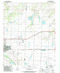
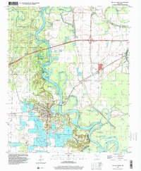
 1990 Brinkley1991 Print · USGSEastern Arkansas at the start of the 1990s is defined by the agricultural rhythms of the Grand Prairie and the vital White River corridor. Genealogists and historians can trace the rail-linked growth of Brinkley and Des Arc alongside older landmarks like Peckerwood Lake.
 - 1994 Map of Hickory Plains
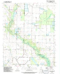
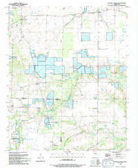 1994 Hickory Plains1994 Print · USGSIn the early nineties, these Arkansas plains were transforming into a center for aquaculture near the Lonoke County line. Trace family roots and local history through landmarks like Walters Chapel, Hayley, and the numerous Fish Farm ponds.
 - 1994 Map of Hazen
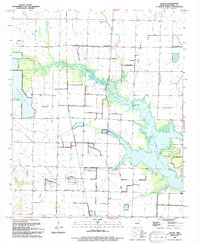
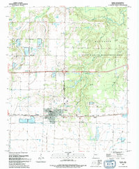 1994 Hazen1994 Print · USGSThe Prairie County landscape around Hazen in the mid-1990s reflects a deep connection to the land through its managed waters and wildlife areas. Genealogists and local historians can trace legacy sites like Old Bethel Cemetery and the settlement of Tarnceville.
 - 1994 Map of Walker
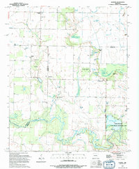
 1994 Walker1994 Print · USGSThe border of White and Prairie Counties in the mid-1990s showcases a landscape defined by meandering waterways and small rural communities. Researchers can trace the heritage of the region through landmarks like Walker Cem, Dogwood Ch, and Griffithville.
 - 1994 Map of Des Arc West
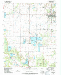 1994 Des Arc West1994 Print · USGSThe western fringes of Des Arc are captured here in the 1990s, showing a landscape defined by extensive aquaculture and the winding Wattensaw Bayou. Genealogists and historians can locate rural landmarks like Morris Chapel and Whippoorwill Cem, or trace the path of an Old Railroad Grade.
 - 1994 Map of Carlisle
 1994 Carlisle1994 Print · USGSLonoke and Prairie counties are captured in the mid-1990s as a landscape of established agriculture and managed water resources. Researchers can trace family history through sites like Old Carlisle Cem and rural centers such as Barrettsville and Prairie Center.
 - 1994 Map of Parkers Corner
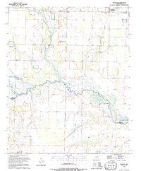
 1994 Parkers Corner1994 Print · USGSThe Grand Prairie region at the close of the twentieth century shows a landscape of precision agriculture and water management. Researchers can trace the rural community of Parkers Corner and historical burial sites like Ray Cemetery along the banks of Two Prairie Bayou.
 - 1994 Map of Slovak
 1994 Slovak1994 Print · USGSThe Grand Prairie region of Arkansas is captured here in the 1990s, showcasing its unique immigrant heritage and complex irrigation landscape. Researchers can trace the roots of the local community through sites like Slovak, the Czech National Cem, and the Russian Orthodox Cam.
 - 1994 Map of Jasmine
 1994 Jasmine1994 Print · USGSPrairie and White counties met in a mosaic of bottomlands and small settlements in the 1990s. Researchers can locate family landmarks like Belcher Cem or trace the drainage of the Bayou Des Arc past Jasmine and Showalters Corner.
 - 1996 Map of De Valls Bluff, 1999 Print
 1996 De Valls Bluff1999 Print · USGSDe Valls Bluff and the White River wetlands are captured in the late 1990s as the modern interstate began to reshape the landscape. Local historians can trace the foundations of riverside life at Bucks Landing or find family history at Oaklawn Cem and Biscoe.
End of results
Showing maps 1-10 of 10
Top cities of Prairie County
- Des Arc historical maps
- Hazen historical maps
- De Valls Bluff historical maps
- Fredonia (Biscoe) historical maps
- Ulm historical maps
Frequently asked questions
- What are the different types of historical maps available for Prairie County?
- What is the oldest map of Prairie County?
- Where can I purchase historical maps of Prairie County for my home or office?
- Where can I download high-res historical maps of Prairie County?
- Are there historical topographic maps available for Prairie County?
- Is there historical aerial imagery available for Prairie County?
- Where are historical maps of Prairie County sourced from?