Old Maps of Jacksonville, Arkansas for Hiking & Exploration
Hike through history with 44 historic maps of Jacksonville. Explore old trails, ghost towns, and forgotten backroads — perfect for outdoor adventurers and local explorers.
- Rediscover forgotten places: Map out old mining camps, roads, and footpaths that no longer exist on modern maps.
- Layer with modern tools: Combine with LiDAR or satellite views to plan hikes through historical terrain.
- Made for exploration: Popular among hikers, overlanders, and local history lovers.
Use these maps to find adventure and explore the hidden past of Jacksonville.
Jacksonville, AR maps
(44)- 1891 Map of Little Rock
 1891 Little Rock1891 Print · USGSLittle Rock and the central Arkansas river valley are shown in detail during the 1890s, when rail travel and river trade dominated the local economy. Genealogists can trace early homesteads and communities near Argenta, the Indian Mounds at Toltec, and Sweet Home.
 - 1893 Map of Little Rock
 1893 Little Rock1893 Print · USGSLittle Rock and the Arkansas River valley are shown here in the early 1890s, just as the regional rail network was maturing. Genealogists can trace family roots through old settlements like Argenta, Shilcott, and Collegeville, or locate archaeological sites such as the Indian Mounds.5 unique versions available
 - 1935 Map of Mc Almont
 1935 Mc Almont1935 Print · USGSPulaski County during the mid-1930s is mapped here with a focus on the railroad hubs and river bottomlands northeast of the capital. Genealogists can trace family landmarks like Brushy Cem, St Luke Ch, and the Sylvan Hills Res settlement.
 - 1941 Map of Olmstead, 1945 Print
 1941 Olmstead1945 Print · USGSNorth of Little Rock in the early 1940s, this area was a network of bayous and ridges punctuated by rural crossroads and family homesteads. Genealogists and local historians can trace legacy sites like Tates Mill, Sumner Cem, and several country meeting houses including Zion Hill Ch and Harmony Ch.
 - 1941 Map of Cabot, 1945 Print
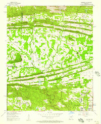
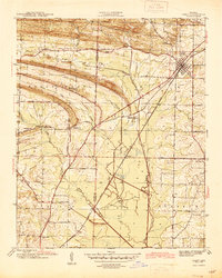 1941 Cabot1945 Print · USGSLonoke and Pulaski counties are captured in detail during the early 1940s, showing a landscape defined by prominent ridges and the Missouri Pacific rail line. Researchers can trace family sites near Concord Cem or locate historic rural centers like Holland and Mt Tabor Ch.2 unique versions available
 - 1943 Map of Jacksonville
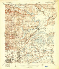
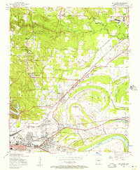
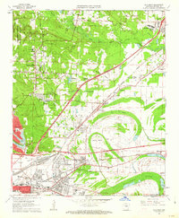
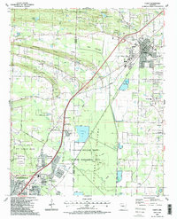
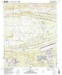
 1943 Jacksonville1943 Print · USGSJacksonville and the Pulaski-Lonoke county line appear here in the early 1940s, revealing a landscape of rail junctions and rural homesteads. Genealogists can trace early family sites like Mc Graw Cem, the South Bend Sch, and the route of the Old Military Road.2 unique versions available
 - 1954 Map of Mc Almont, 1957 Print
 1954 Mc Almont1957 Print · USGSNorth Little Rock and the surrounding Pulaski County countryside are captured in the mid-1950s just as the suburbs began to expand. Genealogists and historians can locate numerous landmarks like Booker Cemetery, the Sylvan Hills School, and the junction at Protho Junction.
 - 1954 Map of Olmstead, 1957 Print
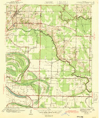
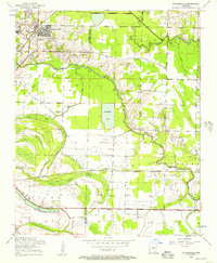
 1954 Olmstead1957 Print · USGSPulaski County at the dawn of the jet age shows a rural landscape of ridges and bayous meeting the new military installations. Genealogists can locate family sites like Mount Valley Cemetery, Tates Mill, and the Bayou Mete School.4 unique versions available
 - 1954 Map of Jacksonville, 1957 Print
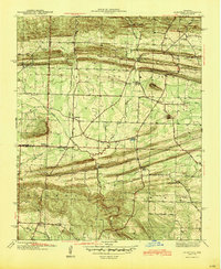
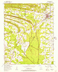
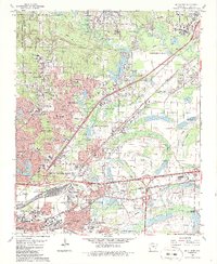
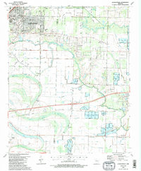
 1954 Jacksonville1957 Print · USGSJacksonville and the surrounding wetlands of the Bayou Meto basin are captured here during a period of steady mid-century growth. Researchers can trace historic routes like Old Military Road and locate family landmarks such as Johnson Cemetery and St Joe Church.4 unique versions available
 - 1954 Map of Cabot, 1957 Print
 1954 Cabot1957 Print · USGSThe Lonoke and Pulaski county line comes alive in the mid-1950s as military expansion meets traditional rail towns. Researchers can trace the early footprint of Little Rock Air Force Base or locate local landmarks like Concord Cemetery and the Midway School.3 unique versions available
 - 1955 Map of Little Rock, 1978 Print
 1955 Little Rock1978 Print · USGSCentral Arkansas in the mid-fifties exhibits a landscape of growing cities, massive military installations, and mountain reservoirs. Genealogists and historians can trace the industrial Bauxite Mines, regional rail lines, and local landmarks like Antioch Church.
 - 1956 Map of Little Rock
 1956 Little Rock1956 Print · USGSCentral Arkansas in the mid-fifties shows a landscape defined by burgeoning military bases and the timber-and-mineral wealth of the Ouachitas. Genealogists and researchers can trace old rail lines like the Missouri Pacific and find established communities such as Bauxite, Sheridan, and Mabelvale.
 - 1960 Map of Little Rock
 1960 Little Rock1960 Print · USGSCentral Arkansas in the late fifties shows a landscape of growing military bases and massive new reservoirs. Local historians can trace the mid-century expansion of Little Rock and Hot Springs alongside the industrial works at Bauxite and the Pine Bluff Arsenal.
 - 1961 Map of Mc Almont, 1962 Print
 1961 Mc Almont1962 Print · USGSPulaski County undergoes a period of rapid suburban and industrial expansion in the early sixties. Genealogists and local historians can trace the footprint of community landmarks like McAlmont, Clayton Chapel, and the Franklin D Roosevelt Sch.3 unique versions available
 - 1964 Map of Little Rock
 1964 Little Rock1964 Print · USGSCentral Arkansas in the mid-sixties is a landscape of mountain ridges, industrial rail lines, and growing military hubs. Researchers can trace the development of Bauxite and Hot Springs or locate rural landmarks like Sparkman and the Pine Bluff Arsenal.
 - 1975 Map of Mc Almont, 1976 Print
 1975 Mc Almont1976 Print · USGSNorth Little Rock and the surrounding river valley are captured in this mid-seventies aerial perspective as suburban growth began to bridge the gap toward Jacksonville. Researchers can trace the precise 1975 footprint of residential blocks and industrial sites near Mc Almont.
 - 1985 Map of Little Rock, 1988 Print
 1985 Little Rock1988 Print · USGSLittle Rock and its surrounding river valley are shown in the mid-eighties as the region balanced urban expansion with its industrial and military roots. Genealogists and historians can locate dozens of institutions and family landmarks, including Mount Holly Cem, the Bauxite Mines, and Central High Sch.
 - 1986 Map of McAlmont
 1986 McAlmont1986 Print · USGSThe northern suburbs of Little Rock expanded rapidly during the eighties as regional transit and industry matured. Genealogists and local historians can trace family roots through Hickman Memorial Cem or locate former landmarks like the Drive-in Theater and Pecan Grove.3 unique versions available
 - 1987 Map of Olmstead
 1987 Olmstead1987 Print · USGSPulaski County in the late 1980s shows a mix of military installations and rural crossroads as the suburbs began to reach northward. Researchers can locate family landmarks like Tates Mill, St Peters Rock Ch, and the community of Olmstead.2 unique versions available
 - 1987 Map of Cabot
 1987 Cabot1987 Print · USGSCabot and Jacksonville were expanding rapidly in the late eighties as the local landscape transitioned from military airbase to residential suburb. Genealogists can locate family landmarks like Concord Cem, Mt Tabor Ch, and the rural homesteads along Backbone Ridge.2 unique versions available
 - 1987 Map of Jacksonville
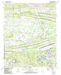
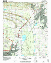
 1987 Jacksonville1987 Print · USGSJacksonville and the surrounding wetlands of Pulaski and Lonoke counties are shown here in the late 1980s. Researchers can trace family sites like Lone Cypress Cem, the small community of Union Valley, and historic Military Road.2 unique versions available
 - 1994 Map of Cabot, 2000 Print
 1994 Cabot2000 Print · USGSThe growing corridor between Cabot and Jacksonville is captured here during the mid-nineties, showing the mix of military, residential, and wild spaces. Genealogists and local historians can locate several family cemeteries like King Cem and Mt Carmel Cem, alongside landmarks like Crow Stadium.
 - 1994 Map of Mc Almont, 2000 Print
 1994 Mc Almont2000 Print · USGSPulaski County in the mid-nineties shows the rapid suburbanization of the corridor between North Little Rock and Jacksonville. Genealogists can locate family sites like Meacham Cem and Hickman Memorial Cem near the rail junctions of McAlmont.
 - 1996 Map of Olmstead, 1999 Print
 1996 Olmstead1999 Print · USGSPulaski County at the close of the twentieth century shows a distinct landscape where military infrastructure meets traditional rural settlements. Genealogists and local historians can locate country landmarks like Cato School, Harmony Church, and the sprawling Little Rock Air Force Base.
 - 2011 Map of Jacksonville, 2011 Print
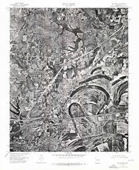
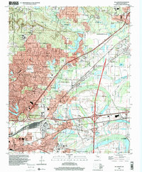
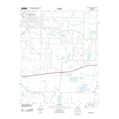 2011 Jacksonville2011 Print · USGSCovers Jacksonville, including North Little Rock, Kerr, and other nearby areas
Showing maps 1-25 of 44
Top cities near Jacksonville
- Little Rock historical maps
- North Little Rock historical maps
- Cabot historical maps
- Sherwood historical maps
- Maumelle historical maps
- Beebe historical maps
See more
Top neighborhoods of Jacksonville
Frequently asked questions
- What are the different types of historical maps available for Jacksonville?
- What is the oldest map of Jacksonville?
- Where can I purchase historical maps of Jacksonville for my home or office?
- Where can I download high-res historical maps of Jacksonville?
- Are there historical topographic maps available for Jacksonville?
- Is there historical aerial imagery available for Jacksonville?
- Where are historical maps of Jacksonville sourced from?