Old Maps of Oak Grove, Arkansas for Academic Research
Study the evolution of Oak Grove with 18 high-resolution historic maps. Whether you're teaching, researching, or modeling changes in land use, these maps provide essential visual documentation of urban, environmental, and geographic change.
- Analyze long-term change: Track patterns in development, transportation, and natural features.
- Ideal for environmental or urban studies: Support academic projects with primary historical map data.
- Use in the classroom or lab: Educators and researchers rely on these maps to bring historical context to life.
These maps are a powerful tool for teaching, research, and visualizing how Oak Grove has changed over the decades.
Oak Grove, AR maps
(18)- 1891 Map of Little Rock
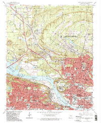
 1891 Little Rock1891 Print · USGSLittle Rock and the central Arkansas river valley are shown in detail during the 1890s, when rail travel and river trade dominated the local economy. Genealogists can trace early homesteads and communities near Argenta, the Indian Mounds at Toltec, and Sweet Home.
 - 1893 Map of Little Rock
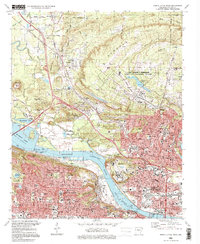
 1893 Little Rock1893 Print · USGSLittle Rock and the Arkansas River valley are shown here in the early 1890s, just as the regional rail network was maturing. Genealogists can trace family roots through old settlements like Argenta, Shilcott, and Collegeville, or locate archaeological sites such as the Indian Mounds.5 unique versions available
 - 1935 Map of North Little Rock
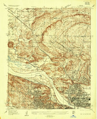 1935 North Little Rock1935 Print · USGSNorth Little Rock and the surrounding Pulaski County hills are captured here in the mid-1930s during a period of significant military and civic expansion. Local historians can trace the grounds of Camp Pike, find the historic St Josephs Orphanage, or locate family sites near Palestine Cem.
 - 1954 Map of North Little Rock, 1975 Print
 1954 North Little Rock1975 Print · USGSThe Arkansas state capital and its northern neighbor are captured here in the mid-fifties during a period of steady urban expansion and military activity. Researchers can trace the footprints of St Josephs Orphanage, the Owen pit mines, and the expansive Camp Joseph T Robinson.
 - 1955 Map of Little Rock, 1978 Print
 1955 Little Rock1978 Print · USGSCentral Arkansas in the mid-fifties exhibits a landscape of growing cities, massive military installations, and mountain reservoirs. Genealogists and historians can trace the industrial Bauxite Mines, regional rail lines, and local landmarks like Antioch Church.
 - 1956 Map of Little Rock
 1956 Little Rock1956 Print · USGSCentral Arkansas in the mid-fifties shows a landscape defined by burgeoning military bases and the timber-and-mineral wealth of the Ouachitas. Genealogists and researchers can trace old rail lines like the Missouri Pacific and find established communities such as Bauxite, Sheridan, and Mabelvale.
 - 1960 Map of Little Rock
 1960 Little Rock1960 Print · USGSCentral Arkansas in the late fifties shows a landscape of growing military bases and massive new reservoirs. Local historians can trace the mid-century expansion of Little Rock and Hot Springs alongside the industrial works at Bauxite and the Pine Bluff Arsenal.
 - 1961 Map of North Little Rock, 1962 Print
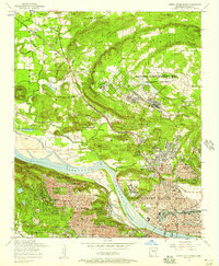
 1961 North Little Rock1962 Print · USGSThe riverfront and uplands of the Little Rock metro area are captured here in the early sixties, as suburban growth began to reach toward the hills. Genealogists and local historians can locate dozens of institutions, from St Josephs Orphanage and Shorter College to Palestine Cem.4 unique versions available
 - 1964 Map of Little Rock
 1964 Little Rock1964 Print · USGSCentral Arkansas in the mid-sixties is a landscape of mountain ridges, industrial rail lines, and growing military hubs. Researchers can trace the development of Bauxite and Hot Springs or locate rural landmarks like Sparkman and the Pine Bluff Arsenal.
 - 1975 Map of North Little Rock, 1976 Print
 1975 North Little Rock1976 Print · USGSCentral Arkansas comes into sharp focus during the mid-1970s through this aerial-based survey of the riverfront. Researchers can trace the development of North Little Rock and the industrial activity along the Arkansas River.
 - 1985 Map of Little Rock, 1988 Print
 1985 Little Rock1988 Print · USGSLittle Rock and its surrounding river valley are shown in the mid-eighties as the region balanced urban expansion with its industrial and military roots. Genealogists and historians can locate dozens of institutions and family landmarks, including Mount Holly Cem, the Bauxite Mines, and Central High Sch.
 - 1986 Map of North Little Rock
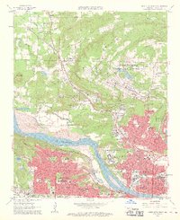
 1986 North Little Rock1986 Print · USGSThe Arkansas River corridor in the mid-eighties shows a period of significant civic and military development in Pulaski County. Researchers can trace the footprints of Camp Joseph T. Robinson, the historic St Josephs Orphanage, and neighborhood schools like Boone Park Sch.2 unique versions available
 - 1996 Map of North Little Rock, 1999 Print
 1996 North Little Rock1999 Print · USGSGreater Little Rock at the close of the twentieth century reveals a landscape defined by the Arkansas River and massive military installations. Genealogists and local historians can trace legacy sites like St Josephs Orphanage, Palestine Cem, and Shorter College.
 - 2011 Map of North Little Rock, 2011 Print
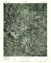
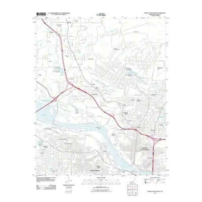 2011 North Little Rock2011 Print · USGSCovers Oak Grove, including Little Rock, North Little Rock, and other nearby areas
 - 2014 Map of North Little Rock, 2014 Print
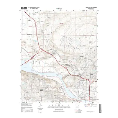 2014 North Little Rock2014 Print · USGSCovers Oak Grove, including Little Rock, North Little Rock, and other nearby areas
 - 2017 Map of North Little Rock, 2017 Print
 2017 North Little Rock2017 Print · USGSCovers Oak Grove, including Little Rock, North Little Rock, and other nearby areas
 - 2020 Map of North Little Rock, 2020 Print
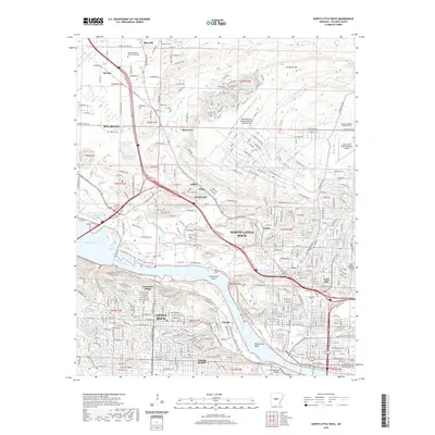 2020 North Little Rock2020 Print · USGSCovers Oak Grove, including Little Rock, North Little Rock, and other nearby areas
 - 2024 Map of North Little Rock, 2024 Print
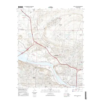
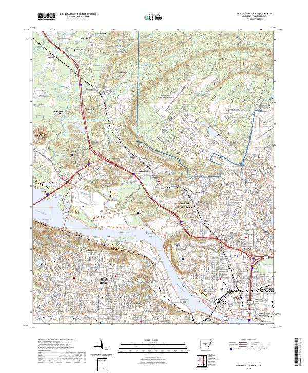 2024 North Little Rock2024 Print · USGSThe Arkansas River corridor at the state capital is shown here in the 2020s, highlighting the area's deep military and urban roots. Trace the footprints of NG Camp Joseph T Robinson, the Union Pacific RR, and established neighborhoods like Cammack Village.
End of results
Showing maps 1-18 of 18
Top cities near Oak Grove
- Little Rock historical maps
- North Little Rock historical maps
- Conway historical maps
- Jacksonville historical maps
- Benton historical maps
- Sherwood historical maps
See more
Frequently asked questions
- What are the different types of historical maps available for Oak Grove?
- What is the oldest map of Oak Grove?
- Where can I purchase historical maps of Oak Grove for my home or office?
- Where can I download high-res historical maps of Oak Grove?
- Are there historical topographic maps available for Oak Grove?
- Is there historical aerial imagery available for Oak Grove?
- Where are historical maps of Oak Grove sourced from?