1900s (20th Century) Maps of Butte County, California
Explore 161 historic maps of Butte County from the 1900s (20th Century). These maps offer a rare glimpse into what life looked like during the 1900s — showing old roads, neighborhoods, homes, and landmarks that have changed or disappeared over time.
Whether you're researching your family's past, planning a metal detecting trip, or studying how Butte County's landscape evolved across the 1900s, these high-resolution maps are a powerful tool for exploring the history of this region.
- Focus on a specific era: All maps on this page are from the 1900s, giving you a focused view of this time period.
- See what’s changed: Compare century-old streets, trails, and buildings to today's modern landscape using overlays and satellite layers.
- Research with precision: Use these maps for genealogy, historical research, land use analysis, or educational projects.
- View, download, or print: Maps are fully viewable online in high resolution, and can be downloaded or printed for your own records.
Start exploring Butte County's history through authentic maps from the 1900s. This is your window into the past.
Butte County, CA maps
(161)- 1904 Map of Vina
 1904 Vina1904 Print · USGSThe Sacramento Valley comes alive in this early century study of the river corridor between Tehama and Butte counties. Trace the rail-and-river economy through the Winery at Vina, the Squaw Hill Ferry, and the planned Lemon Home Colony.3 unique versions available
 - 1906 Map of Willows
 1906 Willows1906 Print · USGSThe northern Sacramento Valley is captured here at the dawn of the irrigation era, centered on the growing railroad hubs of the western plains. Researchers can trace early water infrastructure like the Central Irrigation Canal alongside vanished river landings such as Sidds Ldg and Jacinto.2 unique versions available
 - 1911 Map of Sanborn Slough
 1911 Sanborn Slough1911 Print · USGSIn the wetlands of the Sacramento Valley before modern flood control, this early century survey captures the seasonal landscape of the Colusa and Butte county lines. Trace the historical hydrology of Butte Sink and find the site of the Harmony School.
 - 1911 Map of Landlow
 1911 Landlow1911 Print · USGSNorthern California's agricultural heartland is captured here in the early twentieth century, showing a landscape defined by new irrigation and transport. Researchers can locate Landlow School and trace the original path of the Cherokee Canal and the Oroville and Butte City Road.
 - 1912 Map of Prairie Creek
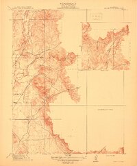 1912 Prairie Creek1912 Print · USGSThe foothills of Yuba and Butte counties come alive in this pre-war survey of the Sacramento Valley’s eastern edge. Genealogists and historians can trace the routes of Bangor Road and locate the historic Salem School and Buckeye School near the banks of Prairie Creek.3 unique versions available
 - 1912 Map of Dry Creek
 1912 Dry Creek1912 Print · USGSButte County agriculture and transit are in transition during the early 1900s as interurban rail lines connect rural outposts. Genealogists can locate family-named sites and schools like Rio Seco School, Tres Vias, and the Northern Electric RR.
 - 1912 Map of Durham
 1912 Durham1912 Print · USGSNorthern Sacramento Valley industry and agriculture thrive in the decade before the Great War. Genealogists can trace the early streets of Chico, the worker housing at Barber, and rural schools like York School near the Diamond Match Factory.
 - 1912 Map of Butte City
 1912 Butte City1912 Print · USGSThe Sacramento River and its complex system of sloughs dominate this Glenn County landscape in the years before intensive irrigation. Trace family roots at Marvin Chapel or locate old school sites like Carson School and Union School.
 - 1912 Map of Nord
 1912 Nord1912 Print · USGSThe northern Sacramento Valley thrived as a rail-dependent agricultural corridor in the early twentieth century. Genealogists can trace early homesteads near the Southern Pacific RR and locate rural landmarks like Antelope School and Cana.2 unique versions available
 - 1912 Map of Chico Landing
 1912 Chico Landing1912 Print · USGSThe Sacramento River corridor near Butte County was a landscape of winding sloughs and emerging rail lines in the early twentieth century. Researchers can trace the footprints of riverside settlements like Munroeville, find old schools such as River Road School, and locate historical crossings of the Northern Electric RR.2 unique versions available
 - 1912 Map of Oroville
 1912 Oroville1912 Print · USGSButte County's gold-mining heartland is shown here in the early twentieth century as it transitioned into a rail-and-agriculture hub. Genealogists can locate family landmarks like the Odd Fellows Home, the Butte County Infirmary, and early settlements such as Thermalito and Thompson Flat.2 unique versions available
 - 1912 Map of Pennington
 1912 Pennington1912 Print · USGSThe foothills of the Marysville Buttes met the developing farmsteads of the Sacramento Valley just before World War I. Genealogists and local historians can locate the old Butte School and the early layout of Pennington along the county line.2 unique versions available
 - 1912 Map of Nelson
 1912 Nelson1912 Print · USGSThe Central Valley's agricultural and rail-driven landscape comes into focus in the years before the Great War. Researchers can trace the diverging paths of the Southern Pacific RR and Northern Electric RR through Nelson and Esquon.2 unique versions available
 - 1912 Map of Keefers
 1912 Keefers1912 Print · USGSButte County land and water rights are visible in high detail on this 1912 preliminary survey of the northern Central Valley. Genealogists and land researchers can trace the early drainage and ranching terrain along Arroyo Chico, Mud Creek, and Sycamore Creek.2 unique versions available
 - 1912 Map of Palermo
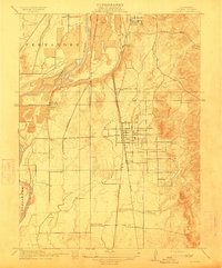 1912 Palermo1912 Print · USGSButte County agriculture and industry are in full swing at the start of the century as two major railroads compete for transit. Genealogists and historians can locate the Chinese Cem near South Oroville or trace family sites near Union School and Palermo.2 unique versions available
 - 1912 Map of Clear Creek
 1912 Clear Creek1912 Print · USGSButte County foothills are captured in detail just before the modern era, showing the early road networks and canyon drainages. Trace historic transport routes like Centerville Road and Magalia Road alongside the waters of Butte Creek.2 unique versions available
 - 1912 Map of Honcut
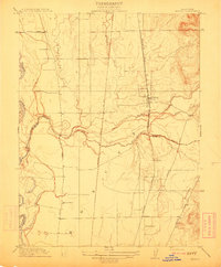 1912 Honcut1912 Print · USGSThe rural borderlands of Butte and Yuba counties come into focus at the height of the steam rail era. Researchers can trace the legacy of early valley education and transport through local landmarks like Central School, the village of Honcut, and the tracks of the Southern Pacific.
 - 1912 Map of Biggs
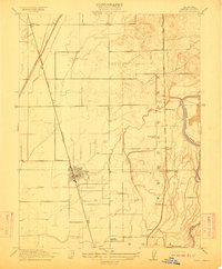 1912 Biggs1912 Print · USGSButte County agriculture was in full bloom at the start of the century, shaped by an intricate system of canals and competing rail lines. Researchers can trace family sites like Ord Ranch and Richland or find the early footprint of the River District School.
 - 1912 Map of Gridley
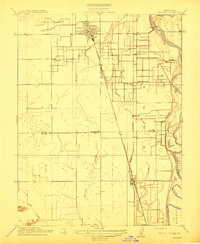 1912 Gridley1912 Print · USGSThe Sacramento Valley at the height of its early rail-and-canal era reveals a landscape of planned agricultural colonies and riverfront commerce. Genealogists and local historians can trace the growth of Gridley and Liveoak alongside early schools like Manzanito School.
 - 1912 Map of Singer Creek
 1912 Singer Creek1912 Print · USGSUpper Sacramento Valley ranching and school life are preserved in this early twentieth-century survey of the foothills. Researchers can trace the Tehama Co Butte Co line and find rural landmarks like the Liveoak School and Singer Creek.2 unique versions available
 - 1912 Map of Newhard
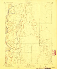 1912 Newhard1912 Print · USGSThe Sacramento River valley in the early twentieth century was a land of sprawling ranchos and vital river landings. Genealogists and historians can trace the foundations of local education at Aguas Frias School and locate former river hubs like Newhard Landing.
 - 1914 Map of McIntosh Landing
 1914 McIntosh Landing1914 Print · USGSThe Sacramento River corridor north of Hamilton City is shown here in the early twentieth century as a complex landscape of shifting islands and landings. Trace the historic riverfront at McIntosh Landing or follow the path of the Central Irrigation Canal.
 - 1917 Map of Jacinto
 1917 Jacinto1917 Print · USGSIn the early twentieth century, the banks of the Sacramento River were transitioning from ranching to irrigation-fed farming. Genealogists and researchers can trace the old landing sites at Sidds Landing and the namesake settlement of Jacinto.2 unique versions available
 - 1935 Map of Paynes Creek
 1935 Paynes Creek1935 Print · USGSUpper Tehama County in the mid-thirties was a hub of mountain industry and early hydroelectric power. Researchers can trace historic family holdings like the Facht Ranch and Wilson Ranch or locate vanished sites like the Forward Mill Camp Forward and Sierra Sch.
 - 1941 Map of Mineral
 1941 Mineral1941 Print · USGSThe volcanic highlands of Tehama and Shasta counties come alive in this pre-war survey of the Lassen region. Genealogists and researchers can locate remote family sites like Childs Ranch, the Ishii Caves, and early timber operations at Forward Mill.3 unique versions available
Showing maps 1-25 of 161
Top cities of Butte County
- Chico historical maps
- Oroville historical maps
- Gridley historical maps
- Durham historical maps
- Paradise historical maps
- Biggs historical maps
See more
Frequently asked questions
- What are the different types of historical maps available for Butte County?
- What is the oldest map of Butte County?
- Where can I purchase historical maps of Butte County for my home or office?
- Where can I download high-res historical maps of Butte County?
- Are there historical topographic maps available for Butte County?
- Is there historical aerial imagery available for Butte County?
- Where are historical maps of Butte County sourced from?