1900s (20th Century) Maps of El Dorado County, California
Explore 108 historic maps of El Dorado County from the 1900s (20th Century). These maps offer a rare glimpse into what life looked like during the 1900s — showing old roads, neighborhoods, homes, and landmarks that have changed or disappeared over time.
Whether you're researching your family's past, planning a metal detecting trip, or studying how El Dorado County's landscape evolved across the 1900s, these high-resolution maps are a powerful tool for exploring the history of this region.
- Focus on a specific era: All maps on this page are from the 1900s, giving you a focused view of this time period.
- See what’s changed: Compare century-old streets, trails, and buildings to today's modern landscape using overlays and satellite layers.
- Research with precision: Use these maps for genealogy, historical research, land use analysis, or educational projects.
- View, download, or print: Maps are fully viewable online in high resolution, and can be downloaded or printed for your own records.
Start exploring El Dorado County's history through authentic maps from the 1900s. This is your window into the past.
El Dorado County, CA maps
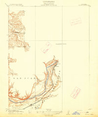
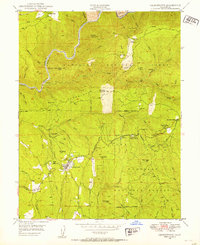
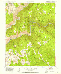
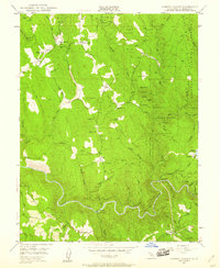
(108)- 1900 Map of Colfax
 1900 Colfax1900 Print · USGSThe Sierra Nevada foothills and high peaks are shown at the turn of the century as the mining economy and transcontinental rail travel reached their maturity. Researchers can trace historic industrial sites like the Alaska Mine, remote camps such as Moores Flat, and the path of the Southern Pacific RR.
 - 1902 Map of Colfax
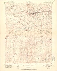
 1902 Colfax1902 Print · USGSGold-rush towns and hydraulic mining sites define this portion of the Sierra Nevada at the turn of the century. Genealogists and historians can trace the foundations of North Bloomfield, locate the remote Alaska Mine, or follow the Southern Pacific through Emigrant Gap.7 unique versions available
 - 1914 Map of Folsom
 1914 Folsom1914 Print · USGSThe American River gold country comes alive in this early century survey of the region surrounding Folsom. Researchers can trace the path of the Placerville Branch railroad or locate early industrial sites like the Power House and a large river Dredge.2 unique versions available
 - 1932 Map of Truckee
 1932 Truckee1932 Print · USGSThe high Sierra and Lake Tahoe's western shore are captured here in the early thirties as the region balanced industrial mining and timber with a growing seasonal economy. Trace early lakeside developments from Tahoe Tavern to Meeks Bay PO, or locate historical sites like the Walker Mine and Donner Monument.
 - 1938 Map of Colfax
 1938 Colfax1938 Print · USGSThe Sierra Nevada's gold and timber country comes into focus in the late 1930s, showing a landscape defined by deep river canyons and industrial high-country camps. Researchers can locate remote sites like the Sixteen to One Mine, the North Bloomfield Ranger Station, and vanished settlements like Lake City.3 unique versions available
 - 1940 Map of Truckee
 1940 Truckee1940 Print · USGSThe High Sierra and Lake Tahoe shoreline appear here in the pre-war era, showing a landscape defined by timber, tourism, and transit. Genealogists and historians can trace the early resort development at Tahoe Vista, the lumber works at Hobart Mills, and the vital Southern Pacific rail line.4 unique versions available
 - 1941 Map of Folsom, 1957 Print
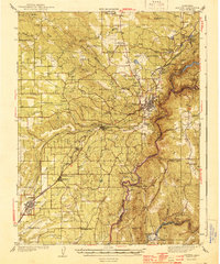
 1941 Folsom1957 Print · USGSThe foothills of the Sierra Nevada meet the Central Valley in the early 1940s, showing the river and rail corridors before major reservoirs were built. Researchers can trace the original tracks of the Southern Pacific and locate historic rural hubs like Natoma, Clarksville, and Mormon Island Sch.2 unique versions available
 - 1944 Map of Auburn
 1944 Auburn1944 Print · USGSThe Placer County foothills in the early 1940s show a landscape of deep river canyons and growing rail towns. Researchers can trace rural school districts like Japanese Sch and old river crossings at Rattlesnake Bridge and Salmon Falls.3 unique versions available
 - 1944 Map of Folsom
 1944 Folsom1944 Print · USGSThe American River region around Folsom thrives in the early 1940s, marked by dredging bars and early rail transport before major reservoirs transformed the valley. Researchers can find many schoolhouses like Mormon Island Sch and landmarks such as the State Prison Represa.2 unique versions available
 - 1947 Map of Sacramento, 1948 Print
 1947 Sacramento1948 Print · USGSThe Sacramento Valley meets the high Sierra during a period of post-war expansion. Trace the historic river delta islands like Grand Island or locate early airfield footprints at McClellan Air Force Base and Mather Air Force Base.2 unique versions available
 - 1948 Map of Walker Lake
 1948 Walker Lake1948 Print · USGSThe high desert of Nevada and the eastern Sierra Nevada are captured just after the war as mining and ranching shaped the local economy. Genealogists can trace family connections to centers like Hawthorne and Mina or locate the historic Rockland Mines and Aurora.2 unique versions available
 - 1948 Map of Sacramento, 1951 Print
 1948 Sacramento1951 Print · USGSPost-war Northern California comes alive in this regional survey, capturing the era of expansion between the Central Valley and the High Sierra. Researchers can trace the rail networks of the Central California Traction and Sacramento Northern RR or locate landmarks like the State Capitol and University of California Davis.
 - 1948 Map of Foresthill, 1975 Print
 1948 Foresthill1975 Print · USGSThe gold-bearing ridges of the Sierra Nevada foothills come alive in this mid-century survey of the Placer County mining country. Genealogists and historians can locate family claims and old outposts like Yankee Jims, the Mayflower Mine, and Ebberts Ranch.
 - 1949 Map of Georgetown
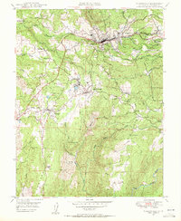
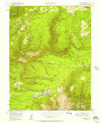
 1949 Georgetown1949 Print · USGSEl Dorado County’s gold country is captured here during the late 1940s, showcasing a landscape shaped by a century of mining. Researchers can trace historic sites like the Sutters Mill Site, Spanish Dry Diggings, and the Uniontown Cem.5 unique versions available
 - 1949 Map of Placerville, 1953 Print
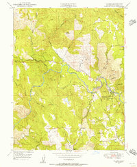
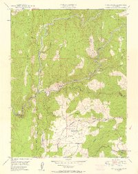
 1949 Placerville1953 Print · USGSEl Dorado County remains deeply rooted in its gold-rush legacy during the late 1940s, from the streets of Placerville to the Shenandoah Valley. Genealogists and historians can trace family properties near Fiddletown, Latrobe, or the historic Logtown settlement.5 unique versions available
 - 1949 Map of Georgetown, 1954 Print
 1949 Georgetown1954 Print · USGSGeorgetown and the surrounding Mother Lode country are shown here in the late 1940s, when the region's mining heritage was still etched clearly into the landscape. Genealogists and historians can locate specific sites like Volcanoville, the Beebe Mine, and the Canyon Creek School.4 unique versions available
 - 1949 Map of Placerville, 1955 Print
 1949 Placerville1955 Print · USGSGold Country life in the late 1940s centered on the rail-and-road network between Placerville and El Dorado. Genealogists can trace family footprints at Logtown, Coon Hollow Sch, and the Union Mine.5 unique versions available
 - 1949 Map of Coloma, 1956 Print
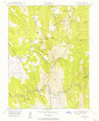
 1949 Coloma1956 Print · USGSEl Dorado County’s historic gold-producing region is documented here in the mid-twentieth century. Local historians can trace the legacy of the 1848 discovery at Sutters Mill and find landmarks like the Lilyama Mine, Springvale School, and Uniontown Cem.6 unique versions available
 - 1949 Map of Latrobe, 1956 Print
 1949 Latrobe1956 Print · USGSEl Dorado County in the late 1940s was a landscape shaped by the Southern Pacific railroad and a long history of mining. Genealogists can trace family footprints at the Miller Ranch, the Chinese Cem, and small settlements like Latrobe and Dugan.3 unique versions available
 - 1949 Map of Greenwood, 1957 Print
 1949 Greenwood1957 Print · USGSGold country in the late 1940s reveals a landscape shaped by river mining and foothill ranching. Genealogists and historians can trace the locations of Spanish Dry Diggings, the Grit Mine, and Penobscot Farm along the American River forks.3 unique versions available
 - 1949 Map of Foresthill, 1957 Print
 1949 Foresthill1957 Print · USGSPlacer County gold mining country is captured here during the late 1940s, showing the ridge-top settlements and deep river canyons. Genealogists and historians can trace family-named sites like Ebberts Ranch, the Mayflower Mine, and the old Iowa Hill diggings.4 unique versions available
 - 1949 Map of Fiddletown, 1957 Print
 1949 Fiddletown1957 Print · USGSThe Mother Lode foothills and the Shenandoah Valley are shown here as they appeared after the war. Genealogists and historians can trace the foundations of Fiddletown, find the Shenandoah Cem, and locate the Briarcliff Mines.5 unique versions available
 - 1949 Map of Shingle Springs, 1958 Print
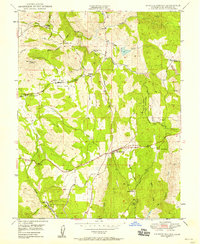 1949 Shingle Springs1958 Print · USGSEl Dorado County foothills in the late 1940s reveal a landscape of mining legacies and small rail-side communities. Researchers can locate early schools like the Tennessee School, the Jayhawk Cem, and inactive gold-era sites such as the Funny Bug Mine.4 unique versions available
 - 1949 Map of Garden Valley, 1959 Print
 1949 Garden Valley1959 Print · USGSEl Dorado County gold country is documented here in the late 1940s, highlighting the mining camps and river life of the era. Genealogists and historians can locate old landmarks like the Kelsey P O, Garden Valley Sch, and the Alhambra Mine among the deep canyons.4 unique versions available
 - 1950 Map of Placerville
 1950 Placerville1950 Print · USGSEl Dorado County in the late 1940s retains the clear footprint of its mining and railroad heritage. Researchers can trace the location of vanished settlements at Logtown (Site) and Cold Springs (Site), alongside active landmarks like the Crusader Mine and the Southern Pacific line.2 unique versions available
Showing maps 1-25 of 108
Top cities of El Dorado County
- El Dorado Hills historical maps
- South Lake Tahoe historical maps
- Cameron Park historical maps
- Placerville historical maps
- Pollock Pines historical maps
- Diamond Springs historical maps
See more
Frequently asked questions
- What are the different types of historical maps available for El Dorado County?
- What is the oldest map of El Dorado County?
- Where can I purchase historical maps of El Dorado County for my home or office?
- Where can I download high-res historical maps of El Dorado County?
- Are there historical topographic maps available for El Dorado County?
- Is there historical aerial imagery available for El Dorado County?
- Where are historical maps of El Dorado County sourced from?