1990s Maps of El Dorado County, California
Explore 11 historic maps of El Dorado County from the 1990s. These maps offer a rare glimpse into what life looked like during the 1990s — showing old roads, neighborhoods, homes, and landmarks that have changed or disappeared over time.
Whether you're researching your family's past, planning a metal detecting trip, or studying how El Dorado County's landscape evolved across the 1990s, these high-resolution maps are a powerful tool for exploring the history of this region.
- Focus on a specific era: All maps on this page are from the 1990s, giving you a focused view of this time period.
- See what’s changed: Compare century-old streets, trails, and buildings to today's modern landscape using overlays and satellite layers.
- Research with precision: Use these maps for genealogy, historical research, land use analysis, or educational projects.
- View, download, or print: Maps are fully viewable online in high resolution, and can be downloaded or printed for your own records.
Start exploring El Dorado County's history through authentic maps from the 1990s. This is your window into the past.
El Dorado County, CA maps
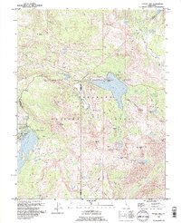
(11)- 1992 Map of Homewood, 1994 Print
 1992 Homewood1994 Print · USGSThe western shores of Lake Tahoe come alive in the 1990s, showcasing the classic resorts and dense forest wilderness of the Sierra Nevada. Trace the early trails and shoreline settlements like Idlewild, find the route of the Pacific Crest National Scenic Trail, and locate high-altitude landmarks like Eagle Rock.2 unique versions available
 - 1992 Map of Caples Lake, 1994 Print
 1992 Caples Lake1994 Print · USGSHigh Sierra recreation and historic transit routes meet in the 1990s near the triple-county junction of Alpine, Amador, and El Dorado. Trace the footprint of Kirkwood Ski Resort alongside the Old Emigrant Trail Historical Marker and the Lost Cabin Mine.3 unique versions available
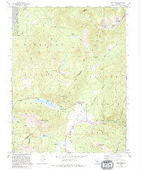
 - 1992 Map of Meeks Bay, 1994 Print
 1992 Meeks Bay1994 Print · USGSThe West Shore of Lake Tahoe in the early nineties reveals a landscape of lakeside communities and protected state parklands. Researchers can trace the development of Tahoma, locate the historic Ehrman Mansion, and identify recreation sites like Meeks Bay Campground.
 - 1992 Map of Freel Peak, 1994 Print
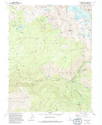
 1992 Freel Peak1994 Print · USGSThe high Sierra peaks and alpine passes of El Dorado and Alpine Counties are documented here in the early nineties. Researchers can trace the routes of the Pioneer Trail and Luther Pass, or locate historical sites like Dangberg Camp and Fountain Place.2 unique versions available
 - 1992 Map of Pyramid Peak, 1994 Print
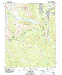
 1992 Pyramid Peak1994 Print · USGSThe Sierra high country near the Crystal Range is captured here in the early 1990s, showcasing the high-basin terrain and river corridors. Researchers can trace historic sites like Lyons (Site), the village at Strawberry, and the waterfront Camp Cody Boy Scout Camp.2 unique versions available
 - 1992 Map of Echo Lake, 1994 Print
 1992 Echo Lake1994 Print · USGSEl Dorado County at the height of its twentieth-century recreation boom shows a landscape where historic ranching meets modern ski culture. Genealogists and hikers can trace the Pacific Crest Trail past Celio Ranch, Phillips, and the old Meyers School.2 unique versions available
 - 1992 Map of Rockbound Valley, 1994 Print
 1992 Rockbound Valley1994 Print · USGSThe high Sierra Nevada backcountry of the early nineties is revealed here through its network of alpine lakes and wilderness trails. Genealogists and hikers can trace historical routes like the Rubicon Trail or locate the Univ of Calif Cow Camp near Willow Flat.
 - 1992 Map of Tragedy Spring, 1994 Print
 1992 Tragedy Spring1994 Print · USGSThe high Sierra landscape of the early nineties is captured here as a blend of pioneer history and modern recreation. Trace the historic Maidens Grave, explore the Iron Mountain Ski Area, and locate old sites like Bankers Tree.2 unique versions available
 - 1992 Map of Emerald Bay, 1994 Print
 1992 Emerald Bay1994 Print · USGSThe southwestern shores of Lake Tahoe in the early nineties show a landscape of landmark estates and expanding mountain settlements. Researchers can trace the development of Tallac Village, locate the historic Vikingsholm estate, and follow the Pacific Crest National Scenic Trail.
 - 1992 Map of South Lake Tahoe, 1994 Print
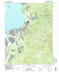 1992 South Lake Tahoe1994 Print · USGSSouth Lake Tahoe is shown in the early nineties as a bustling cross-border hub of recreation and commerce. Trace the historic Von Schmidt Line, find local landmarks like Happy Homestead Cem, or explore the development around Stateline.
 - 1994 Map of Sacramento
 1994 Sacramento1994 Print · USGSThe Sacramento valley was a landscape of massive flood control and military aviation during the mid-nineties. Researchers can trace the complex network of the Yolo Bypass and the Sacramento River alongside McClellan Air Force Base and Zamora.2 unique versions available
End of results
Showing maps 1-11 of 11
Top cities of El Dorado County
- El Dorado Hills historical maps
- South Lake Tahoe historical maps
- Cameron Park historical maps
- Placerville historical maps
- Pollock Pines historical maps
- Diamond Springs historical maps
See more
Frequently asked questions
- What are the different types of historical maps available for El Dorado County?
- What is the oldest map of El Dorado County?
- Where can I purchase historical maps of El Dorado County for my home or office?
- Where can I download high-res historical maps of El Dorado County?
- Are there historical topographic maps available for El Dorado County?
- Is there historical aerial imagery available for El Dorado County?
- Where are historical maps of El Dorado County sourced from?