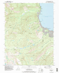
1992 Map of Homewood
USGS Topo · Published 1994About this map
Lake Tahoe dominates the eastern edge of this region, where the shoreline is dotted with established lakeside communities like Homewood, Idlewild, and Chambers Lodge. This 1990s-era record details the intersection of recreation and conservation, showing the dense network of roads and campgrounds such as General Creek Campground alongside the sprawling reaches of the Tahoe National Forest and Sugar Pine Point State Park.
Find a feature on this map
51 named features on this map. Tap any name to fly to it.
Don’t see what you’re looking for? This feature index may not catch every label — zoom into the map to look around manually.
Map Details
Editions of this 1992 Homewood Map
2 editions found
Other maps of this area

1889 · Pyramid Peak
USGS Topo · 1:125,000

1891 · Truckee
USGS Topo · 1:125,000

1891 · Pyramid Peak
USGS Topo · 1:125,000

1893 · Truckee
USGS Topo · 1:125,000

1895 · Pyramid Peak
USGS Topo · 1:125,000

1895 · Truckee
USGS Topo · 1:125,000

1896 · Pyramid Peak
USGS Topo · 1:125,000

1932 · Truckee
USGS Topo · 1:96,000

1940 · Truckee
USGS Topo · 1:125,000

1947 · Sacramento
USGS Topo · 1:250,000