Old Maps of Firebaugh, California for Genealogy
Trace your family roots with 24 historic maps of Firebaugh. These high-res maps reveal old neighborhoods, homesites, landmarks, and streets — helping you uncover where your ancestors lived and how the area evolved over time.
- Explore historic neighborhoods: Identify where your relatives may have lived in the 1800s or 1900s.
- Compare maps over time: Trace the changes in streets, buildings, and landmarks for multi-generational research.
- Perfect for genealogy & ancestry research: Used by family historians and researchers to map out lineage and migration.
These maps are an incredible resource for exploring your personal connection to Firebaugh's past.
Firebaugh, CA maps
(24)- 1922 Map of Pozo Farm
 1922 Pozo Farm1922 Print · USGSThe San Joaquin River and its complex system of canals define the Madera and Fresno county line in the early 1920s. Researchers can trace early irrigation at Pozo Farm or locate landmarks like the Rasin City Gun Club and the Southern Pacific rail line.2 unique versions available
 - 1923 Map of Firebaugh
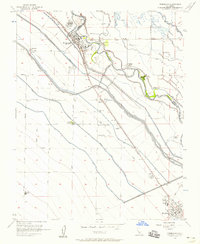
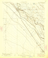 1923 Firebaugh1923 Print · USGSThe San Joaquin Valley comes alive in the early twenties as irrigation canals and rail lines transformed the Fresno and Madera county line. Genealogists and historians can trace old homesteads and transit stops like Arbios, Helm Ranch, and Mendota along the Southern Pacific tracks.
 - 1941 Map of Firebaugh
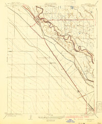 1941 Firebaugh1941 Print · USGSFresno and Madera counties are shown here just before the mid-century, defined by the irrigation canals and rail lines of the Central Valley. Researchers can trace the industrial footprint of the Standard Oil Pump Station and family landmarks like Helm Ranch.
 - 1946 Map of Firebaugh, 1954 Print
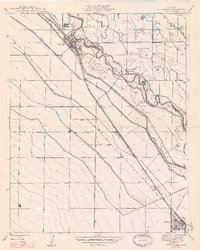
 1946 Firebaugh1954 Print · USGSThe Central Valley ranching and rail corridor comes to life in the mid-1940s as irrigation projects began reshuffling the landscape. Trace the Southern Pacific line through Firebaugh and Mendota, or locate family-named sites like Helm Ranch and Arbios.2 unique versions available
 - 1947 Map of Pozo Farm
 1947 Pozo Farm1947 Print · USGSThe San Joaquin Valley's intricate irrigation and rail network is captured here in the late 1940s. Researchers can trace early water management systems like Helm Canal and the Southern Pacific tracks near Pozo Farm.
 - 1947 Map of Firebaugh
 1947 Firebaugh1947 Print · USGSFresno and Madera counties are seen here in the mid-1940s, where the river and rail lines defined the pace of valley life. Researchers can trace the Southern Pacific line between Firebaugh and Mendota, locating smaller sidings like Benito and Arbios.2 unique versions available
 - 1948 Map of Santa Cruz
 1948 Santa Cruz1948 Print · USGSThe Central Coast and San Joaquin Valley meet in this mid-century look at the region's agricultural and military geography. Genealogists and historians can trace the paths of El Camino Real, locate family farms near Hollister, or study the footprint of the Fort Ord Military Reservation.2 unique versions available
 - 1955 Map of Santa Cruz
 1955 Santa Cruz1955 Print · USGSCoastal Monterey Bay and the fertile Salinas Valley are captured here during the post-war expansion of the mid-fifties. Researchers can trace the era's rail-and-road network via the Southern Pacific lines and find landmarks like Fort Ord or the Lonoak School.
 - 1956 Map of Firebaugh, 1958 Print
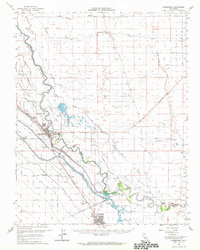
 1956 Firebaugh1958 Print · USGSThe San Joaquin Valley's agricultural heartland is captured here in the mid-1950s, showing the vital irrigation and rail networks between Firebaugh and Mendota. Genealogists and researchers can locate several rural schools like McCabe Sch and trace family-named sites such as Helm Ranch or Benito.3 unique versions available
 - 1957 Map of Santa Cruz
 1957 Santa Cruz1957 Print · USGSCentral California comes into sharp focus during the late fifties, from the fog-swept Monterey Bay to the sun-drenched San Joaquin Valley. Genealogists and historians can trace the mid-century footprints of Fort Ord Military Reservation, the Southern Pacific line, and the historic streets of San Juan Bautista.
 - 1958 Map of Santa Cruz
 1958 Santa Cruz1958 Print · USGSCoastal California and the central valleys are shown during the mid-fifties, capturing a landscape of massive military reserves and vital rail arteries. Genealogists and historians can trace the Southern Pacific line through Salinas or explore the early footprints of the Fort Ord Military Reservation and San Juan Bautista.2 unique versions available
 - 1962 Map of Poso Farm, 1963 Print
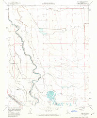 1962 Poso Farm1963 Print · USGSThe Central Valley borderlands of Fresno and Madera Counties come alive in this early 1960s survey of industrial agriculture. Trace the intricate irrigation systems of the Columbia Canal and the Southern Pacific rail line near Poso Farm.2 unique versions available
 - 1962 Map of Firebaugh, 1964 Print
 1962 Firebaugh1964 Print · USGSCentral Valley agriculture and irrigation are in full focus here during the early sixties. Researchers can trace the water infrastructure of the Mendota Pool or locate family-named operations like Mowry Ranch and Helm Ranch.
 - 1965 Map of Santa Cruz, 1968 Print
 1965 Santa Cruz1968 Print · USGSThe Central Coast and San Joaquin Valley meet here during the mid-sixties, capturing the growth of agricultural and coastal hubs. Trace the historic Southern Pacific RR lines and locate sites like the Presidio of Monterey or Pinnacles National Monument.
 - 1974 Map of Monterey, 1977 Print
 1974 Monterey1977 Print · USGSThe Central Coast and San Joaquin Valley meet in this mid-seventies survey of the Monterey region. Genealogists and historians can locate Spanish-era sites like the San Antonio de Padua Mission, early industrial markers such as the New Idria Mine, and coastal landmarks like the Point Sur Lighthouse.
 - 1982 Map of Mendota, 1983 Print
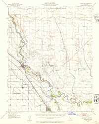
 1982 Mendota1983 Print · USGSThe Central Valley's massive water-moving infrastructure is in full view during the early eighties, from the San Joaquin River to the California Aqueduct. Researchers can trace the Southern Pacific rail lines through towns like Mendota, Firebaugh, and Tranquillity.2 unique versions available
 - 2012 Map of Firebaugh, 2012 Print
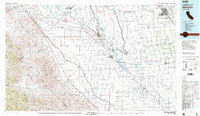
 2012 Firebaugh2012 Print · USGSCovers Firebaugh, including Mendota, Fresno County, and other nearby areas
 - 2012 Map of Poso Farm, 2012 Print
 2012 Poso Farm2012 Print · USGSCovers Firebaugh, including Fresno County, Madera County, and other nearby areas
 - 2015 Map of Firebaugh, 2015 Print
 2015 Firebaugh2015 Print · USGSCovers Firebaugh, including Mendota, Fresno County, and other nearby areas
 - 2015 Map of Poso Farm, 2015 Print
 2015 Poso Farm2015 Print · USGSCovers Firebaugh, including Fresno County, Madera County, and other nearby areas
 - 2018 Map of Poso Farm, 2018 Print
 2018 Poso Farm2018 Print · USGSCovers Firebaugh, including Fresno County, Madera County, and other nearby areas
 - 2018 Map of Firebaugh, 2018 Print
 2018 Firebaugh2018 Print · USGSCovers Firebaugh, including Mendota, Fresno County, and other nearby areas
 - 2021 Map of Poso Farm, 2021 Print
 2021 Poso Farm2021 Print · USGSMadera and Fresno counties are captured here in the early twenty-first century, showing the complex water systems of the Central Valley. Researchers can trace the meandering San Joaquin River and irrigation networks like the Poso Canal and River Br Columbia Canal.
 - 2021 Map of Firebaugh, 2021 Print
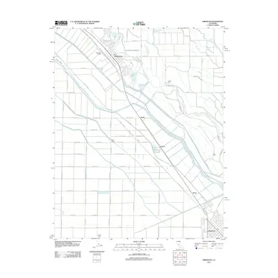
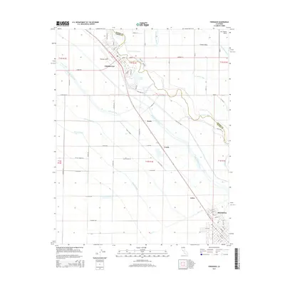
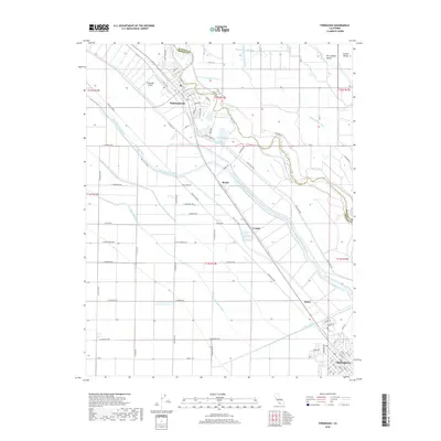
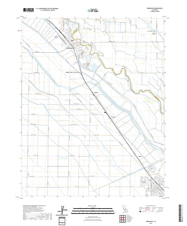 2021 Firebaugh2021 Print · USGSModern agriculture and historic transport corridors meet in this 2021 view of the Central Valley near the Fresno-Madera line. Genealogists and researchers can trace the development of Firebaugh and outlying stops like Benito and Arbios along the Santa Fe Grade.
End of results
Showing maps 1-24 of 24
Top cities near Firebaugh
- Mendota historical maps
- Dos Palos historical maps
- South Dos Palos historical maps
- Tranquillity historical maps
Frequently asked questions
- What are the different types of historical maps available for Firebaugh?
- What is the oldest map of Firebaugh?
- Where can I purchase historical maps of Firebaugh for my home or office?
- Where can I download high-res historical maps of Firebaugh?
- Are there historical topographic maps available for Firebaugh?
- Is there historical aerial imagery available for Firebaugh?
- Where are historical maps of Firebaugh sourced from?