2000s (21st Century) Maps of Eureka, California
Explore 12 historic maps of Eureka from the 2000s (21st Century). These maps offer a rare glimpse into what life looked like during the 2000s — showing old roads, neighborhoods, homes, and landmarks that have changed or disappeared over time.
Whether you're researching your family's past, planning a metal detecting trip, or studying how Eureka's landscape evolved across the 2000s, these high-resolution maps are a powerful tool for exploring the history of this region.
- Focus on a specific era: All maps on this page are from the 2000s, giving you a focused view of this time period.
- See what’s changed: Compare century-old streets, trails, and buildings to today's modern landscape using overlays and satellite layers.
- Research with precision: Use these maps for genealogy, historical research, land use analysis, or educational projects.
- View, download, or print: Maps are fully viewable online in high resolution, and can be downloaded or printed for your own records.
Start exploring Eureka's history through authentic maps from the 2000s. This is your window into the past.
Eureka, CA maps
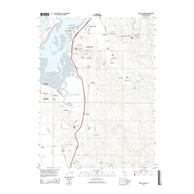
(12)- 2012 Map of Fields Landing, 2012 Print
 2012 Fields Landing2012 Print · USGSCovers Eureka, including Loleta, Pine Hills, and other nearby areas
 - 2012 Map of Arcata South, 2012 Print
 2012 Arcata South2012 Print · USGSCovers Eureka, including Arcata, Bracut, and other nearby areas
 - 2012 Map of Eureka, 2012 Print
 2012 Eureka2012 Print · USGSCovers Eureka, including Pine Hills, Cutten, and other nearby areas
 - 2015 Map of Fields Landing, 2015 Print
 2015 Fields Landing2015 Print · USGSCovers Eureka, including Loleta, Pine Hills, and other nearby areas
 - 2015 Map of Eureka, 2015 Print
 2015 Eureka2015 Print · USGSCovers Eureka, including Pine Hills, Cutten, and other nearby areas
 - 2015 Map of Arcata South, 2015 Print
 2015 Arcata South2015 Print · USGSCovers Eureka, including Arcata, Bracut, and other nearby areas
 - 2018 Map of Eureka, 2018 Print
 2018 Eureka2018 Print · USGSCovers Eureka, including Pine Hills, Cutten, and other nearby areas
 - 2018 Map of Arcata South, 2018 Print
 2018 Arcata South2018 Print · USGSCovers Eureka, including Arcata, Bracut, and other nearby areas
 - 2018 Map of Fields Landing, 2018 Print
 2018 Fields Landing2018 Print · USGSCovers Eureka, including Loleta, Pine Hills, and other nearby areas
 - 2021 Map of Fields Landing, 2021 Print
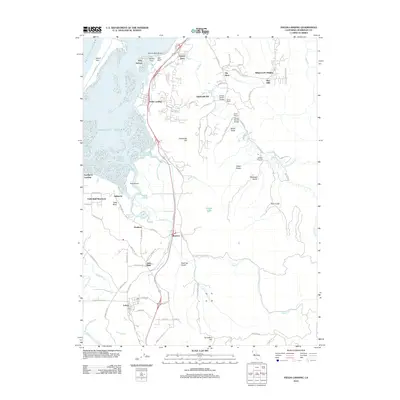
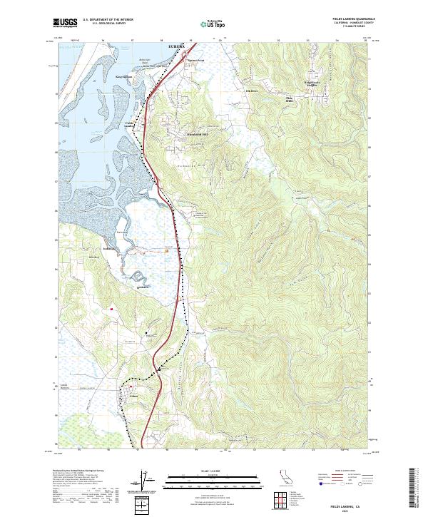 2021 Fields Landing2021 Print · USGSHumboldt Bay and the coastal bluffs south of Eureka are shown here in the twenty-first century. Genealogists can locate Table Bluff Cem and Saint Patrick's Catholic Cem, or trace the Northwestern Pacific RR through Fields Landing.
 - 2021 Map of Arcata South, 2021 Print
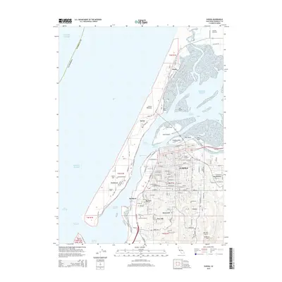
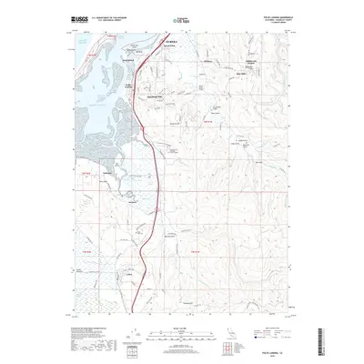
 2021 Arcata South2021 Print · USGSCoastal Humboldt County is shown here in the early 2020s, where the tidal marshes of the bay meet the redwood-forested ridges. Trace local history through the sloughs of the Arcata Bottoms and the small communities at Sunny Brae, Bracut, and Freshwater.
 - 2021 Map of Eureka, 2021 Print
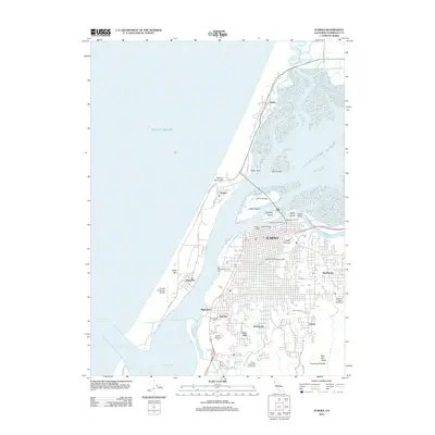
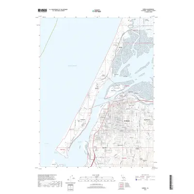
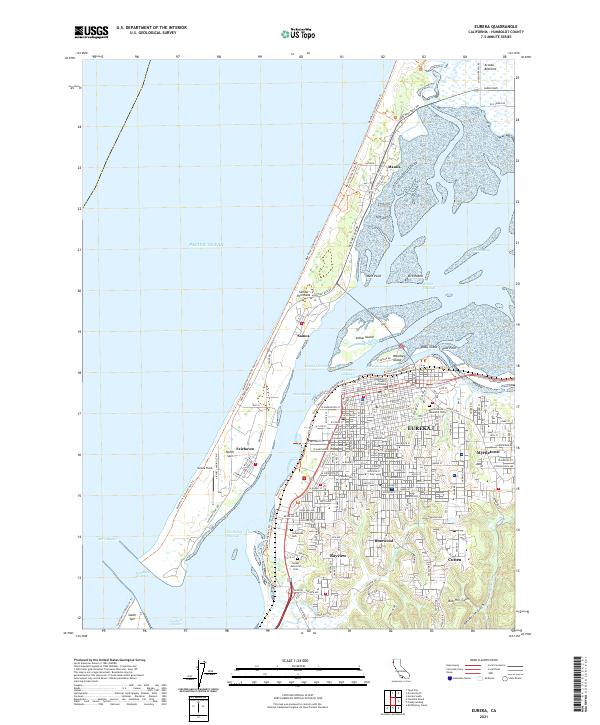 2021 Eureka2021 Print · USGSEureka and the Samoa Peninsula are shown here in the modern era as a hub of maritime navigation and coastal settlement. Genealogists can locate family sites near Myrtle Grove Memorial Cem, while historians trace the layout of Samoa and Fairhaven.
End of results
Showing maps 1-12 of 12
Top cities near Eureka
- Arcata historical maps
- McKinleyville historical maps
- Fortuna historical maps
- Fortuna historical maps
- Ferndale historical maps
- Blue Lake historical maps
See more
Top neighborhoods of Eureka
- Bucksport historical maps
- Madaket Plaza historical maps
- Highland Park historical maps
- South California historical maps
- Old Town historical maps
- Broadway historical maps
See more
Frequently asked questions
- What are the different types of historical maps available for Eureka?
- What is the oldest map of Eureka?
- Where can I purchase historical maps of Eureka for my home or office?
- Where can I download high-res historical maps of Eureka?
- Are there historical topographic maps available for Eureka?
- Is there historical aerial imagery available for Eureka?
- Where are historical maps of Eureka sourced from?