Old Maps of Aspendell, California for Genealogy
Trace your family roots with 16 historic maps of Aspendell. These high-res maps reveal old neighborhoods, homesites, landmarks, and streets — helping you uncover where your ancestors lived and how the area evolved over time.
- Explore historic neighborhoods: Identify where your relatives may have lived in the 1800s or 1900s.
- Compare maps over time: Trace the changes in streets, buildings, and landmarks for multi-generational research.
- Perfect for genealogy & ancestry research: Used by family historians and researchers to map out lineage and migration.
These maps are an incredible resource for exploring your personal connection to Aspendell's past.
Aspendell, CA maps
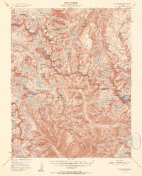
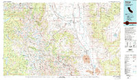
(16)- 1912 Map of Mt. Goddard
 1912 Mt. Goddard1912 Print · USGSThe high Sierra crest at the opening of the twentieth century remains a land of seasonal camps and early hydroelectric power. Trace the old trails to Andrews Camp, the Old Brewery near Bishop, and early wilderness outposts at Hot Springs.10 unique versions available
 - 1947 Map of Mariposa, 1948 Print
 1947 Mariposa1948 Print · USGSThe High Sierra and Owens Valley transition is captured here in the late 1940s, just as the region’s hydroelectric and tourism infrastructure was maturing. Genealogists and historians can trace old ranger stations, the Casa Diablo Mine, and rail stops along the Southern Pacific like Benton Station and Zurich.2 unique versions available
 - 1948 Map of Mariposa, 1951 Print
 1948 Mariposa1951 Print · USGSThe High Sierra and Mariposa foothills are shown here in the late 1940s as the post-war tourism and water infrastructure expanded. Genealogists and historians can locate vanished waypoints like Mormon Bar, the Glacier Point Hotel, and the granite quarries of Knowles.
 - 1948 Map of Mt. Goddard, 1958 Print
 1948 Mt. Goddard1958 Print · USGSHigh Sierra peaks and remote mines appear in this 1940s survey of the alpine divide. Trace early backcountry routes along the Muir Trail and locate historical outposts like Parchers Camp or the Cardinal Mine.2 unique versions available
 - 1951 Map of Mt. Goddard
 1951 Mt. Goddard1951 Print · USGSHigh Sierra wilderness and the crest of the Sierra Nevada are captured here in the early fifties, documenting a vast landscape of granite peaks and glacial lakes. Researchers can trace historic mineral sites like the Cardinal Mine and Sally Peterson Mine or locate high-country crossings at Muir Pass.2 unique versions available
 - 1952 Map of Mt. Goddard
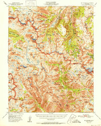 1952 Mt. Goddard1952 Print · USGSThe High Sierra backcountry is captured here in the early fifties, documenting the remote intersection of Fresno and Inyo counties. Researchers can trace the era's mining and recreation footprint at sites like Schober Mine, Parchers Camp, and the Cardinal Mine.2 unique versions available
 - 1957 Map of Mt. Goddard, 1964 Print
 1957 Mt. Goddard1964 Print · USGSThe High Sierra divide at the border of Inyo and Fresno counties is shown here in the mid-1950s during a period of transition for the high country. You can trace the historic route of the John Muir Trail past McClure Meadow or locate early mining sites like the Salty Peterson Mine and Cardinal Mine.3 unique versions available
 - 1957 Map of Mariposa, 1966 Print
 1957 Mariposa1966 Print · USGSThe High Sierra and Owens Valley appear in the mid-fifties, showing the intersection of conservation, hydroelectric power, and mountain industry. Genealogists and researchers can trace local landmarks like Yosemite Cemetery, the remote Kinsley Station, and the Pine Creek Mine.4 unique versions available
 - 1963 Map of Mariposa
 1963 Mariposa1963 Print · USGSThe High Sierra and Owens Valley meet in the early sixties, showing a landscape defined by gold-rush history and massive post-war water projects. Genealogists and researchers can trace old mining routes near Mariposa, locate the Glacier Point Hotel, and find small settlements like Coarse Gold or Knowles Junction.
 - 1978 Map of Bishop, 1994 Print
 1978 Bishop1994 Print · USGSThe Owens Valley and Eastern Sierra come alive in this late seventies study, documenting a landscape shaped by mining and high-altitude water storage. Local researchers can trace family names and industry at Pine Creek Mine, Scheelite, and Lucky Strike Mine.2 unique versions available
 - 1983 Map of Mt. Thompson
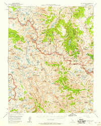
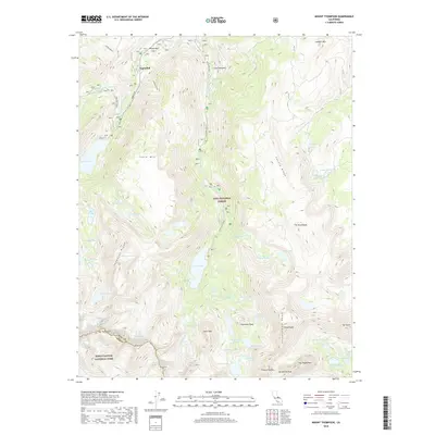
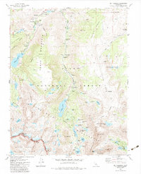 1983 Mt. Thompson1983 Print · USGSThe high Sierra landscape near the Inyo and Fresno county line is captured here in the early eighties. Genealogists and historians can trace old mining interests at Cardinal Mine and Salty Peterson Mine or locate the small settlement of Aspendell.4 unique versions available
 - 1994 Map of Mt. Thompson, 1997 Print
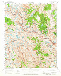
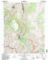 1994 Mt. Thompson1997 Print · USGSThe High Sierra near Bishop comes to life in the mid-1990s, showing the intersection of historic mining claims and modern alpine recreation. Trace the paths to Cardinal Mine, locate the remote Salty Peterson Mine, or explore the trails around Aspendell and Parchers Resort.
 - 2012 Map of Mount Thompson, 2012 Print
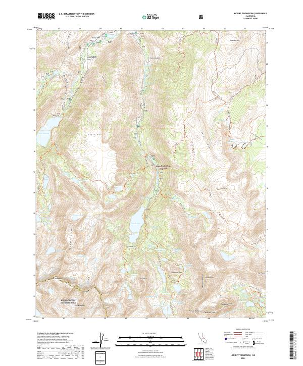
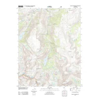 2012 Mount Thompson2012 Print · USGSCovers Aspendell, including Fresno County, Inyo County, and other nearby areas
 - 2015 Map of Mount Thompson, 2015 Print
 2015 Mount Thompson2015 Print · USGSCovers Aspendell, including Fresno County, Inyo County, and other nearby areas
 - 2018 Map of Mount Thompson, 2018 Print
 2018 Mount Thompson2018 Print · USGSCovers Aspendell, including Fresno County, Inyo County, and other nearby areas
 - 2021 Map of Mount Thompson, 2021 Print
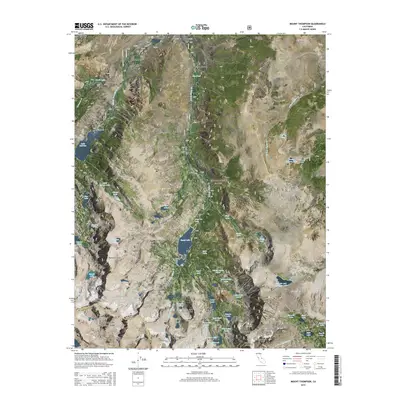
 2021 Mount Thompson2021 Print · USGSThe High Sierra backcountry near the Inyo and Fresno county line is captured here in detail, showcasing a landscape of alpine lakes and granite peaks. Hikers and historians can trace routes like the Rainbow Pack Station Trail to remote landmarks such as Cloudripper and Thompson Lake.
End of results
Showing maps 1-16 of 16
Top cities near Aspendell
- Bishop historical maps
- Dixon Lane–Meadow Creek historical maps
- West Bishop historical maps
- Wilkerson historical maps
- Round Valley historical maps
- Mesa historical maps
Frequently asked questions
- What are the different types of historical maps available for Aspendell?
- What is the oldest map of Aspendell?
- Where can I purchase historical maps of Aspendell for my home or office?
- Where can I download high-res historical maps of Aspendell?
- Are there historical topographic maps available for Aspendell?
- Is there historical aerial imagery available for Aspendell?
- Where are historical maps of Aspendell sourced from?