
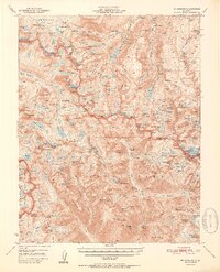
1952 Map of Mt. Goddard
USGS Topo · Published 1952About this map
The High Sierra divide along the boundary of Fresno and Inyo counties dominates this mid-century survey, centered on the towering peaks of the Sierra Nevada. The eastern slopes are defined by the headwaters of North Fork Bishop Creek and South Fork Bishop Creek, where recreation and resource extraction converged. Settlements like Andrews Camp, Parchers Camp, and the Circle S Ranch provided staging grounds for those entering the high country.
Find a feature on this map
177 named features on this map. Tap any name to fly to it.
Don’t see what you’re looking for? This feature index may not catch every label — zoom into the map to look around manually.
Map Details
Editions of this 1952 Mt. Goddard Map
2 editions found
Other maps of this area

1903 · Tehipite
USGS Topo · 1:125,000

1905 · Tehipite
USGS Topo · 1:125,000

1907 · Mt. Whitney
USGS Topo · 1:125,000

1912 · Mt. Goddard
USGS Topo · 1:125,000

1913 · Bishop
USGS Topo · 1:125,000

1919 · Mt. Whitney
USGS Topo · 1:125,000

1937 · Mt. Whitney
USGS Topo · 1:125,000

1947 · Mariposa
USGS Topo · 1:250,000

1948 · Fresno
USGS Topo · 1:250,000

1948 · Mariposa
USGS Topo · 1:250,000