1920s Maps of Long Beach, California
Explore 7 historic maps of Long Beach from the 1920s. These maps offer a rare glimpse into what life looked like during the 1920s — showing old roads, neighborhoods, homes, and landmarks that have changed or disappeared over time.
Whether you're researching your family's past, planning a metal detecting trip, or studying how Long Beach's landscape evolved across the 1920s, these high-resolution maps are a powerful tool for exploring the history of this region.
- Focus on a specific era: All maps on this page are from the 1920s, giving you a focused view of this time period.
- See what’s changed: Compare century-old streets, trails, and buildings to today's modern landscape using overlays and satellite layers.
- Research with precision: Use these maps for genealogy, historical research, land use analysis, or educational projects.
- View, download, or print: Maps are fully viewable online in high resolution, and can be downloaded or printed for your own records.
Start exploring Long Beach's history through authentic maps from the 1920s. This is your window into the past.
Long Beach, CA maps
(7)- 1923 Map of Artesia
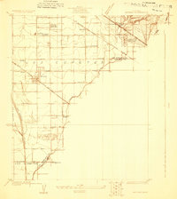 1923 Artesia1923 Print · USGSSoutheast Los Angeles and Orange County appear here in the early twenties, showing a rural landscape transitioning into an industrial and oil-producing corridor. Researchers can trace the early footprints of Artesia and Los Alamitos, alongside vanished landmarks like the C Julian Tank Farm and the Bloomfield School.
 - 1923 Map of Wilmington
 1923 Wilmington1923 Print · USGSThe Los Angeles waterfront was a hub of rapid industrial and military growth in the early twenties. Genealogists and historians can trace the early rail yards of the Pacific Electric, the footprint of Fort Mc Arthur Lower Res, and the busy wharves of Fish Harbor.
 - 1924 Map of Compton
 1924 Compton1924 Print · USGSThe Los Angeles basin near Compton and Gardena was a landscape of citrus groves and oil derricks in the mid-twenties. Genealogists and researchers can trace local landmarks like the Woodlawn Cemetery, the Dominguez Ranch, and schools including Carson School.
 - 1925 Map of Long Beach
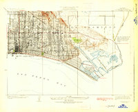 1925 Long Beach1925 Print · USGSIn the mid-1920s, the Southern California coast was rapidly urbanizing around the oil-rich heights and growing beach communities. Researchers can trace the early layout of Naples, the legacy of the Bixby Ranch, and the vital routes of the Pacific Electric railway.2 unique versions available
 - 1925 Map of Wilmington
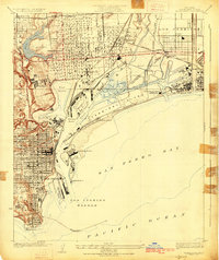 1925 Wilmington1925 Print · USGSThe harbor district and Palos Verdes foothills come alive in this mid-twenties survey of a rapidly industrializing coastline. Trace the early maritime infrastructure of Wilmington and San Pedro, from the Canal St Sta to the Fish Harbor and Terminal Island.3 unique versions available
 - 1925 Map of Artesia
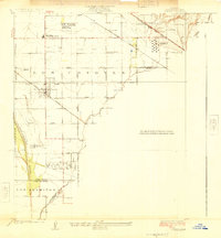 1925 Artesia1925 Print · USGSThe dairy and oil lands of Los Angeles and Orange Counties are captured here in the mid-twenties as the rail lines were expanding. Researchers can trace the path of the Pacific Electric or locate local landmarks like Artesia Cemetery and the C G Julian Tank Farm.2 unique versions available
 - 1925 Map of Clearwater
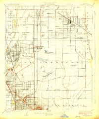 1925 Clearwater1925 Print · USGSSoutheast Los Angeles County emerges as an industrial powerhouse during the 1920s oil boom. Genealogists and historians can trace early residential blocks in Bellflower and Clearwater or locate vanished sites like the Federal Telegraph Co Wireless Sta and Cerritos Gun Club.2 unique versions available
End of results
Showing maps 1-7 of 7
Top cities near Long Beach
- Los Angeles historical maps
- Anaheim historical maps
- Santa Ana historical maps
- Huntington Beach historical maps
- Garden Grove historical maps
- Torrance historical maps
See more
Top neighborhoods of Long Beach
- Cota historical maps
- Willowville historical maps
- Los Altos historical maps
- North Long Beach historical maps
- Naples historical maps
- Vista del Mar historical maps
See more
Frequently asked questions
- What are the different types of historical maps available for Long Beach?
- What is the oldest map of Long Beach?
- Where can I purchase historical maps of Long Beach for my home or office?
- Where can I download high-res historical maps of Long Beach?
- Are there historical topographic maps available for Long Beach?
- Is there historical aerial imagery available for Long Beach?
- Where are historical maps of Long Beach sourced from?